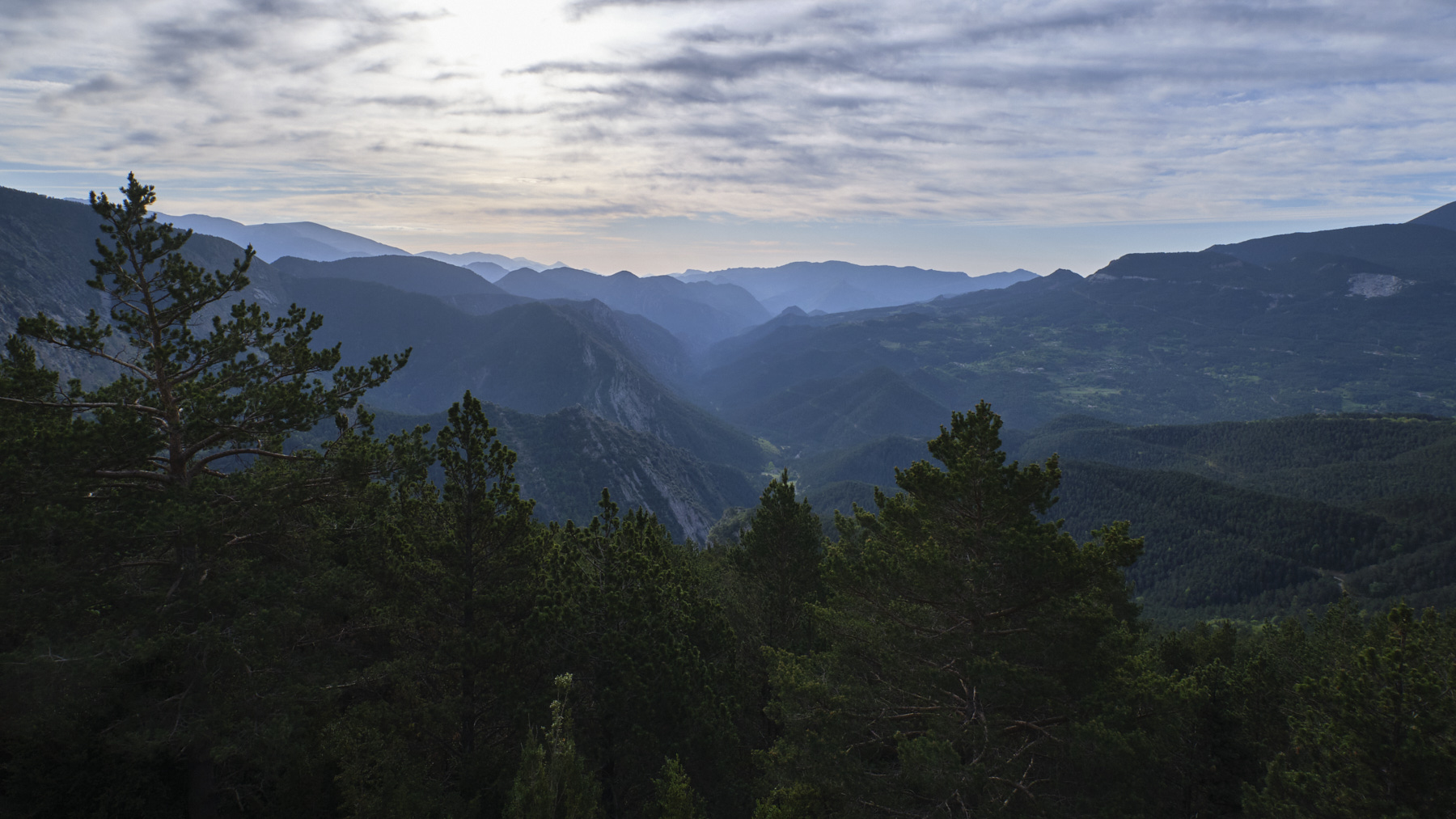
A superb route to climb the impressive Fourche de Pierre, Catalunya's most emblematic mountain. From the Gresolet viewpoint, the loop begins at the Estasen refuge. A sustained ascent to the Col de Verdet to the north of the summit enables you to tackle the equipped rocky ramps leading to the Pollegó superior at over 2500m. Then, following the ridges to the south-east, we reach the foot of a second summit, Caldere, reached by 2 sections equipped with chains. The 360° views are superb. The return journey is via the Enforcadura and the Tartera de Pedraforca, a long, wide scree slope down to the starting hut. Although the distance and altitude difference are reasonable, the hike requires a lot of energy in the legs and arms for the Calderer finale.
❱❱ Technical summary
■ S tarting point: mirador de Gresolet, above the village of Saldes, Catalunya, Spain
■ Type of route: alpine loop hike
■ Distance: 8.5 km
■ Cumulative elevation gain: +900 m
■ Cumulative negative altitude gain: -900 m
■ Estimated total time: 5h to 6h ■ Min and max altitude: m / 2506 m
■ Beaconing: white and yellow except the section from Pollegó Superior to Calderer with cairns.
■ Equipment in place: for access to the Calderer, knotted ropes and chains (no lifelines).
■ Equipment to bring: helmet and possibly harness and 30m rope.
Difficulties: steep slopes, sections to be climbed in III with knotted ropes, final Calderer chimney to be climbed with chains (K3). Delicate, long descent through scree.
❱❱ Access to the place
On the C16 between Barcelona and Puigcerda, between Berga and Guardiola de Bergueda, take the B-400 east to Saldes, at the foot of the Pedraforca massif. At the eastern end of the village, you'll find the small road that winds up to Pedraforca. At the very top, park in the Mirador de Gresolet parking lot, or before in the reserved spaces on the side of the road.
❱❱ Map & topo
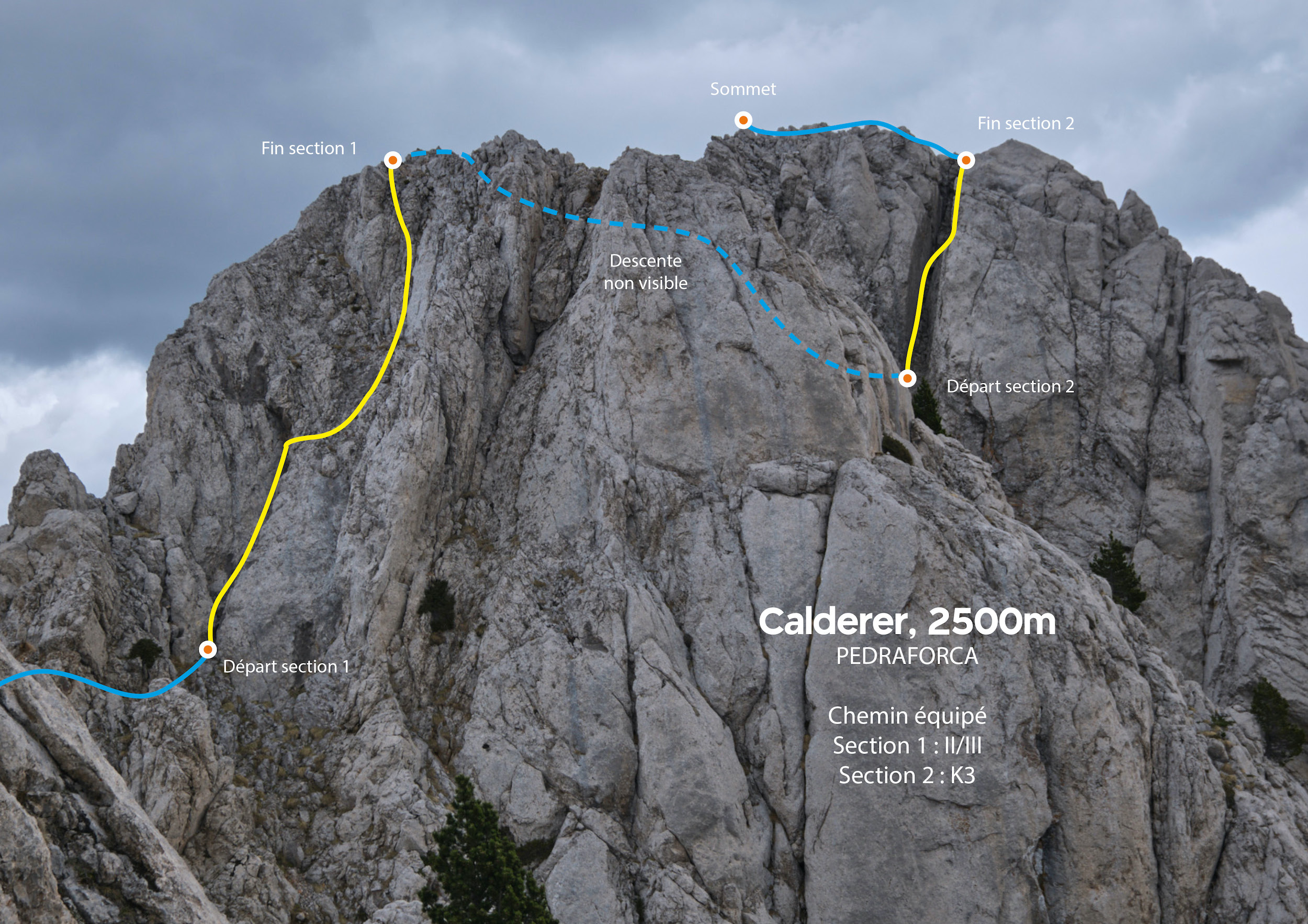
The descent route from Calderer to Enforcadura is indicative.
Part 1: Estasen hut and Col de Verdet (2255m, 1h15' to 1h30')
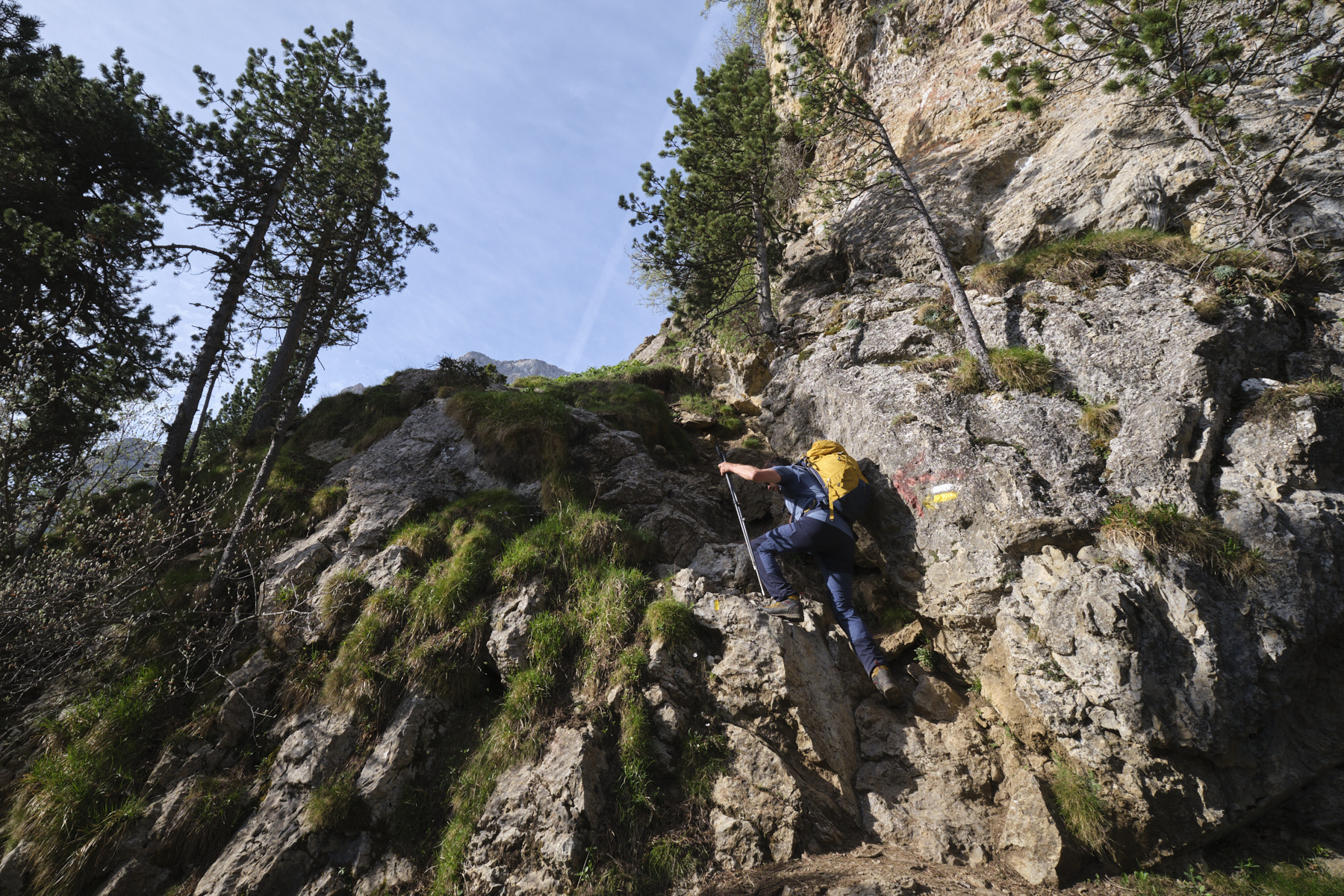
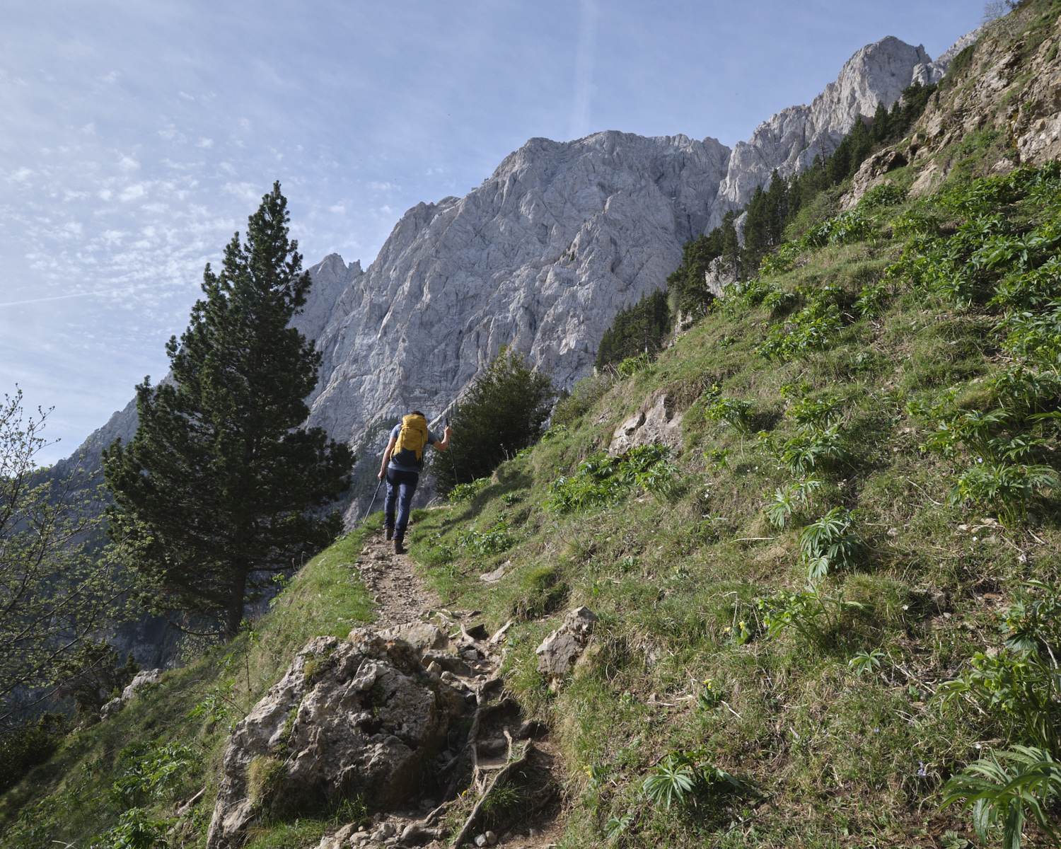
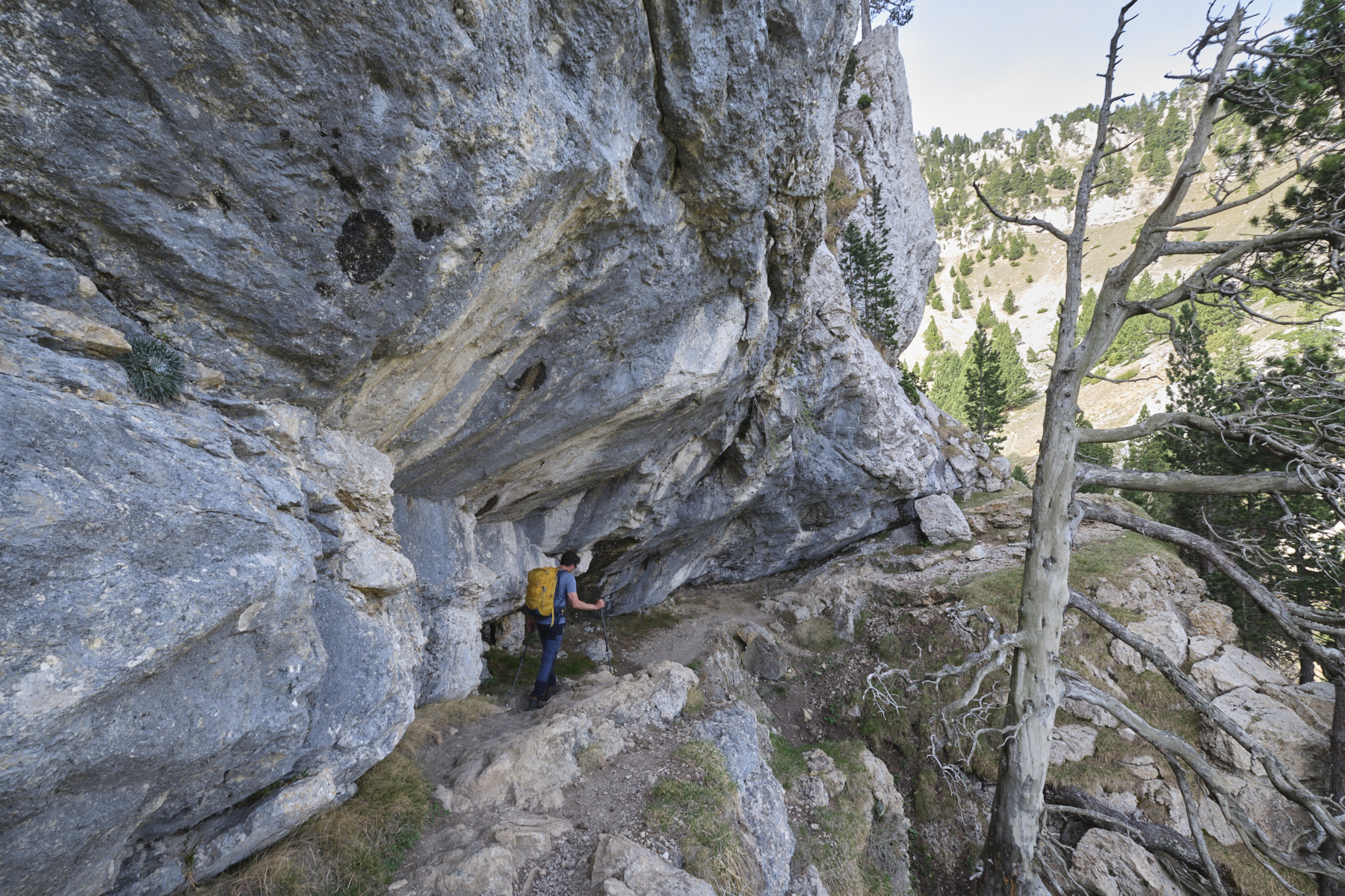
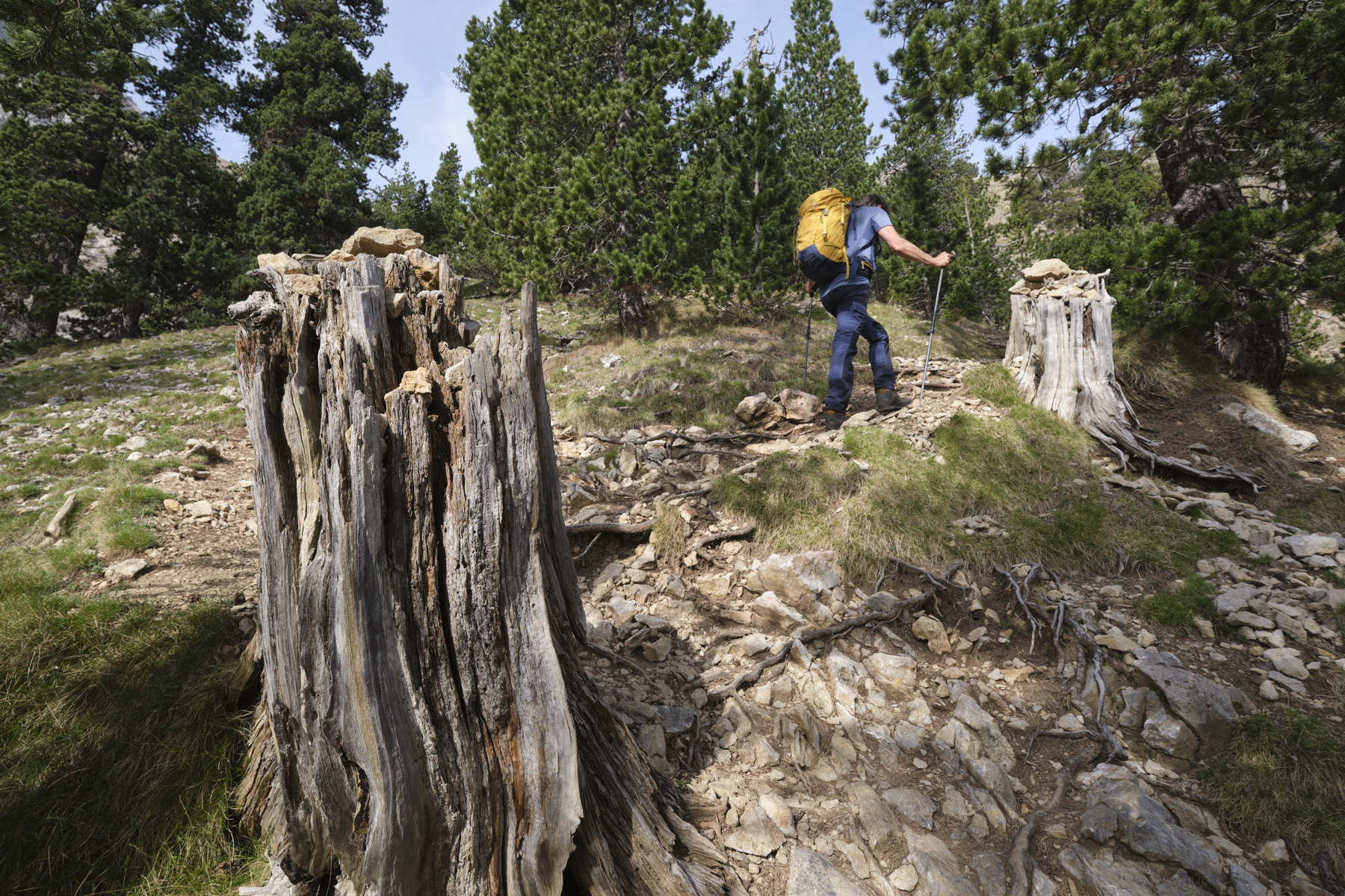
Walk back along the road from the parking lot and you'll soon find the path leading up to the refuge. Pass the Col de la Cabana and the path joins the Estasen refuge. From here, follow the path due west (signposted), which first crosses over the top of the track and passes several small dry streams. The slope then steepens before reaching a shoulder higher up, giving access to a mini faja (ledge). Behind it, the path enters the valley of the Gerdera torrent, heading south-west. The slope is still steep and the climb steady. Gradually, you approach the large upper walls. The end is steep and airy, with a few steps leading up to the Col de Verdet at 2255m, on the north side of the massif, with a view of the west side and the village of Gosol below.
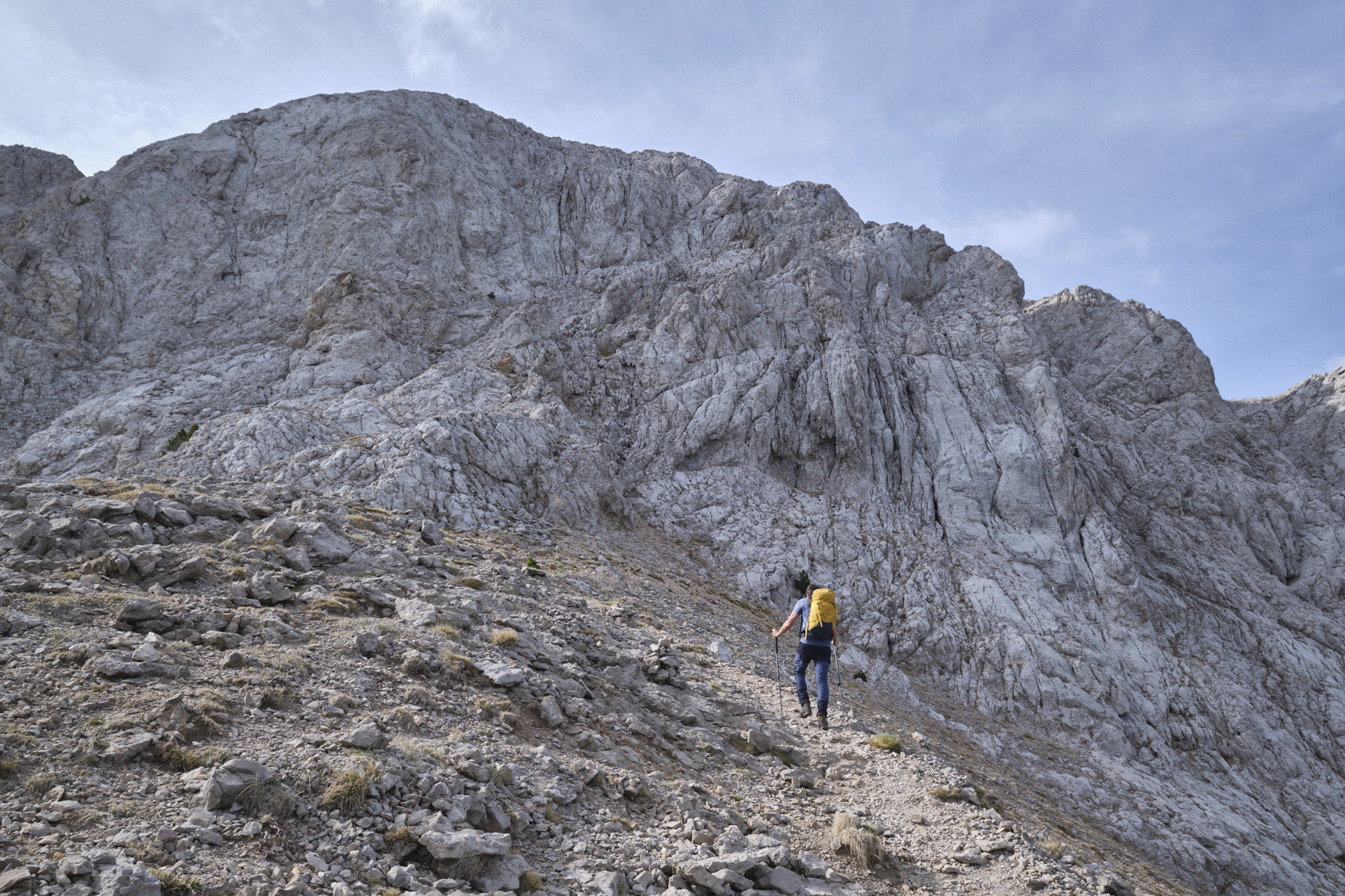
Part 2: Col de Verdet to Pollegó Superior (2506m, 1h to 1h15')
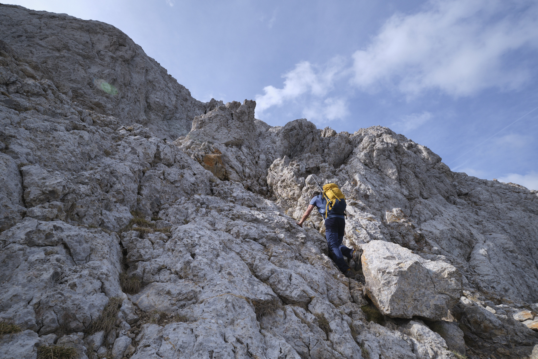
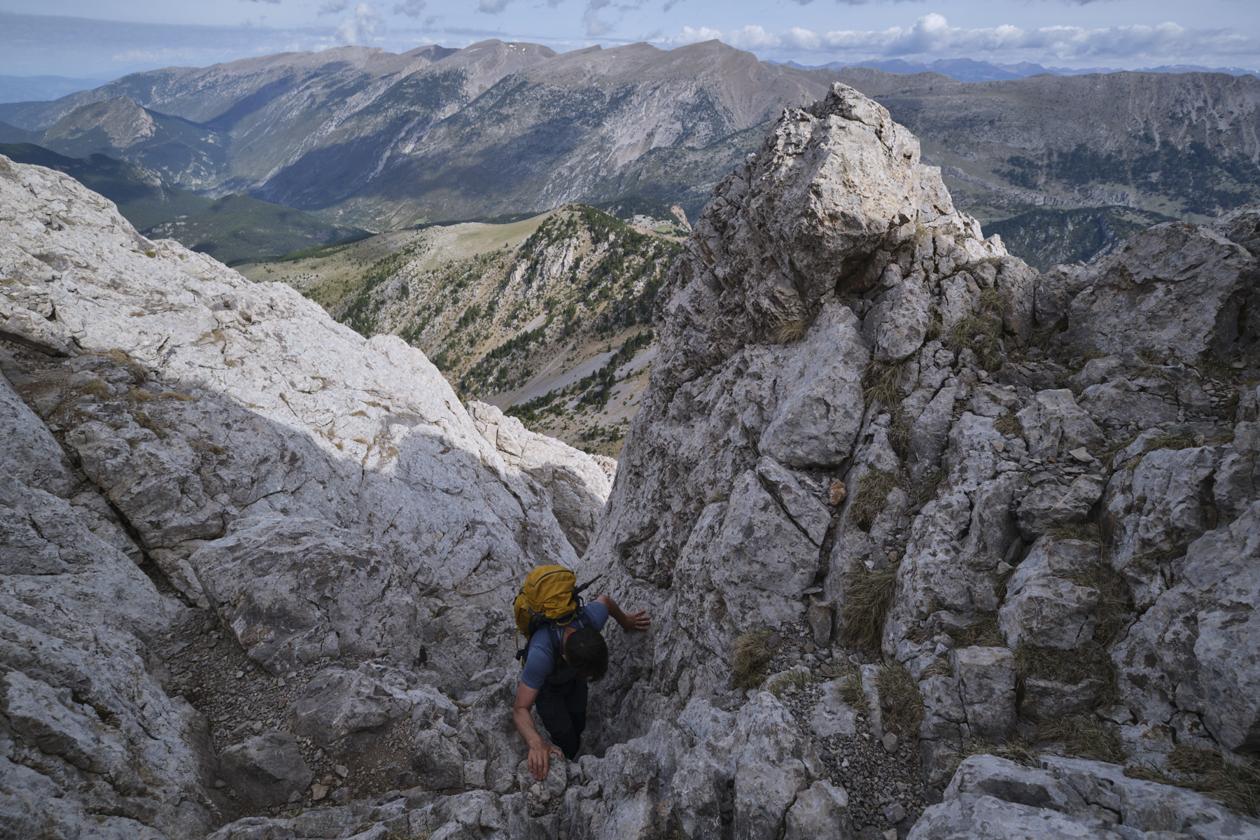
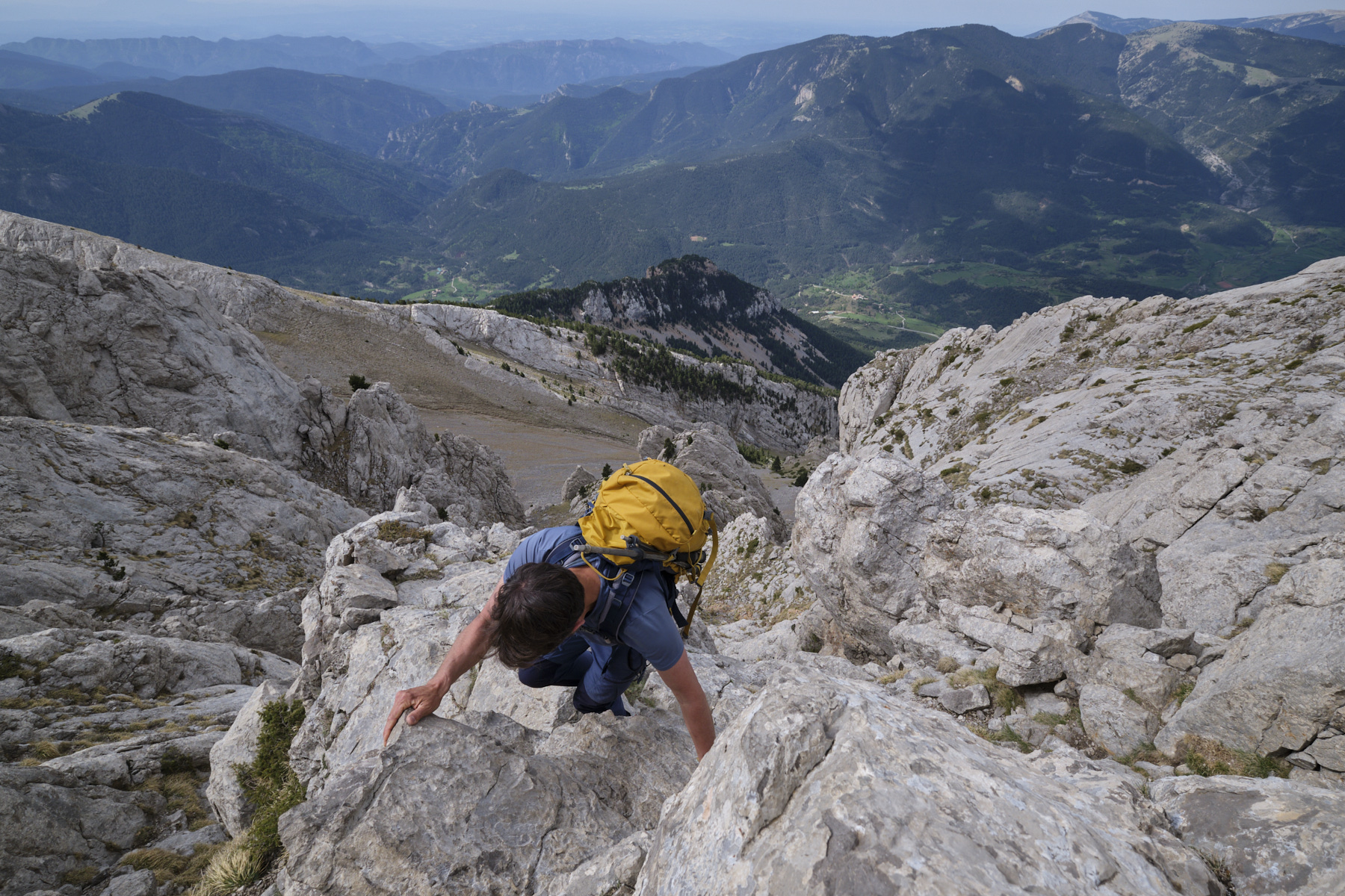
From the pass, take the path on the ridge heading south (unmarked, but cairns can be found). You pass to the left of a rocky tooth and soon reach the base of the sloping walls. Follow the yellow lines and cairns that indicate the path. With the help of your hands, but without much difficulty (II/III-), you climb up a series of rocky couloirs to reach the upper ridge. Descend a little to pass the first gap. Climb up again, then down again to pass a second gap. Then another ascent, descent and breach to tackle the final section leading to the summit of the Pedraforca, the Pollegó Superior at 2506m. Superb 360° panoramic views.
Part 3: Pollegó Superior to Calderer (2500m, 30' to 45')
Follow the ridges to the east, descending a little but staying high if possible. You soon reach the 1st equipped section: 3 chains to climb a crack and cross an exposed couloir. Finish on the Antecime du Calderer. You can see the chimney leading to the summit.
Follow the airy ridge for a while and then descend to the foot of the final chimney. 2nd equipped passage, short but more physical (K3). A knotted rope helps to climb up to the narrowest part under a small boulder wedged between the walls. Here, with a chain, we manage to extract ourselves as best we can, with slippery rock for our feet but good handholds around the boulder. Finally, a last section with a chain to get over an inclined slab and get back on the ridge with the strength of your arms. Finish by walking on the summit ridge at 2500m.
4th part: from Calderer to Enforcadura and Tartera de Pedraforca to the start parking lot (1h45 to 2h15)
Descend the 2 equipped sections, more easily than on the way up, and retrace your steps towards the Pollegó Superior. You'll then find the path leading down from the summit to the Enforcadura, the wide pass between Pollegó Superior and Pollegó Inferior. Here begins the long descent due east into the Tartera de Pedraforca, a huge, steep scree slope. Fortunately, the path is equipped with small wooden logs as steps, but the descent is tricky, the terrain unstable and it's hard on the thighs. At the very bottom, the path returns to the undergrowth, but remains as steep and leg-breaking as ever. Finally, we find the fork to head north again, more or less level, and return to the Estasen hut. End of the loop.
Monte Rotondo, Melo and Capitello, Corte 5 August 2017 From the Restonica Valley, climb Corsica's second highest peak, Monte Rotondo at 2622m, and return via the…
Mascun Superior, Sierra de Guara 26 May 2021 This is one of the major canyons of the Sierra de Guara! Long and demanding, the descent…


 Partager sur WhatsApp
 Partager sur Twitter
Partager sur Instagram
Partager sur Twitter
Partager sur Instagram

 Partager sur Facebook
 Imprimer le topo
 Laisser un commentaire


![2017-08-05_13-35-40 [Monte Rotondo]](https://climbing7.com/wp-content/uploads/2017/09/2017-08-05_13-35-40-monte-rotondo-1024x683.jpg "Monte Rotondo, Melo and Capitello, Corte")


Leave a Reply