At 3404m, the Pic d'Aneto towers over the Pyrenees, just ahead of its immediate neighbor, the Pic des Posets. The ascent to the summit via the Salterillo ibon avoids the long crossing of the increasingly crumbling glacier from the Portillon breach. Access to the summit via the Pont de Mahomet is very aerial but not difficult. The descent via the Ibones de coronas on the south-western slope is wilder, in a mineral setting, before literally tumbling down to the spectacular Vallibierna Gorge, over 1000m below.
❱❱ Technical summary
■ Departure and return point: Besurta (1900m) / Coronas Refuge (1970m) in the Vallibierna Gorge, Benasque, Aragon, Spain
■ Type of route: high-mountain traverse hike
■ Distance: 13 km
■ Cumulative elevation gain: +1505 m
■ Cumulative negative altitude gain: -1435 m
■ Estimated total time: 8h to 9h ■ Min and max altitude: 1900 m / 3404 m
■ Markings: cairns all along the route
■ Equipment in place: none
■ Equipment required: crampons, ice axe, useful GPS trace
Difficulties: the glacier passages below the summit (crampons), the aerial section from the Pas de Mahomet to the summit (easy but impressive) and the de-escalation of the Collado de Coronas (very steep first 50 meters).
❱❱ Access to the place
Getting to Benasque in Aragon, in the Posets-Maladeta National Park. During the summer months, access to the Besurta parking lot is closed and you have to take a shuttle bus from Benasque or, better still, from the Benasque Hospital parking lot (currently €3.30 one way, 25').
For the return journey, via the Vallibierna Gorge, there's also a shuttle bus from the Coronas refuge to Benasque or Senarta if you've left a car there (€11 one-way, 45').
Please note that the shuttles take walkers on a first-come, first-served basis, with priority given to those with a return ticket. If the shuttle is full, wait for the next one or walk the rest of the way...
❱❱ Map & topo
The route from the ibon de Salterillo to the summit of Aneto is indicative, as there are several options for ascending the ancient glacier through a maze of slabs and rocks (cairns everywhere!).
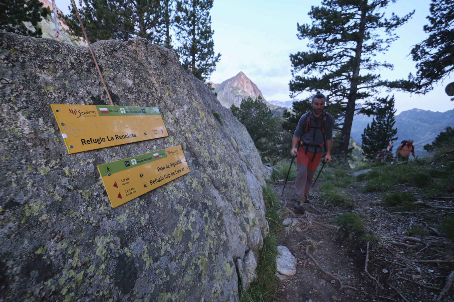
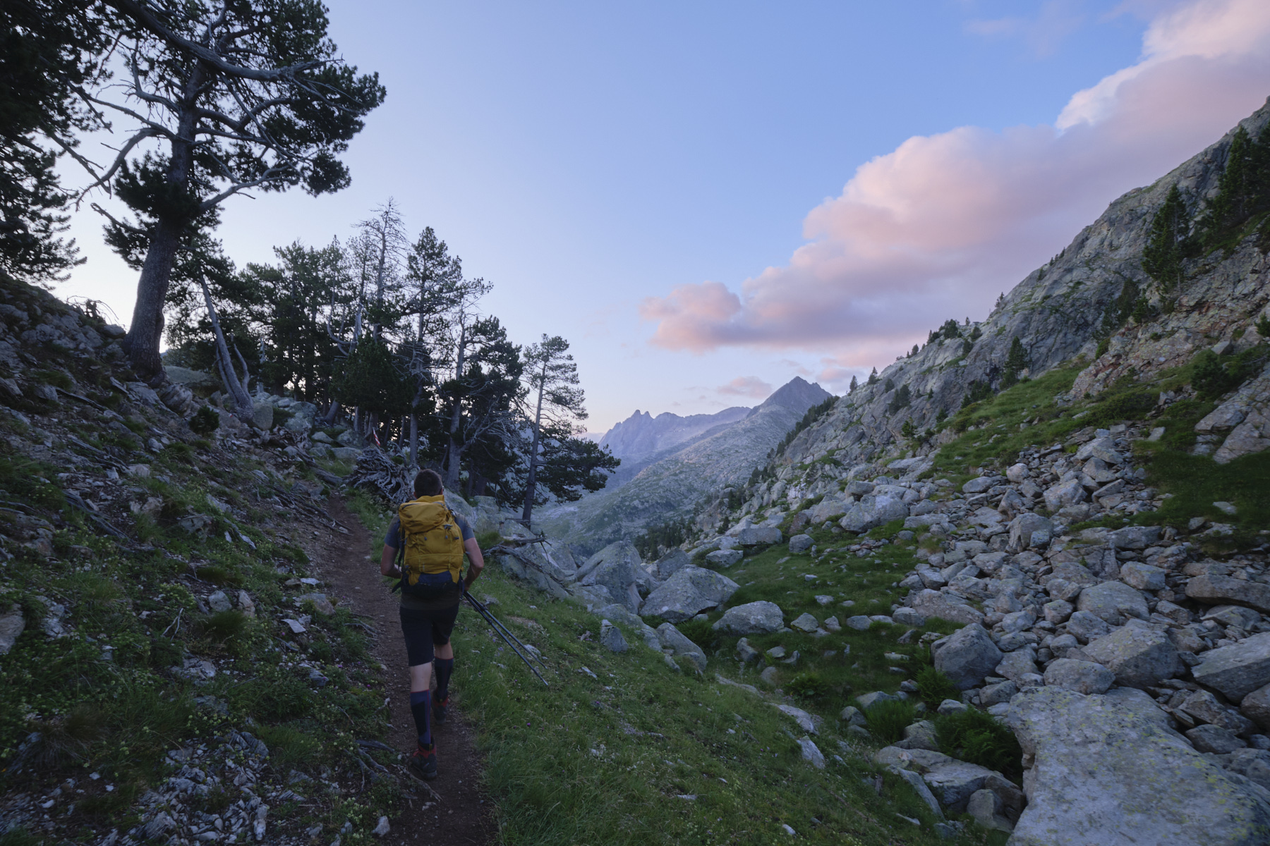
1st part: from Besurta to Ibon de Salterillo via Renclusa (2470m, 2h)
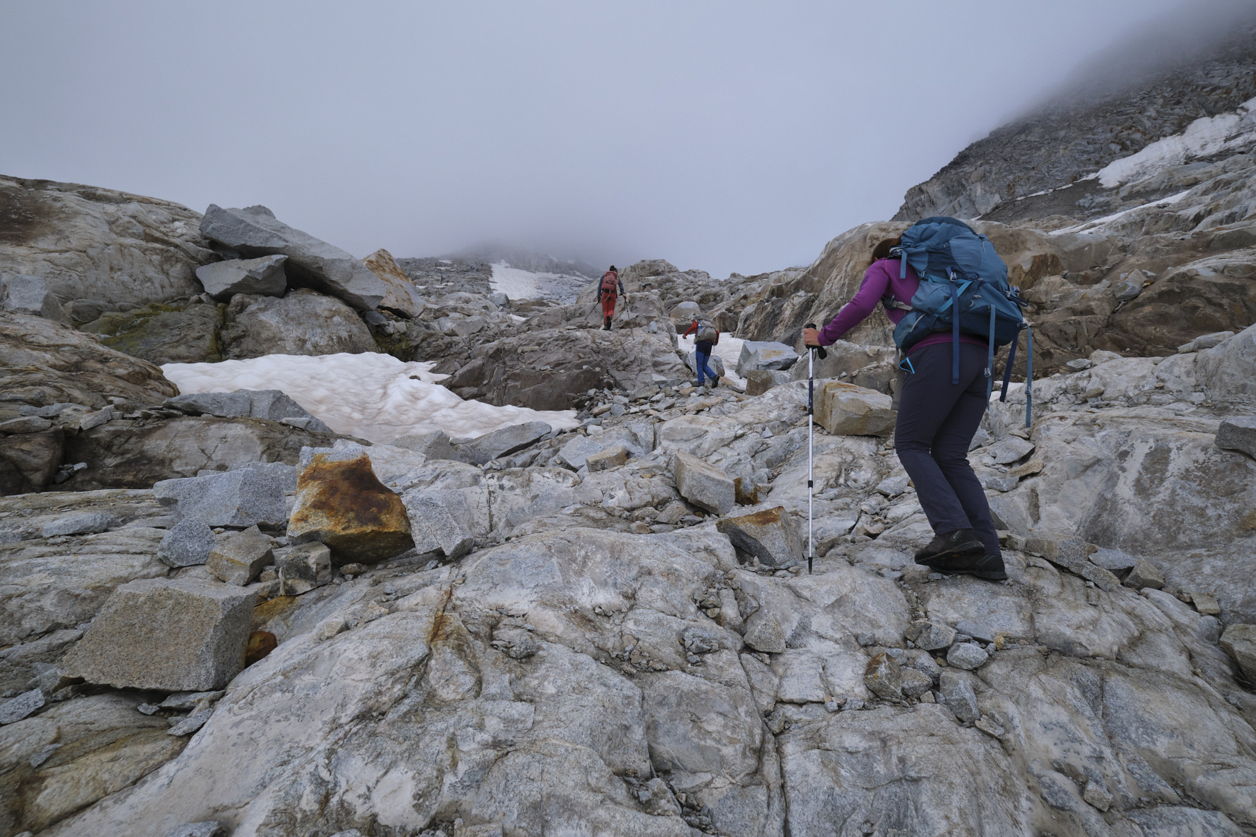
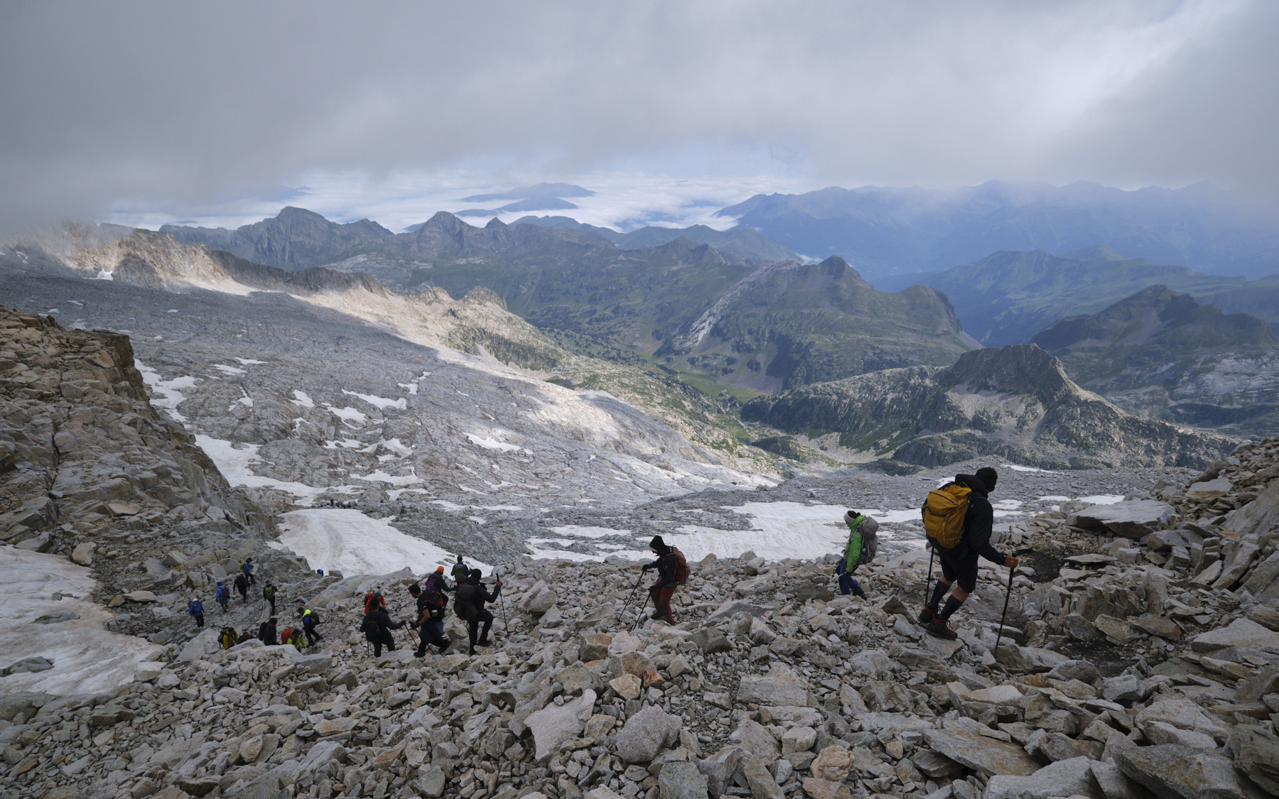
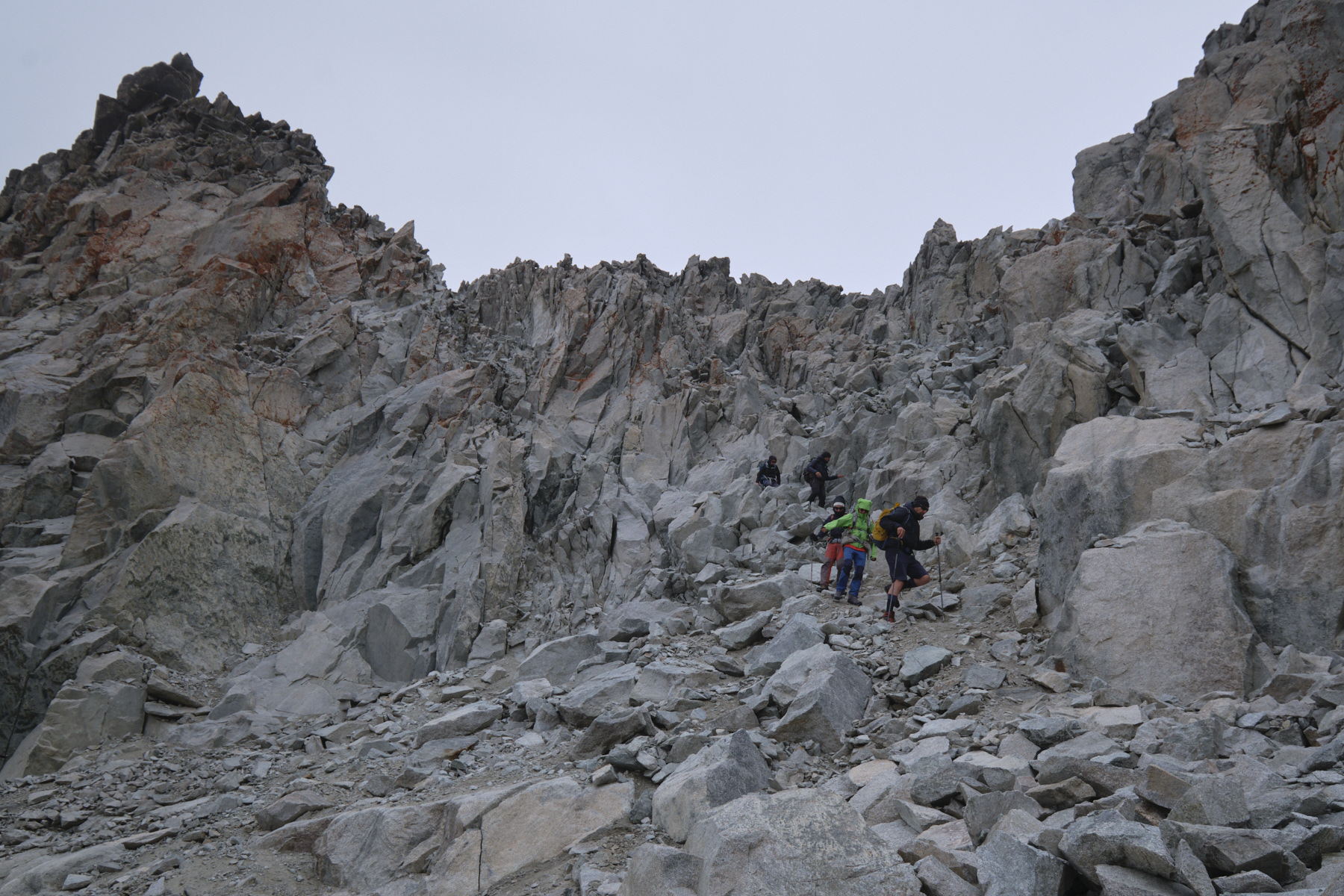
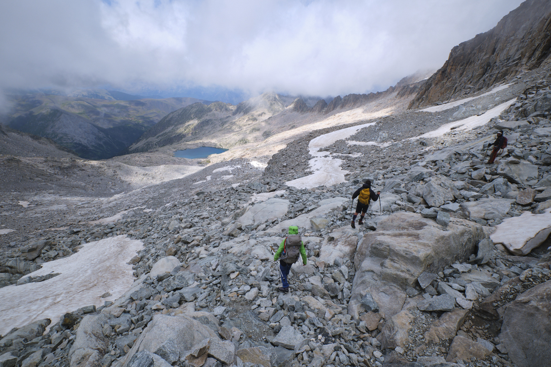
3/4 of an hour up to the Renclusa hut, then steeply uphill to the Renclusa pass and into the Plan des Aigualluts valley. Descend a little and, just as the path heads down towards the Plan des Aigualluts, continue upwards and southwards. The path climbs further and further up, finally reaching the level of the basin formed by the Ibon de Salterillo, now dry. From here, it's easy to see the summit of the ANeto and the path that remains to climb the wide glacier, which is almost completely uncovered, on large slabs smoothed by ice and water.
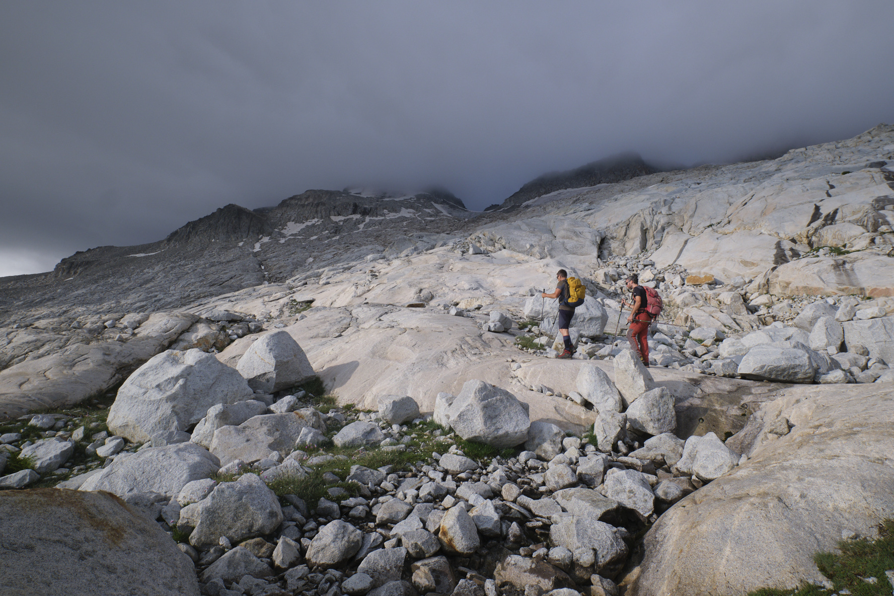
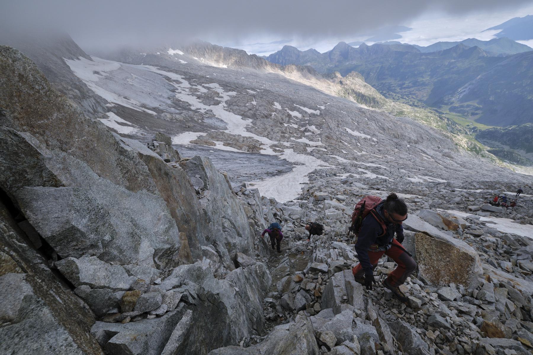
2nd part: from Ibon de Salterillo to Aneto summit (3404m, 2h30 to 3h)
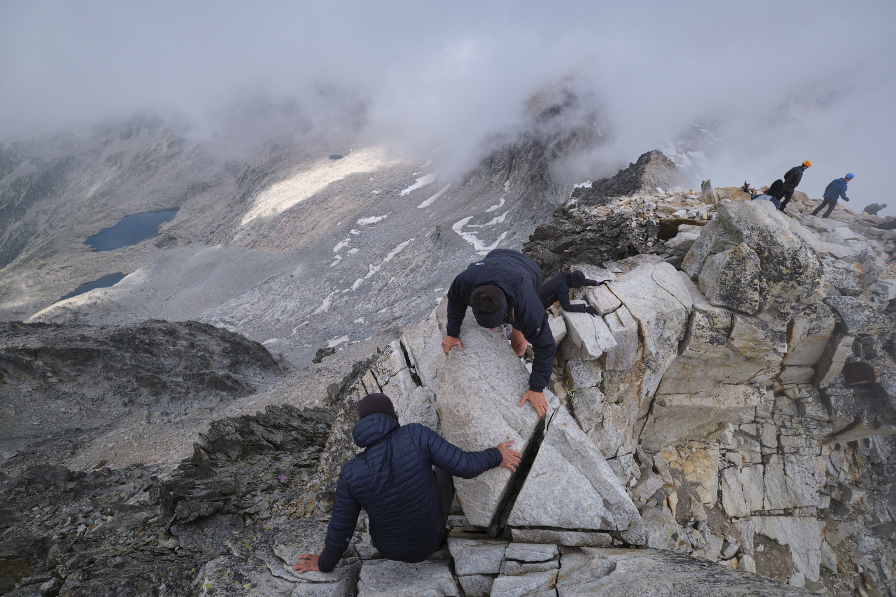
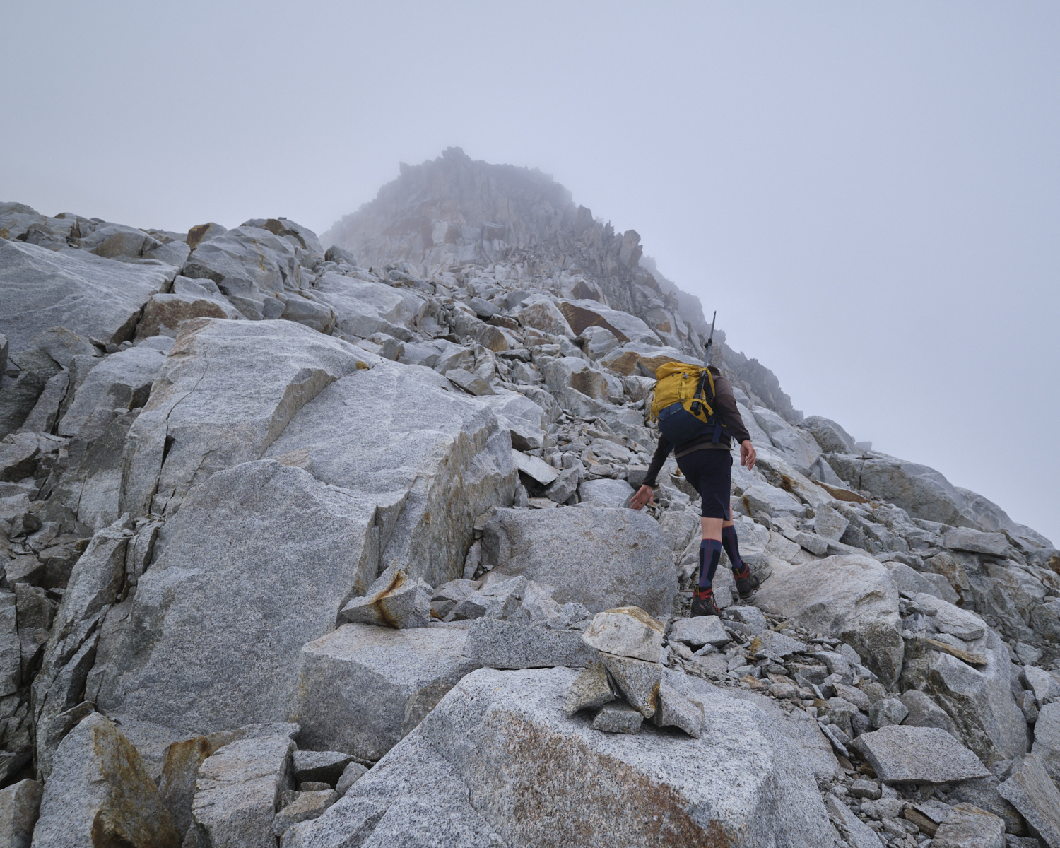
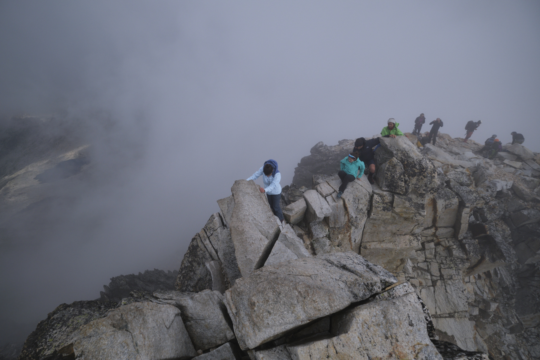
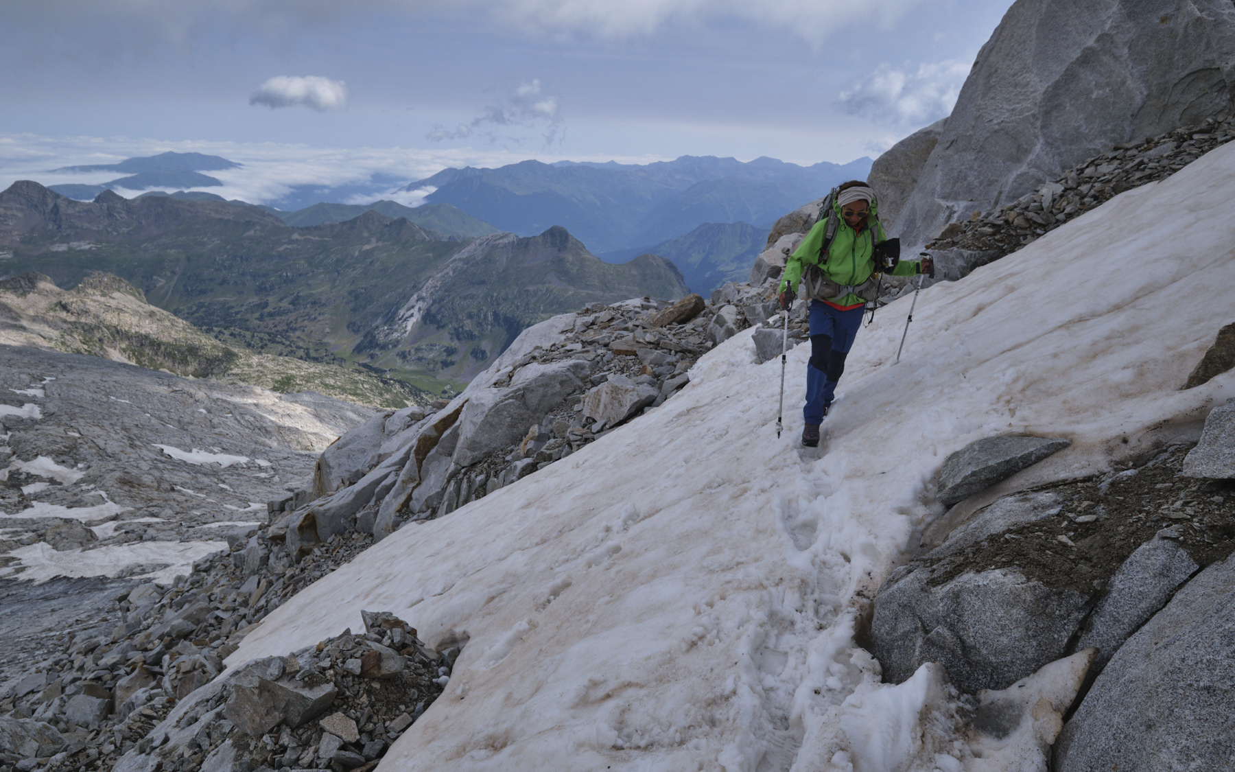
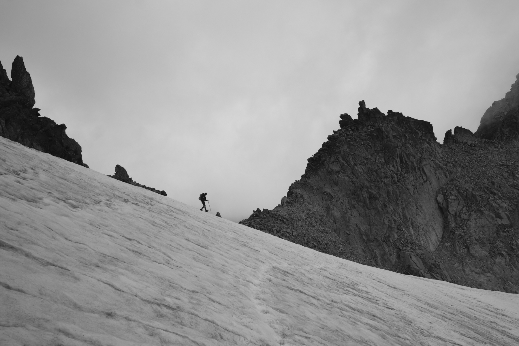
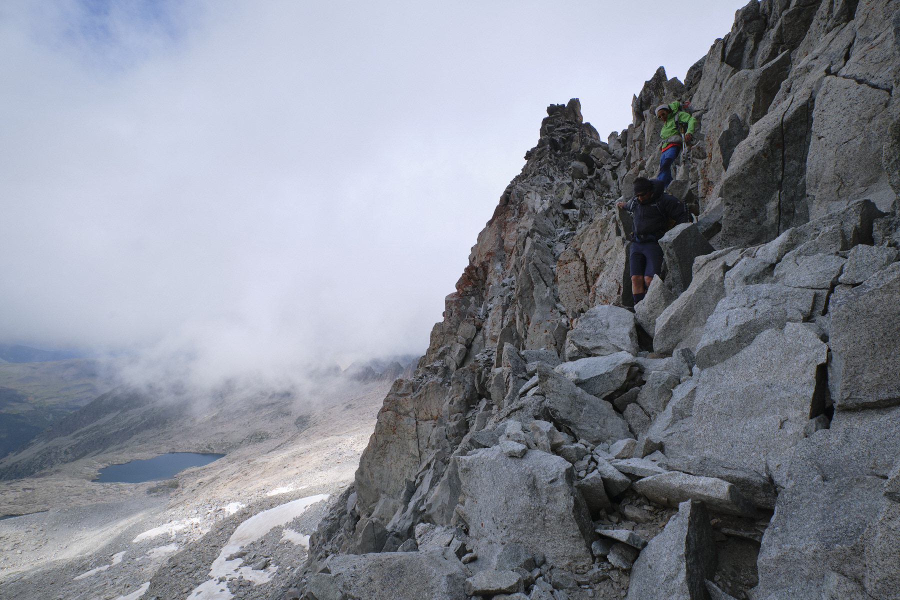
Start the ascent by following one of the cairned routes that weave in and out of the polished slabs. Higher up, there are a few small névés to cross, but not much else. You can even avoid the glacier by climbing without difficulty to the left to reach the Punta Oliveira-Arenas. There's a 100m section to be climbed on snow (crampons) along the wall to the spur that gives access to the summit ramp. Climb the rock until you come to the Pont (Pas?) de Mahomet.
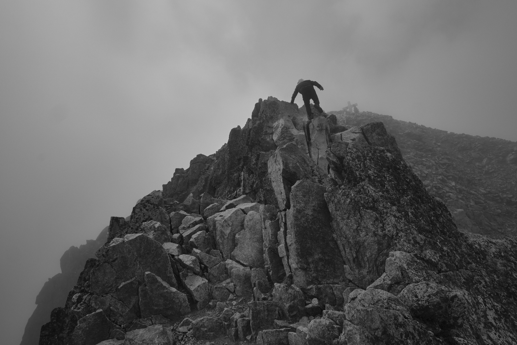
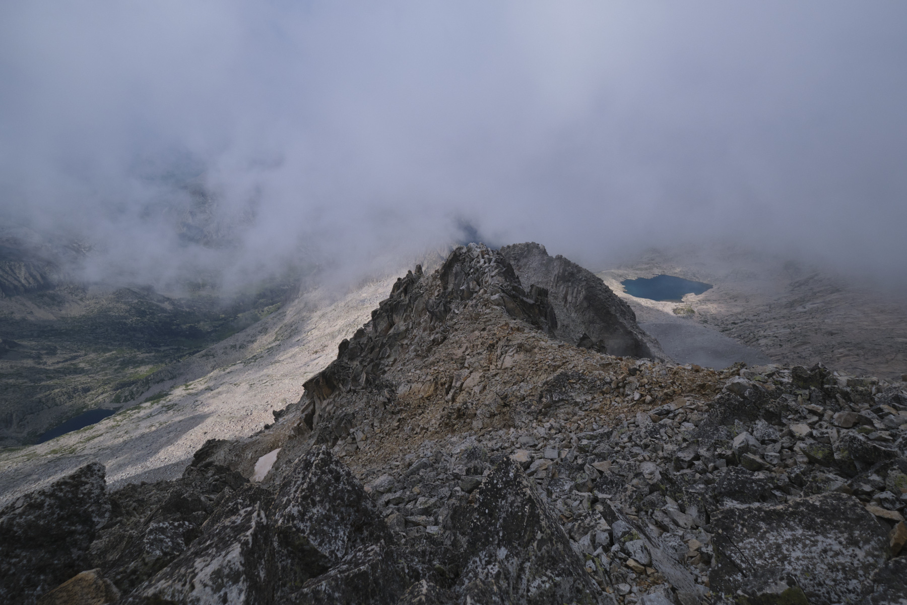
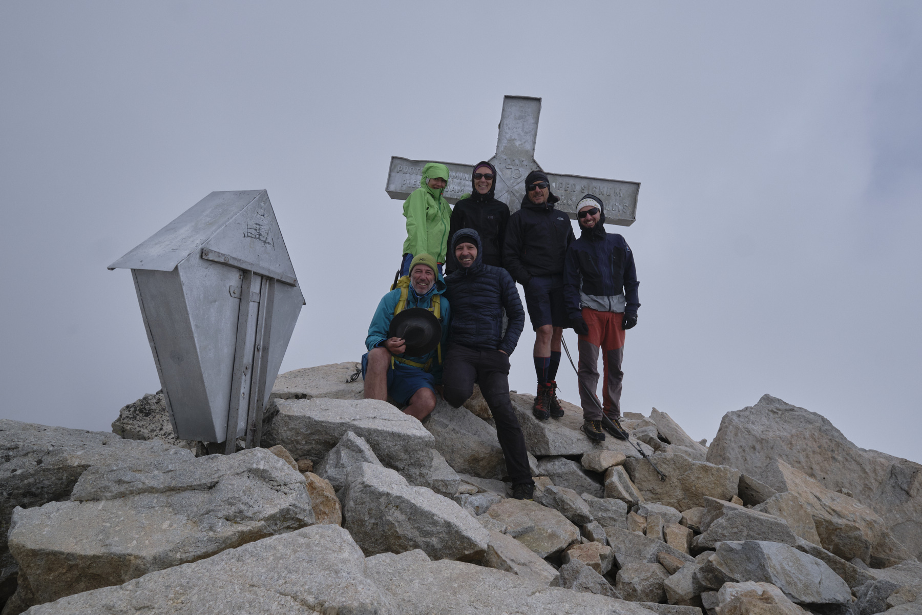
This is a 50m section on a very airy ridge, to be climbed on the boulders. No difficulty, but lots of gas to the left and right. Just beyond is the summit. To the south-west, we overlook the Coronas valley and the Ibones on the way down.
3rd part: from the Aneto to the Coronas refuge via the Ibones de Coronas (1970m, 2h30 to 3h)
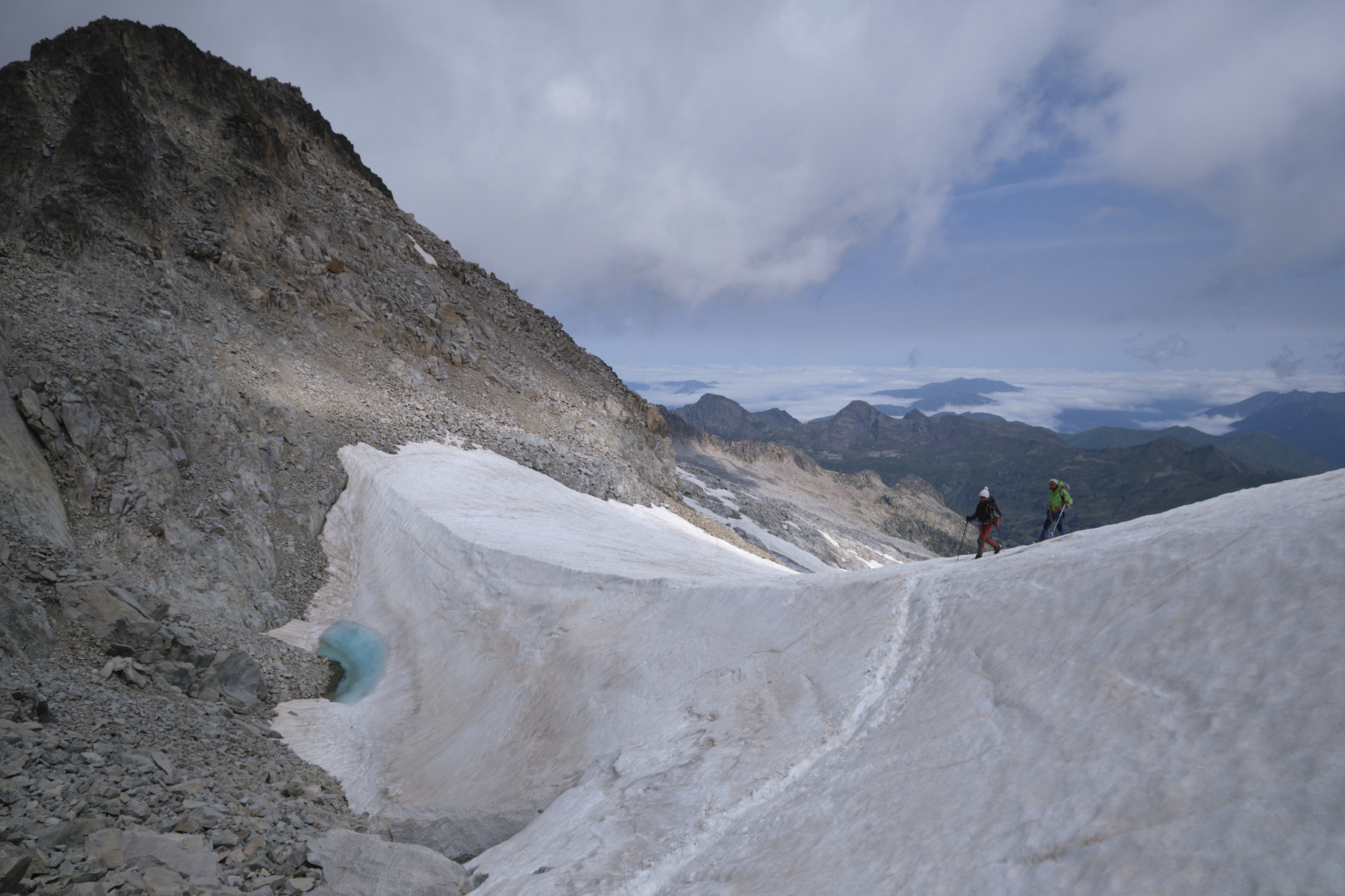
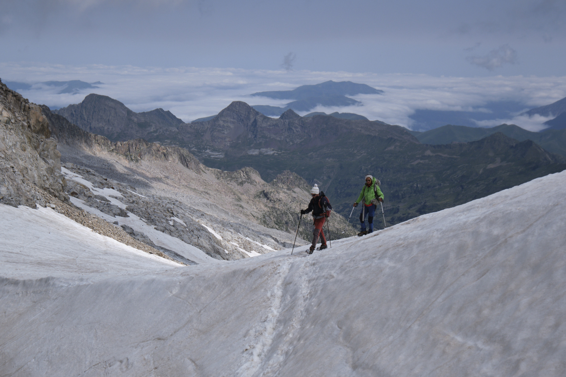
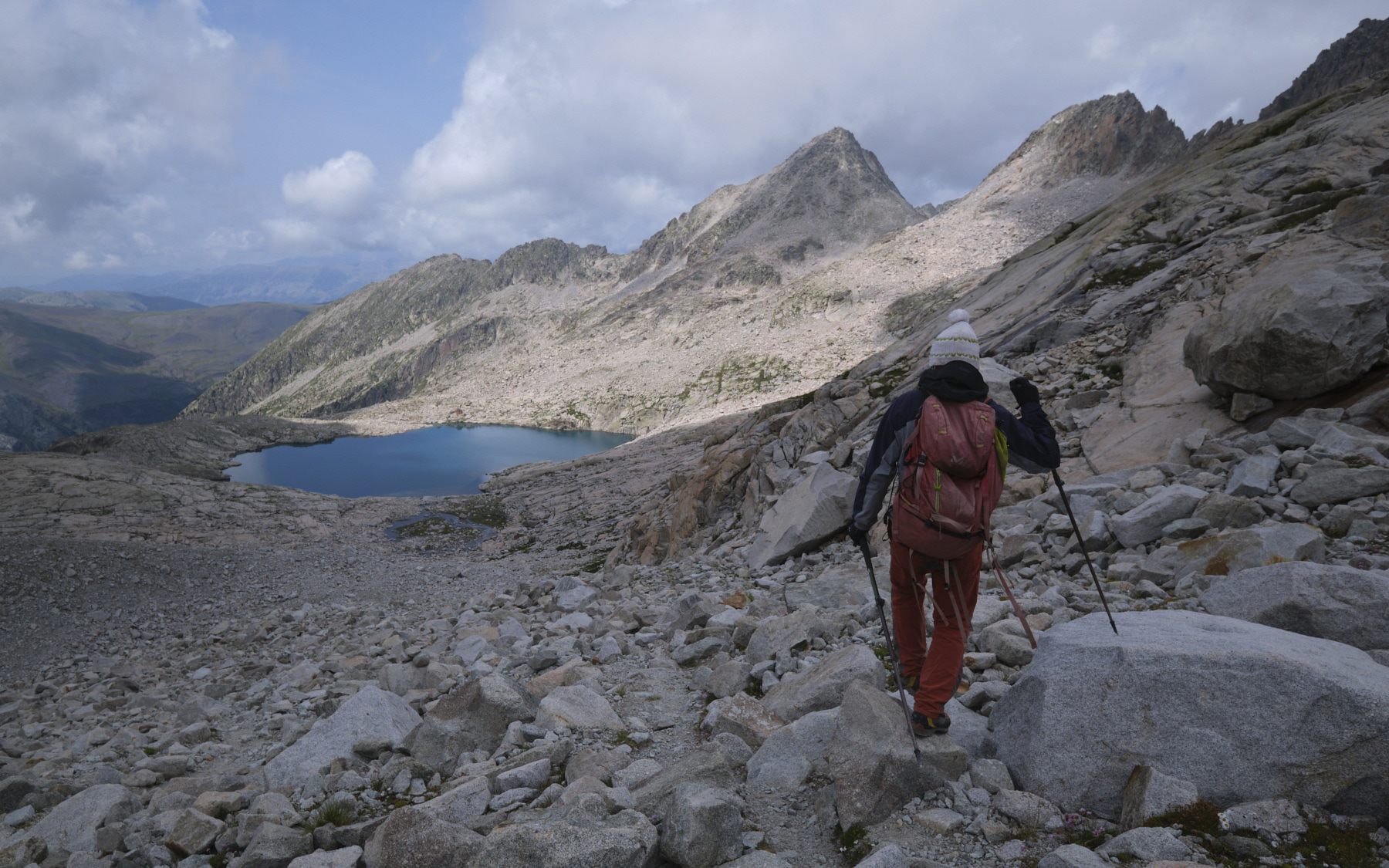
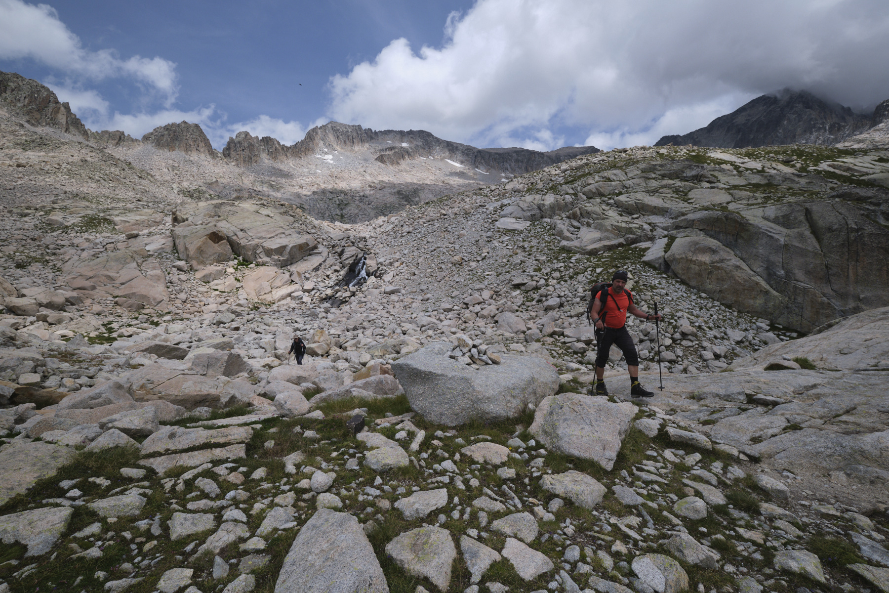
Retrace your steps, cross the Pont de Mahomet (Mahomet Bridge), still as aerial as ever, and repeat the snow-covered section below Punta Oliveira-Arenas. Just below, find a path through the boulders and turn west, skirting the Punta and crossing the névés to reach the Collado de Coronas. The descent is initially very steep and requires careful descent. Further down, the slope becomes gentler, but the route to the Ibones de Coronas through a scree field is long and quite physical. We land on the undulating banks of pink granite that plunge into the bluish waters of the Ibon de Coronas. An ideal lunch break.
Follow the cairns along the left-hand side of the Ibon and suddenly discover the whole way to the bottom of the Vallibierna gorge. The path goes down a second level, passing another small pond further down and then even further down to the Ibonet de Coronas. From here, follow the path down to the left of the barranco de Coronas and the large waterfall. The slope is steep, then becomes gentler further down in the forest. At this point, you cross the main track and follow it to the right, ending up at the Coronas or Pescadores refuge. Cross the small bridge just beyond. Here you'll find the bus station for the return shuttle to Sanarta or Benasque.


 Partager sur WhatsApp
 Partager sur Twitter
Partager sur Instagram
Partager sur Twitter
Partager sur Instagram

 Partager sur Facebook
 Imprimer le topo
 Laisser un commentaire


Leave a Reply