The ascent of the Pic de Bure to dominate the Dévoluy, admire the Grand Ferrand and Obiou massif, overlook the Céüse massif and catch a glimpse of the highest peaks in the Écrins massif: it's a classic hike, but what a spectacle! Not to mention the lunar atmosphere of the plateau du Bure, the unusual installations of the astronomical radio telescopes of the observatoire du ciel and the return to the wild and spectacular Combe Ratin. Although the route largely follows the GR Tour du Dévoluy, the long distance and steepness of the climb make it physically demanding and technically tricky on the monumental scree passages. Bring plenty of water and set off on a clear day, if only to admire the breathtaking panoramas along the way.
❱❱ Technical summary
■ Departure point: Superdévoluy resort, Saint-Étienne-en-Dévoluy, Hautes Alpes (05)
■ Type of route: high-mountain loop hike
■ Distance: 19 km
■ Cumulative elevation gain: +1350 m
■ Cumulative negative altitude gain: -1350 m
■ Estimated total time: 2h30 to 4h ■ Min and max altitude: 1500 m / 2709 m
■ Beaconing: unmarked ascent. The Pas de la fenêtre and the plateau up to the summit are marked GR de pays in red and yellow (GR at the end). The descent via Combe Ratin is also on the GR de pays. Only the final section from the bottom of the vallon de Corne to cut off towards Bonnet Rouge is on an inconspicuous, unmarked path.
■ Equipment in place: a wired section for the Pas de la fenêtre.
■ Equipment required: useful GPS track.
Difficulties: on the way up, passage of the Pas de la Fenêtre, in a scree slope, followed by a steep, aerial section equipped with a cable. On the way down, the unstable and steep Combe Ratin scree.
❱❱ Access to the place
Go to the Superdévoluy resort in the Hautes Alpes, south of Corps, north and north-west of Gap. Park in the first large parking lot on the left as you arrive, at Chalets Margot, where you'll return at the end of the tour.
❱❱ Map & topo
Shown in purple are the shortcuts you can take to avoid the twists and turns of the slopes as you climb into the resort.
From the parking lot, climb up to stand in front of the first bar of the resort's building, on the south side, opposite the start of the pistes, particularly the Jas chairlift where the ascent begins.
Course
1st part: up the slopes to the Pas de la fenêtre (2540m)
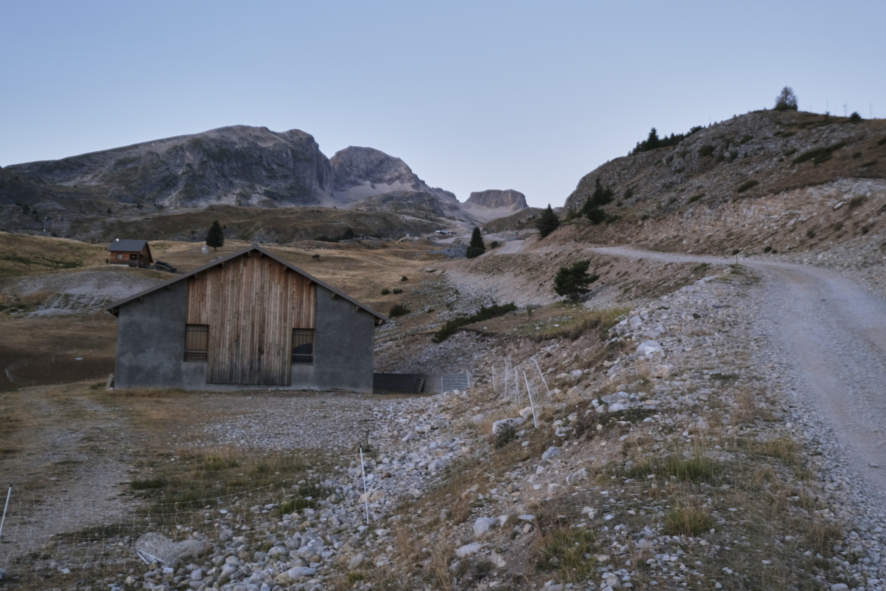
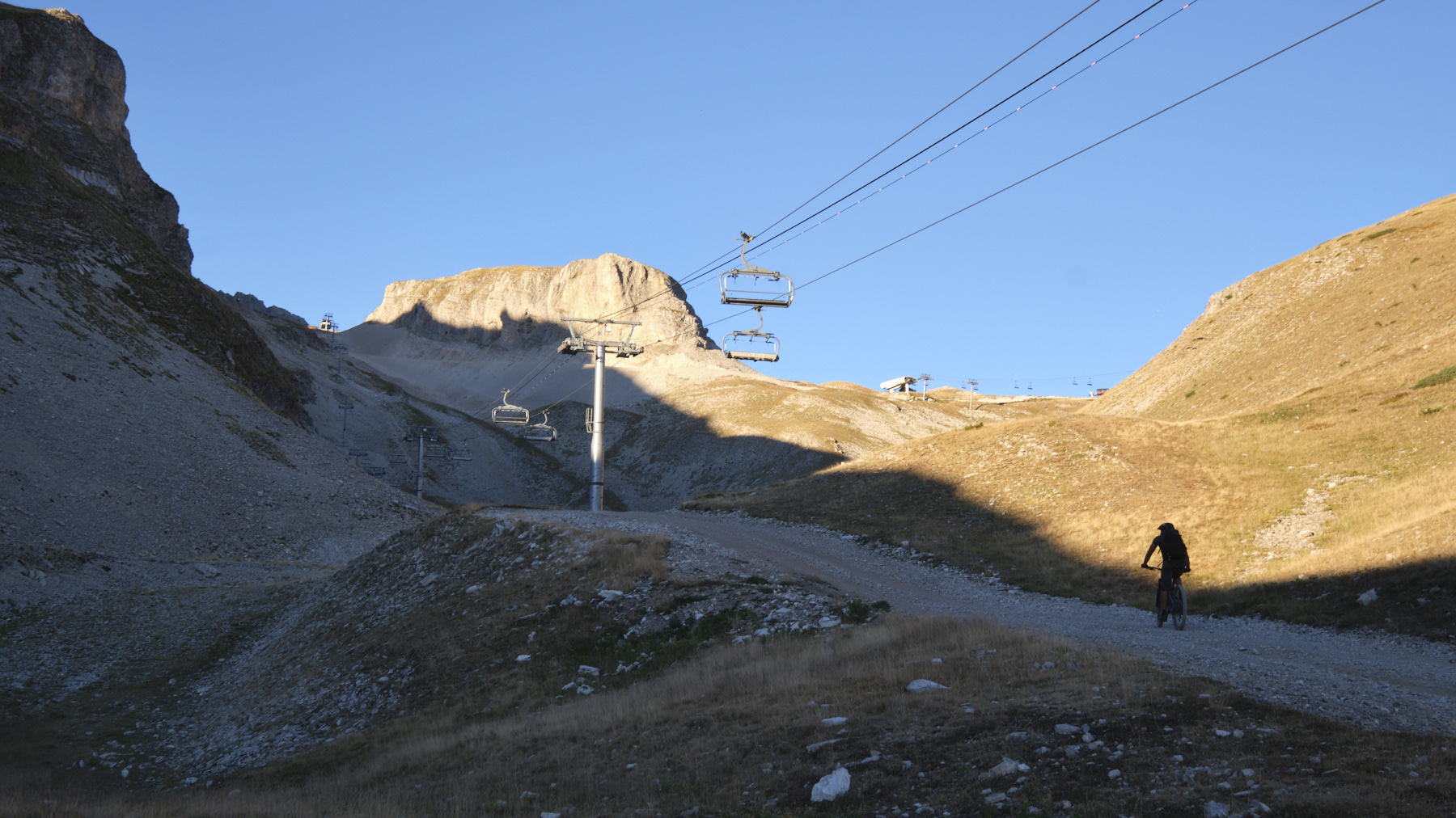
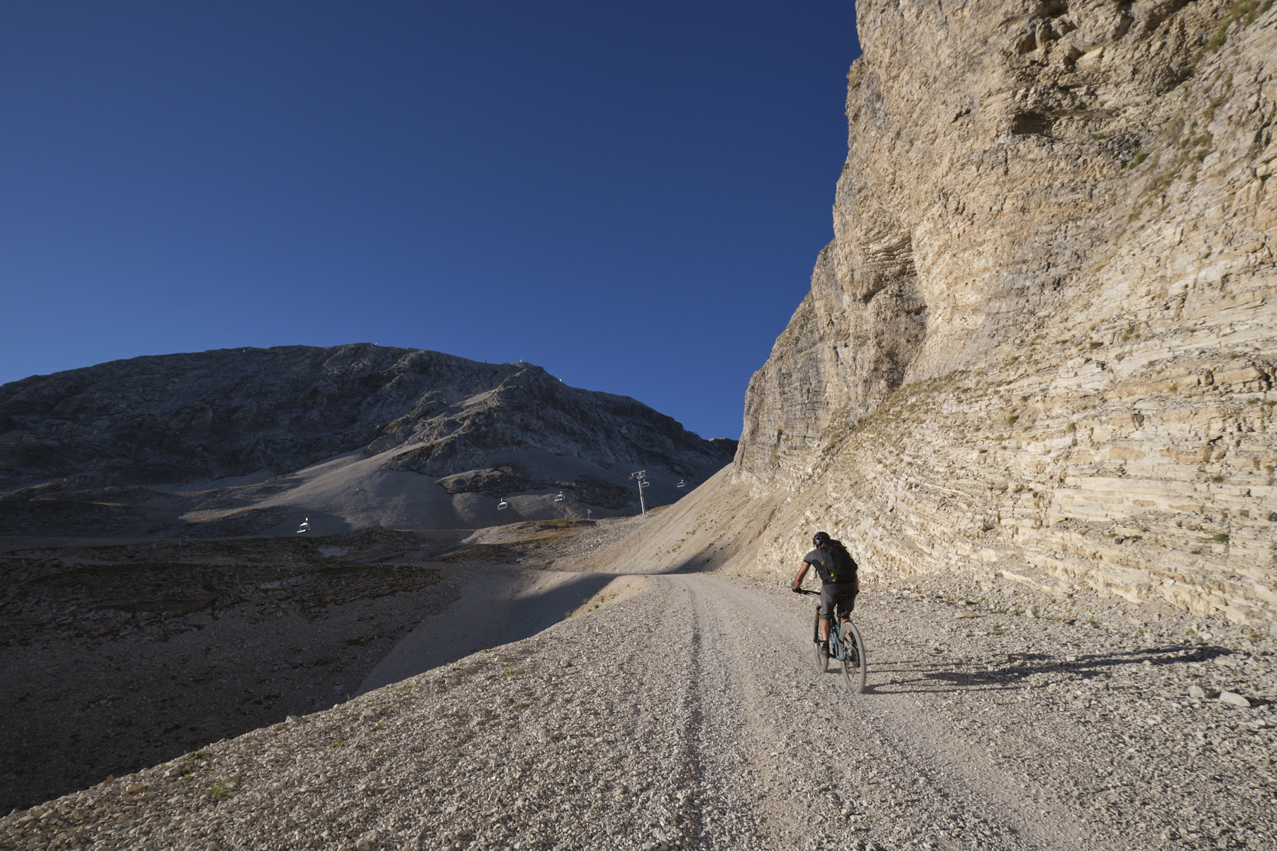
Start by taking the track that rises to the left of the Jas chairlift. Continue more or less under the chairlift, cutting the switchbacks to emerge above the forest. Continue on the trail that passes a large hut on the right, then a small chalet just beyond. The Sommarel hump is clearly visible here (see photo). The trail climbs gradually and more or less straight up to the top of Pélourenq, where it turns at right angles to the Sommarel chairlift departure point.
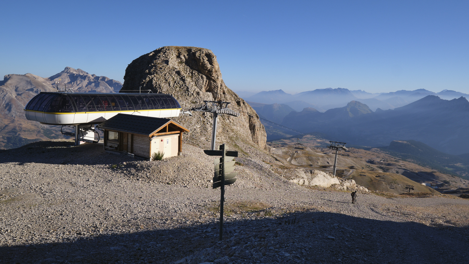
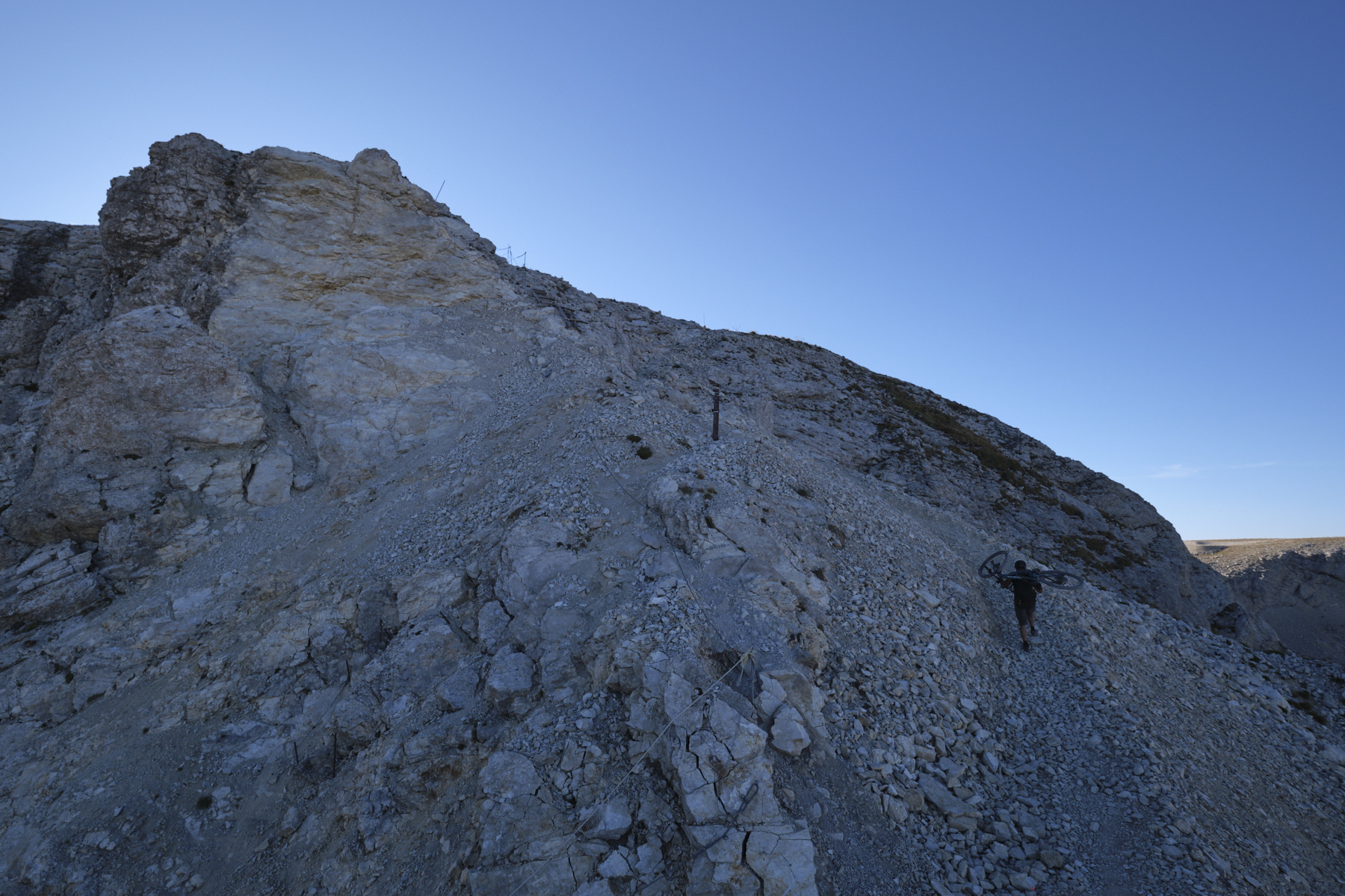
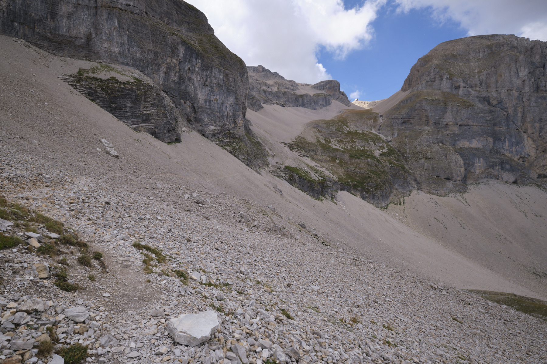
Climb up on the track beside the chairlift, pass under it and eventually cut off to shorten the track, aiming for the characteristic Sommarel tooth. You'll find the trail again at the foot of the Sommarel hump, which you skirt until you reach the chairlift. From here, take the track that climbs towards the "window", a small hole in the rocky ridge that can be seen clearly from below. Further on, follow the path that climbs steeply to the left, cutting across the track and leading to a platform at the Pierra ski lift arrival point.
The section that follows is equipped with a lifeline and wooden risers to pass through a gap to the left of the window (see photo on the front page taken from this spot).
Part 2: the plateau and Pic du Bure (2709m)
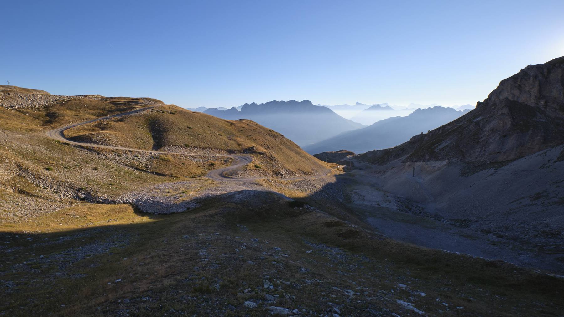
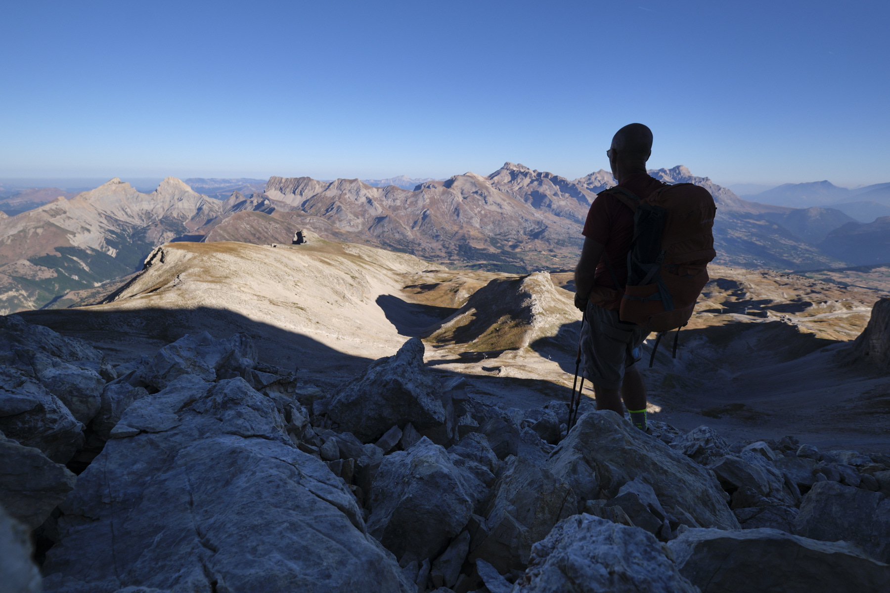
From the gap, continue on the equipped path, which bends to the southeast, passing over the southern slope of the ridge. It climbs steeply for a while longer, before leading to the Bure plateau. Walk along the plateau and descend slightly to pass the giant antennae of the sky observation station. To the east is a spectacular view of the nearby peaks and glaciers of the Écrins.
After the station, follow the GR as it crosses the long desert plateau, descending a little before finally tackling the final ramp up to the bow-shaped Pic de Bure at the far end. Once at the summit, the view is an incredible 360°!
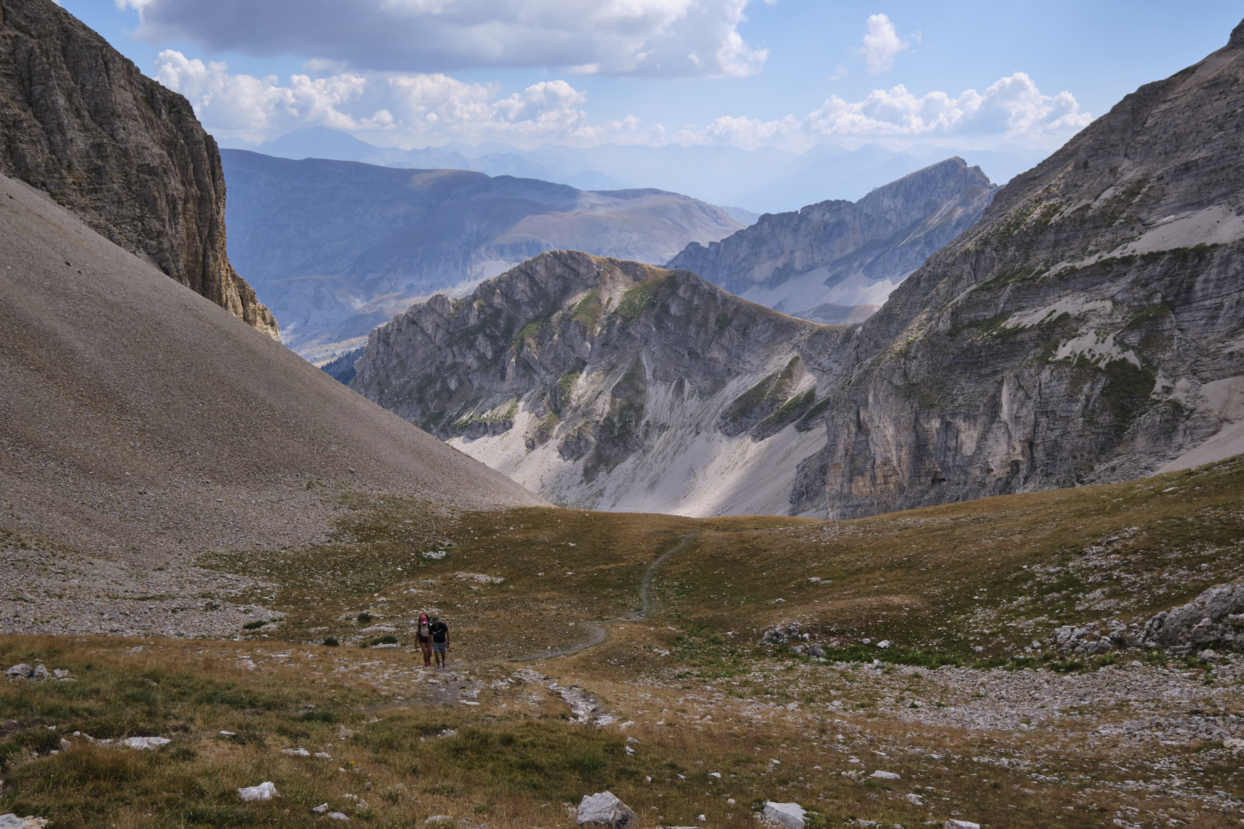
Part 3: Combe Ratin and vallon de Corne on the way back
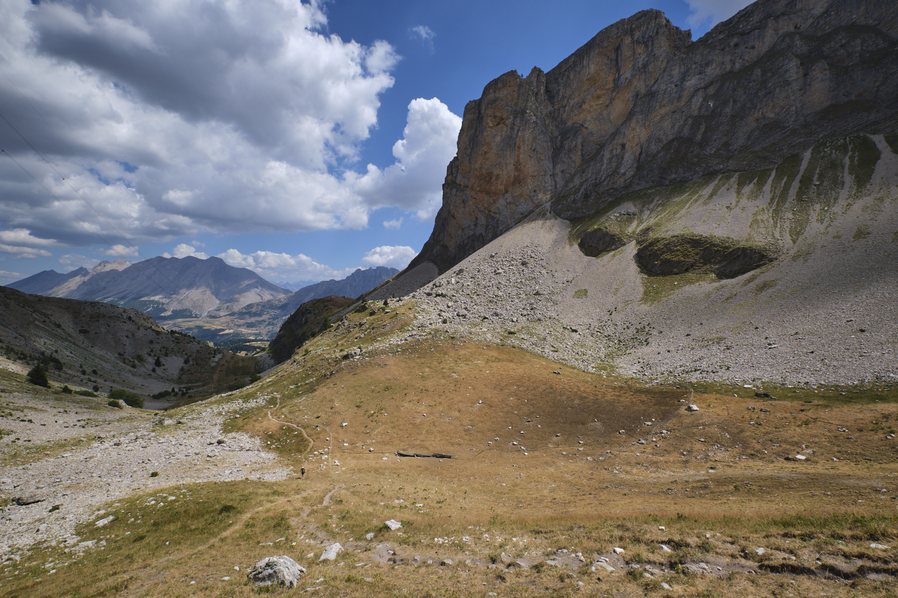
From the summit of Pic de Bure, retrace your steps to the observatory and begin the descent of Combe Ratin (GR), which leads off to the right into a huge scree slope, past the cable car. At the bottom of the scree slope, the path continues down into the combe, which opens out a little more, then crosses a large scree slope again to reach a small pass above a basin with a kind of big hump in front of it. At the pass, turn left to return to the cable car and enter the Corne valley.
A steep descent begins down the valley to the bottom. Continue on almost level ground to cross the entire length of the valley. From the end of the vallon de Corne, at the corner of the track under the cable car pylon, cross over to the north-west, following a faint path that cuts through a scree slope and then crosses a shoulder to cross a grassy valley until you reach another small valley under the Bonnet Rouge. From here, follow the visible path in the grass to the north-east, passing the Bergerie de Pied Gros, then the entrance to the via souterrata de la Tune, and finally back to the resort via the Chalet Margot residences. Cross between the chalets back to the start parking lot.


 Partager sur WhatsApp
 Partager sur Twitter
Partager sur Instagram
Partager sur Twitter
Partager sur Instagram

 Partager sur Facebook
 Imprimer le topo
 Laisser un commentaire


Leave a Reply