


TOPO Hiking | CLIMBING7.COM
Publié le
 Partager sur WhatsApp
 Partager sur Twitter
Partager sur Instagram
Partager sur Twitter
Partager sur Instagram

 Partager sur Facebook
 Imprimer le topo
 Laisser un commentaire

A superb loop around and on the Montaña de Tauro, in the southern part of the island. A varied itinerary, aerial panoramas over the center, south and west of the island, and moods that change as the day progresses. In the end, there's not much to take away. More than the summit of Montaña de Tauro (1225m), which is nothing special, it's the whole route that's really worth the detour. If the orientation in the 1st part is not obvious, with trail combinations to be found, there is no particular difficulty on the route apart from a few slightly more aerial passages to be crossed in the last part. One of the most beautiful treks we did during our stay on Gran Canaria.
❱❱ Technical summary
Type ✦ Hiking
Location ✦ Baranquillo Andrès
Region ✦ Gran Canaria
Country ✦ Spain
Length ✦ 15kms
Vertical drop ✦ 780m
Difficulty ✦ MD
Max altitude ✦ 1225m
Duration ✦ 4h30 to 5h
Interest ✦ ★★
❱❱ Access to the place
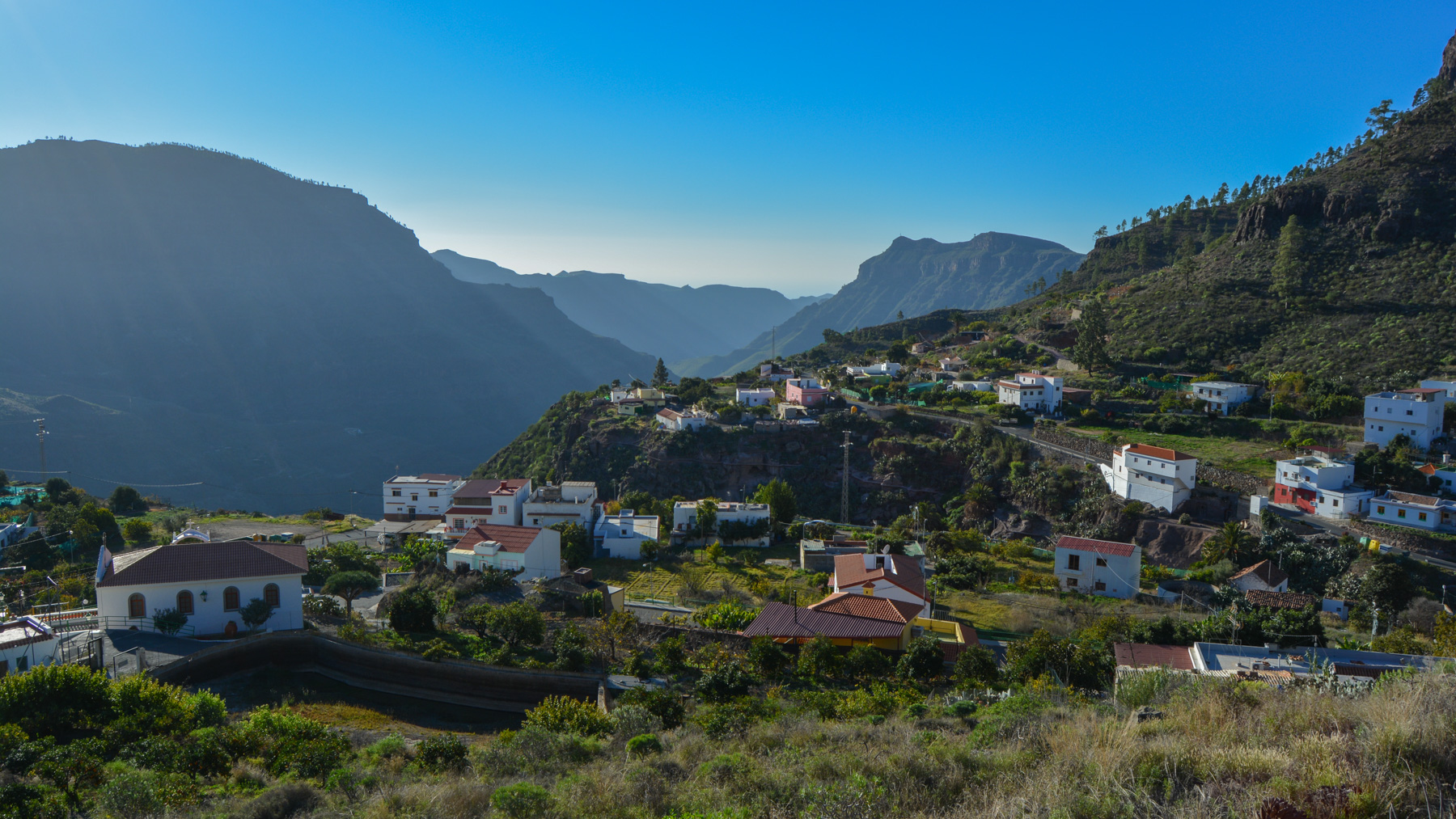
Take the G-505 road from the freeway in the south of the island and head north towards Soria. Park in the village of Baranquillo Andrès, near the church.
❱❱ Map & topo
❱❱ Itinéraire
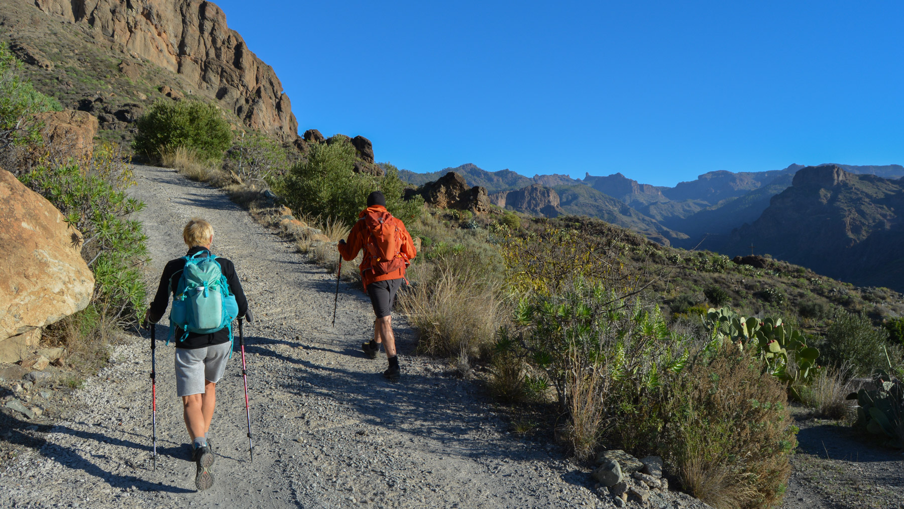
In the village, follow the G-505 road up to the church. Go behind it to find a large black gate which appears to be closed, but which opens when you pass your hand through it. This is where the trekking trail starts, on a cemented track that climbs to the village heights.
This is an "almost loop" as the trail ends on the G-505 road some 2kms below the starting village. The combination of trails used and the absence of signposts along the way mean that it's best to use the GPS track as a guide. There are, however, signposts at important junctions.
Climb the winding cement road above the village. This then becomes a wide track, leading up to the large orange wall above us. Once you're more or less below it, at the level of a last dwelling, take the track that climbs to the right, eventually passing to the left of the wall. At the end of this track, at a widened flat, take care to catch the little path that goes off to the right towards the Presa de las Niñas (small wooden sign).
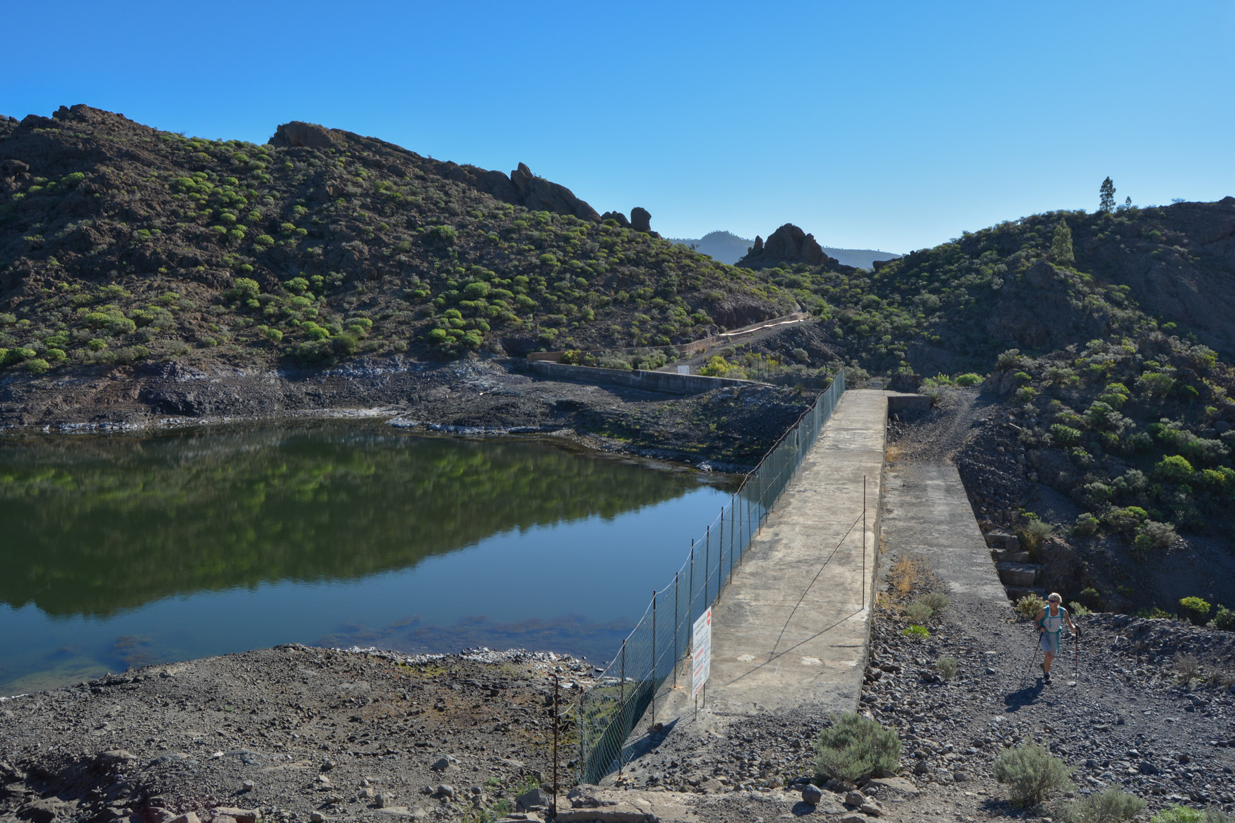
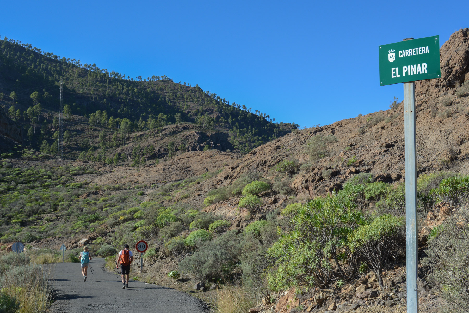
Climb up, pass a small shoulder and continue straight on to reach a sort of upper valley covered with low vegetation. Continue upwards and you come to a ledge with a falaj-type water pipe. Turn left and follow the pipe to reach the small Salto del Perro reservoir fairly quickly. Cross the dam and climb uphill to reach the asphalt road, Carretera El Pinar.
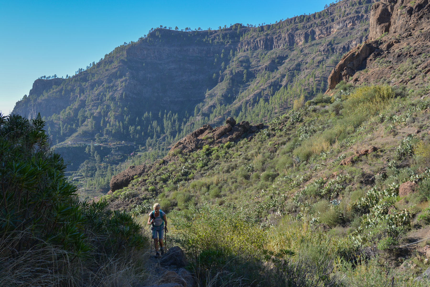
Descend onto the Carretra El Pinar and almost immediately turn right again onto the path. You reach a platform with a view to the west, and following the path, head back south to skirt a wall and climb into the pine forest on the flanks of the mountain. A gentle, gradual ascent along a well-marked path.
At the top, after a wide bypass to the north, take the fork to the left towards Montaña de Tauro (indicated by PR GC-45). You'll soon reach a platform overlooking the Soria valley, with lovely views of the central peaks.
Continue on the small cairned path that climbs up to finally reach the summit at 1225m, not really a summit but rather a platform with a ruined stone shelter (and a book of piadas to leave a message).
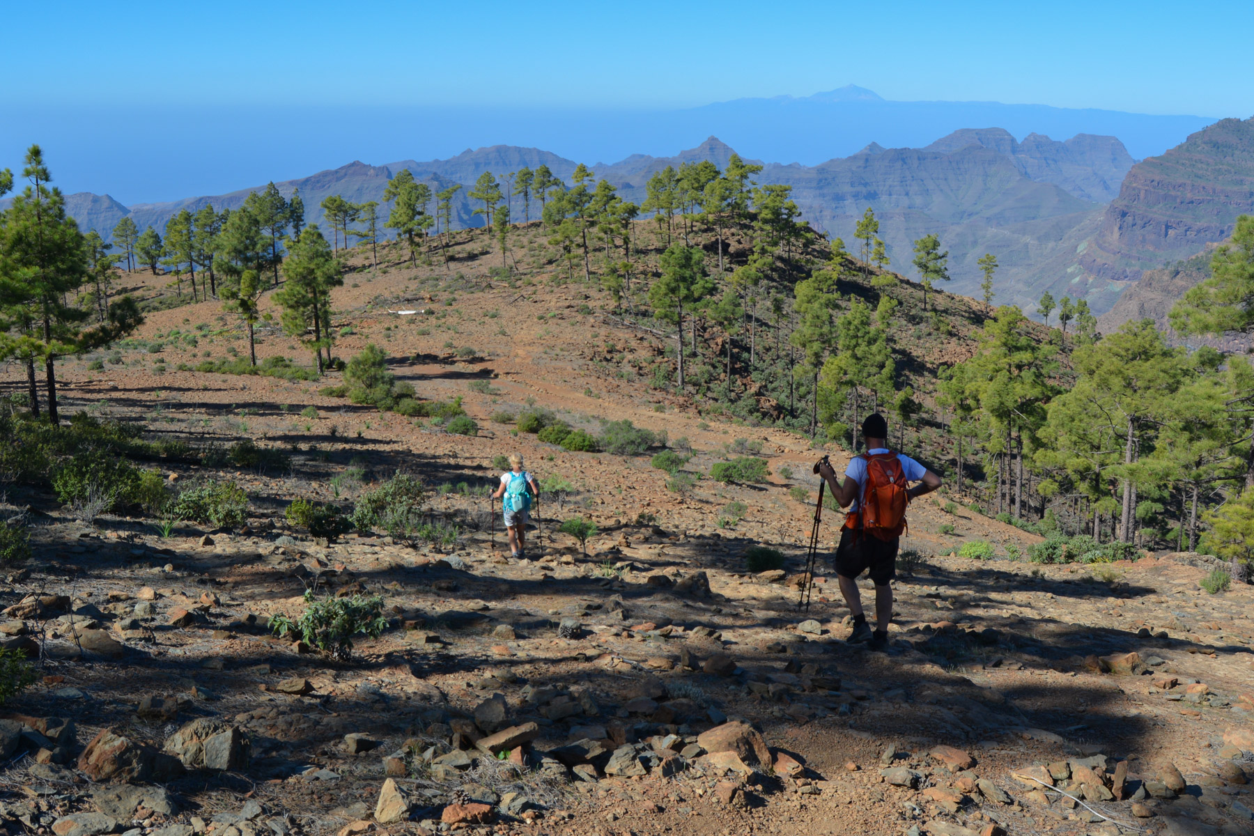
A very beautiful section that changes the landscape completely, with splendid views to the south and onto the large high plateau formed by the Montaña de Tauro, overlooking the neighbouring valleys and the barranco de Tauro.
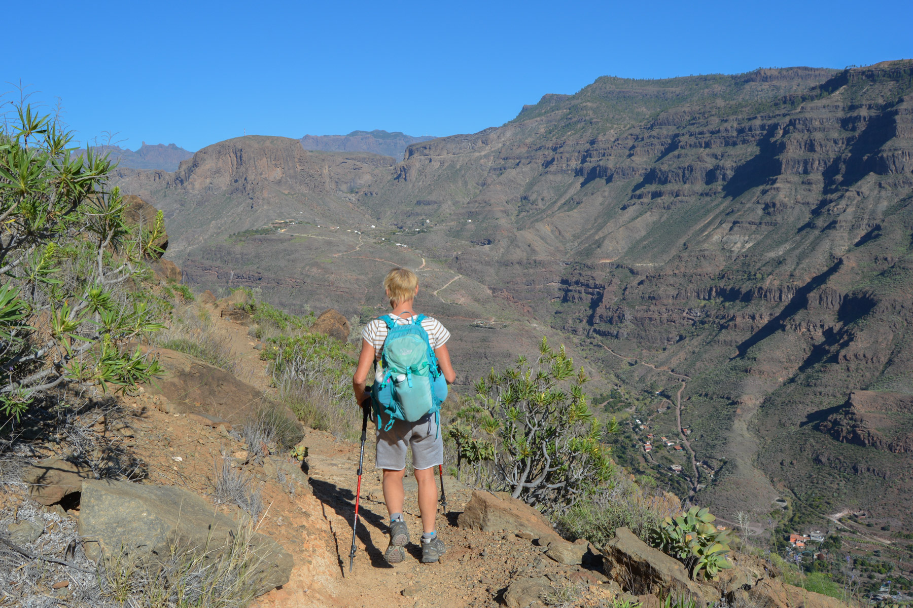
Descend from the summit to the west (cairns) and reach a flat area below where the main path passes, which we'll follow to the left, heading south. The path quickly winds its way across the open plateau, turning slightly to the west at the bottom to reach the Degollada de las Lapas (960m), which offers a spectacular panorama of the valley with Tenerife's Teide in the background.
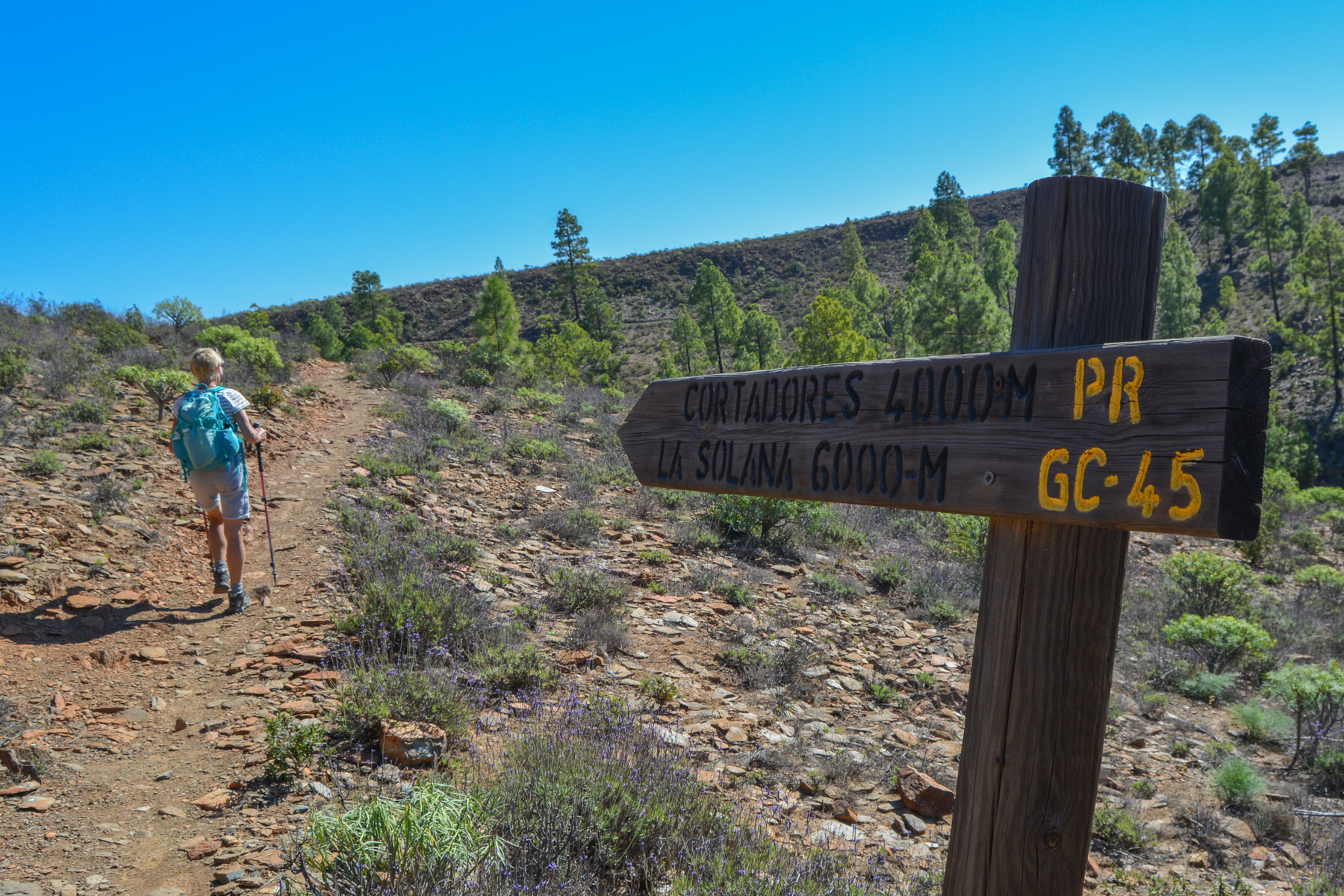
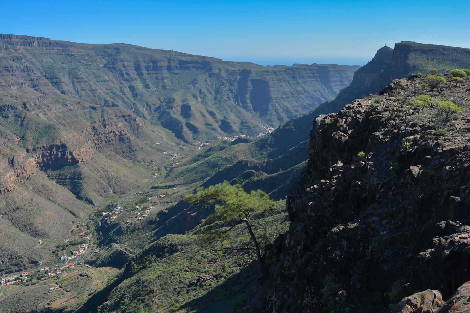
From here, head almost in the opposite direction towards the degollada de los Cortadores via the PR GC-45 (follow Cortadores 4000m). This is the start of a superb itinerary along a path that remains more or less on the flank and, following the relief or crossing high walls, crosses the entire upper valley floor of the barranco de Tauro. In the distance, on the south side, towards the sparkling sea, we can see a natural promontory jutting out, pointing due south: the Punta de los Cortadores, our goal.
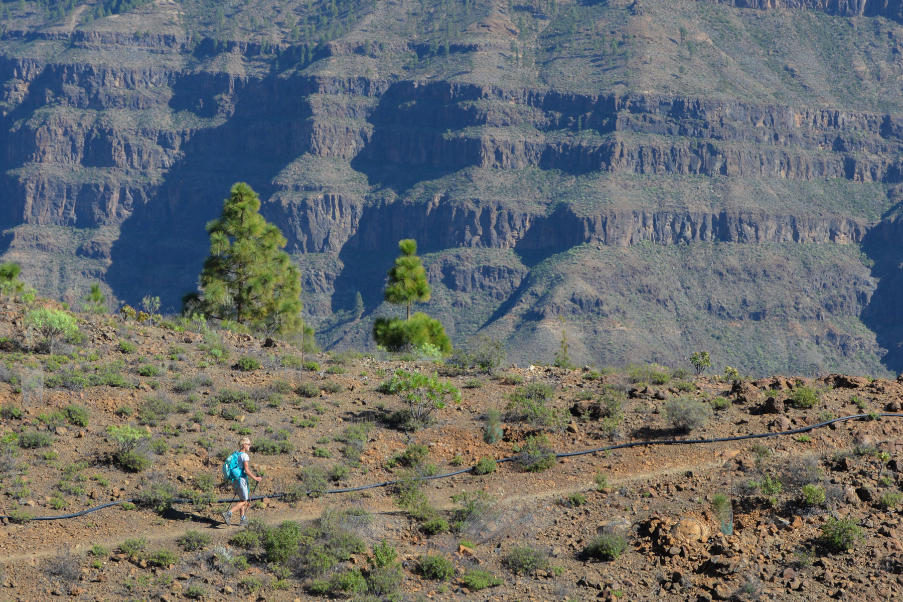
Once through the barranco valley, the trail joins the crest of the walls overlooking the Arguineguin barranco valley on the east side, the village of Filipinas and the access road by car. Beautiful views once again. We continue to descend very gradually along this broad ridge, finally reaching the degollada de los Cortadores (720m) where we fork back towards Baranquillo Andrès.
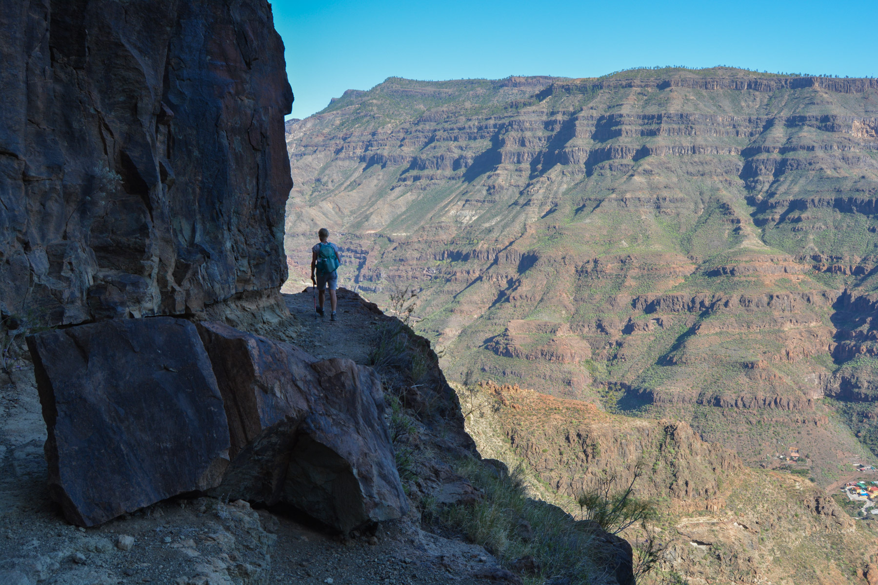
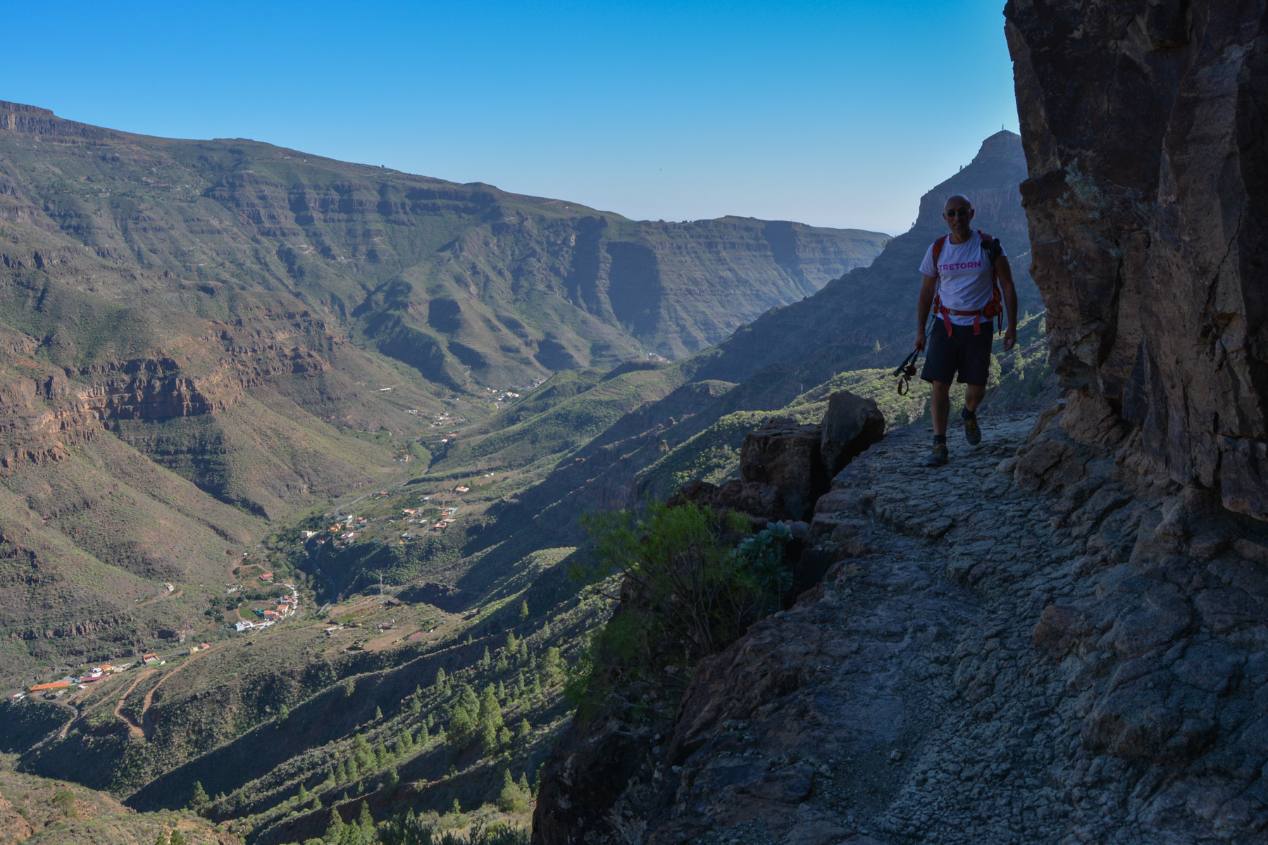
Take the path that descends and heads north again PR GC-45 signposted to La Solana 2000m. This part is also splendid, as the aerial path winds its way up the entire valley, threading its way along the base of the great eastern walls of Montaña de los Cardones, sometimes through passages cut into the rock beneath the cliffs. There's plenty of time to admire the uninterrupted view, even if some of the narrow, exposed passages close to the void require care and vigilance.
The trail, again following all the mountain's contours, slowly loses altitude, eventually joining the G-505 road that climbs from Filipinas to Baranquillo Andrès.
Drive up the G-505 back to Baranquillo Andrès on asphalt or, if possible, leave a second vehicle at the trailhead.


Leave a Reply