


TOPO Hiking | CLIMBING7.COM
Publié le
 Partager sur WhatsApp
 Partager sur Twitter
Partager sur Instagram
Partager sur Twitter
Partager sur Instagram

 Partager sur Facebook
 Imprimer le topo
 Laisser un commentaire

Guadayeque, a canyon with Latin American resonance, which rises from the island's south-east coast towards the center, forming a beautiful wadi-like valley. The itinerary from Cueva Bermeja offers superb panoramic views as you climb directly onto the ridges overlooking the canyon on its western bank. You'll also come across a number of ancient troglodyte dwellings, some dug out on the edge of the void. However, the valley is actually quite short, and the loop around the top is less interesting. It's only on the way back, just above the last village, that the route regains all its interest, with an absolutely vertiginous final descent. An uneven package, then, but one which, shortened in its lower section, could earn a star!
❱❱ Technical summary
Type ✦ Hiking
Location ✦ Agüimes
Region ✦ Gran Canaria
Country ✦ Spain
Length ✦ 17,4kms
Difference in altitude ✦ 1210m
Difficulty ✦ MD
Max altitude ✦ 1000m
Duration ✦ 5h30 to 7h
Interest ✦ ★
❱❱ Access to the place
From the town of Agüimes, take the uphill G-103 road, which quickly enters the corridor formed by the Guadayeque valley. Continue for a few kilometers and park at Cueva Bermeja. If 2 vehicles, leave the other at Montaña de las Tierras a little further up the road.
❱❱ Map & topo
❱❱ Itinéraire
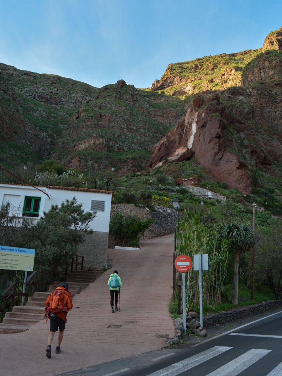
Climb up the hamlet's narrow streets to find a well-marked trail just below the large wall. And how on earth are you going to climb this gigantic wall by foot? It looks totally impassable...
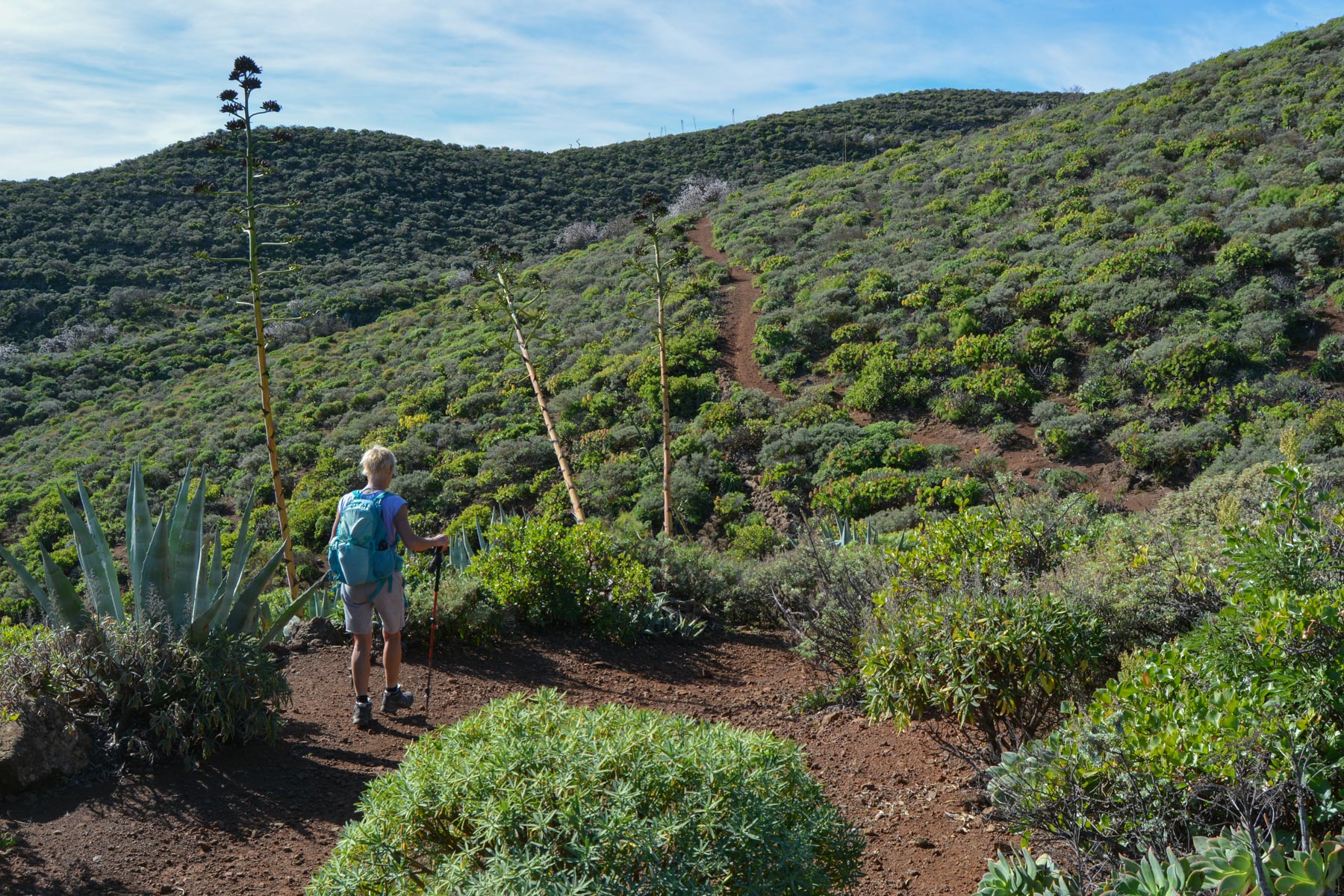
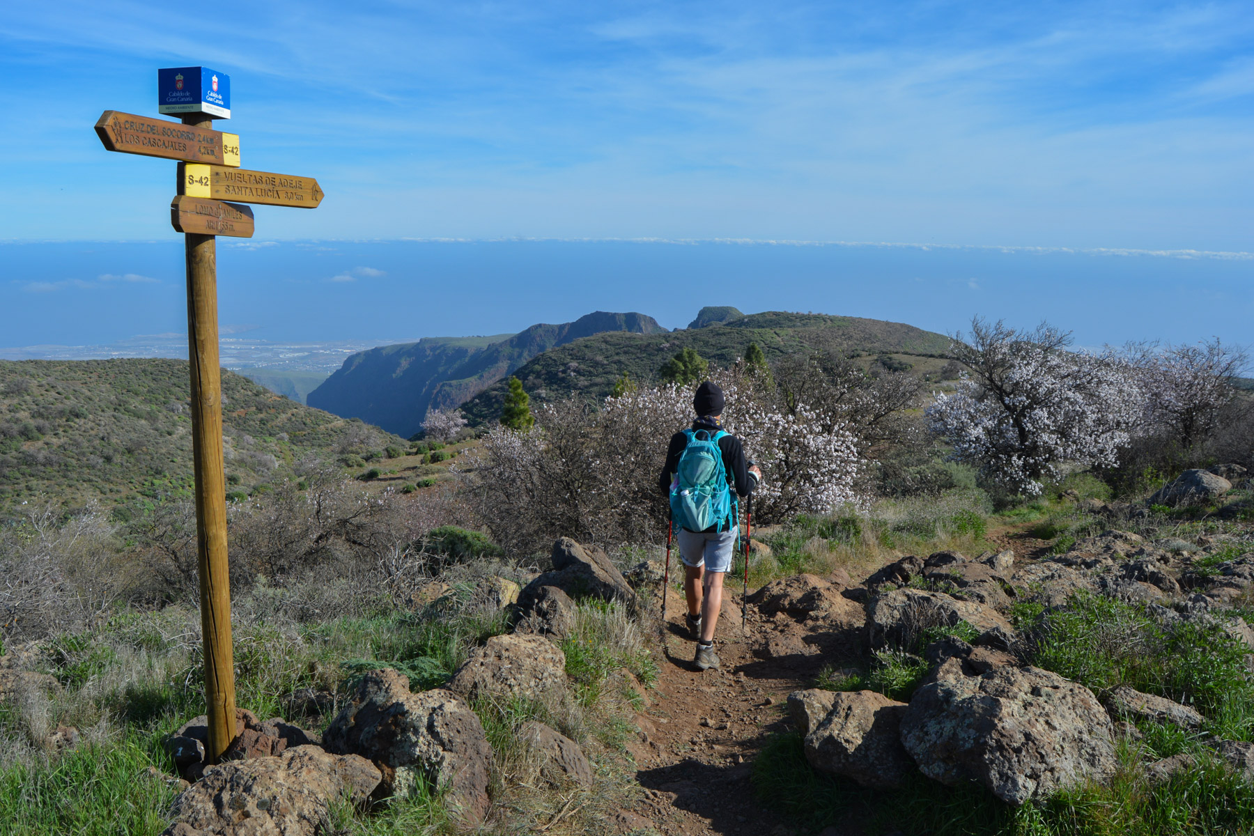
As with most of the treks offered here, the itinerary follows a combination of trails, some official (mainly S-37, S42), others less so, but in all cases unmarked along the way, with only signposts at important junctions or forks. It's best to have the GPS track with you, especially for the upper loop where you have to take shortcuts in the middle of sometimes 2 or 3 trail options. The route is long and the difference in altitude significant, which makes the hike difficult.
The top loop is less interesting and could be skipped (unless you want to go as far as Caldera Los Marteles, a crater dating back over 1 million years). This would shorten the route, with either the traverse at the top (part 4), then the return via the trail to Montaña de las Tierras, or the direct descent when above the village (part 5).
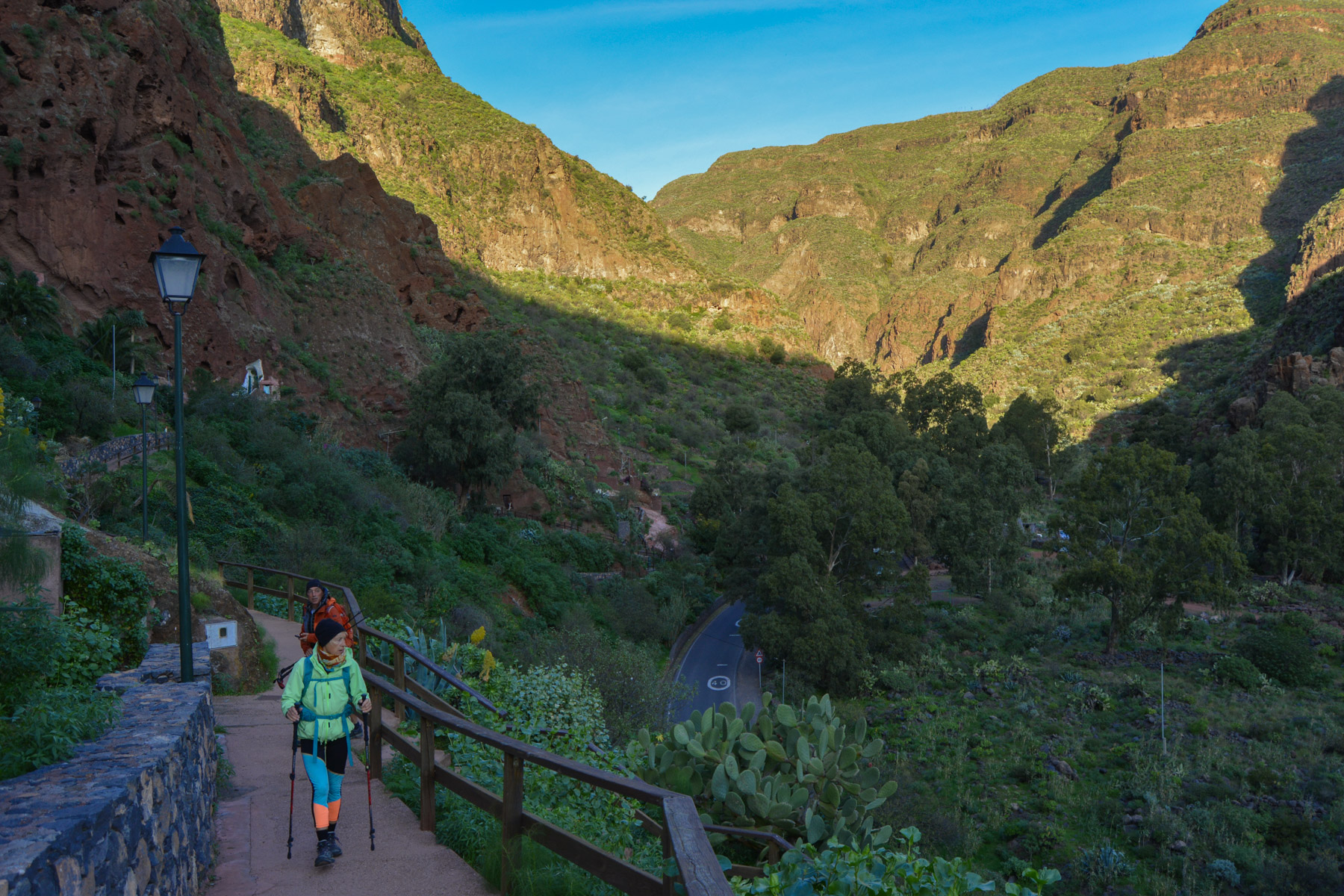
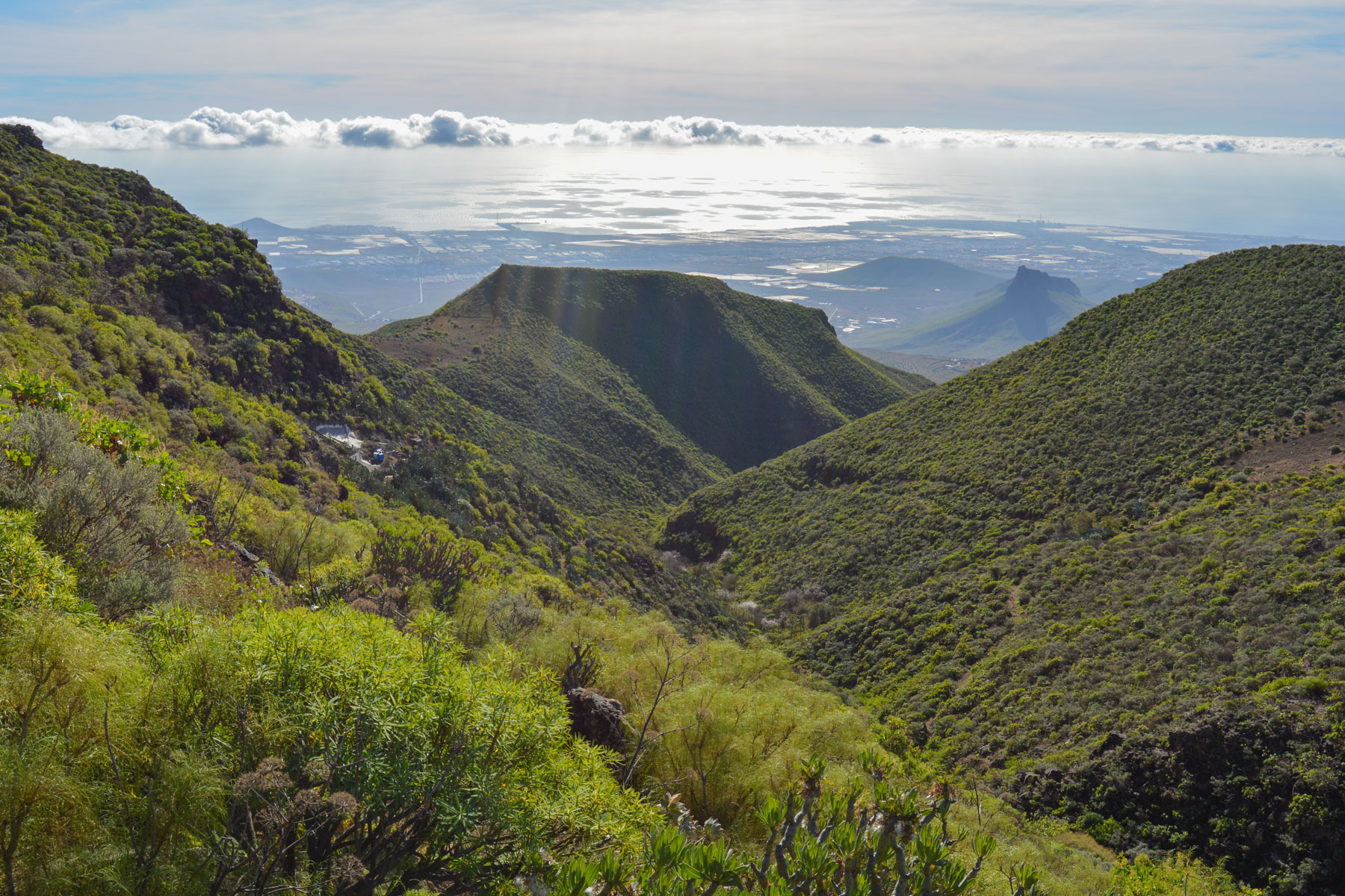
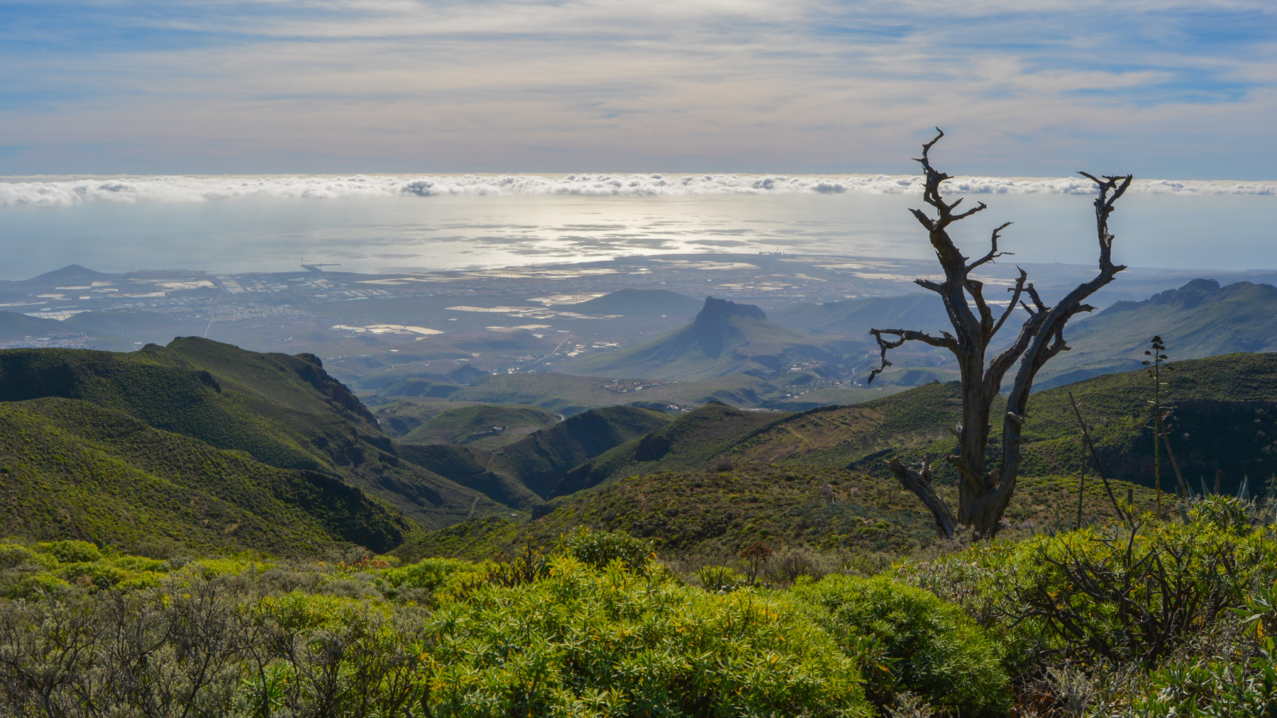
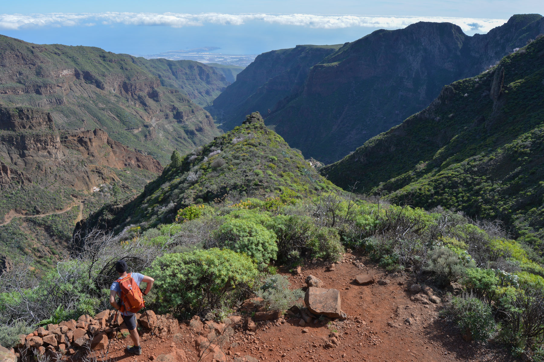
The aerial trail climbs steeply, clinging to the wall and rising quickly above Cueva Bermeja. To avoid the large walls, the route heads south and cleverly climbs the most accessible parts. We pass ancient stone dwellings built into the cliffs. Finally, after 45′ of almost continuous ascent, we come out on the ridge. We're now on a sort of long dome of vegetation which, on the south side, seems to slide towards the sea and, on the north side, climbs up along the Guadayeque. At the fork, turn right towards Temisas (SL2 or S-37).
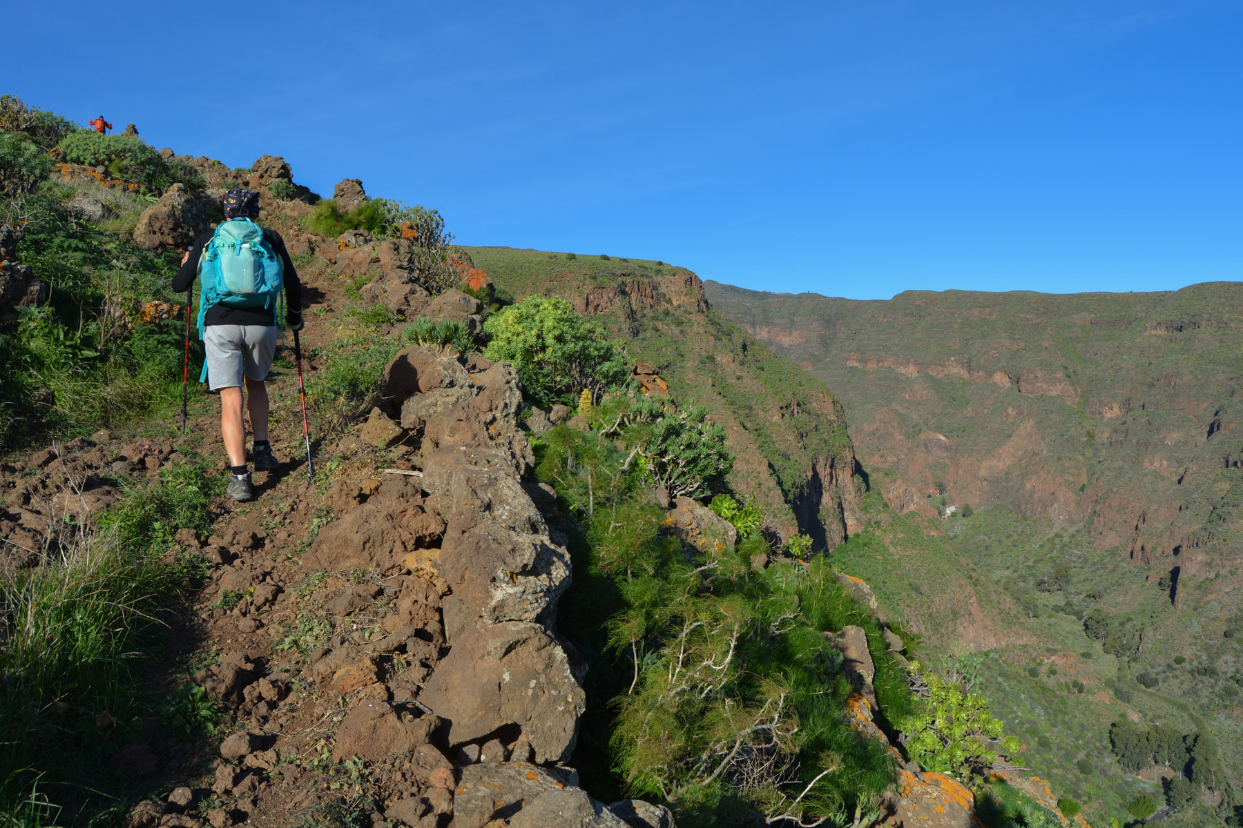
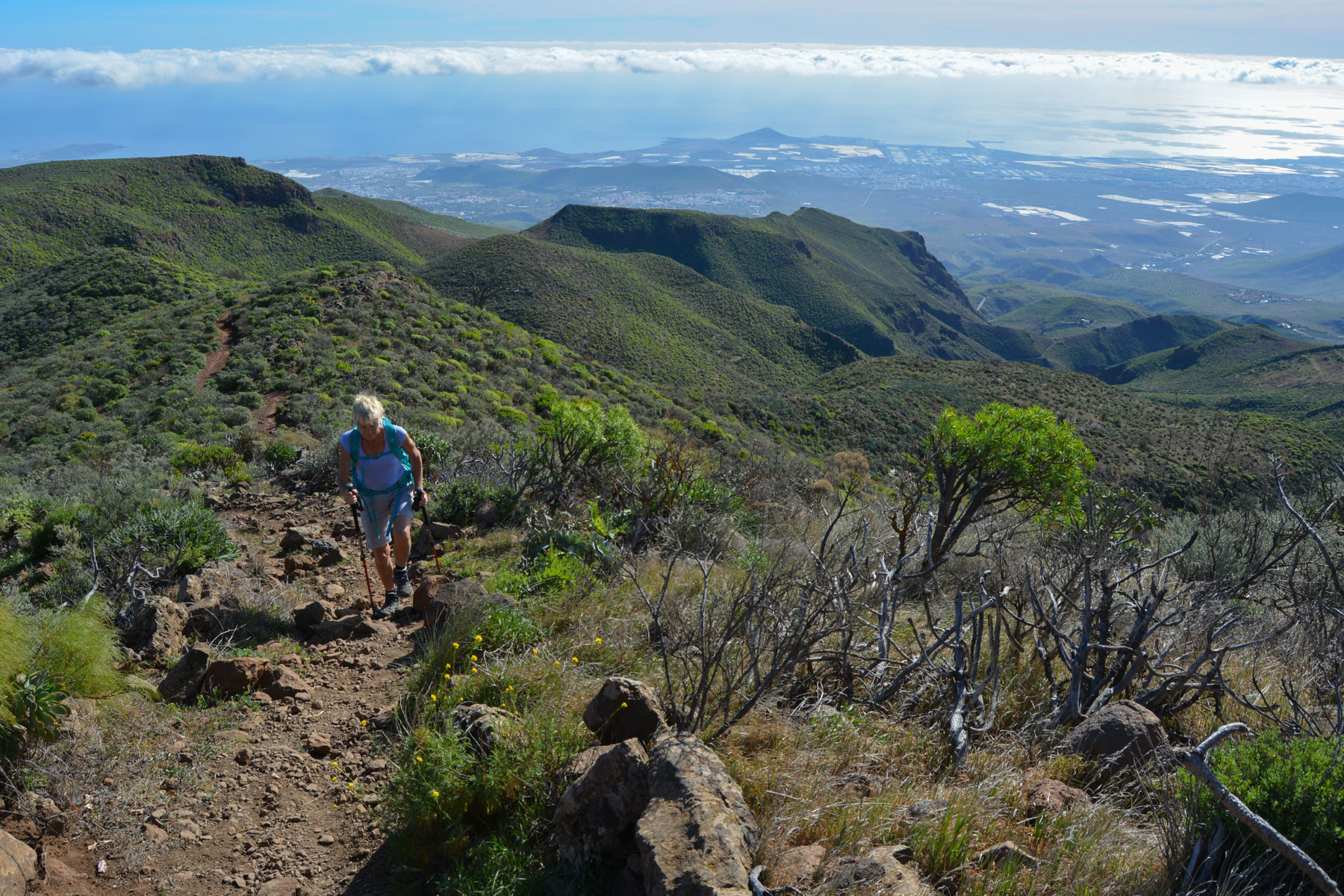
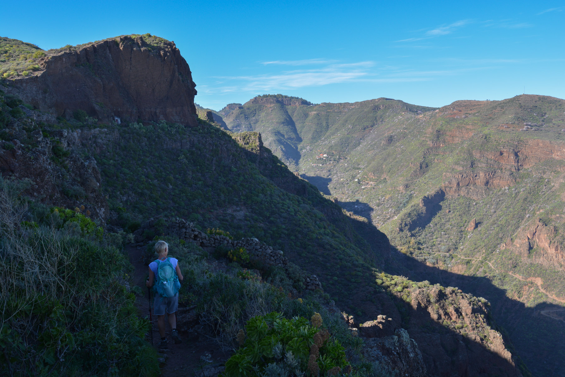
This is the start of a long climb up the dome, weaving through the vegetation or skirting the edge of the cliffs above the canyon. The trail is always well marked and easy to follow. Further on and higher up, the trail diverges and heads more to the west, with lovely views over this part of the island, before returning to skirt the back of a large rocky spine overlooking the canyon. After skirting the canyon, the path winds its way along the void, with Montaña de las Tierras at the bottom. This is the junction for the long final descent.
Continue along the ridge, and after a steep climb, you'll reach Boca Guadayeque (1350m), where the path from the top meets the one that crosses the top of the canyon. Then take the S-37 to Montaña de las Tierras.
This is a pretty trail that descends slightly, following the relief, to cross the upper valley of the Guadayeque barranco diagonally.
All along the way, you'll enjoy plunging views of the canyon entrance and the defile formed by the east and west walls, with Agüimes and the sea in the background. After about 45′ of easy walking, we descend a little to rejoin the trail that climbs up from Montaña de las Tierras, at the hamlet of Lereta.
This option is longer and less interesting. The trail climbs back up to the valley floor, which is gradually losing its steepness. Much higher up, we pass a 1st dwelling where we follow the blue "Camino de la Caldera" sign, then just above it follow the 2-37 to Pico Las Nieves, slightly to the left. It climbs again through the pines to reach another dwelling (Los Bucios), cross a track and climb again. Finally, at the Caldera de los Marteles, at a trail junction, turn left to cut across and join the ridge on the east side of the barranco, again via the Calderilla trail. You come to a wide forest track with a cross.
Descend due south, following the valley on the west side. This is a long, uninteresting track with no particular view. Much lower down, the track joins the S-42 trail at Lomo Guaniles (1455m). Follow the trail downhill until you reach the Boca Guadayeque, and then descend a little further to the fork in the road leading to the final descent.
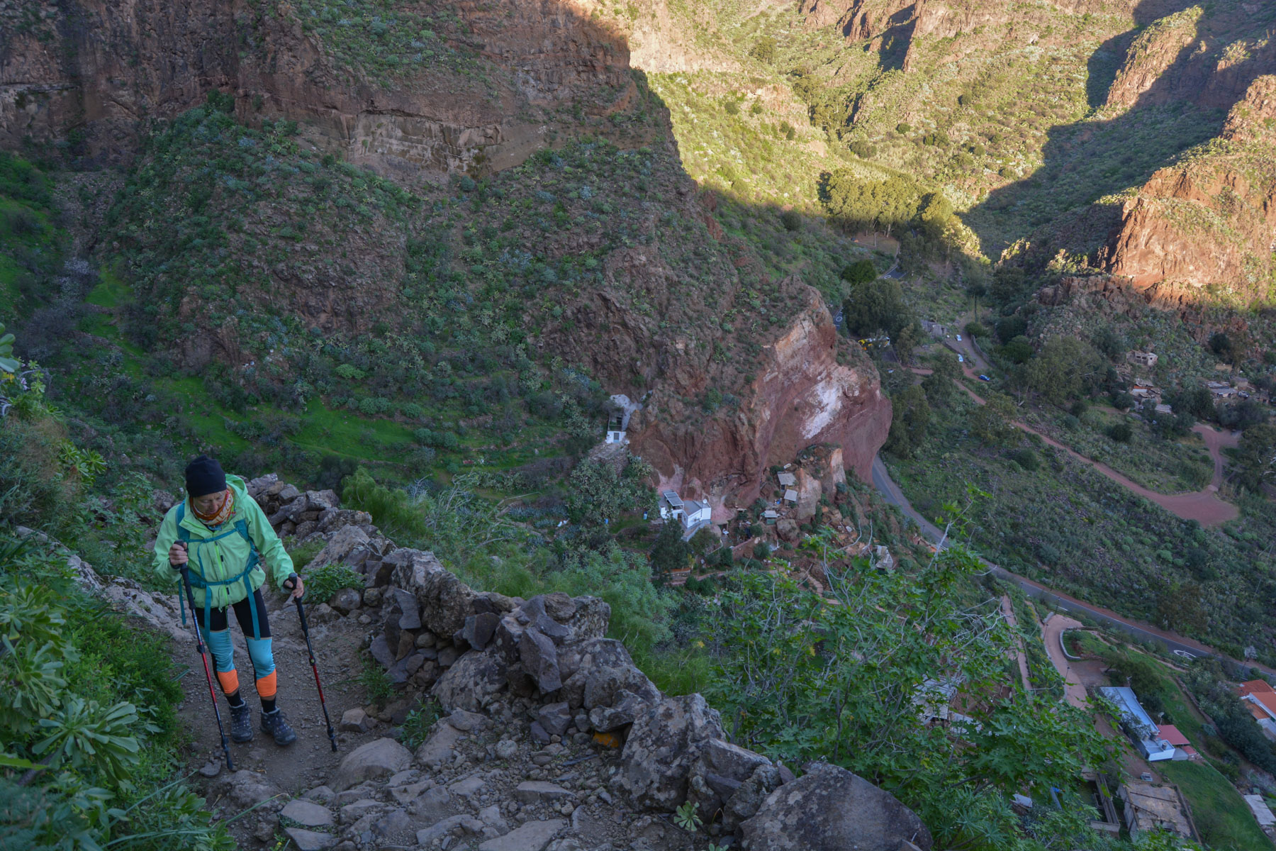
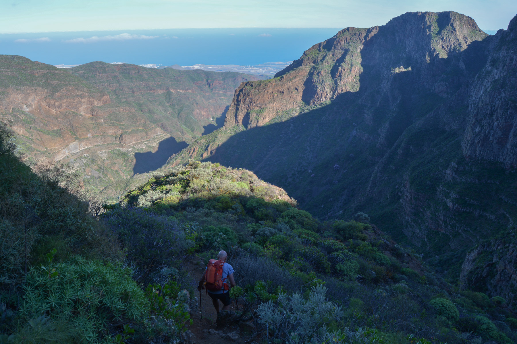
This small, vertiginous and exposed trail descends a huge wall using a very clever route that avoids impassable bars. Marked from time to time with small traces of yellow paint, you can't go wrong because there's no other option. After a 30-minute descent, clinging on and facing the void above the road, the trail ends up in fields of almond and cactus trees to emerge at the Montaña de las Tierras parking lots. Looking at the wall we've just descended, it's very impressive!
A few kilometers of road remain on the G-103 to return to Cueva Bermeja. A hitch-hiking descent is a real possibility, given the number of cars parked at Montaña de la Tierras.


Leave a Reply