


TOPO Hiking | CLIMBING7.COM
Publié le
 Partager sur WhatsApp
 Partager sur Twitter
Partager sur Instagram
Partager sur Twitter
Partager sur Instagram

 Partager sur Facebook
 Imprimer le topo
 Laisser un commentaire

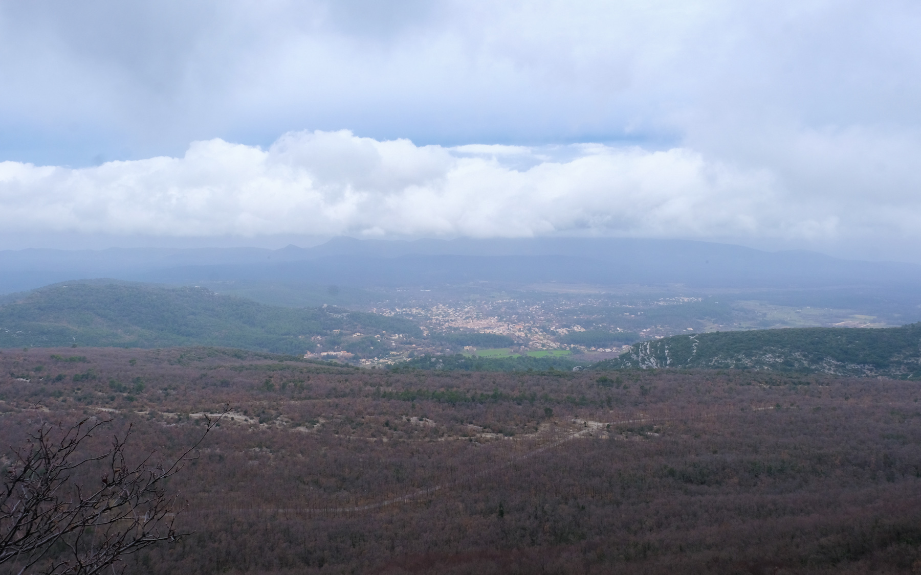
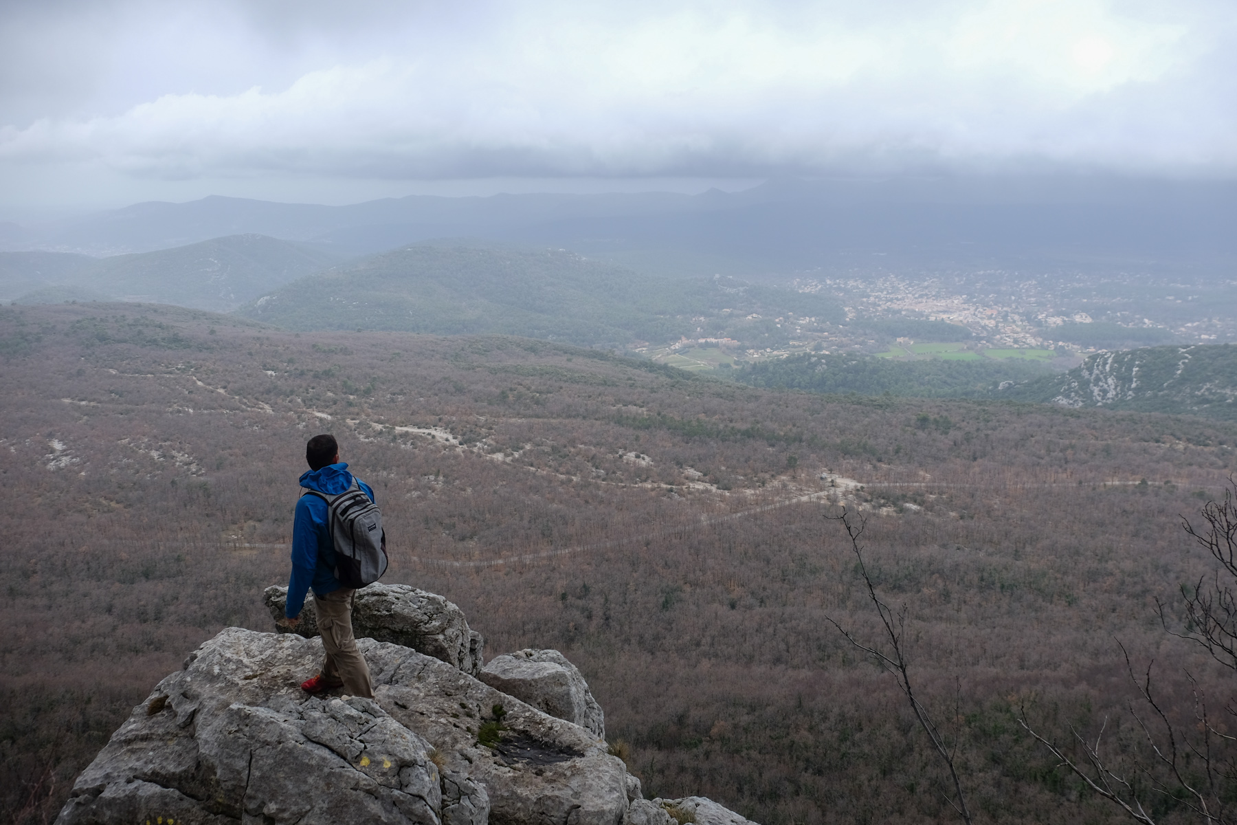
Here's a great way to discover the Sainte Baume massif and enjoy beautiful panoramic views of the region, provided the weather is fine. This ingenious combination of the Gombault route and the Estruch trail allows you to cross the North Face on an equipped route before crossing the walls of the same North Face from East to West on an aerial trail, also equipped. If you're sensitive to vertigo, it's best to refrain, as the route, although not very difficult, requires you to be comfortable free-climbing above the void. Today, wind and low skies, a pity for the views. We'll do it again in better conditions.
❱❱ Technical summary
Type ✦ Equipped hike
Location ✦ Plan d'Aups
Region ✦ Massif de Sainte-Baume, Var
Country ✦ France
Length ✦ 14kms
Vertical rise ✦ 550m
Difficulty ✦ D
Duration ✦ 6h to 6h30
Interest ✦ ★★
❱❱ Access to the place
Take the D80 between Plan d'Aups and Nans les Pins, north of the Massif de la Sainte Baume. Park in the parking lot at the junction of the D80 and D95.
❱❱ Map & topo
❱❱ Itinéraire
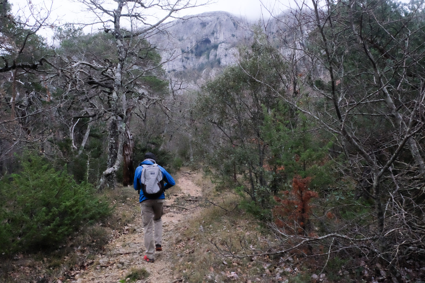
Leave the parking lot at the back and take the wide path on the left. Further on. Turn right to follow a narrower path marked in yellow. This is the "sentier merveilleux". At the Ravel spring, go straight ahead and follow this little path through the undergrowth for a while.
After about 40' from the parking lot, fork right onto a mini-trail. There's a small cairn on the ground and, above all, clearly visible black markers on a tree. This is the start of the Gombault route.
Overall, the loop is a sort of elongated figure 8, with the Gombault path on the way up and the Estruch path on the way back across.
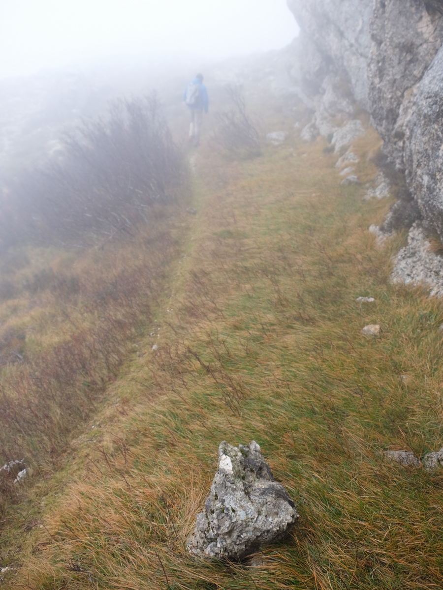
The signposts on site are very generous and make orientation safe: black signposts for the voie Gombault and yellow 3-dot signposts for the sentier Estruch. Only the crossing below the ridges is on an unmarked but well-traced path which then joins the GR9.
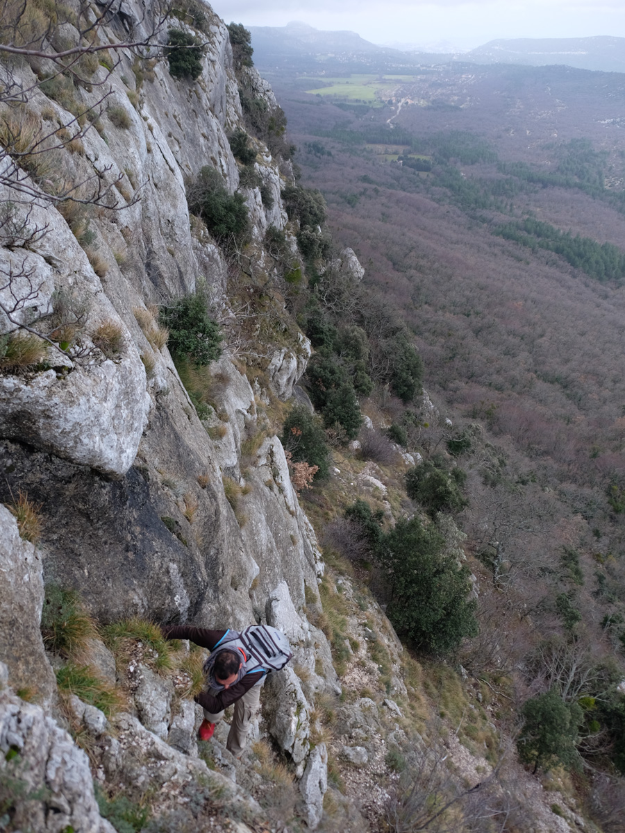
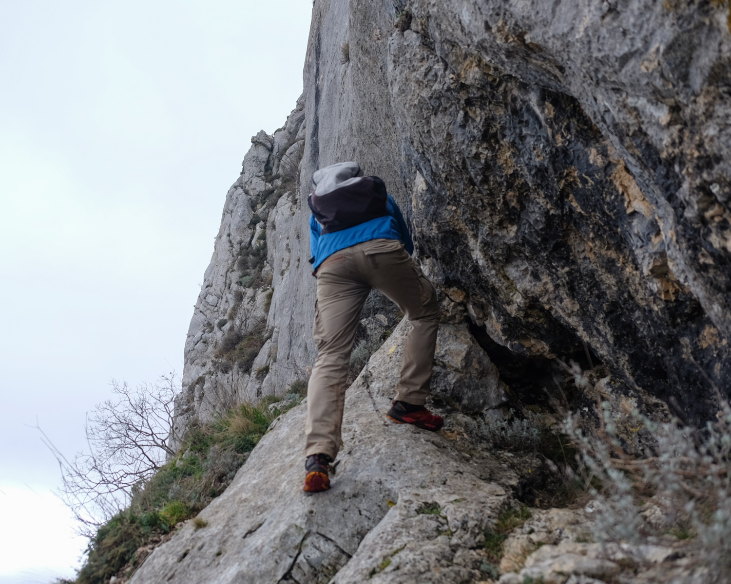
You don't need any equipment to get through, just sure-footedness and the ability to tackle slightly exposed III+/IV- terrain without any problems. However, a helmet to protect you from falling rocks and a small safety rope (20m) to help you on one of the aerial passages may be useful.
Follow the path marked in black, which quickly climbs up through the rock. Steep switchbacks on a scree slope, then a few small jumps to cross the Estruch path on a small ledge. At this point, turn left for a few metres and head back up the rock face, following the black line.
The rest of the climb is a little more vertical, with 3 or 4 fairly exposed climbs, but still in the III+/IV- range, and easier traverses to the west. After about 1 hour of climbing, the path joins the GR9, just below the massif crest. Turn left to the east.
A round trip to the crest and the Jouc de l'Aigle via the GR allows you to enjoy the view, and eventually climb to the Béguines cross. To continue, retrace your steps.
Back on the GR below the ridge on the north side, pick up the well-marked but unmarked path that runs along the ridge, a little below, due east. There are no difficulties on this path, so keep going for a while before rejoining the GR9 at the end, which we follow. The route begins to veer north-east until you come to a fork in the road with a yellow signposted path.
Turn left, and you'll soon find a small corridor leading down to the left: the Pas de l'Aï. Descend, then at the bottom turn right (do not follow the yellow markings). The "Paradis du Paradis" path winds its way between the rock faces and finally emerges from the gorge into a clearing.
At this point, turn left, due west, onto a narrow path that descends into the woods. Further down, we cut left onto a path which joins the yellow path further west at a hairpin bend. Climb this path and you'll soon find the entrance to the Estruch trail. Danger" sign at entrance.
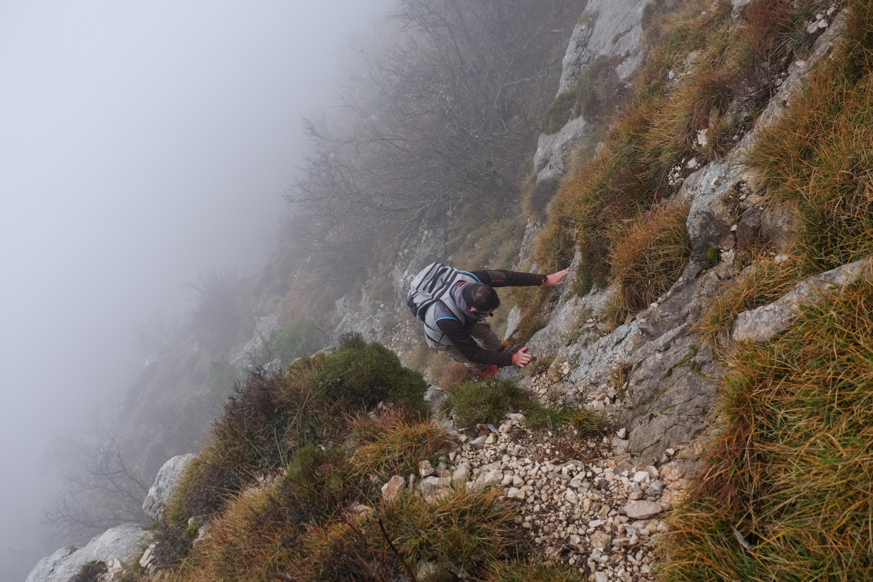
The "Danger" sign seems a little excessive, but it does indicate that there are overhead passages equipped with chains. The trail is marked with 3 or 4 small yellow dots, which must be followed scrupulously to avoid getting lost or finding yourself in a tricky situation, given the verticality of the itinerary.
The 1st section up to the Gombault route presents no difficulties whatsoever. It's a very small path that crosses the north wall on a series of ledges or balconies. It's aerial in places, exposed on small passages on the edge of the void, with a few de-escalations but no difficulty.
The 2nd part starts like the 1st part, before the difficulties quickly begin. A mini-climb (IV) with good holds, and further on a small exposed traverse with good holds (3 pins for belaying). Then come the chain-equipped passages: 2 pendulars and some fine aerial ledges to cross above the void. Further on, a slab to climb (8m) with the help of a vertical chain and a few free holds. A final equipped passage further on climbs a small overhang, not a little harder (IV+/V) but short.
The trail continues eastwards, with the rounded summit of the Sainte Baume (1147m) in sight. There's no difficulty in finishing the trail, with some pretty passages on or under impressive cliffs. We finish by joining a wide path with steps. End of the Estruch trail.
Descend to the right and follow the path through the woods before turning right onto the Chemin des Roys, which quickly returns to the starting parking lot.


Leave a Reply