


TOPO Hiking | CLIMBING7.COM
Publié le
 Partager sur WhatsApp
 Partager sur Twitter
Partager sur Instagram
Partager sur Twitter
Partager sur Instagram

 Partager sur Facebook
 Imprimer le topo
 Laisser un commentaire

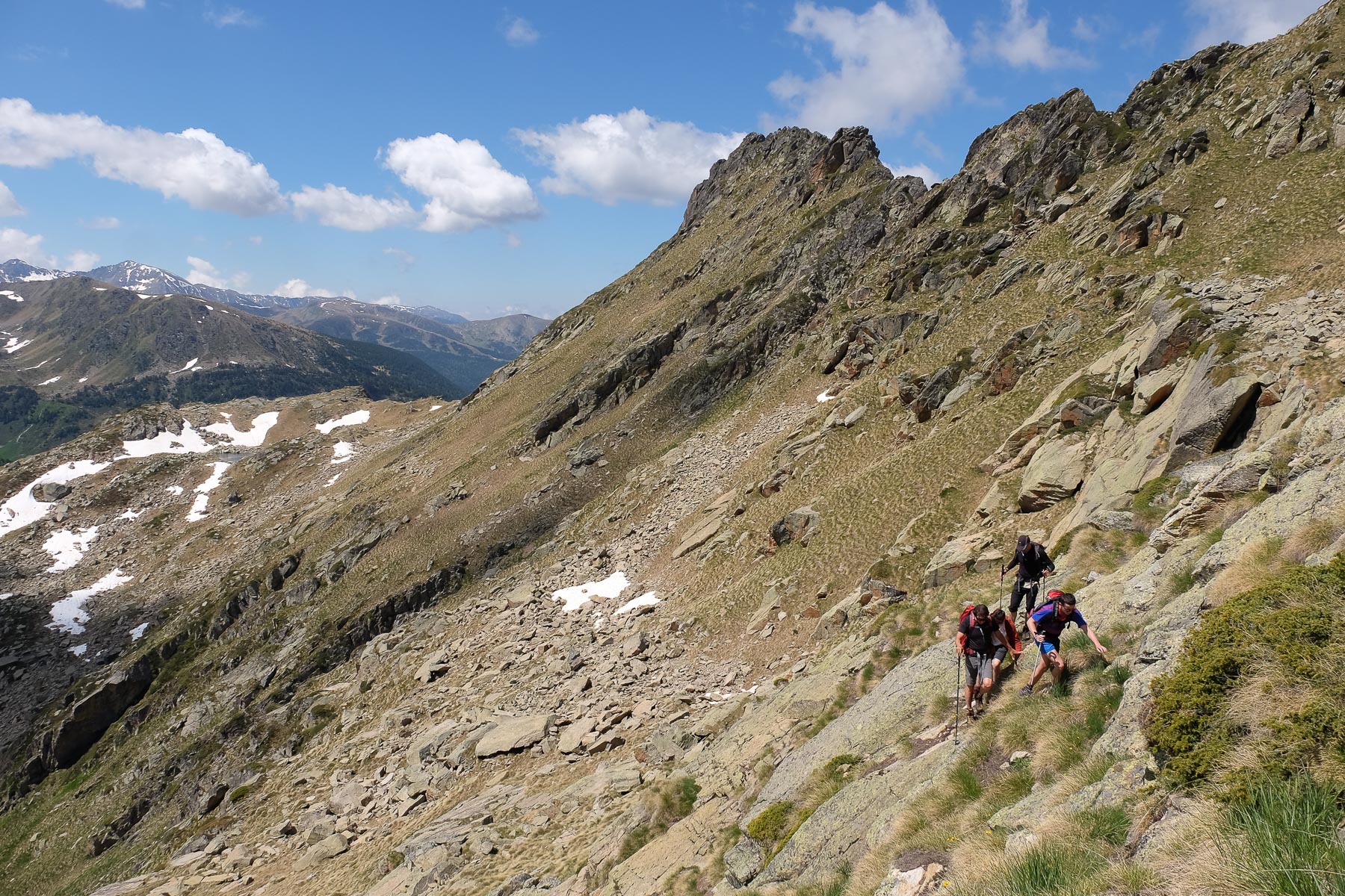
Departing from the Étangs de Fontargentes, an exceptional site in the Aston valley, the proposed route makes an incursion into Andorra, passing behind the Pic Negre de Juclar before returning to the Ariege side to climb the Pic Negre de Joclar via a rocky ridge. From here, you overlook the Etang de Joclar, the Etang de l'Estagnol and the Etangs de Fontargentes. The entire off-trail route on the Andorra side, behind the Fontargentes ridges and up to the Collada de Juclar, overlooks the magnificent Etang de Juclar. Joclar or Juclar, Pic or Pic Negre, it's a bit confusing, but the location is splendid and the views quite exceptional. A difficult hike, but one that can be adapted, either by looping directly around the étang de Joclar without making the Pic (simpler) or by traversing the crêtes de Fontargentes from the Port d'Inclès (more complex).
❱❱ Technical summary
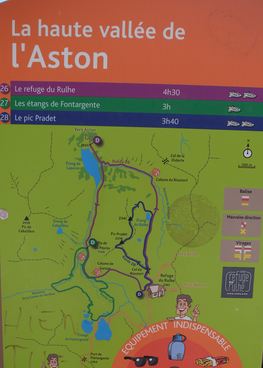
The hike is described from the Fontargente ponds. It can also be done from the Pla de Las Peyres parking lot, but at a greater distance and with a greater difference in altitude.
Type ✦ Hiking (Alpine if Pic)
Location ✦ Étangs de Fontargentes, Aston
Region ✦ Ariège
Country ✦ France / Andorra
Max altitude ✦ 2627m
Distance ✦ 9km / 8.5km (without Pic)
Vertical drop ✦ 600m / 450m (without Peak)
Difficulty ✦ D / AD (without peak)
Duration ✦ 5h to 6h / 4h to 5h (without Pic)
Interest ✦ ★★★
❱❱ Access to the place
From Les Cabanes, on the N20 between Foix and Ax-les-Thermes, take the small road heading south into the Aston valley. It's over 20 kms to the final parking lot at Pla de las Peyres (1700m), passing the Riete pond and then the Laparan pond. Park here.
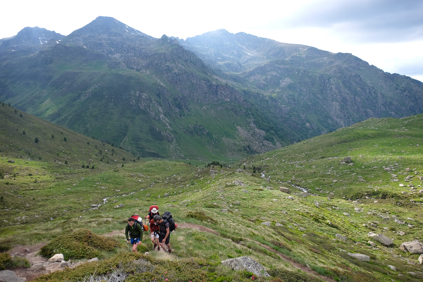
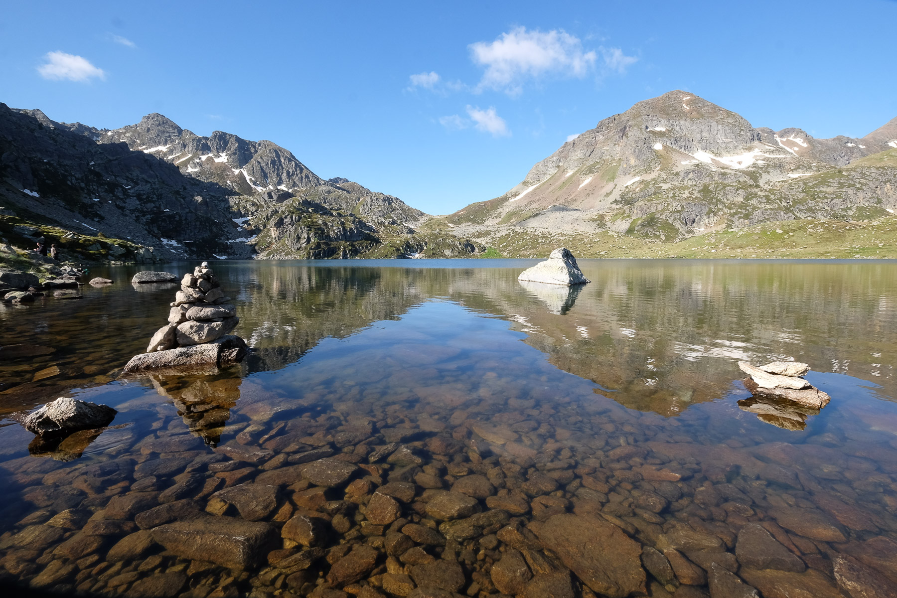
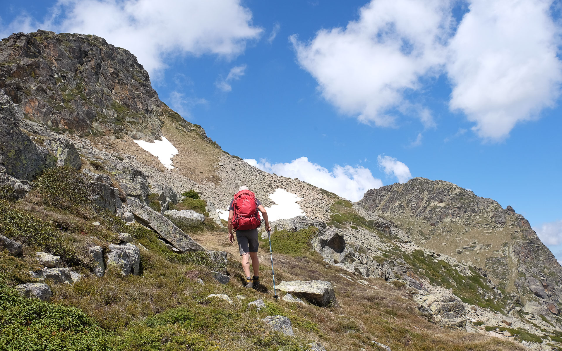
Leave the parking lot to the south and follow path N°26 towards the Rhule refuge and N°27 towards the Fontargentes ponds. After a short climb, leave the refuge path and continue along the Aston. Further on, cross over a metal footbridge and turn right onto the yellow-marked path. It climbs steeply to reach a shoulder at Malpas level, then rises a little more to finally reach a large altitude basin, invisible until now, where you'll find the Fontargentes ponds (2150m). A magnificent spot! You can easily bivouac here. It can get crowded, as it's also a trout fishing spot. Allow 1h15 to 1h30 to climb from the parking lot.
❱❱ Map & topo
Purple: access to the ponds from the parking lot. In blue, the loop via the Pic. In green, the shorter variant without the Pic. The blue route between Port d'Incles and Collada de Juclar and the route to Pic Negre de Joclar are indicative.
❱❱ Itinéraire
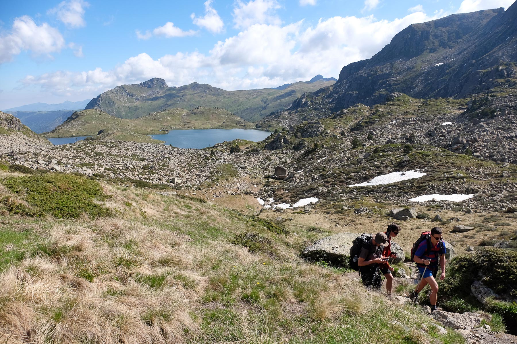
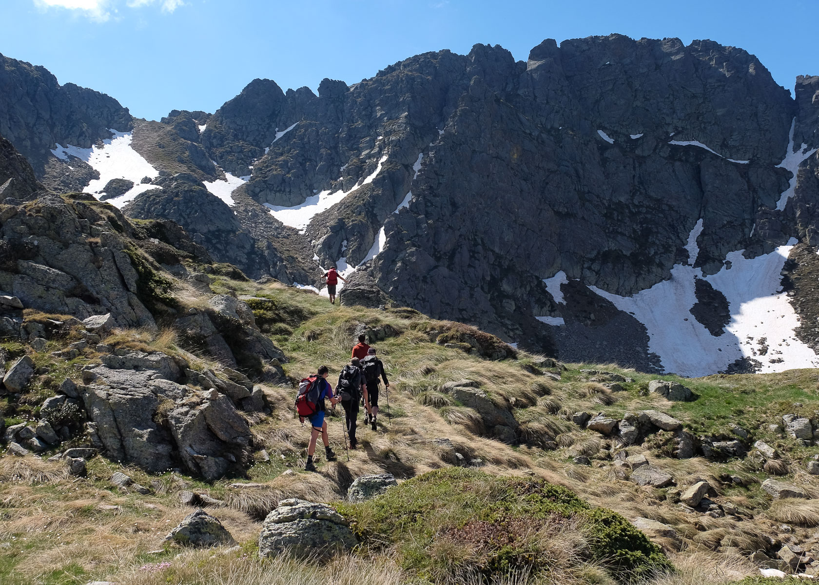
From the Fontargentes ponds, take the GRT66 signposted path heading due south to reach the Port d'Inclès or Port de Fontargentes, the natural border with Andorra, quickly and easily.
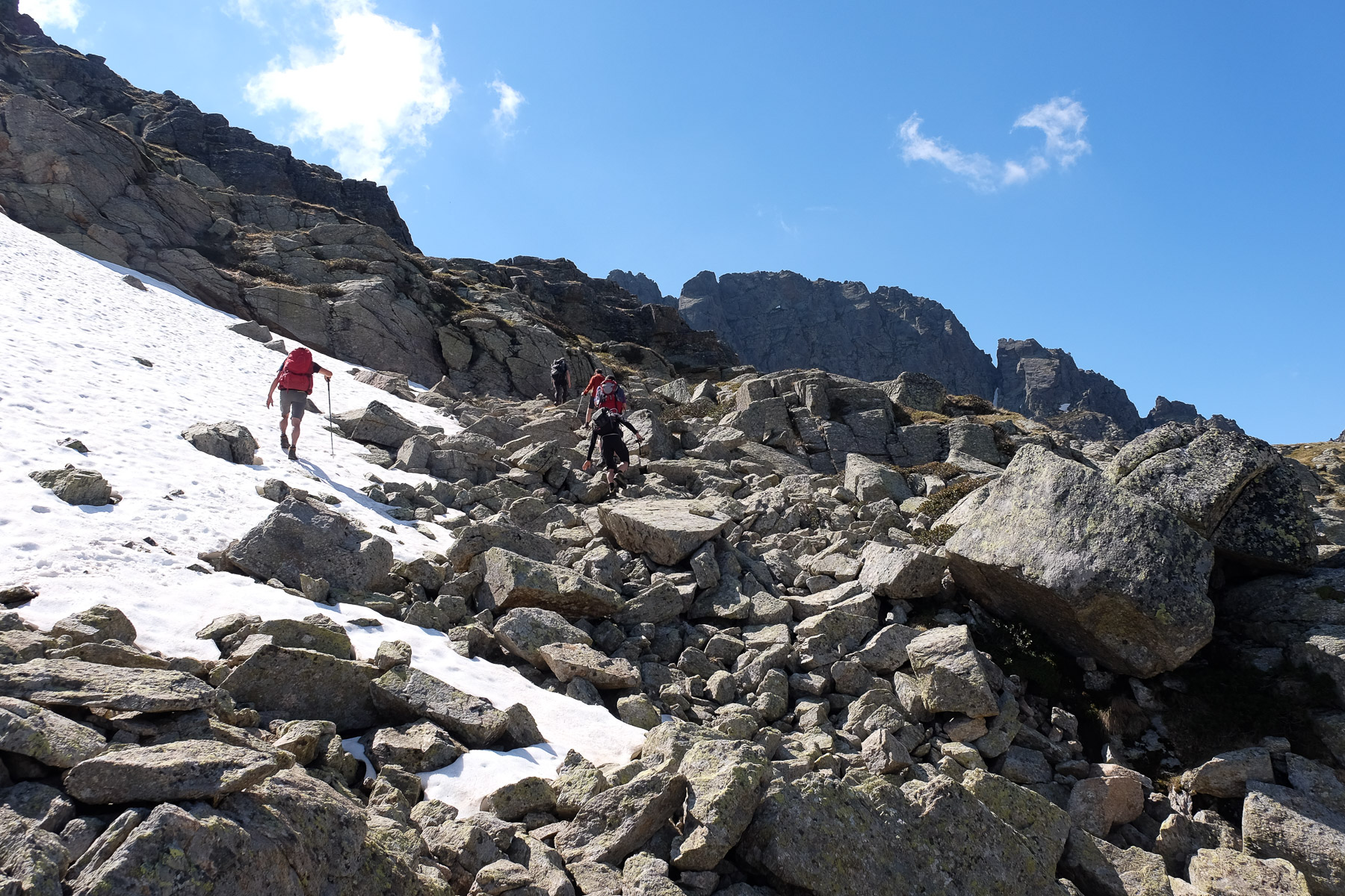
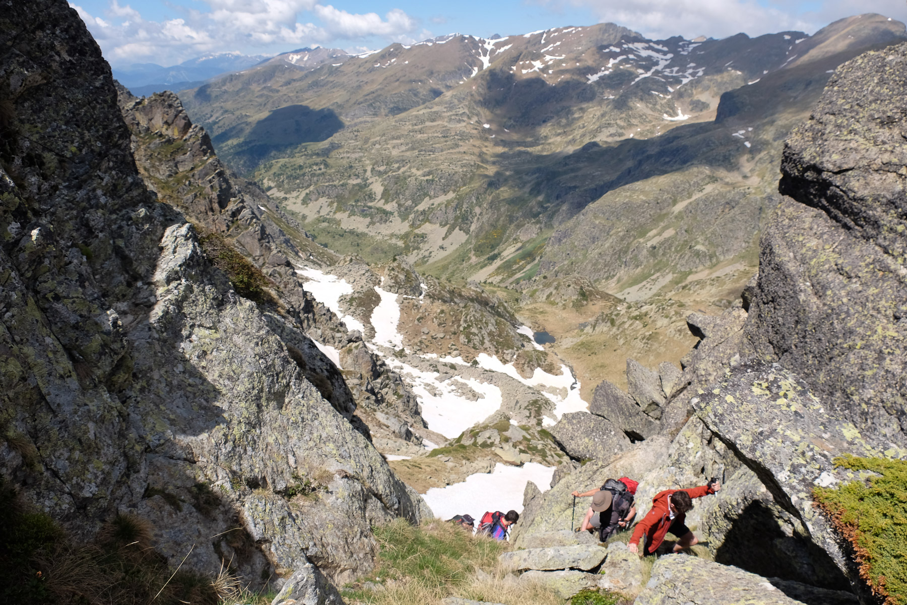
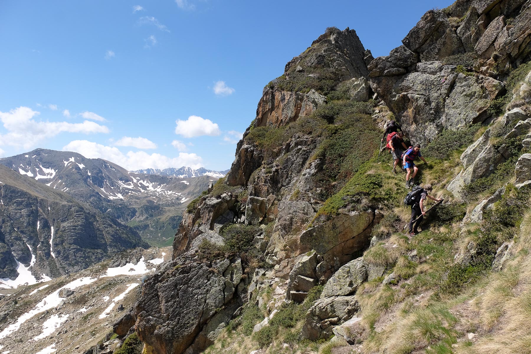
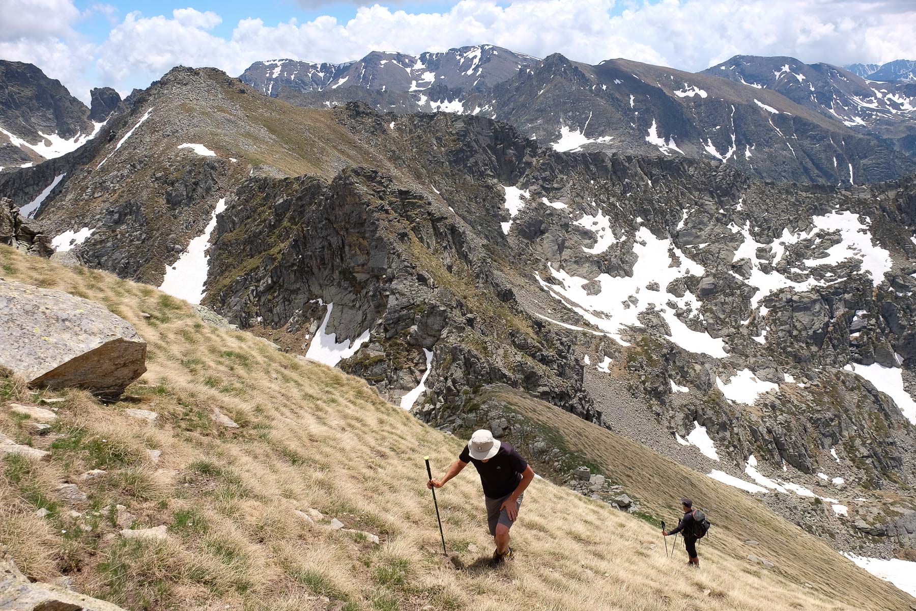
The whole of the Andorran section along the Fontargente ridge is off-piste, although there are a few cairns here and there. Before reaching the Collada de Juclar, there are 1 or 2 exposed passages to negotiate. From the Collada, to reach the ridge leading to Pic Negre de Joclar, the route is again off-piste, with further exposed passages. The ridge, though not overly difficult, is aerial, exposed in places and with a few handholds (II/III max).
After skirting the Etang de l'Estagnol, the GR 66 soon forks, with the path to the Refuge au Rhule on the right and the return path to the Etangs de Fontargentes on the left. Turn left. The path crosses over and rises slightly to the west to return to the starting basin.


Leave a Reply