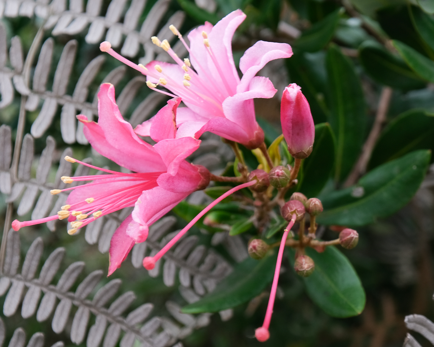
A short foray into the Cordilleras Occidentales. Despite the rainy season, the Farallones National Nature Park to the south of Cali is a small but beautiful introduction, with the ascent of Cerro del Trueno and the discovery of a superb waterfall, Chorro del Plata, in a lush, tropical setting. Views of Cali and the Cauca valley remained misty, with the central cordillera buried in the clouds. It's still an interesting loop to get away from the hundreds of caleños who come here on Sundays to enjoy the pools of the Rio Pance.
❱❱ Technical summary
■ S tart and finish point: villages of Pance and Voragine, Farallones Natural Park, Valle del Cauca, Colombia
■ Type of route: cross-country mid-mountain hike
■ Distance: 10 km
■ Cumulative elevation gain: +450 m
■ Cumulative negative altitude gain: -760 m
■ Estimated total time: 3h to 4h ■ Min and max altitude: 1230 m / 1993 m
■ Marking: no indication, no markers or cairns, but trails are well visible and generally well-maintained.
■ Equipment in place: none
■ Equipment required: useful GPS track.
Difficulties: none, except for some steep or slippery trails (if it rains), and a bit of orientation to find the right path.
❱❱ Access to the place
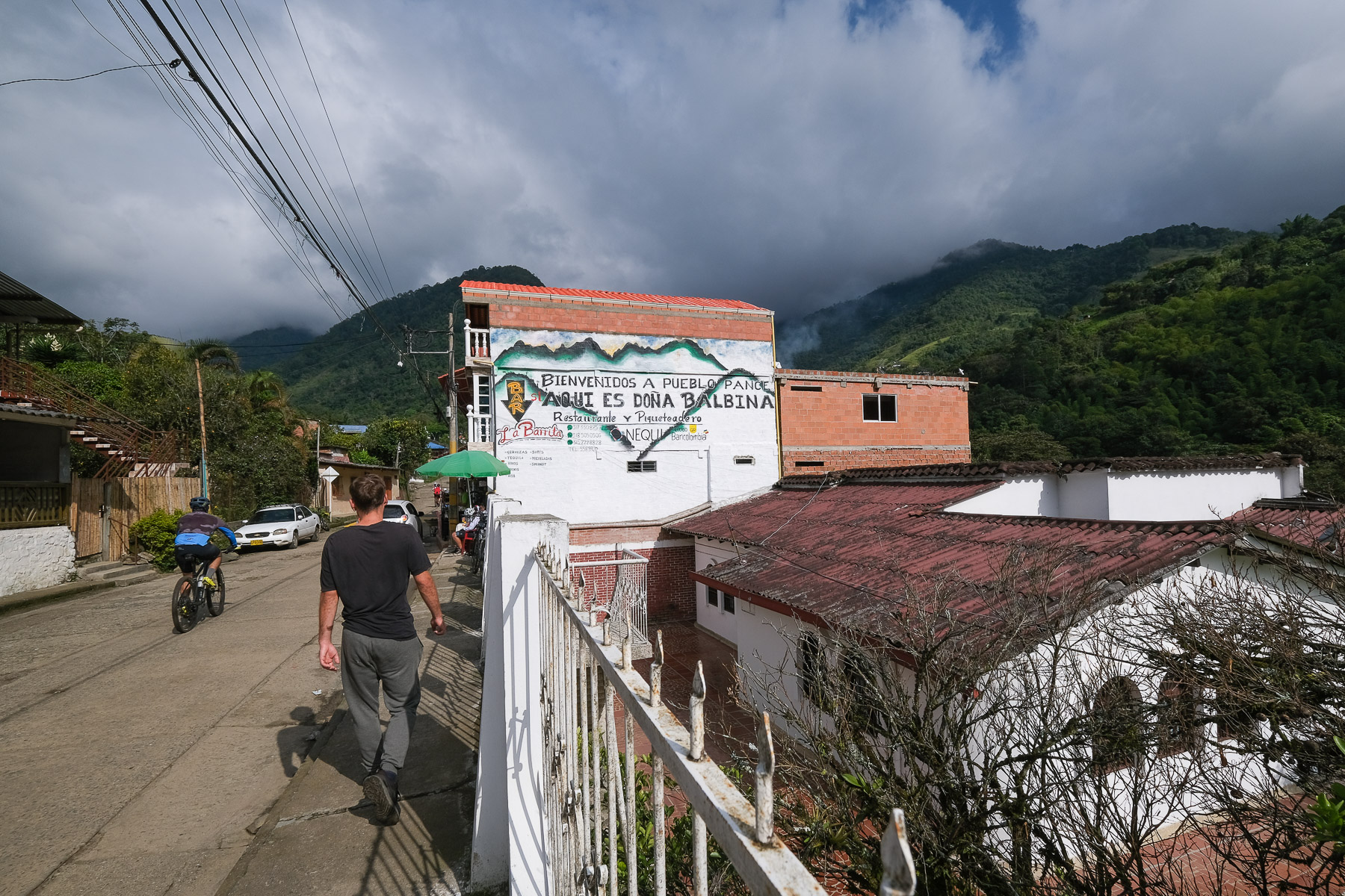
Descend to the south of Cali and before leaving the city, turn west to enter the Rio Pance valley. Pass Voragine (arrival point) and climb up to Pueblo Pance. The end of the road is in very poor condition, in places a sort of gravel track with cemented sections. We can get through without a 4x4, but the car suffers. Cabs from Cali cost between 40,000 and 50,000 pesos.
❱❱ Map & topo
The purple route is indicative as it is not marked on the base map, but it is the easiest and best-maintained path up Cerro del Trueno.
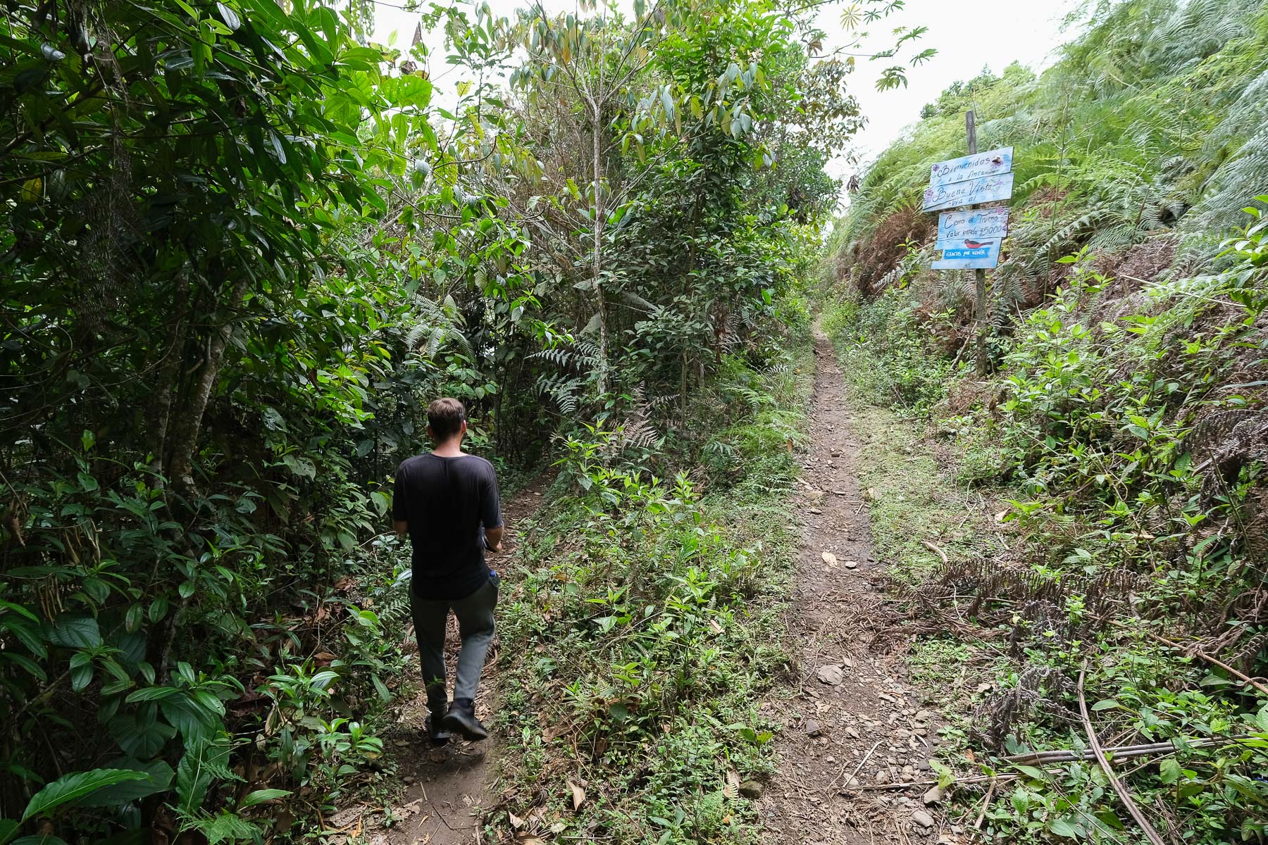
Go through the village of Pance and cross the bridge over the rio. Continue slightly uphill to the left and soon find the climb to the pass and the Trueno. No signpost.
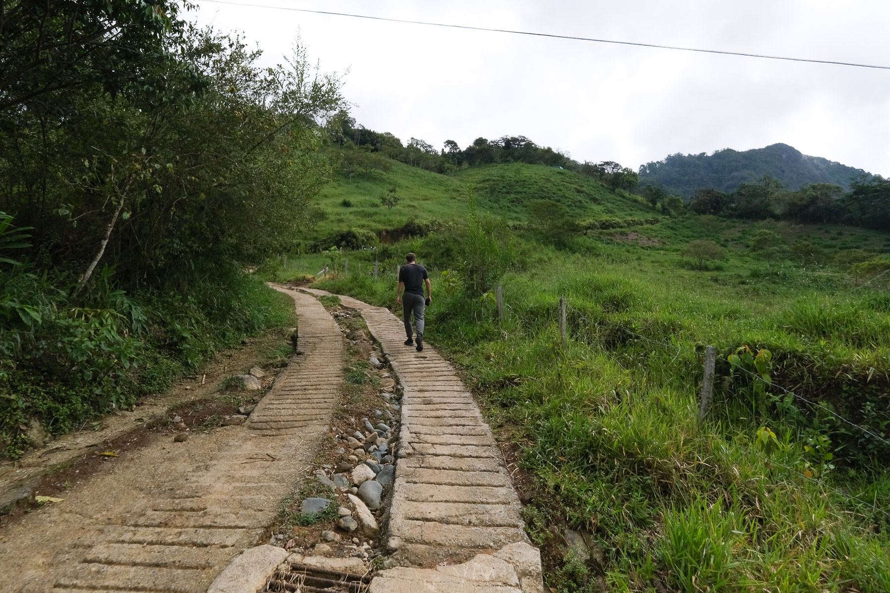
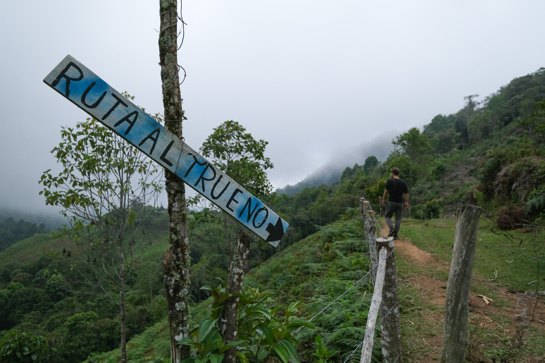
It's a steep climb on a kind of cement road, then on a wide dirt path. After 20' of effort, you reach a pass with a view over the valley to the north. From here, continue right, following the only remaining signpost to Trueno. The path crosses to the east. Leave the little-maintained secondary path on the right (the one shown on the map). Further on, you pass a fork with a 5000 peso right-of-way fee to pay (no one there today). Go right at the fork and shortly afterwards, a path rises to the right. Take it to climb steeply and join the ridge that leads to the summit of Trueno, where there are antennas and satellite dishes. (We've tried it on the right, and the path also leads to the summit, but it's less well-maintained and more hazardous).
Part 2: Trueno summit to Cascadas de Chorro del Plata (1h30)
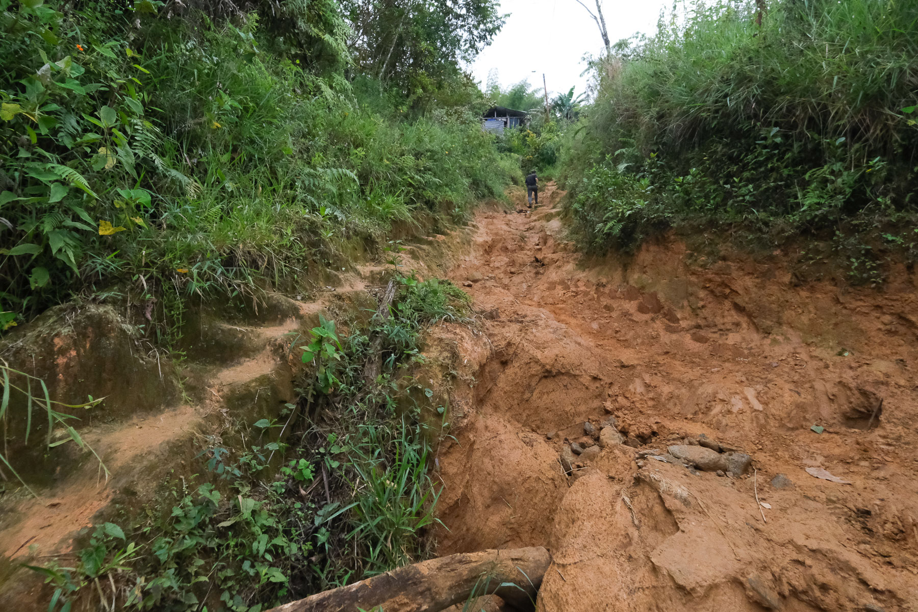
From the Trueno summit, retrace your steps along the ridge and descend to the right along the ascent route. At the bottom, turn left to return to the fork. Here, turn sharp right to take the other branch of the fork. The path is dug into the earth and descends for a while, crossing a stream at the bottom and climbing up the opposite side until you come to a wooden gate and fence. From here, follow the path to the right, which remains flat and then descends a little into the red earth deformed by the water.
The path makes a 90° bend to descend a little further and find the junction with the path coming from the bridge over the Rio Pance. There's also a signpost to the waterfalls. We then turn left again on a fairly wide track, which we leave very quickly by taking a path that leads off to the right through the vegetation (an open gate with wooden stakes). This is a shortcut to avoid having to do the whole loop, but the path is narrower and less well-maintained, and in places you have to literally walk into the vegetation or under plant corridors. At the end of this shortcut, a small gate closed by barbed wire can be crossed without too much difficulty, and you descend to a flat area where you find the official trail again.
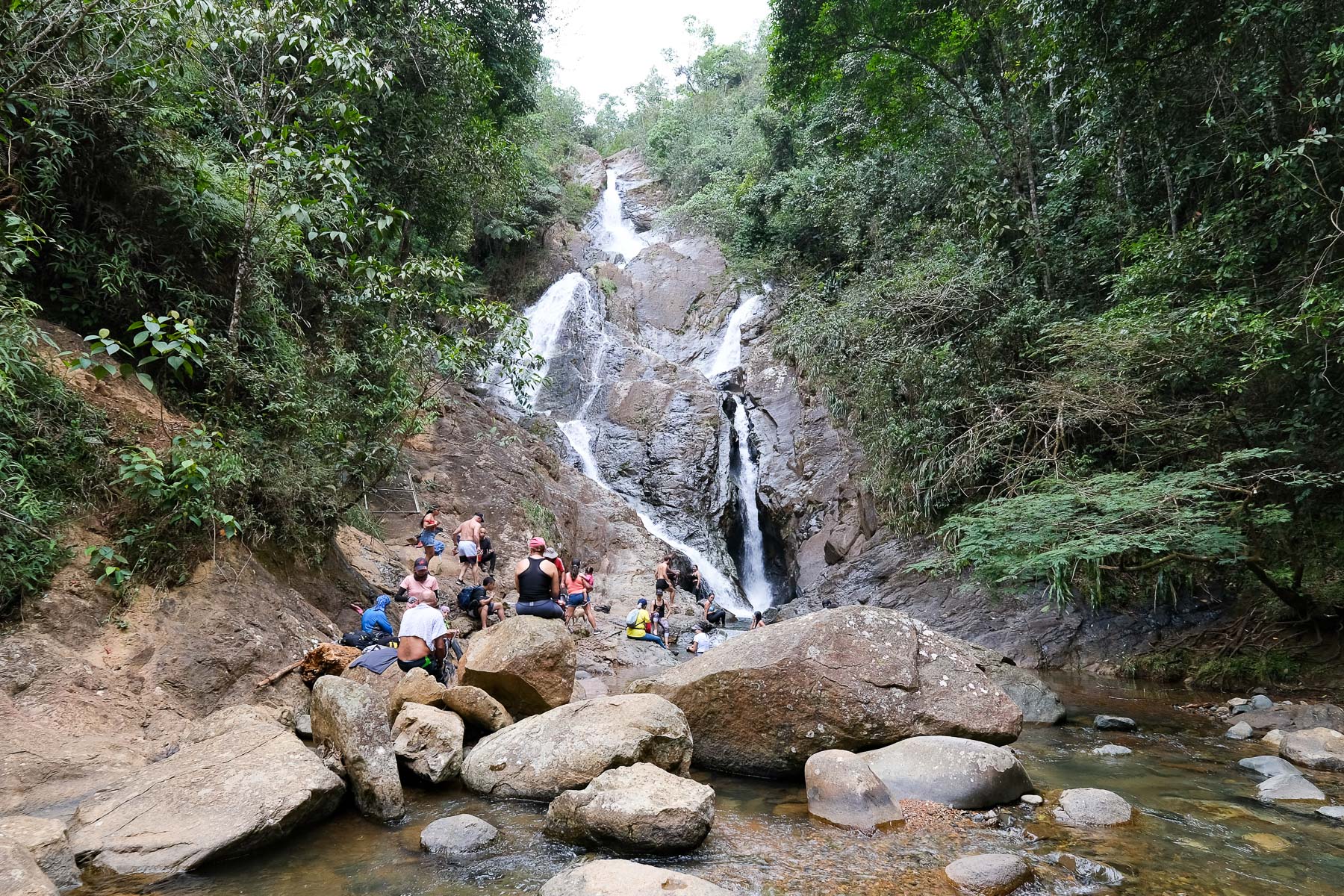
At this point, there are 2 options: either go straight down to reach the top of the waterfall, or go right and descend to reach the bottom of the waterfall, where there are more people, but where there are some lovely pools to swim in.
Part 3: from Cascadas de Chorro del Plata to Voragine (30')
From the bottom of the waterfall, retrace your steps and this time, at the clearing, continue straight on downhill to reach the asphalt fairly quickly. Follow the road down to Voragine, which runs alongside the rio Pance. Cross the Rio Pance again and catch a cab back to Pance or back to Cali.


 Partager sur WhatsApp
 Partager sur Twitter
Partager sur Instagram
Partager sur Twitter
Partager sur Instagram

 Partager sur Facebook
 Imprimer le topo
 Laisser un commentaire


Leave a Reply