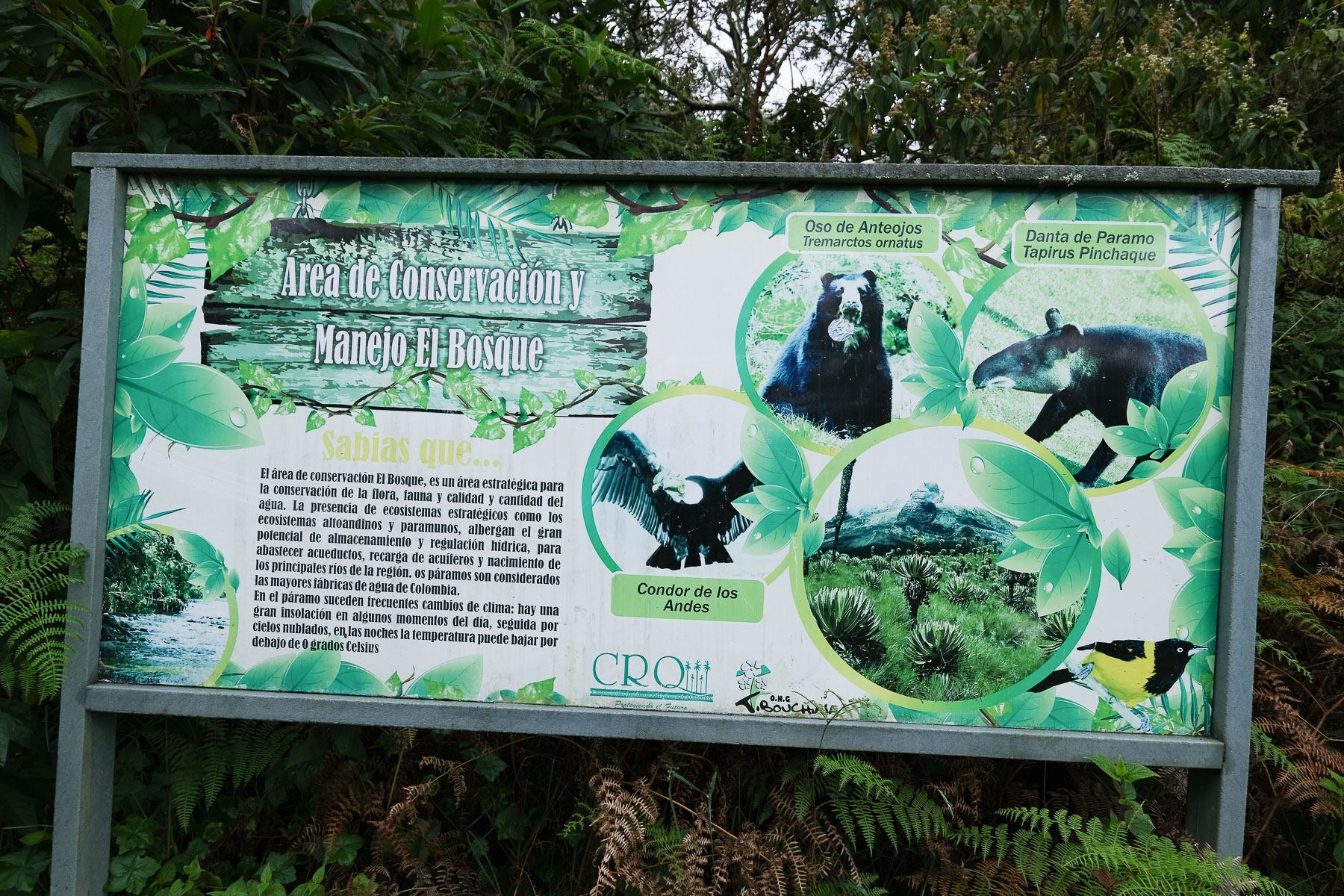
An exceptional hike to discover the Los Nevados Natural Park, starting from Salento in the department of Quindío. Three days of itinerant hiking to climb the different levels of the Colombian cordillera, from the tropical forest to the páramo where thousands of frailejones bloom, and climb the northern ridge of the Paramillo to the Quindío Norte peak at 4700m. From here, spectacular views of the Santa Isabel and Tolima nevados at over 5200m. A fourth day may be useful to acclimatize or wait for the right weather window. A major trek in Colombia, meeting the inhabitants of the high Andean valleys and the wild territories of the Cordillera.
❱❱ Technical summary
The data below corresponds to the 3 or 4-day itinerary.
■ Departure point: Salento, Quindio, Colombia
■ Type of route: very high mountain itinerary
■ Distance: 41 km
■ Cumulative elevation gain: +2910 m
■ Cumulative negative altitude gain: -2910 m
■ Estimated total duration: 3 to 4 days ■ Min and max altitude: 1895 m / 4690 m
■ S ignposting: none, but well-marked trails with occasional signs. GPS tracking is very useful, as the route combines several trails that are not always easy to connect.
■ Equipment in place: none
■ Equipment required: GPS track very useful, basic boots ideal for walking in muddy and swampy areas (botas pantaneras).
Difficulties: the main difficulty is altitude, particularly above 4000m. Progress in the paramo is difficult because the ground is very muddy or swampy.
❱❱ Access to the place
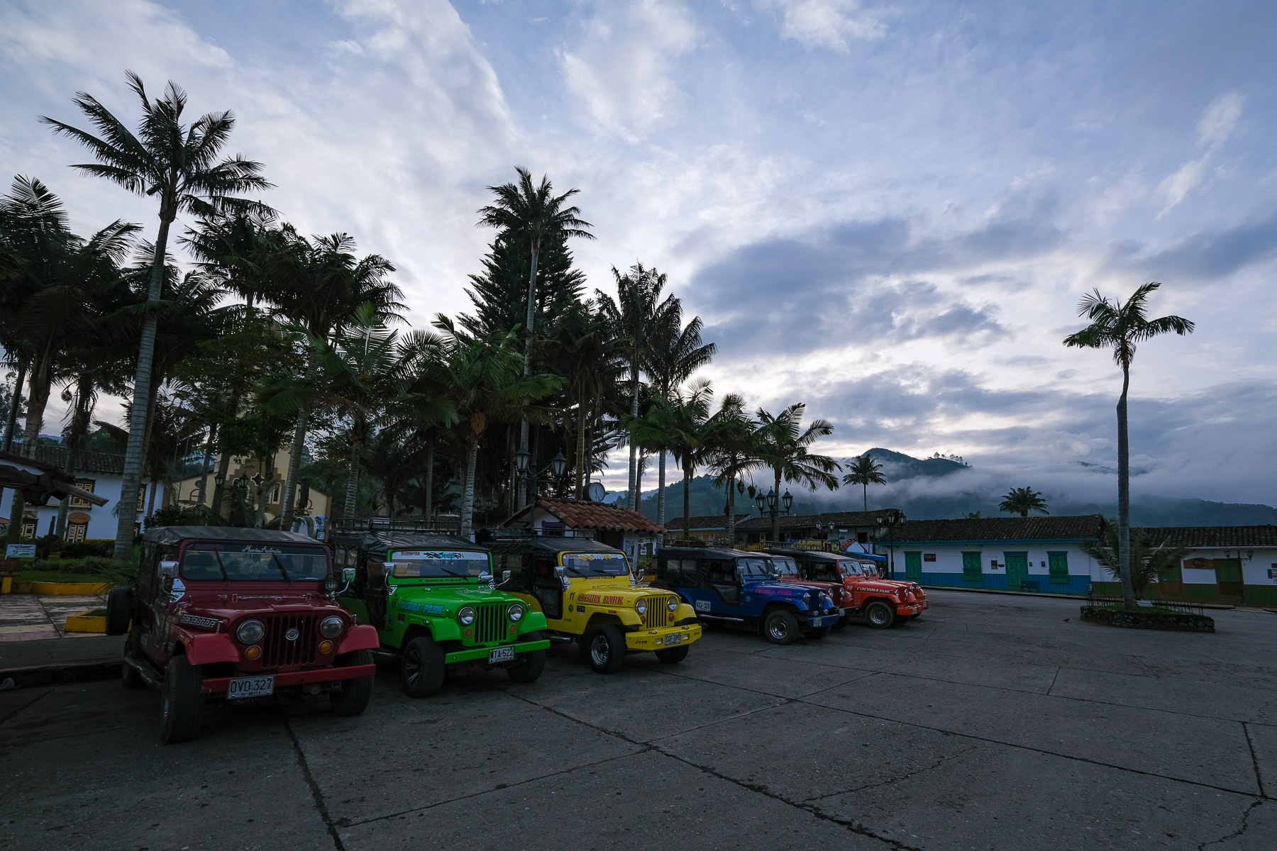
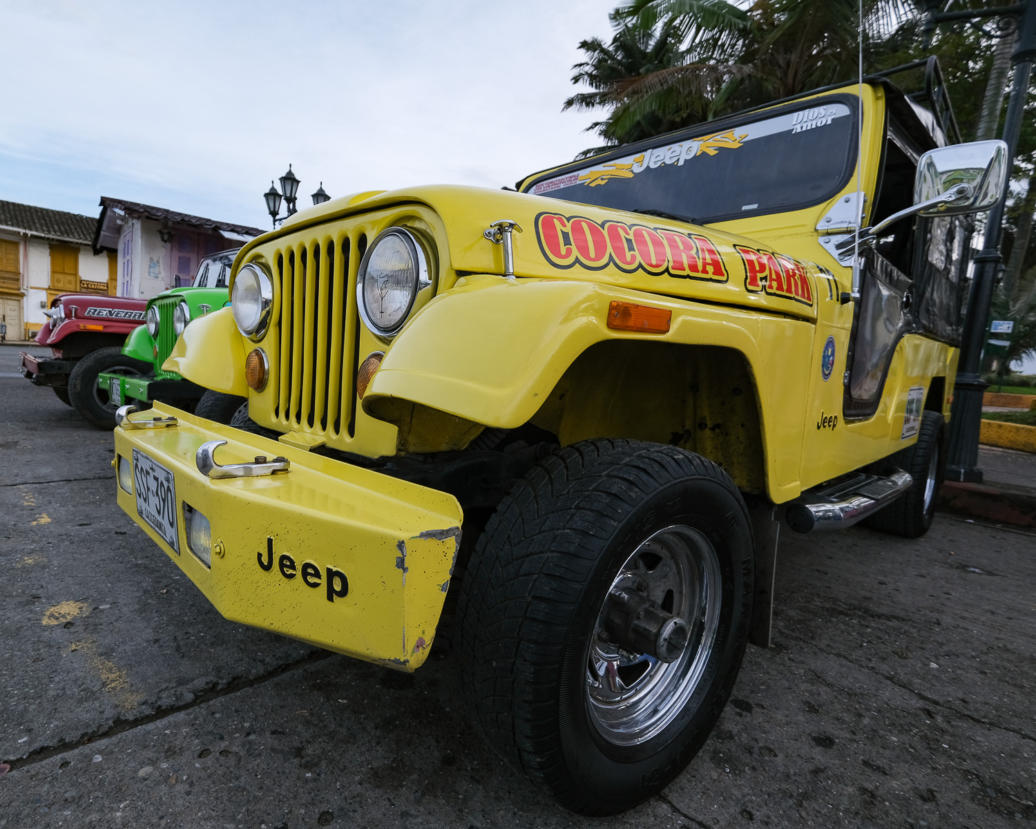
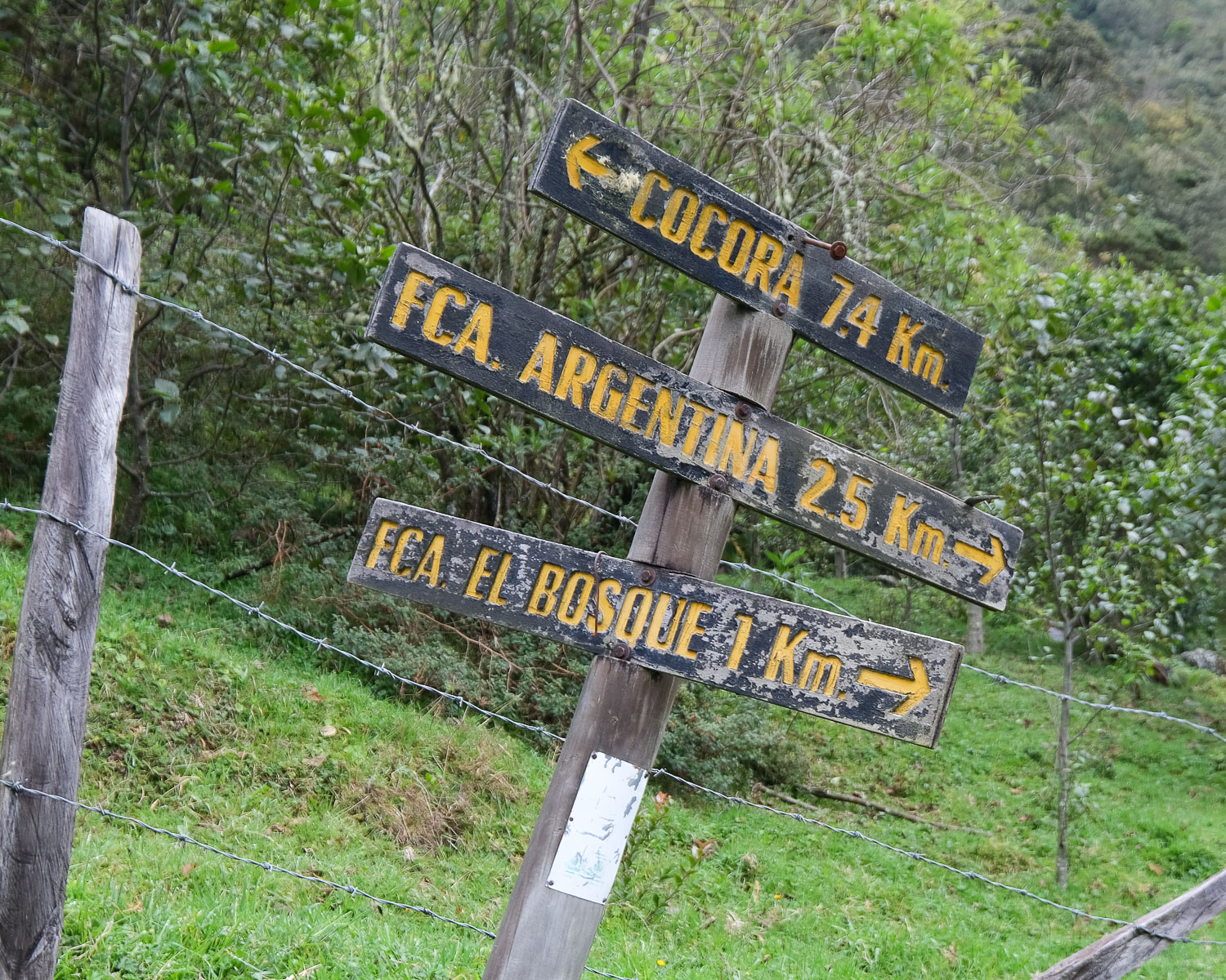
From Armenia or Peirera, take a bus to the town of Salento. From there, at the main Bolivar square, take a Jeep up to Cocora (4,000 pesos to date, 1st departure at 7 a.m., approx. 45' drive). Day 1 departs from there. It's a tourist spot because of the presence of huge wax palms over 70m high, emblematic of Colombia.
❱❱ Map & topo
The route of the ridge on day 2 to return to Finca Primavera is indicative, as the trail exists but does not appear on the base map. For the transfer from Salento to Cocora, to date, departure by jeep from 7 a.m. to 5 p.m. every 2 hours and return from Cocora from 8 a.m. to 6 p.m. also every 2 hours.
About Fincas
These are small properties run privately by local people. Comfort is basic, but the welcome is warm. You can sleep in dormitory rooms (25,000 to 30,000 pesos), have breakfast (8,000 to 12,000 pesos) and dinner (12,000 to 14,000 pesos). There are even hot showers, also basic but really hot (4,000 to 5,000 pesos). The owners are able to give precise information on possible itineraries. Reservations don't seem necessary during the week, but are preferable at weekends or on public holidays. Here are the contacts for the Fincas where I stayed (see facebook page for all contacts):
- Finca Argentina - Don Javier and Gloria - +57 316 46 74 802
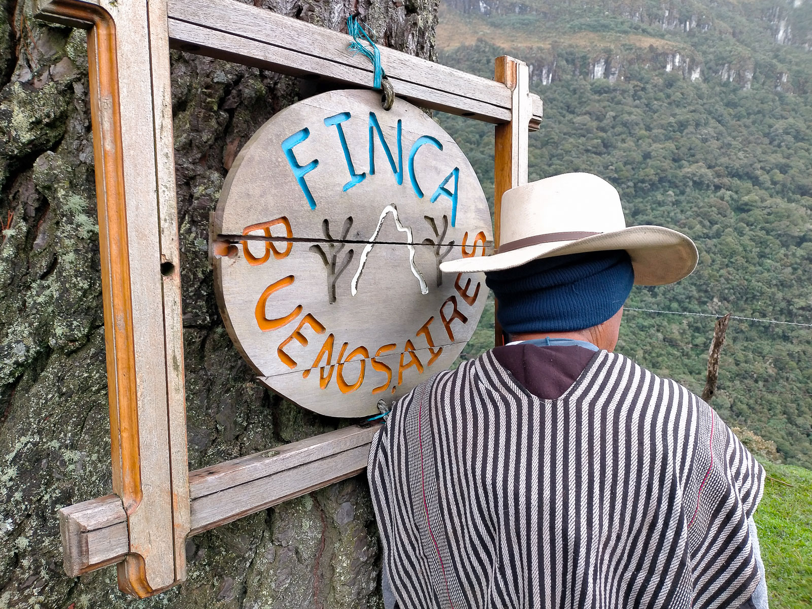
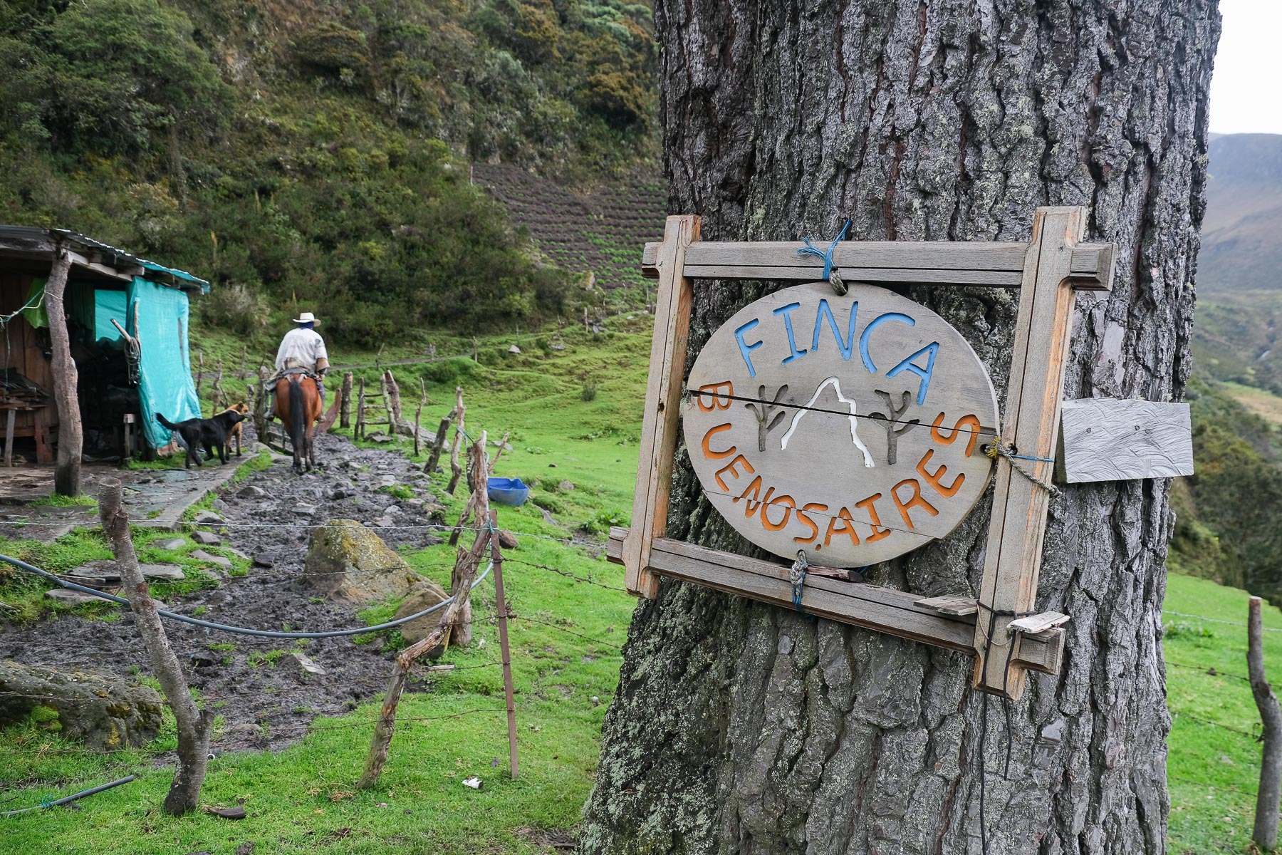
- Finca Buenos Aires - Don Enrique and Juliana (his daughter) - +57 314 83 93 397
- Finca Primavera - Dona Mabel - +57 310 832 78 79
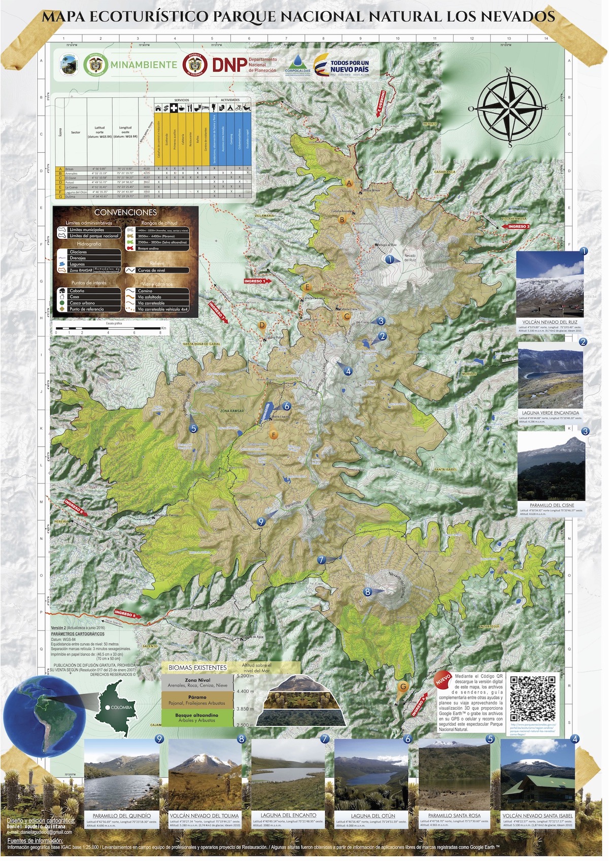
Download the Nevados Natural Park map in PDF
Difficulties mainly concern terrain, orientation and altitude.
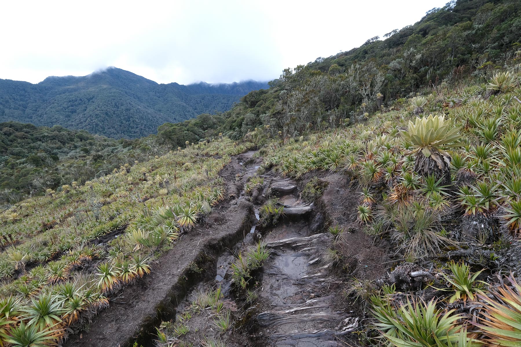
Terrain: trails are well marked on the ground, but unmarked, often with wooden rungs to form steps or deflect water run-off. However, up to 4000m, the terrain is extremely muddy and slippery. I quickly opted for the basic high boots or botas pantaneras worn by all the locals. They keep your feet and pants dry and are less slippery than hiking boots. Don't hesitate to buy them in Salento.
Orientation: there aren't many options, often only one trail and few forks, but it's highly recommended to have a GPS track of the itinerary with you, as there are areas where it's less visible and the spaces are very wide. What's more, you're really on your own, and even if the progression is naturally logical, you can find your bearings with greater certainty. Only the return journey from Fonca Primavera to Cocora is fairly well signposted, with numerous signs along the way.
Altitude: this is the one thing you mustn't overlook, otherwise you risk turning back before the summit. As Salento is at almost 2000m, it's best to spend 1 full day there before climbing. A break at 3500m or 3700m also seems necessary before heading towards 4500m. That's why the loop seems more feasible in 4 days, to respect the body's acclamation to effort at altitude.
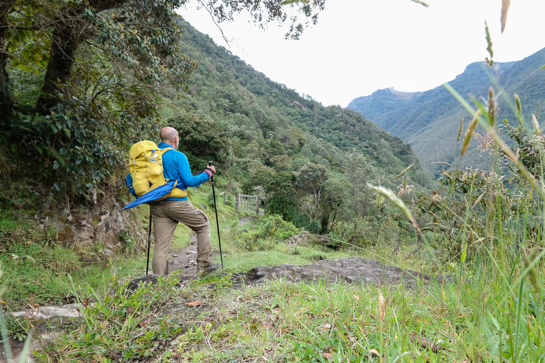
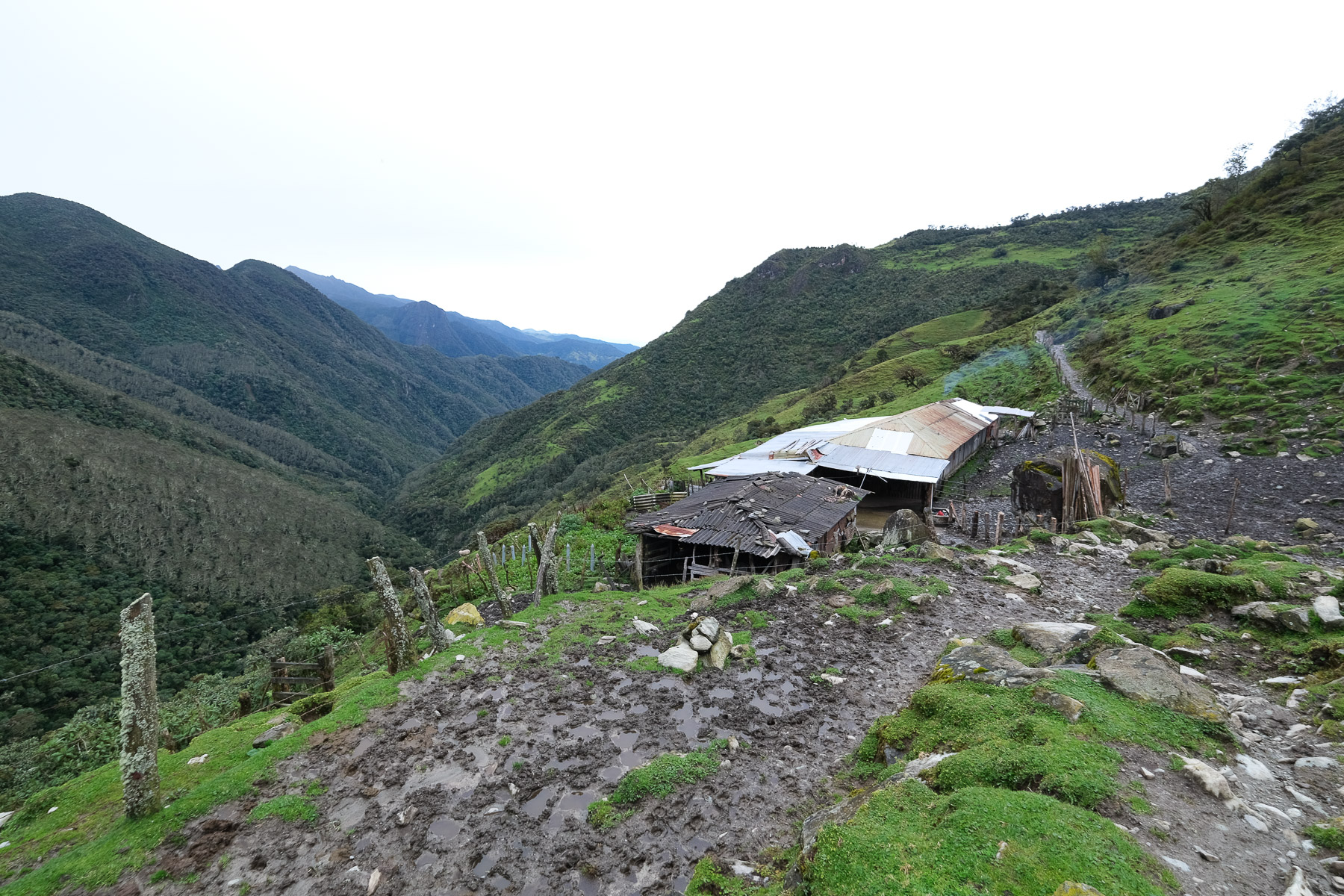
Day 1: Cocora to Finca Buenos Aires (3700m, 5h to 6h, 1500m d+, 12 km)
This stage can be done in one go or, if you prefer to acclimatize more gradually, in 2 stages, with a stopover at Finca Argentina at 3450m, and a break the next day in Buenos Aires, leaving acclimatization to take care of itself, so you don't have to do a thing!
From Cocora, walk along the track that crosses the hamlet and the tourist facilities to reach the bed of the Cardenas torrent, which we'll generally follow on the left bank as far as the isolated Cascada house, except at the start where we cross it twice on trunks with a small taut cable. Immediately afterwards, the path climbs slightly, before descending and crossing the torrent again on a bridge made of trunks and cable. Behind, the ascent begins and the trail climbs steadily. At over 2900m, there's a flat spot with a fork signposted to Santa Lucia. Continue downhill to pass a small stream on a few logs at the bottom of a talweg. It climbs back up to pass 3000m and then 3200m, gradually revealing the valley of the rio Cardenas as it plunges ahead of us. There's then a fairly long, flatter, undulating section around 3300m. Further on, we cross another torrent for a final climb to reach Finca Argentina. 4 to 5 hours' walk from Cocora.
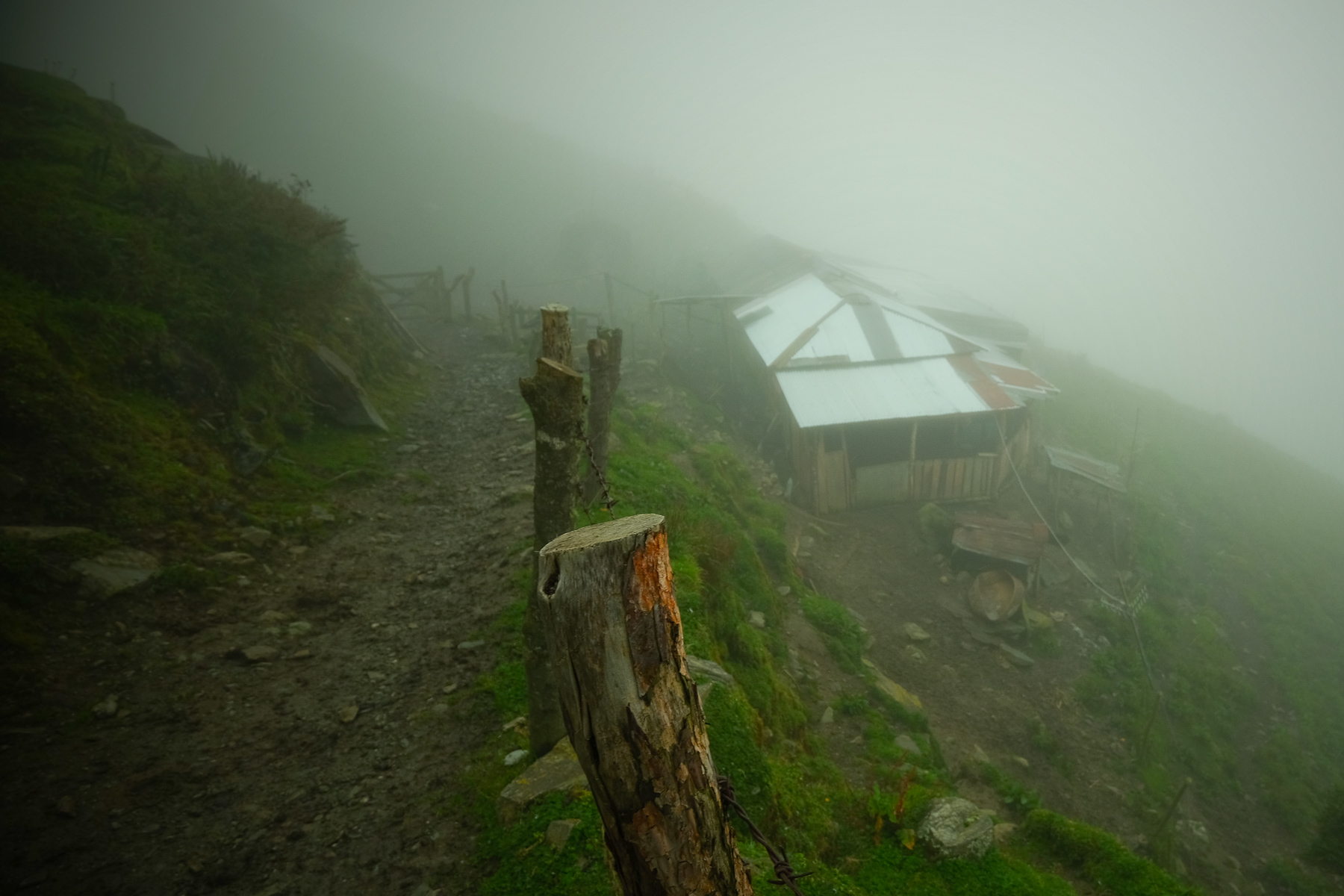
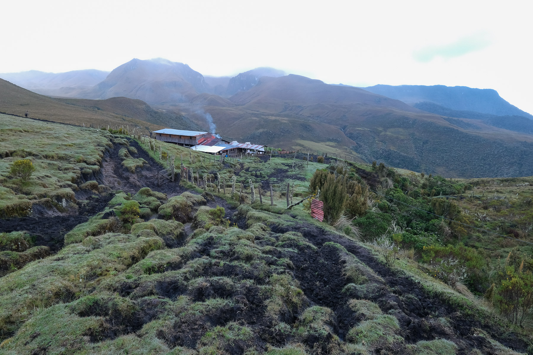
You can stop here at the home of Javier and his family, or continue on to Finca Buenos Aires, about 1 hour further up the valley. The Finca is run by Enrique, alone with his horses, cows, dogs and cat. Smaller than Argentina, the view is superb, more open and you can already see a piece of the Paramillo del Quindio at the very bottom of the valley.
Day 2: Finca Buenos Aires to Paramillo del Quindio base camp (4200m, 3h)
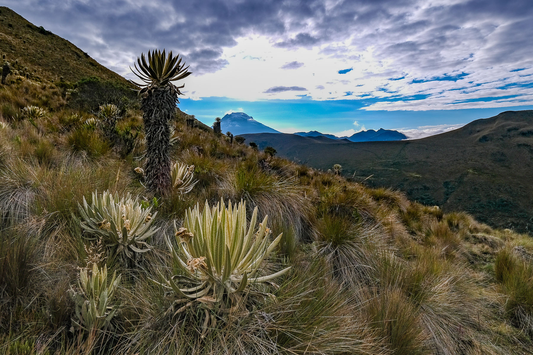
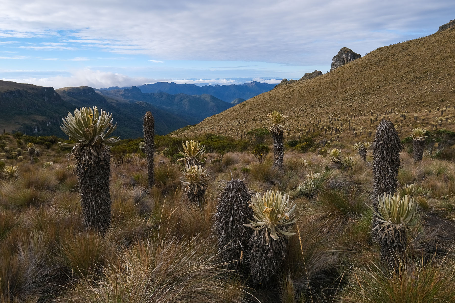
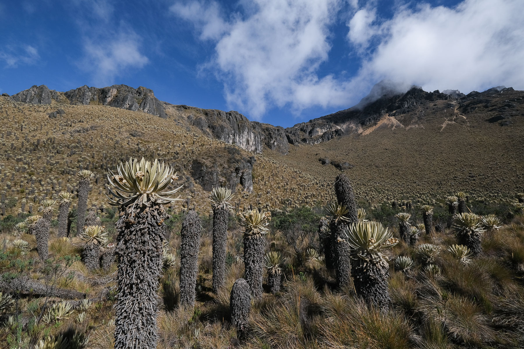
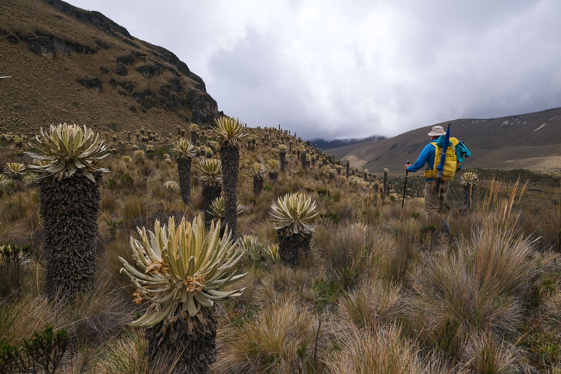
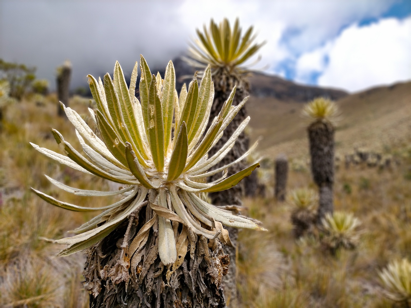
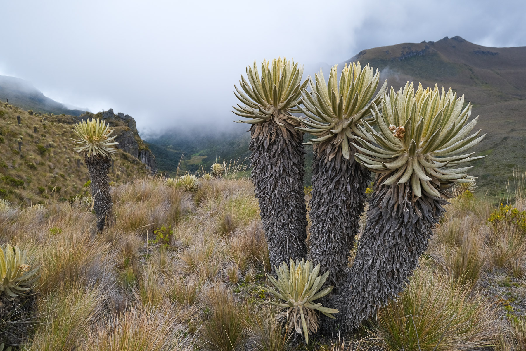
Leave Finca Buenos Aires and at the first fork in the road, climb into increasingly open terrain. The first frailejones appear and the path leads to a plateau above 4000m, covered with frailejones. Behind us, if we're lucky, we can see the summit of the spectacular Tolima nevado. Here, after about 45' of walking, there's a Y fork: continuing slightly to the left, this is the road to Finca Berlin, slightly to the right, we head for the base camp. Climb up to cross a ridge and switch to the other side, accessing a large upper valley and a swampy area in the middle. The path descends a little and, in the middle of the frailejones, describes a large curve to the left and climbs back up to cross a new ridge, about 1h50 after the start, all around 4100m altitude.
Once over the ridge, you'll discover the Paramillo cirque at the far end of the Cardenas valley. Follow the well-marked path, which gradually descends in a long traverse, without losing or gaining too much elevation, to reach the base of the cirque below a small waterfall that is probably the source of the Cardenas, beyond the marshes. Climb one level, passing to the left of the small waterfall, to reach a flat area at the foot of the cirque, the base camp at 4200m.
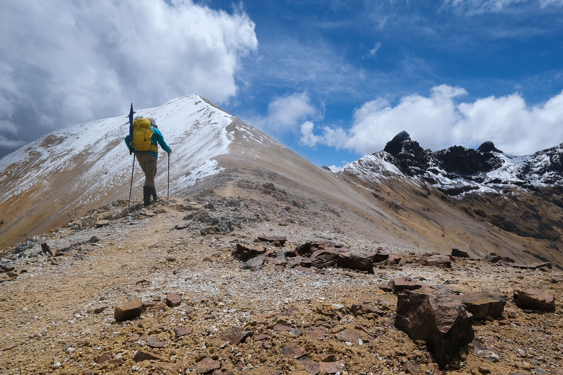
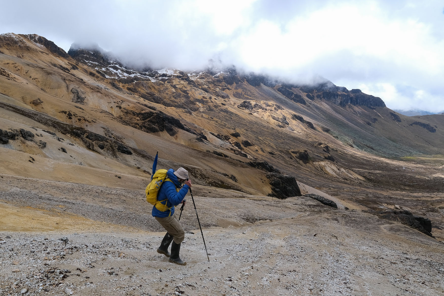
Day 2: from base camp to the summit of Paramillo del Quindio (4690m, 1h30 to 2h)
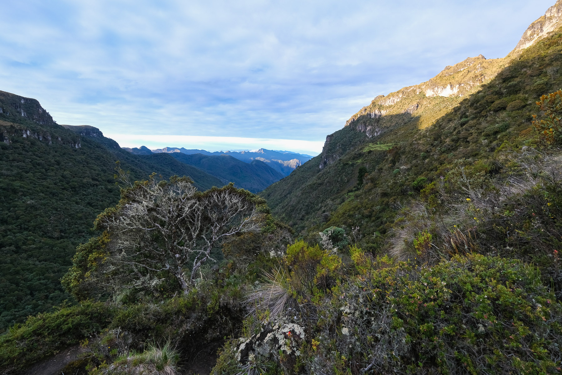
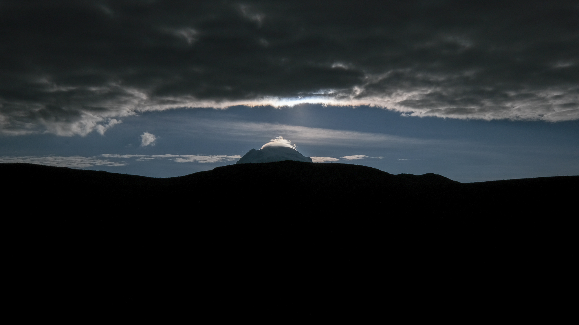
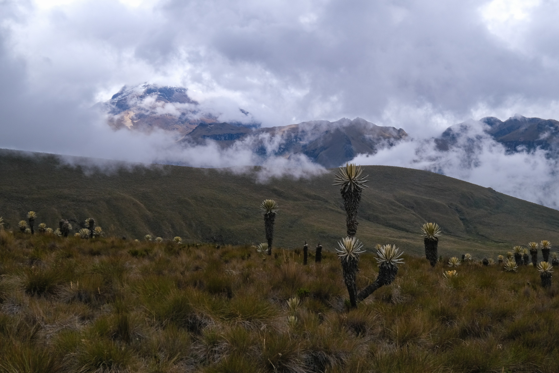
The distance is short but the effort intense, given the altitude and steepness of the slope. The path leading to the ridge on the west side is clear and well marked in the black and orange sandy slopes. The higher you go, the steeper it gets, and the sand doesn't help. You then reach the ridge between a black pyramid-shaped mountain (left) and the summit of Quindio Nord (right) at the end of the ridge. We're already at over 4500m. All that remains is to climb the ramp formed by the rounded ridge of hard sand and a thin film of snow today to the summit at almost 4700m. A tough finish, but the view from the summit is incredible: the Santa Isabel nevado to the north, the Tolima to the southeast, the silvery Leona lagoon at our feet. Spectacular!
Day 2: Paramillo del Quindio summit to Finca Primavera (3740m, 2h30 to 3h)
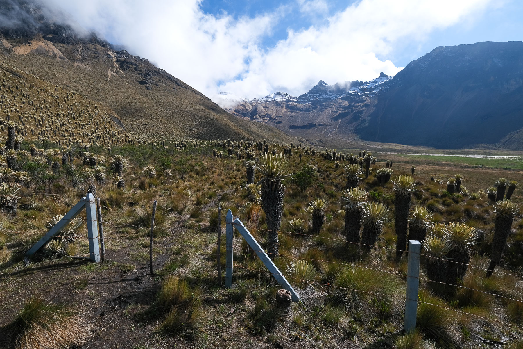
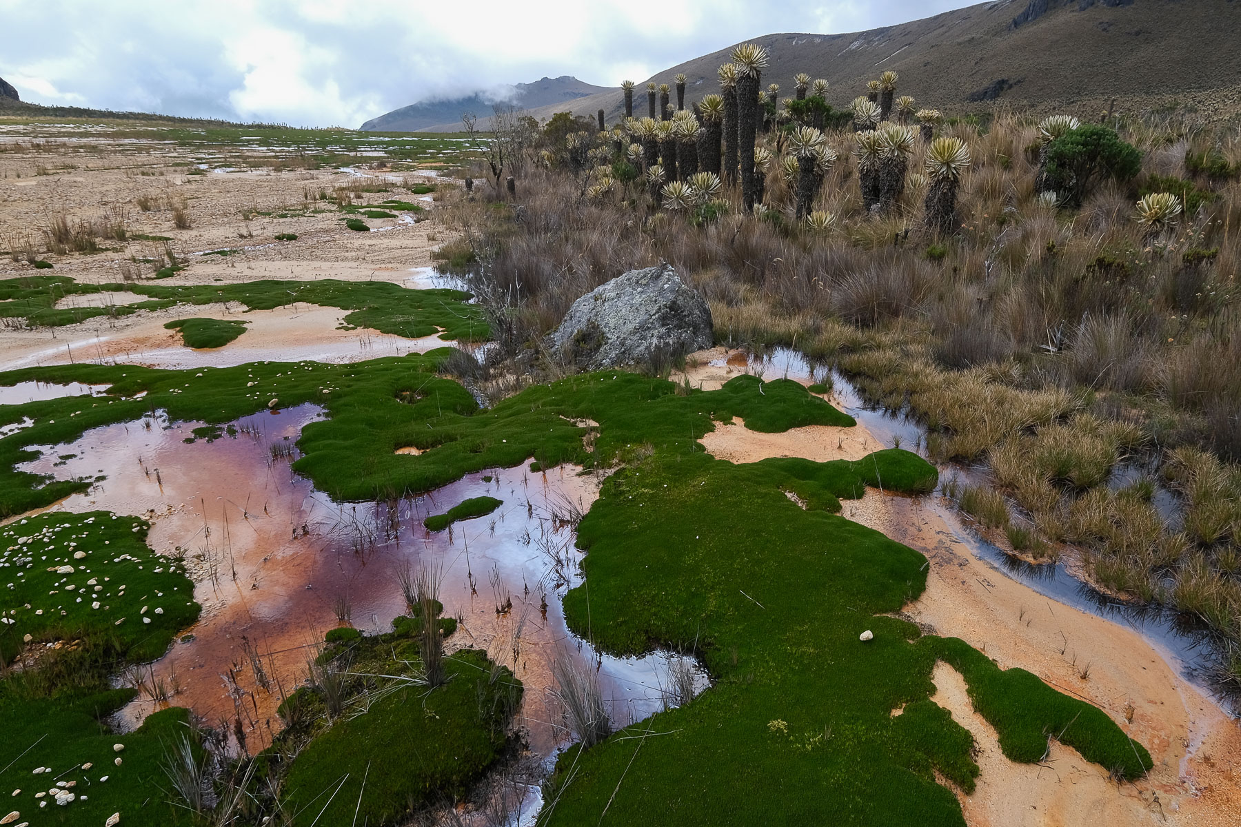
Descend back to base camp, this time using the sandy slopes to our advantage, and return to the large swamp area. Crossing the swamps can be tricky, as there are water holes and you can put your whole leg into them. You can either shift to the left from the start, or try to cross the marshes by staying on hard ground for a long time, but in either case, you'll reach a well-marked path that runs along the left side, a little higher up, on a ledge that actually hides 2 small ponds. Once on this path, go straight on, gradually moving away from the Paramillo cirque.
Pass under small black rock bars and cross a fence. Just ahead, branch off onto a path that crosses and climbs diagonally up the left side of the mountain. Climb back up, aiming for the ridge, passing a small basin and not far from another small silver pond. Once on the ridge at the level of a wide pass, the path climbs over a first hump and then continues for a long time along the edge of the ridge, with flat ground and a second small hump to negotiate but without difficulty. On the right-hand side, you have a bird's-eye view of the Cardenas valley, and you can appreciate the whole itinerary on the opposite side.
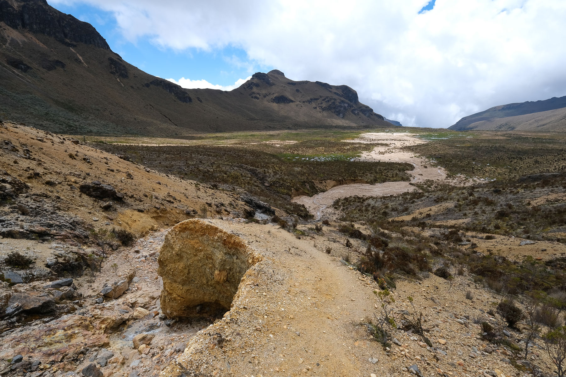
Finally, after this long traverse around 4000m, the trail descends to reach a pass and a path visible in the distance, which runs crosswise to the south-east. Follow it across and then down to Finca Primavera, facing the Tolima crater.
Day 3: Finca Primavera to Cocora (4h30 to 5h30)
The route from Finca Primavera to Cocora is long and quite demanding, with a good negative gradient. Leave the Finca at the top and follow the wide, extremely muddy trail to gradually extract yourself from the Tolima valley. As you approach the 4000m mark, you come to a large upper páramo plateau populated by frailejone. You soon come to the fork in the road leading to the Estrella de Agua finca. A long, undulating traverse follows the small wooden signs for los Romerales. Then it descends a little to the left to cross a wooden bridge and climb back up to cross a pass in front of an enormous tooth. We're on the border between the departments of Quidio and Tolima.
You reach a small valley which you cross, staying high up, and at the end of which you cross another small pass into the valley leading down to the bed of the Rio Quindio. This time the descent is continuous, until you reach forest level at around 3700m altitude. This is the start of a long descent through the forest on a trench-like path, sometimes very narrow, through dense vegetation. At the very bottom, the trail finally reaches the Quidio and follows it along the left bank to the Finca Estrella de Agua at 3240m. 2h30 to 3h from Finca Primavera. Coffee break available.
There's still some way to go to get out at Cocora, 2h to 2h30. Follow the torrent, then the trail climbs upwards for a long section of alternating ascent and descent that breaks the legs a little. The rainforest gradually returns. At the end, it descends steeply and steadily back to the Quindio riverbed and crosses it a first time on a rickety wooden suspension bridge secured by rusty cables... but it's all right. You then enter a trail in Cocora park (entrance fee on the Cocora side, 5000 pesos). Follow the torrent bed and cross 6 or 7 suspension bridges, each as brilliant as the next. The route is pleasant and original. You finally emerge onto magnificent grassy slopes where colorful cows graze peacefully, with the slender, oversized silhouettes of wax palms reaching for the sky. Leave the park, pay the 5,000 pesos if the janitor is there, and return to the main street where the jeeps are parked for the return to Salento.
Ressources
Facebook page with all Nevados Natural Park contacts: guides, agencies, fincas, hotels, equipment rental, transport, emergencies.


 Partager sur WhatsApp
 Partager sur Twitter
Partager sur Instagram
Partager sur Twitter
Partager sur Instagram

 Partager sur Facebook
 Imprimer le topo
 Laisser un commentaire


Leave a Reply