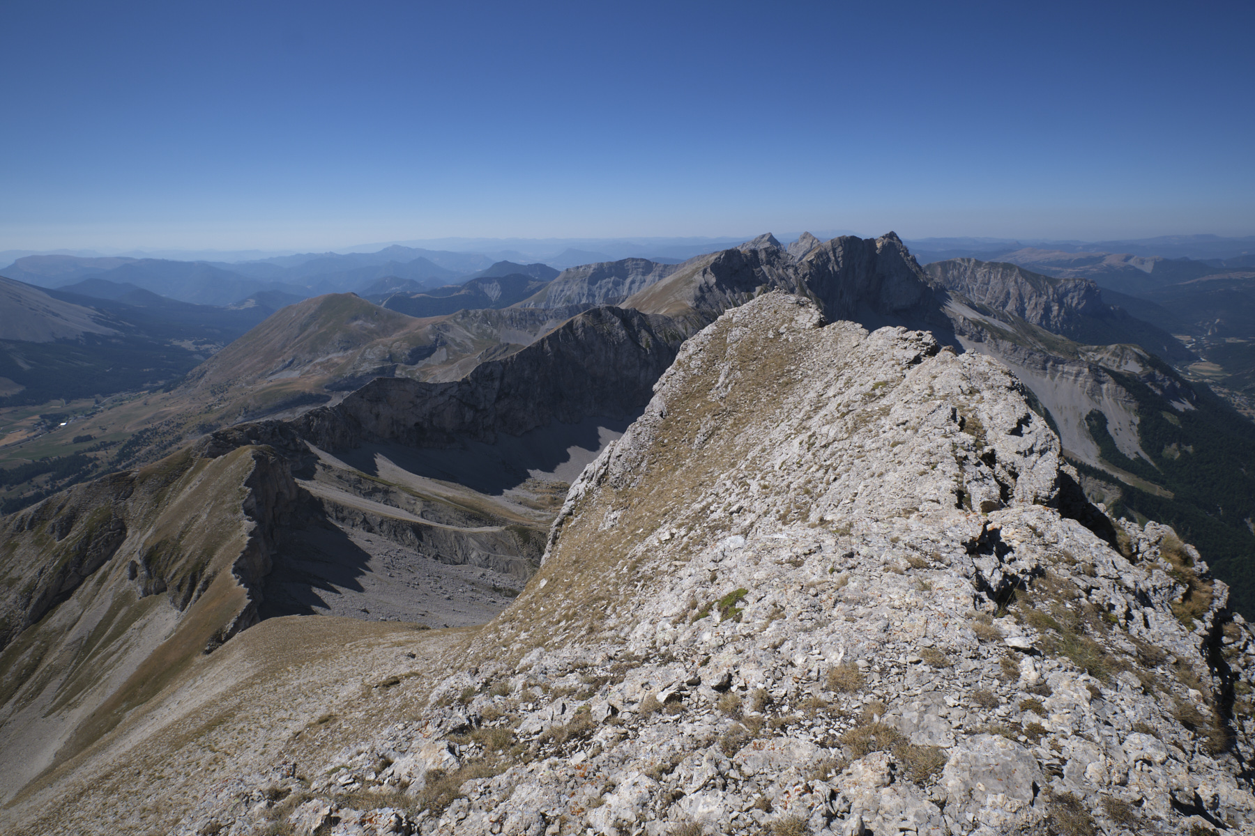
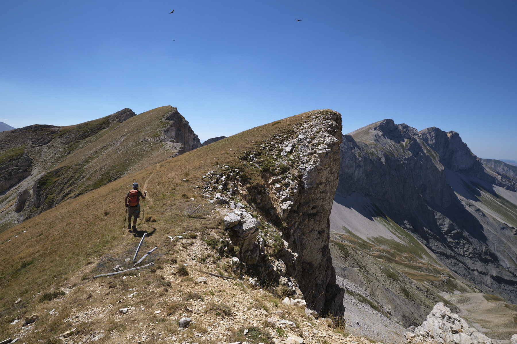
An exceptional hike in the Grand Ferrand and Obiou massif. The ascent of Rocher Rond via the Costebelle ridge and the aerial route over the crests to Aiglière and La Rama, watched by the many vultures that turn and turn, offers breathtaking panoramic views of Dévoluy, neighboring Vercors and, in the distance, over Montagne de Faraut to the high peaks of the Écrins massif. Demanding, off-piste and in full sunshine, the hike requires good physical condition, ease on aerial terrain and a good sense of direction. The passage at the foot of the Saut Aure waterfall is worth the detour in less dry periods, when it is watered by the Aiguilles valley.
❱❱ Technical summary
■ S tarting point: village of Lachaup, Agnière-en-Dévoluy, Hautes Alpes (05)
■ Type of route: high-mountain loop hike, ridge traverse
■ Distance: 12.5 km
■ Cumulative elevation gain: +1100 m
■ Cumulative negative altitude gain: -1100 m
■ Estimated total time: 5h to 6h30 ■ Min and max altitude: 1380 m / 2453 m
■ Marking: almost all off-piste except for the final section from the cascade de Saute Aure (yellow PR).
■ Equipment in place: none
■ Equipment required: GPS track very useful
Difficulties: some tricky descents on steep stony terrain, from the summit of Rocher Rond and below La Rama.
❱❱ Access to the place
Between Col du Festre and Aginère-en-Dévoluy, take the narrow road that leads to the village of Lachaup at 1400m altitude. Park in the village, in front of a fountain, in a small parking lot.
❱❱ Map & topo
The route is indicative as it is off-path and has been traced afterwards on the map.
Part 1: Rocher Rond via Arête de Costebelle (2h to 3h)
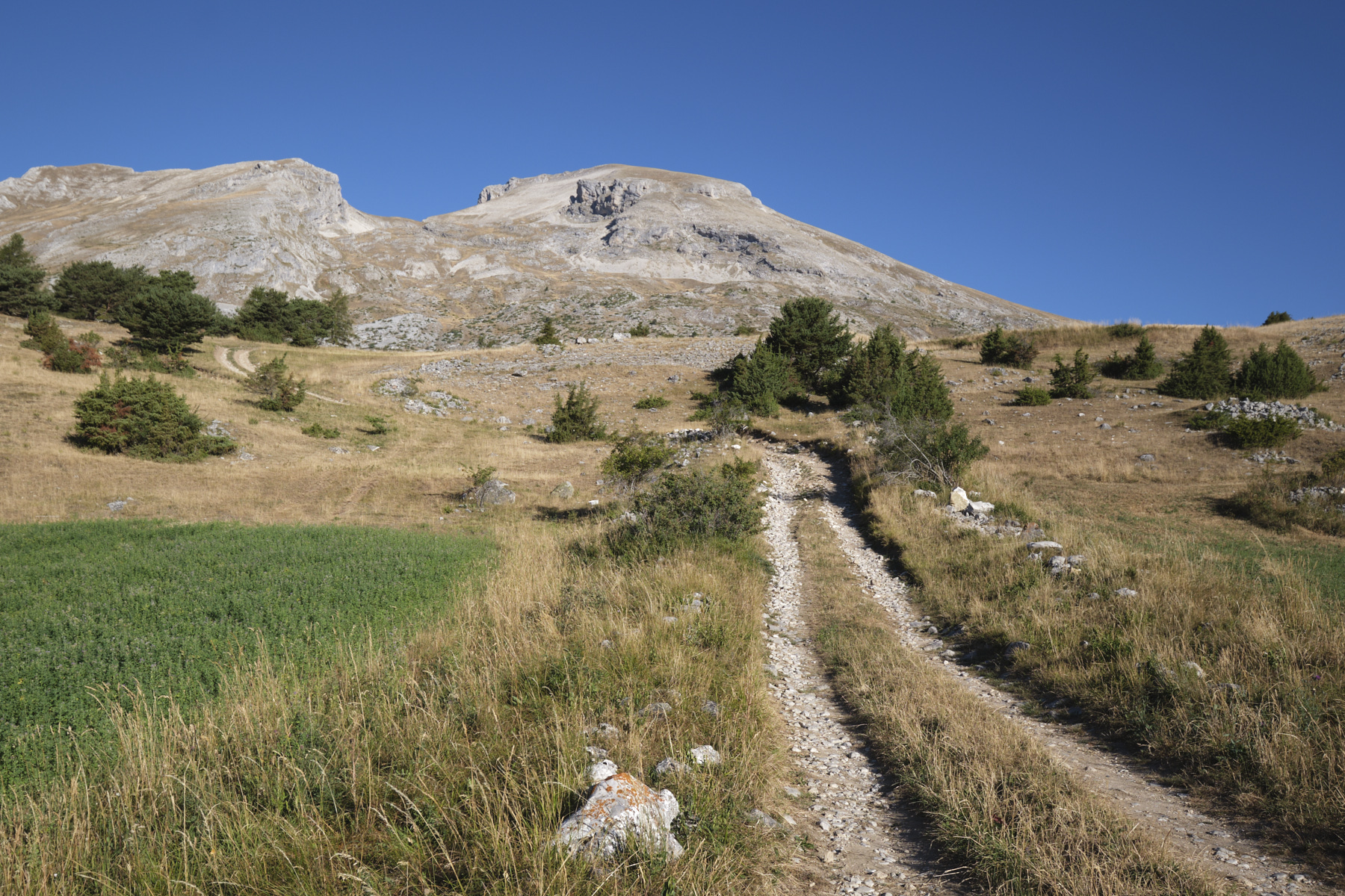
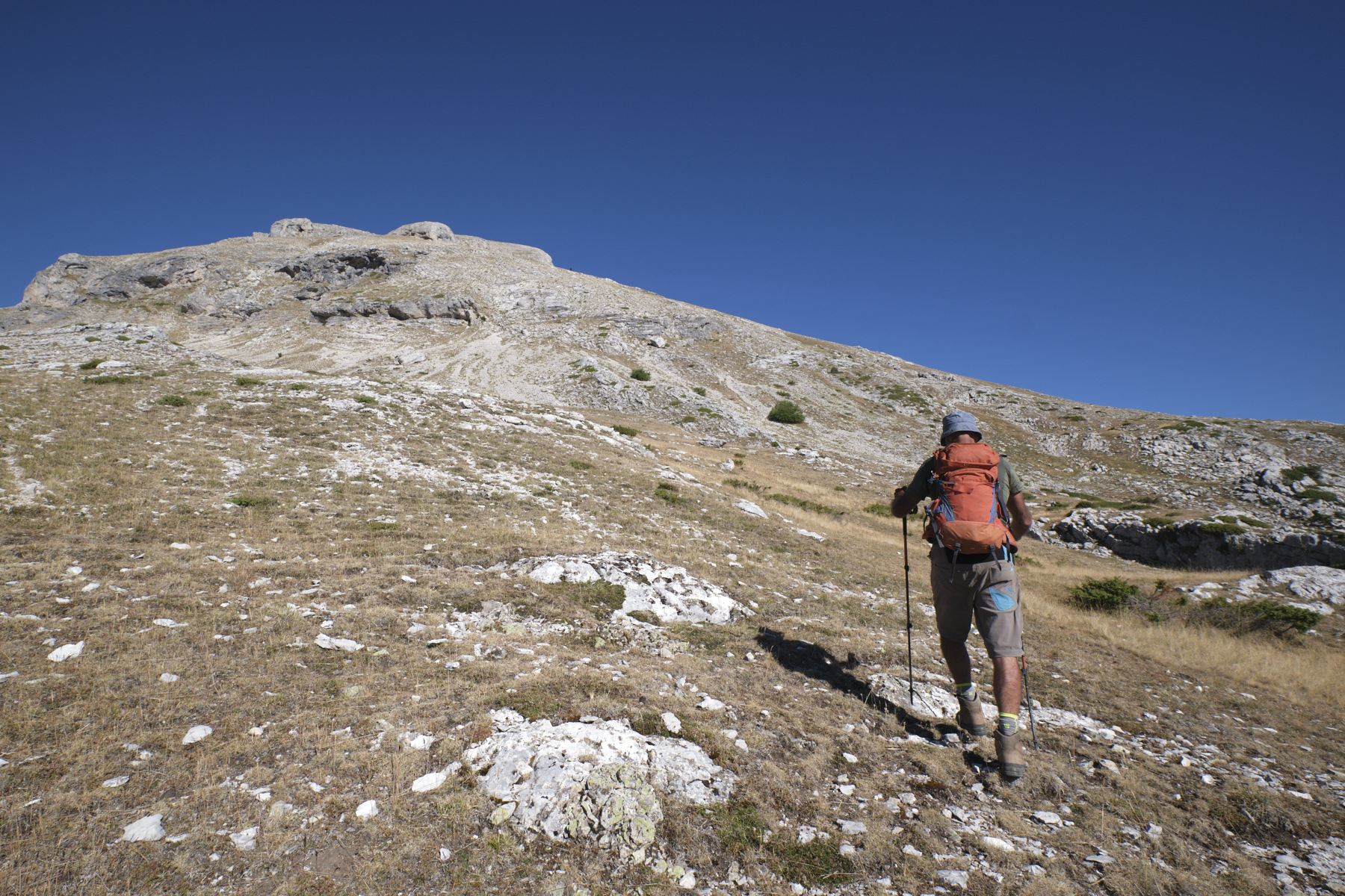
Leave the village to the south, following the GR de Pays Tour du Dévoluy trail. After a bend to the left, leave the GR where you'll be returning, and climb to the right on the track heading south-west, then after a wide bend, gradually climb to the north-west. You pass a wooded area which forms a wide basin. Continue in this direction to pass to the left of a second, smaller basin. Continue on an inconspicuous path, crossing to the north-west and gradually climbing. We cross the wide grassy slopes to the east of Rocher Rond and reach the edge of the ridge at around 2120m. Here, at our feet, we discover a small, deep valley and, in front of us, the very mineral Grand Ferrand massif.
Climb up the edge of the ridge to reach the summit ridge without difficulty, which continues westwards. We're at 2453m. The view is incredible, with the Dévoluy behind us and the Écrins beyond. On the west side, the Jarjatte valley.
2nd part: l'Aiglière and the ridges towards la Rama (1h30 to 2h)
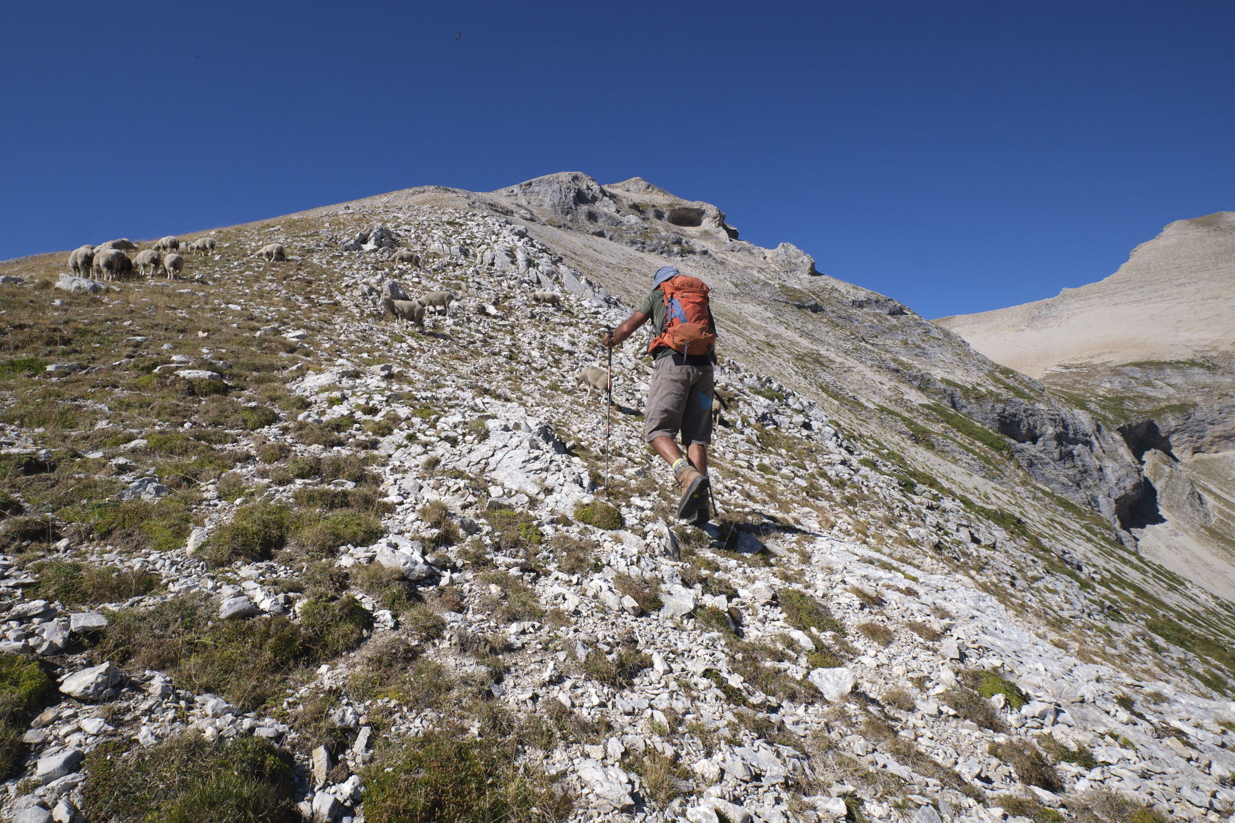
Return a little behind the summit to find an accessible descent route on the slope, then turn south to reach the obvious pass at the foot of Rocher Rond. Climb back up following the ridge that undulates in front of us. We pass over the summit of the Aiglière ridge, then continue along the ridge, staying almost on the edge, on flat or downhill terrain until we reach a col in front of the ascent to La Rama.
Part 3: Le Touret and the Saute Aure waterfall (45' to 1h)
From the pass, start the descent on a south-facing path, then look for a route up a slightly steep section to reach a wide, stony valley (tricky section). Once in the valley, descend eastwards towards a characteristic little pyramid: Le Touret. At the base of the Touret, turn right into a grassy valley and find your way without difficulty to the yellow-marked path leading to the Saute Aure waterfall.
Part 4: Saute Aure waterfall to Lachaup (45' to 1h)
From the waterfall, follow the yellow-marked path down to the cabane de la Rama. At this point, leave the path that descends to the right towards the Col du Festre and continue straight ahead on the track. It descends gently and ends at the Château Rolland crossroads. Turn left on the stony track which rises slightly, pass the Serre la Garcine crossroads and continue to return to the village of Lachaup.


 Partager sur WhatsApp
 Partager sur Twitter
Partager sur Instagram
Partager sur Twitter
Partager sur Instagram

 Partager sur Facebook
 Imprimer le topo
 Laisser un commentaire


Leave a Reply