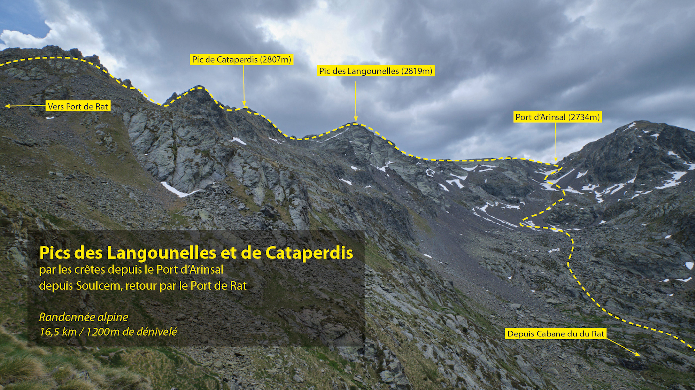
The ridges between Port d'Arinsal and Port de Rat offer a spectacular itinerary, with many passages to climb or unclimb in III+ max but often on exposed terrain. Two peaks are on the program: the Pic des Langounelles overlooking the beautiful Angonella valley and its ponds on the Andorran side, and the Pic de Cataperdis just beyond, dominating the top of the Arinsal ski resort. The loop is long in distance, with a fairly substantial vertical drop. This alpine hike is reserved for experienced hikers ready to take on a ridge route that is accessible but requires a good reading of the rock and is exposed in many places.
❱❱ Technical summary
■ Departure point: parking des Orris du Carla, Soulcem valley, Ariège (09)
■ Type of route: alpine hike, out-and-back to the Rat hut, then loop, ridge route
■ Distance: 16.5 km
■ Cumulative elevation gain: +1200 m
■ Cumulative negative altitude gain: -1200 m
■ Estimated total time: 6h to 7h30 ■ Min and max altitude: 1630 m / 2819 m
■ Marking: GR then yellow to Port d'Arinsal, unmarked on the ridge, GR on return.
■ Equipment: none
■ Equipment required: crampons, safety rope
Difficulties: steep slopes, scree, possible névés, rugged ridge route with route reading not always obvious, many sections to climb in the III+, sometimes quite exposed.
❱❱ Access to the place
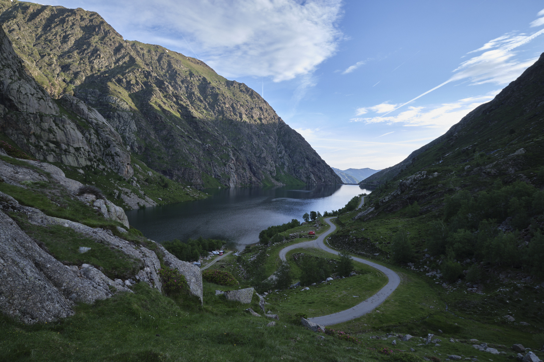
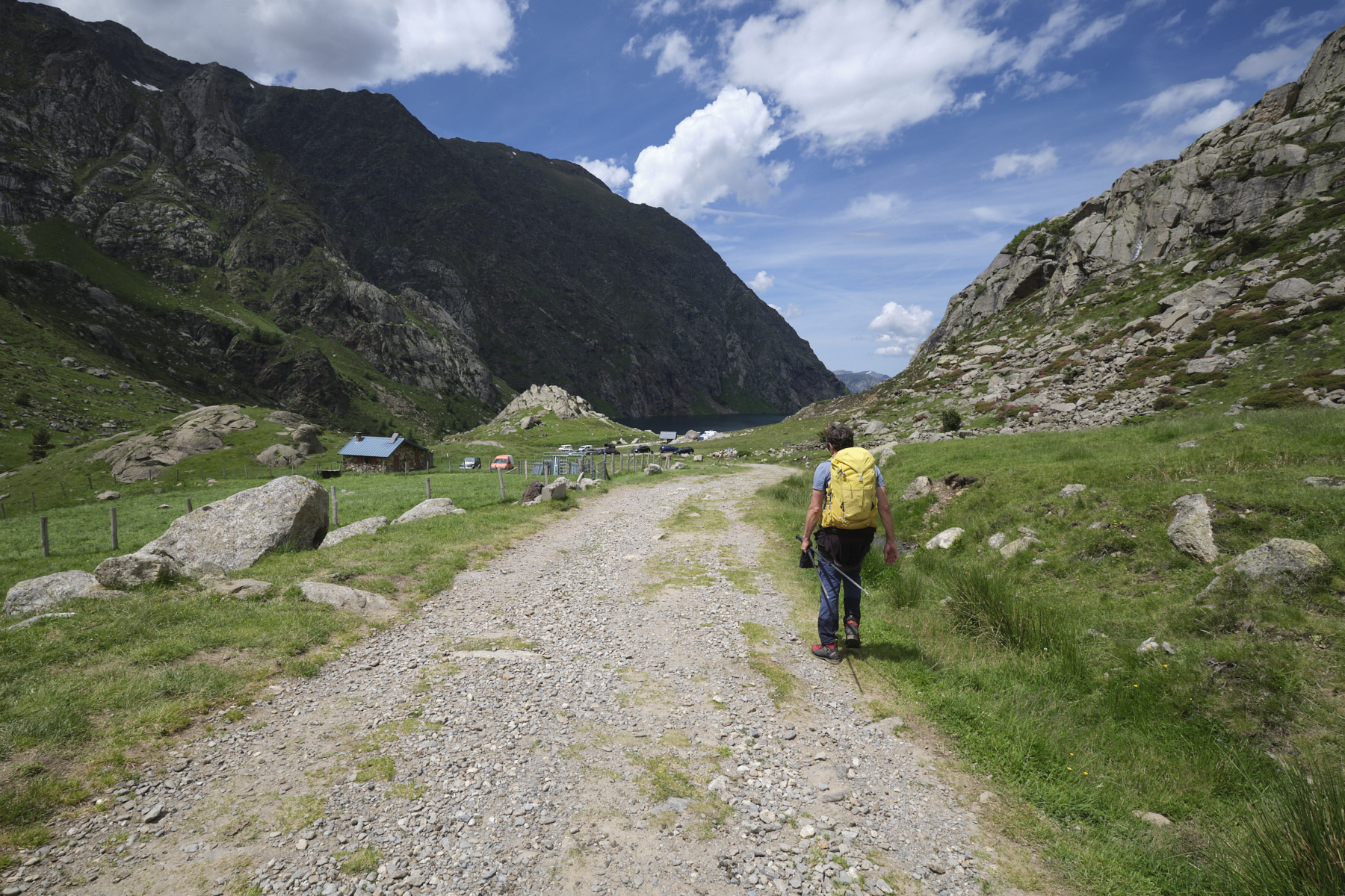
On the N20, just outside Tarascon in the direction of Ax-les-Thermes, turn south to pass Vicdessos then Auzat and continue along the Vicdessos stream up to the Soulcem pond at 1600m. Park at the end of the road, on the south bank of the pond, at the Orris du Carla parking lot.
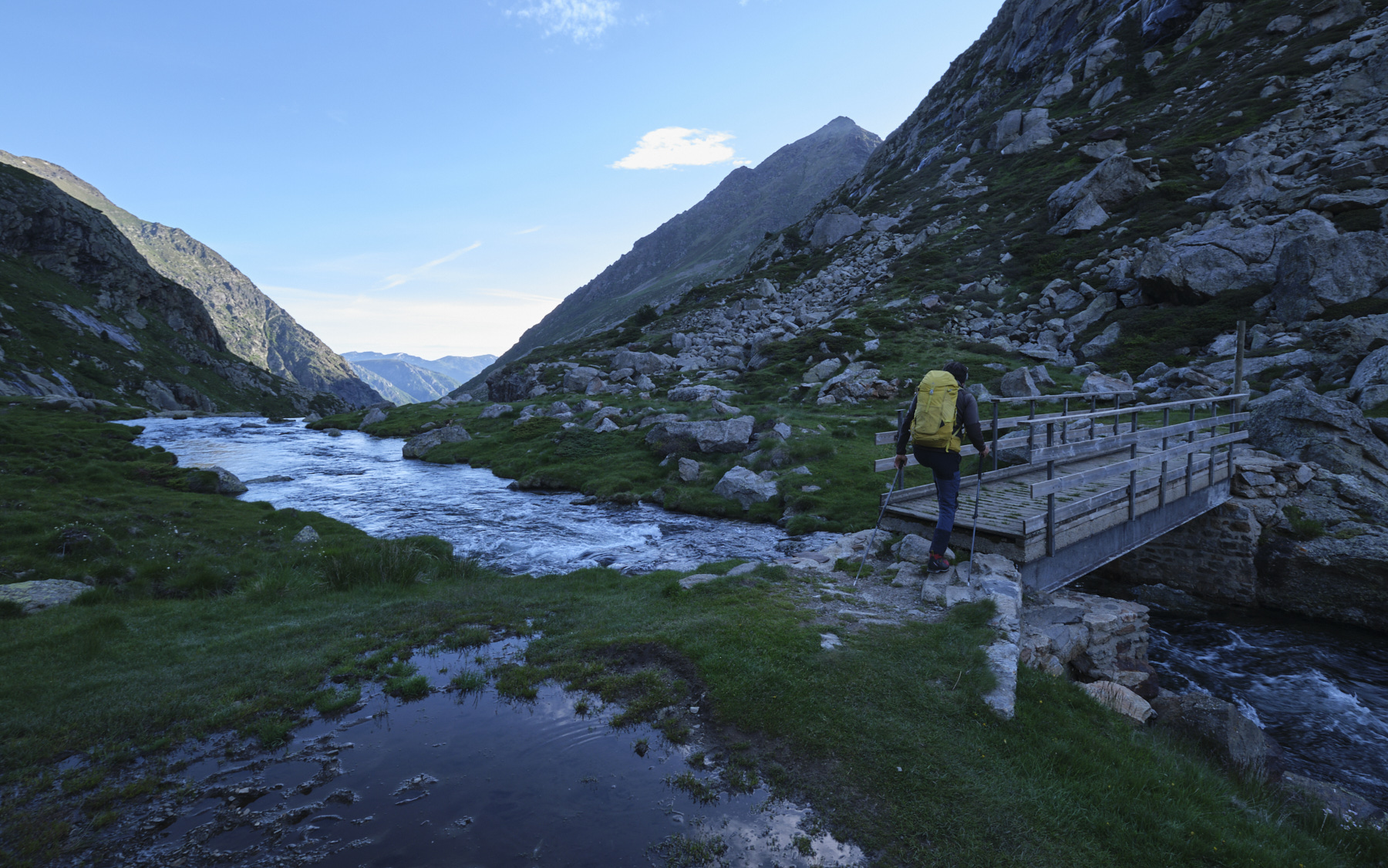
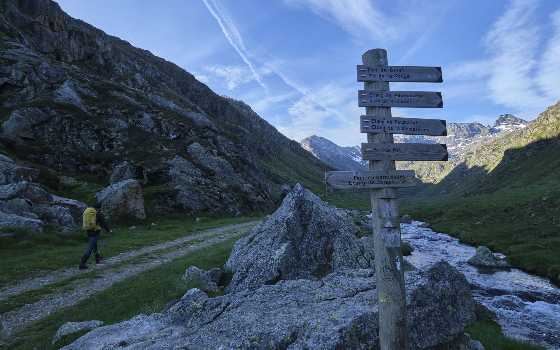
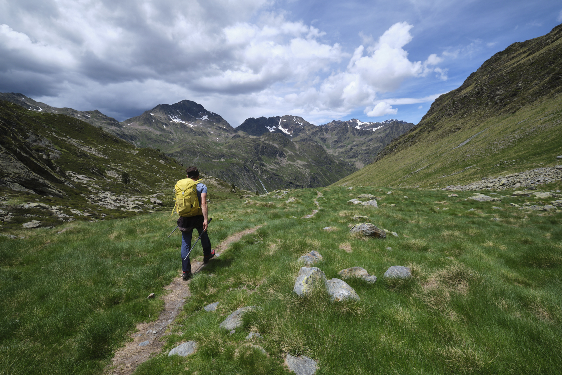
1st part: from the parking lot to the Port d'Arinsal (2734m, 2h30 to 3h)
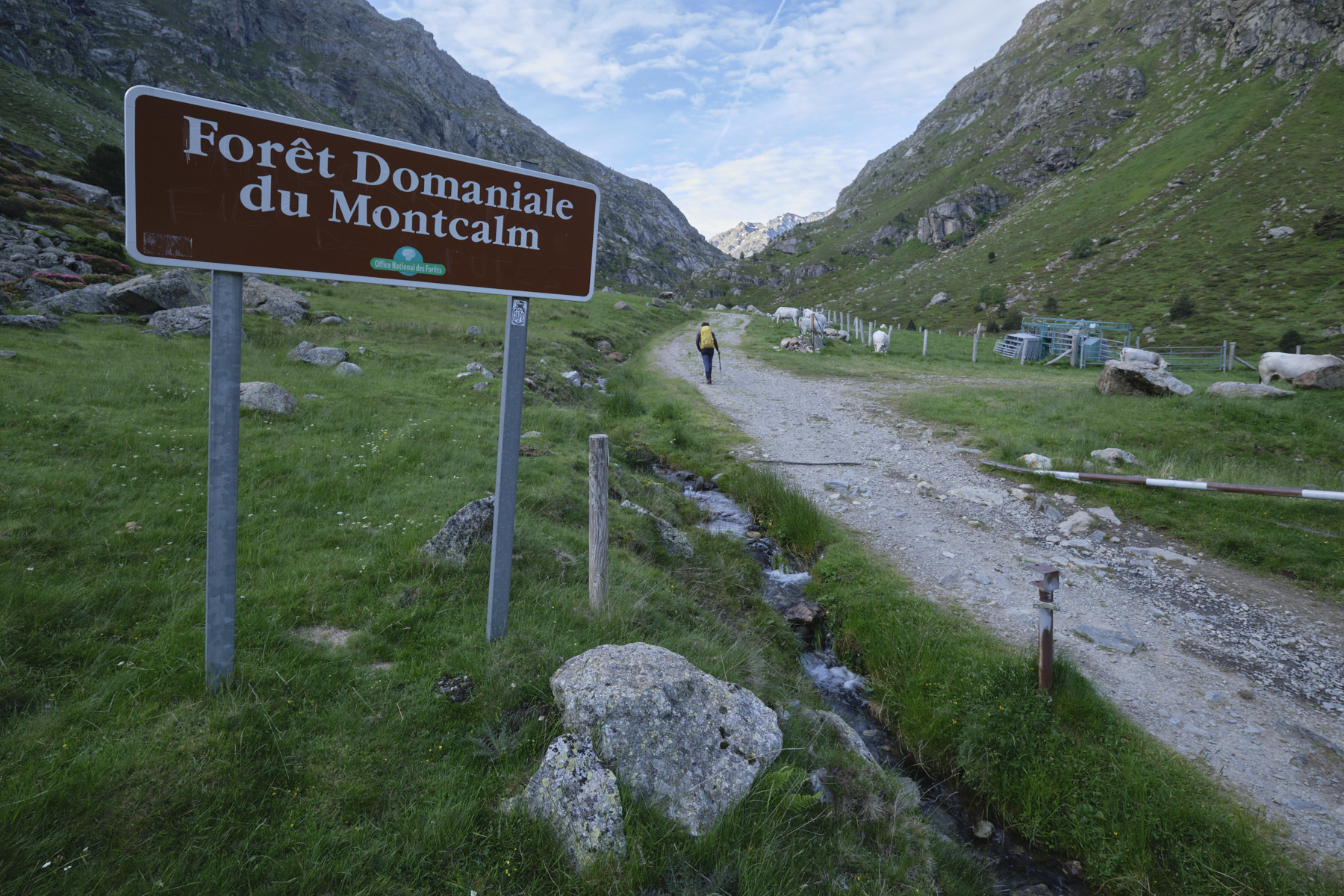
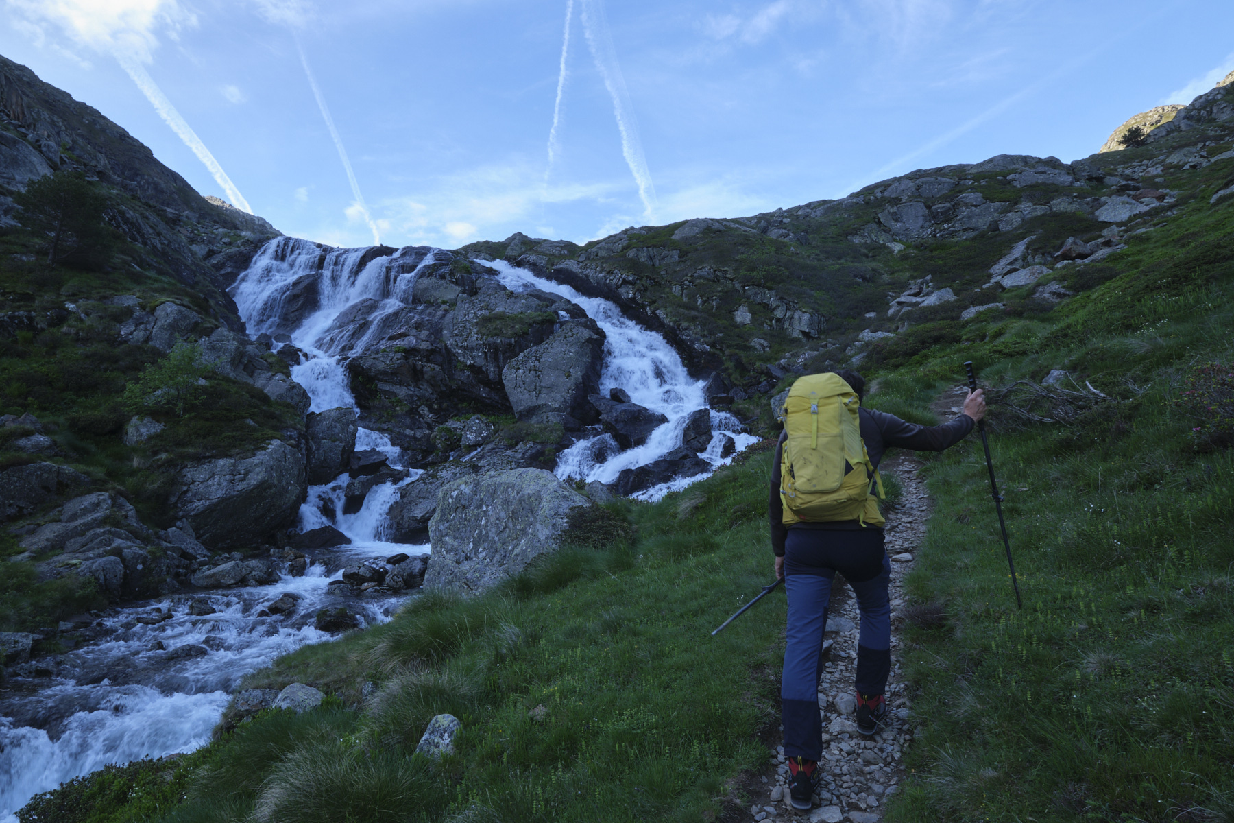
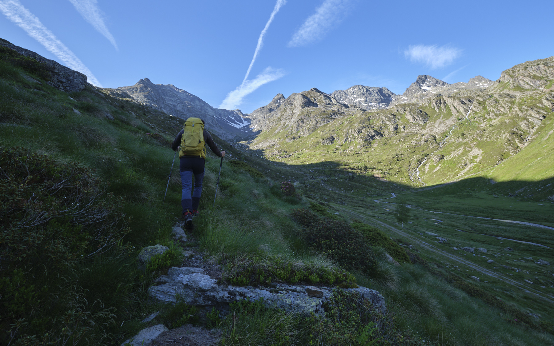
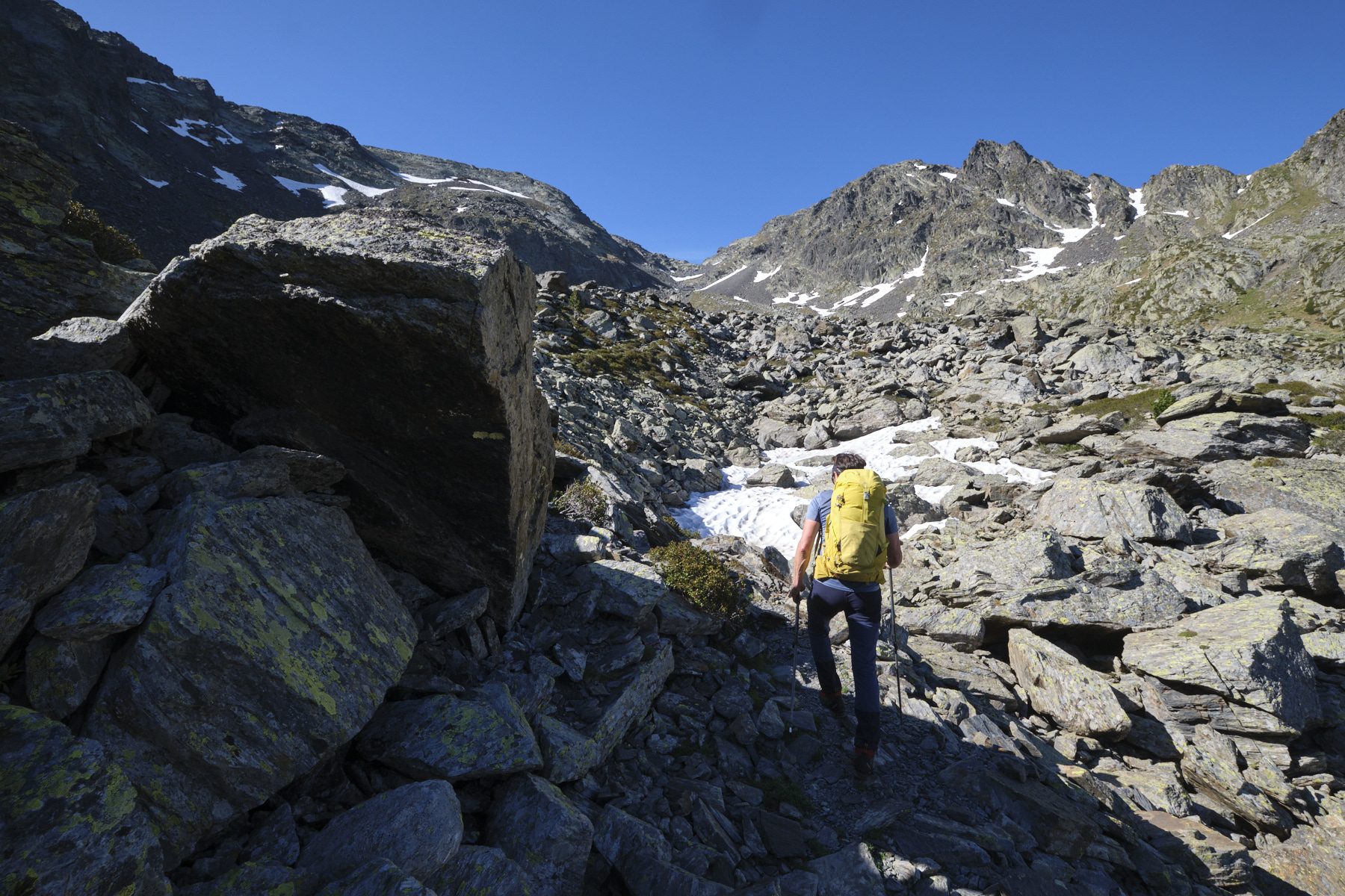
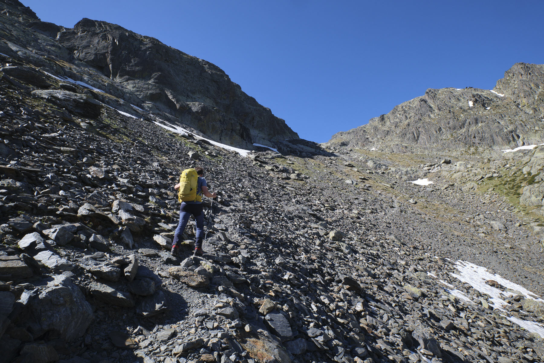
Walk along the track that starts from the parking lot, cutting the switchbacks higher up on the left bank of the stream to reach the Pla de Labinas. Cross over and pick up the track again, this time on the right bank. At the Cabane d'Estrets, follow the GR path up the western slope. Further up, the path crosses the winding track several times to reach the grassy valley of the Ruisseau de Rat. Continue on less steep terrain, leaving the GR below the Port du Rat to follow the yellow-marked, cairned path on the right, which heads straight for the Port d'Arinsal, which is already in sight.
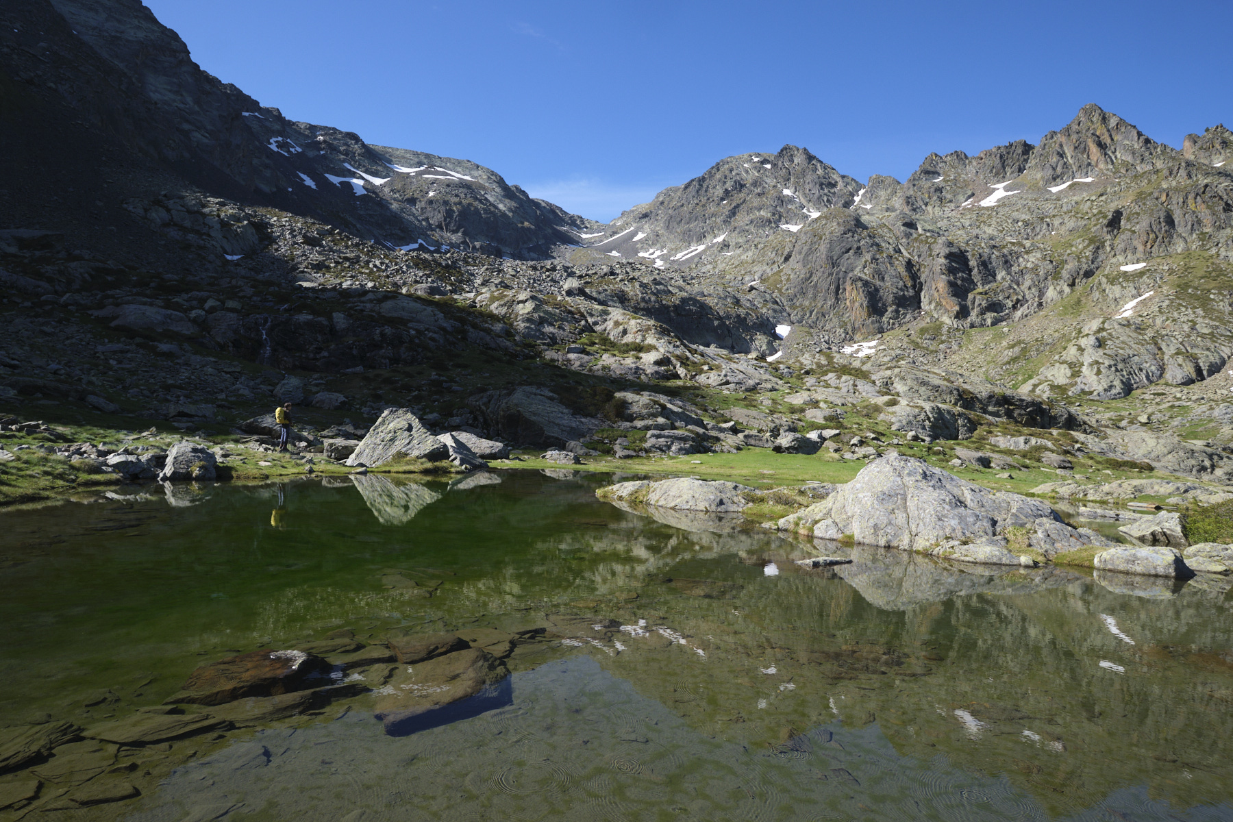
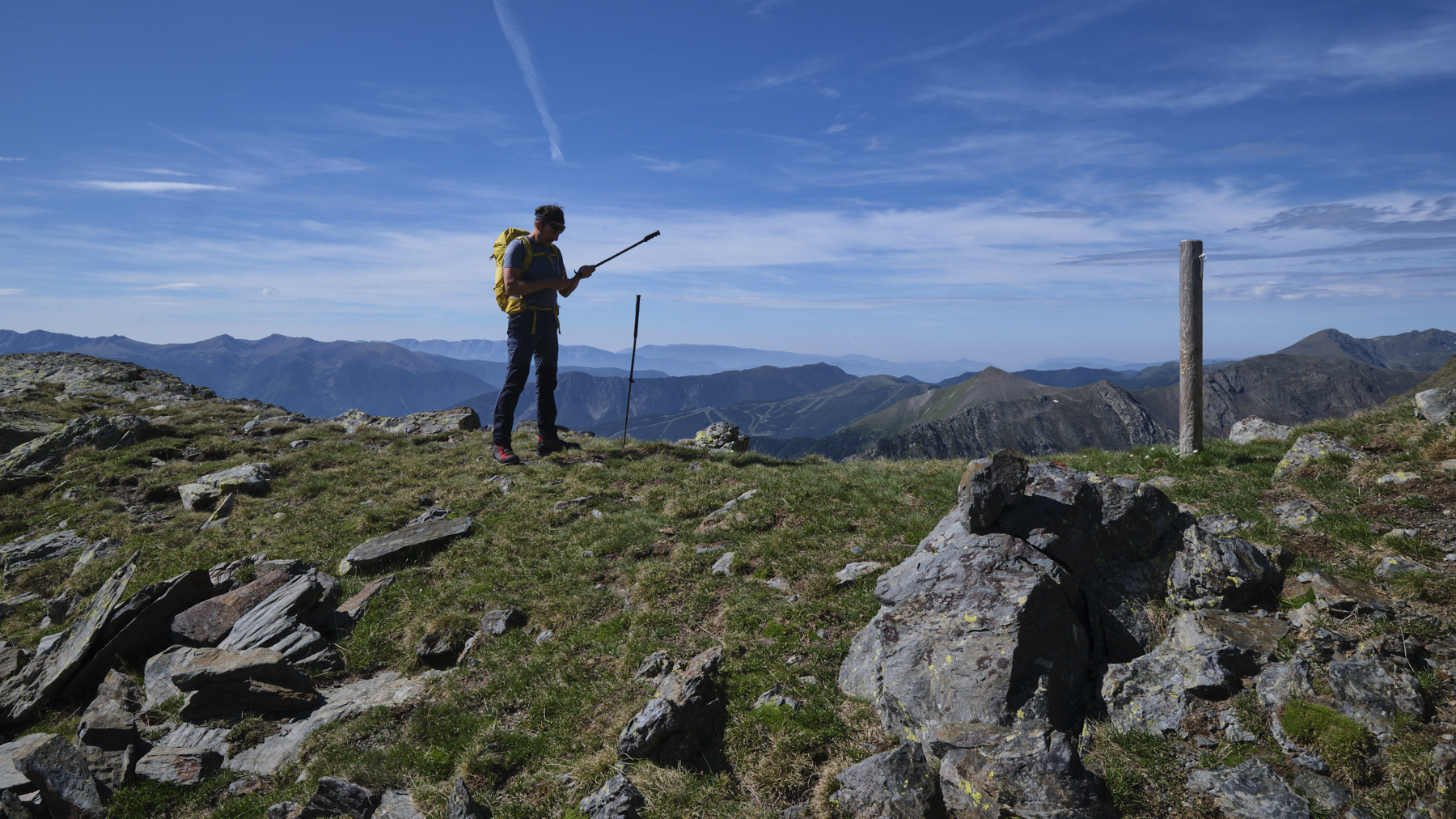
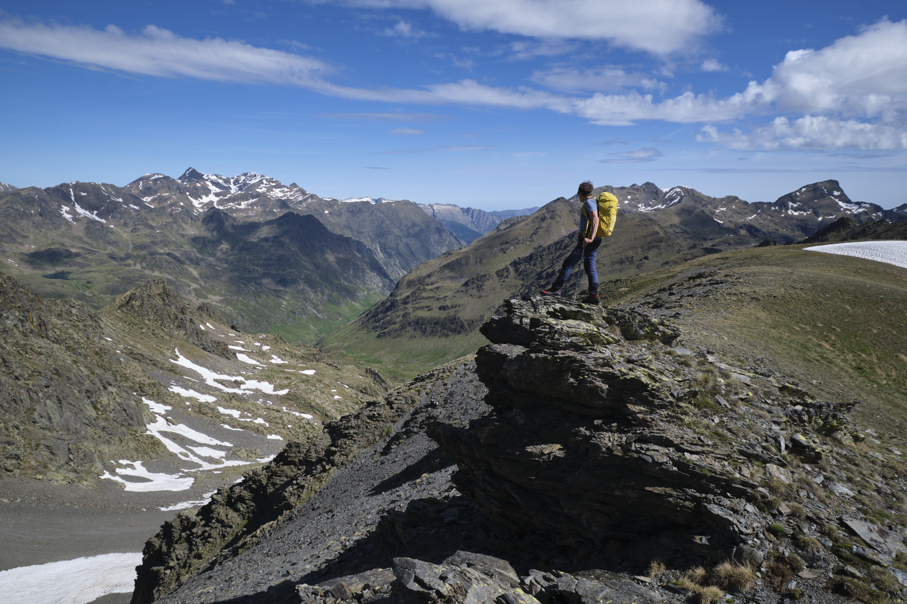
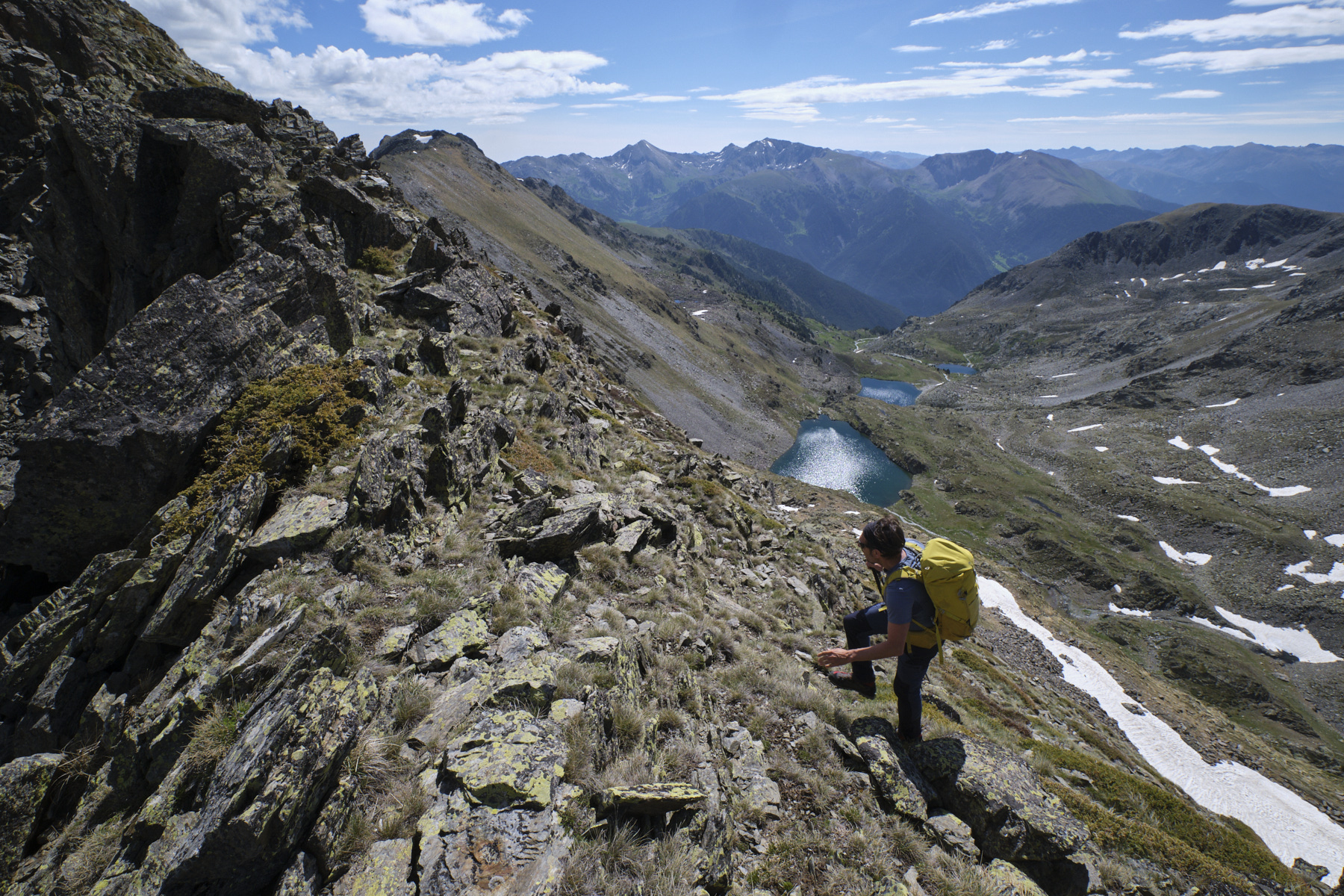
We climb up to discover a small basin with a small pond near the Cabane du Rat. The path becomes much rockier, crossing large scree slopes and possibly a few late-arriving névés. There are a few steeper passages, and the path weaves its way through the gradually narrowing couloir to emerge on the ridge at Port d'Arinsal at 2834m, the border with Andorra.
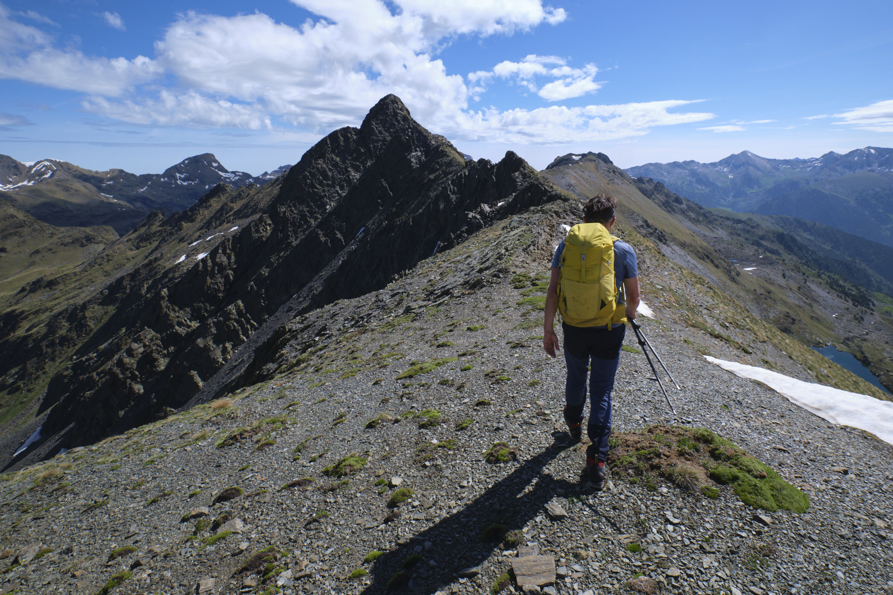
Part 2: Pic des Langounelles and Pic de Cataperdis via the ridges (2819m, 2805m, 1h to 1h30)
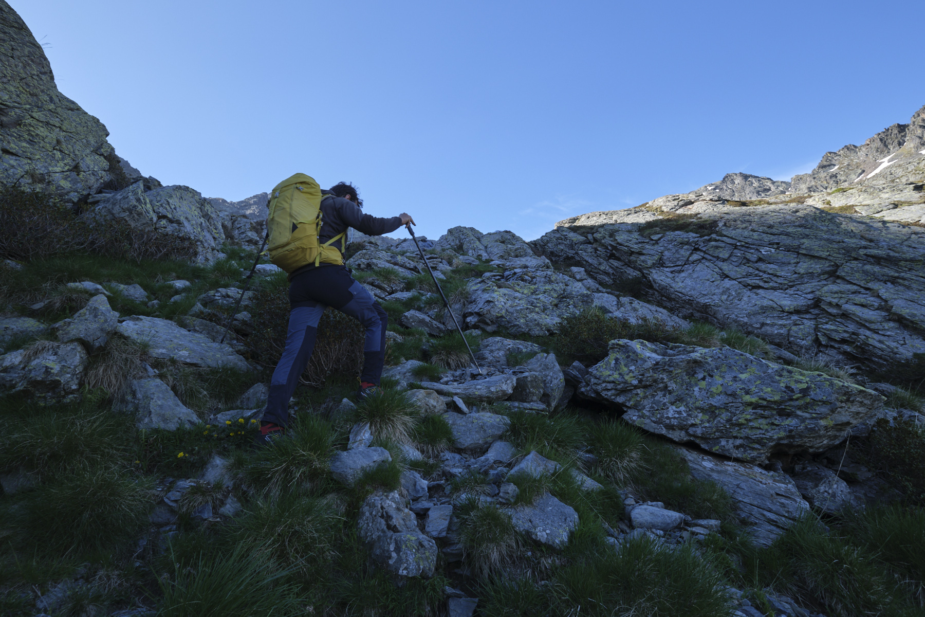
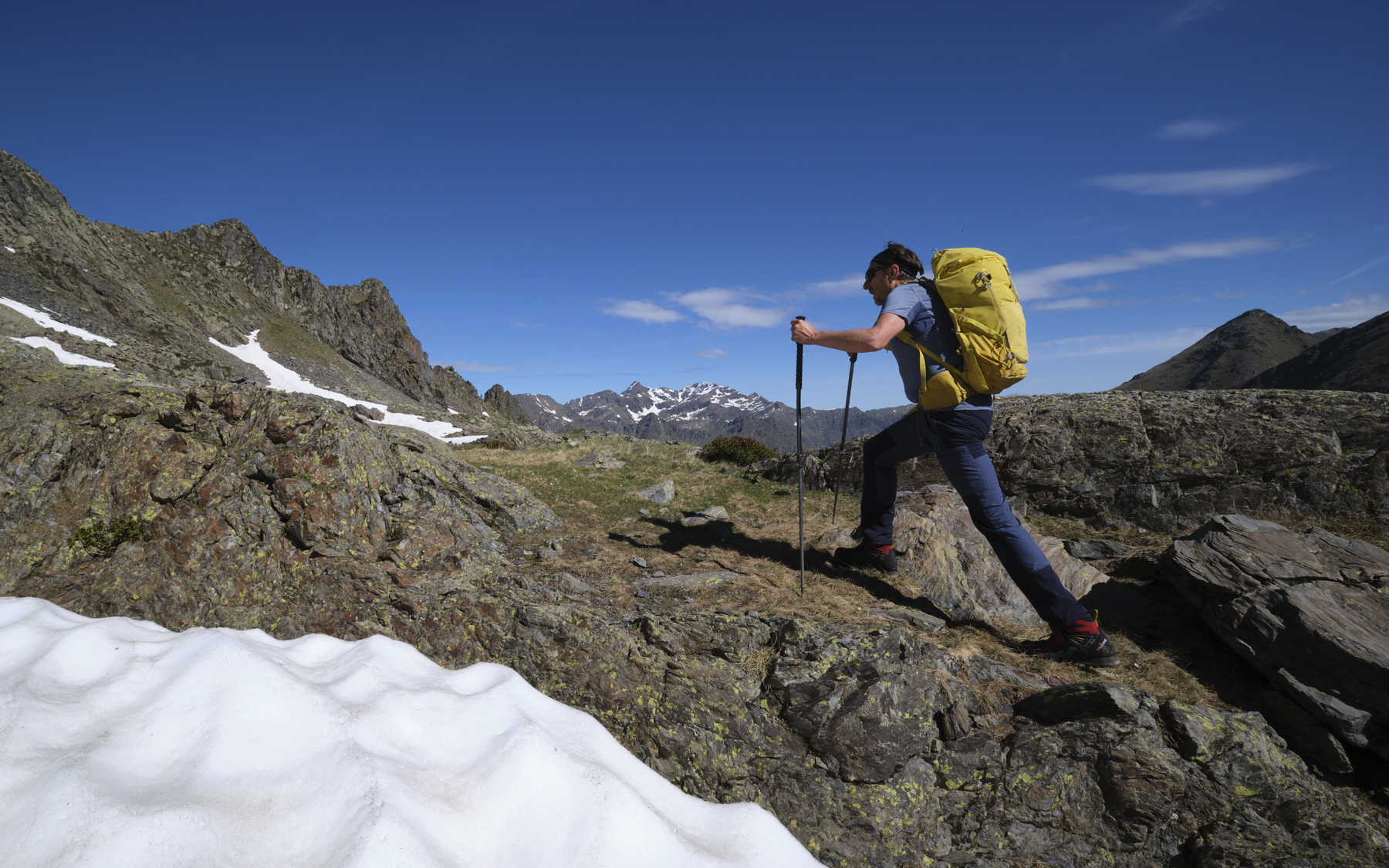
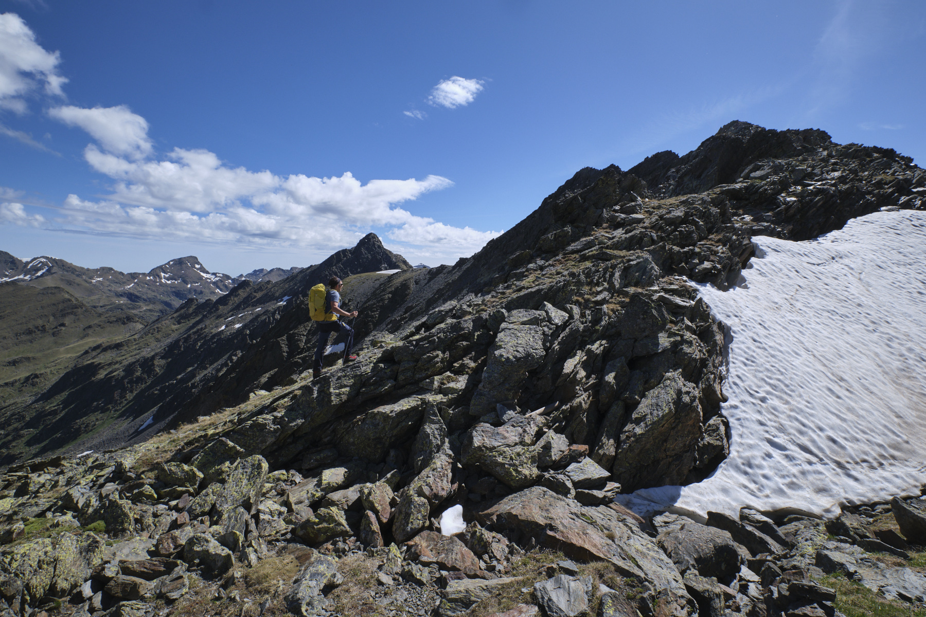
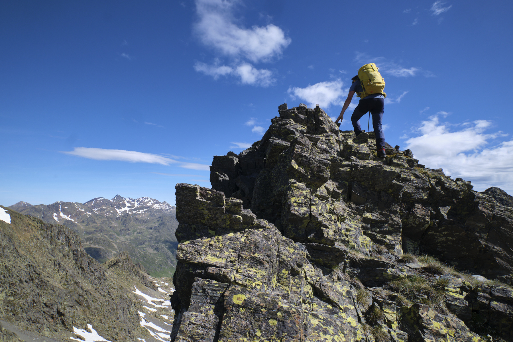
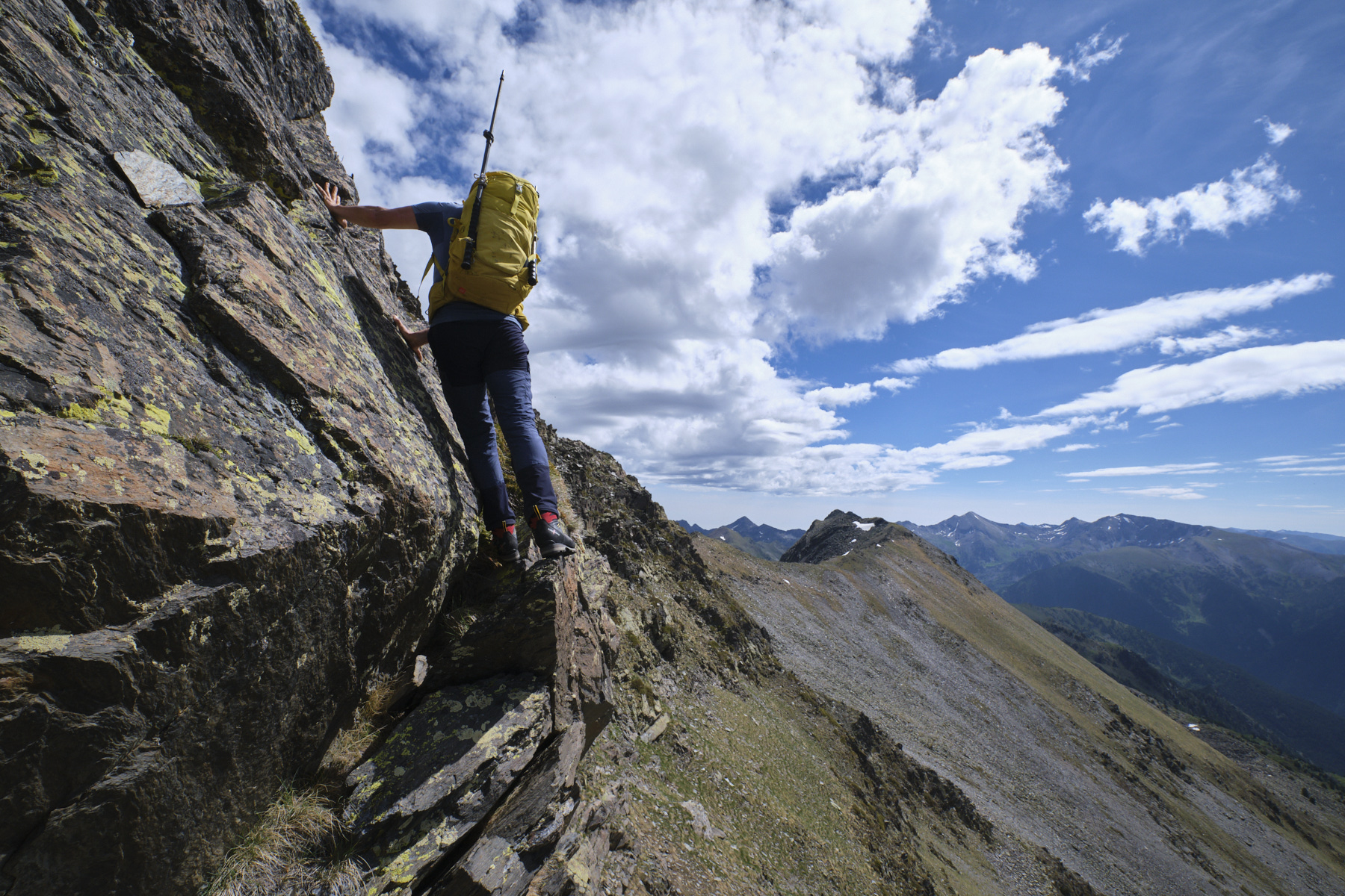
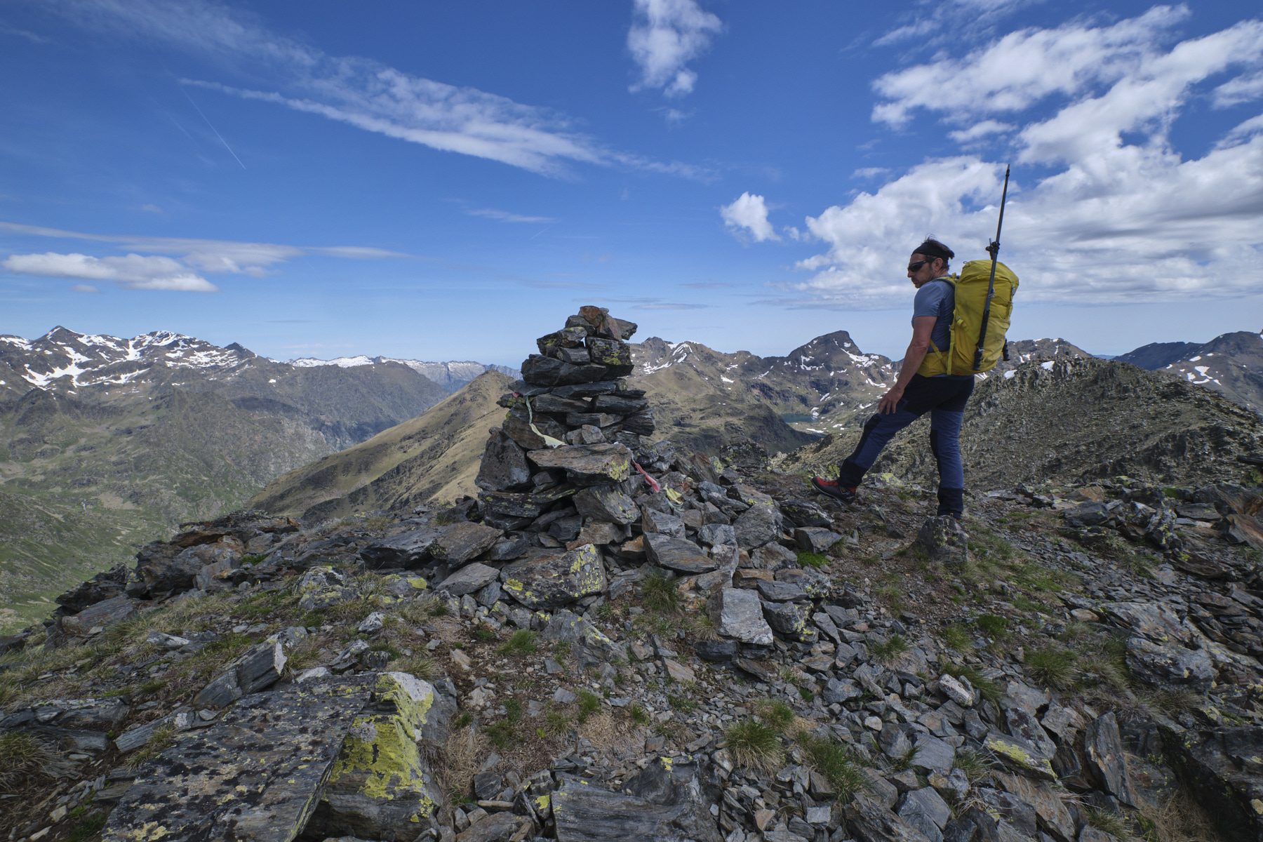
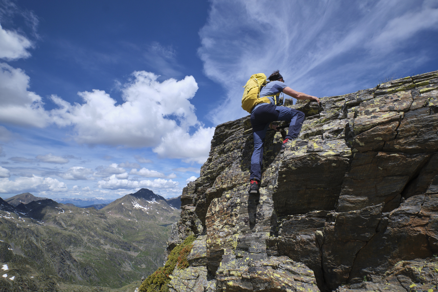
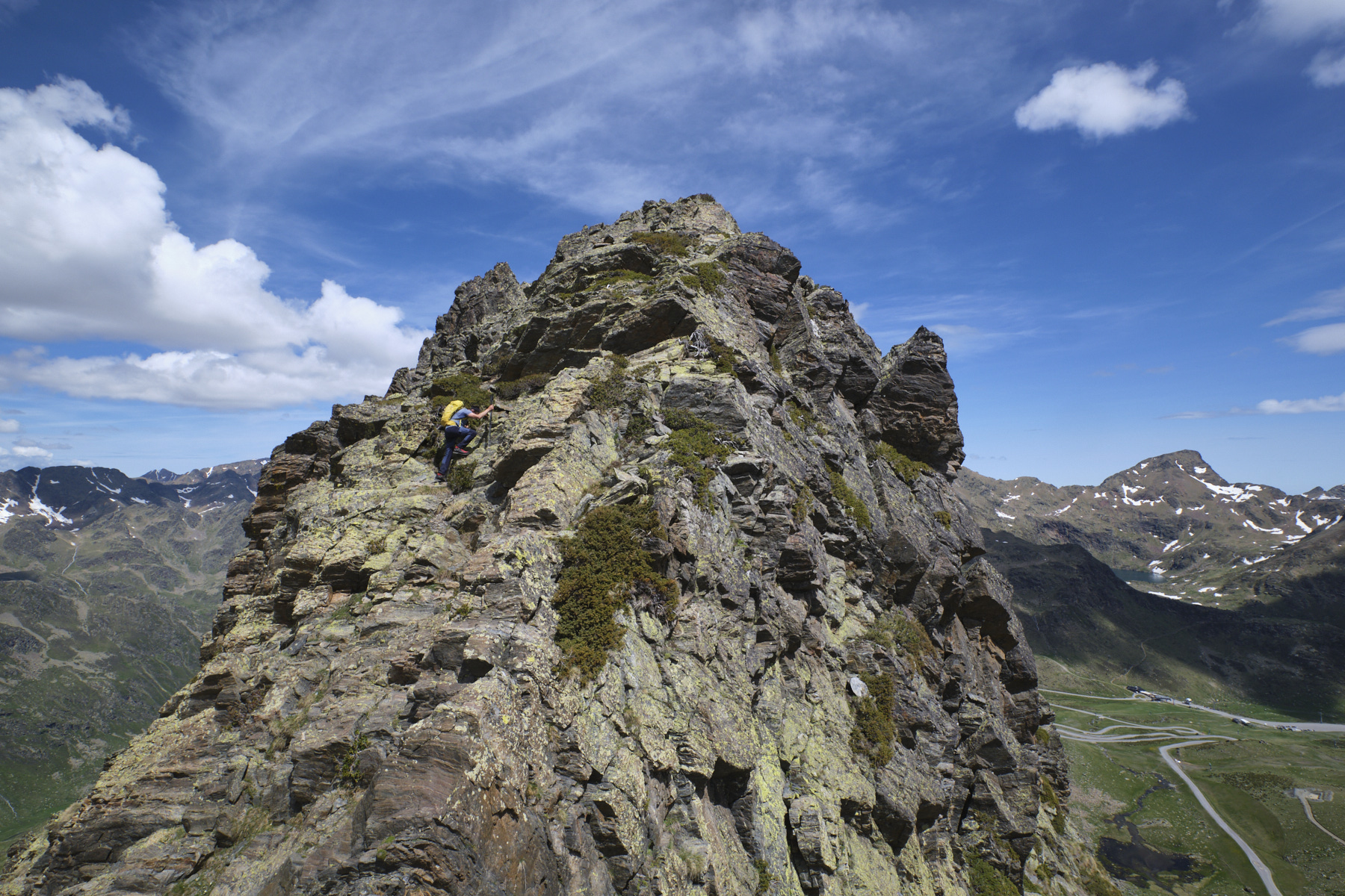
At the Port d'Arinsal, tackle the ridge directly to the east. We soon put our hands down (II/III) to pass a mini-summit, then descend and walk along a flat, rounded ridge that leads to the Pic des Langounelles at the far end, in the shape of a rounded pyramid at the summit. Put your hands down again to pass a rugged, chaotic section that leads to the foot of the final section, at the level of a mini-pass.
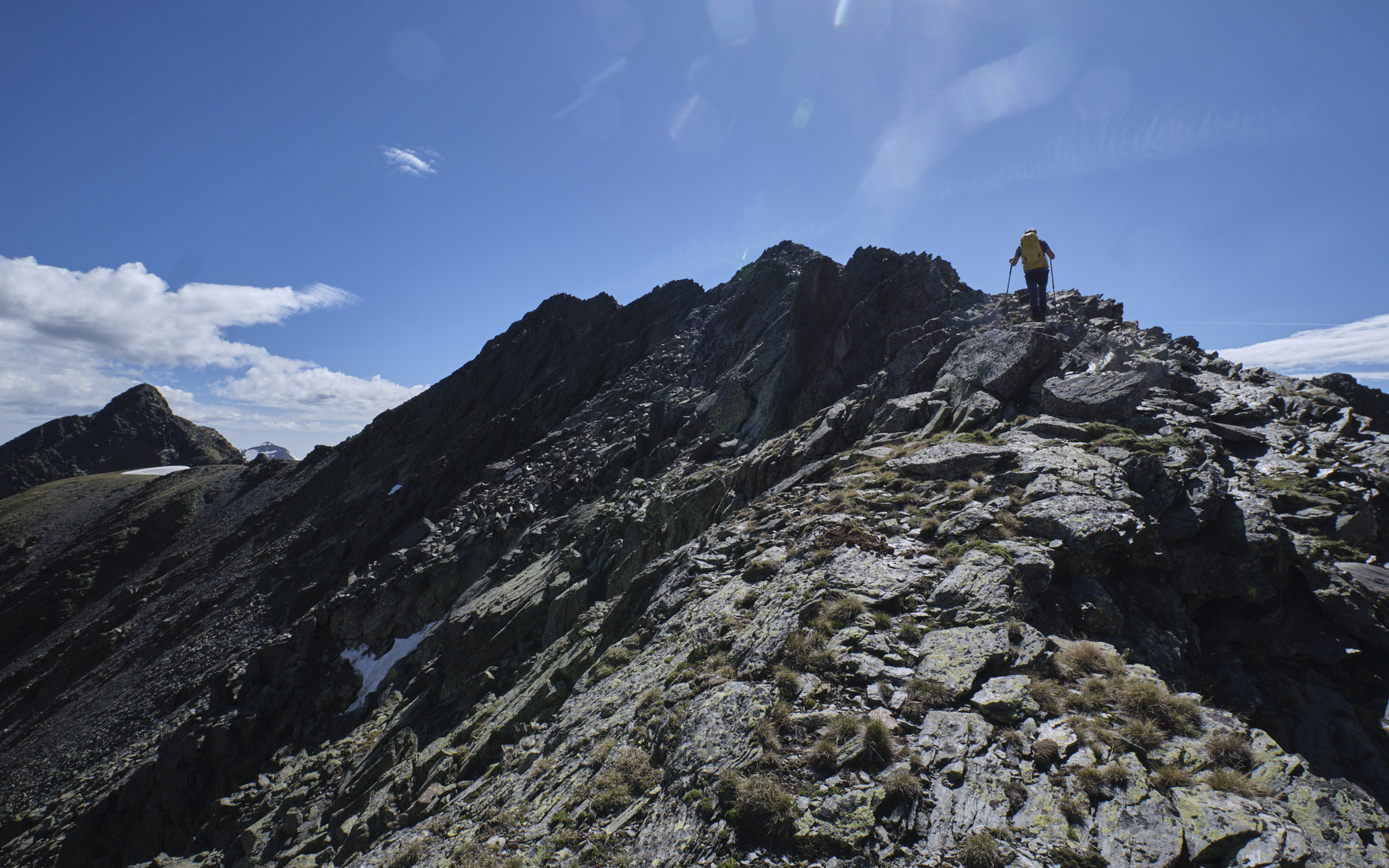
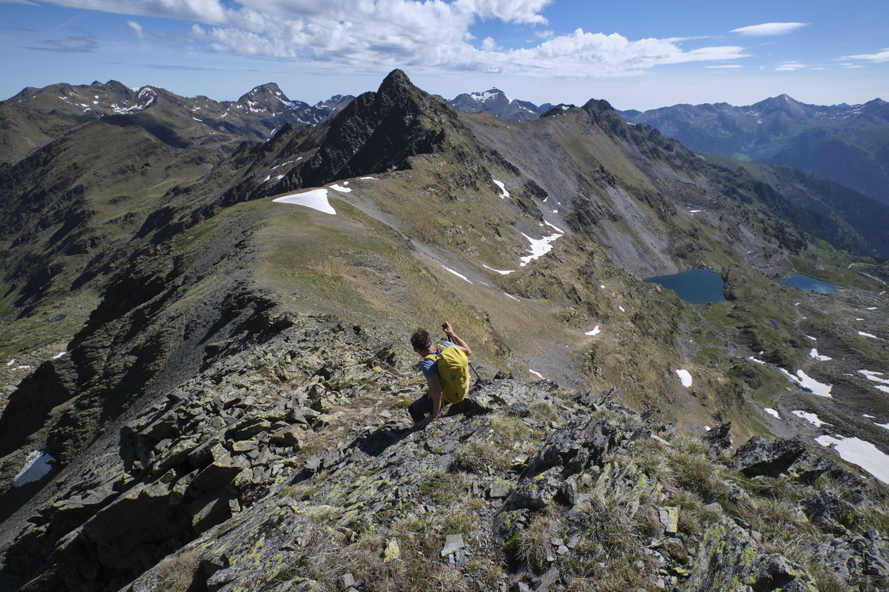
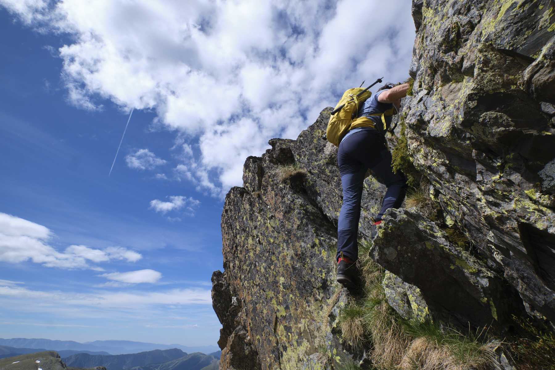
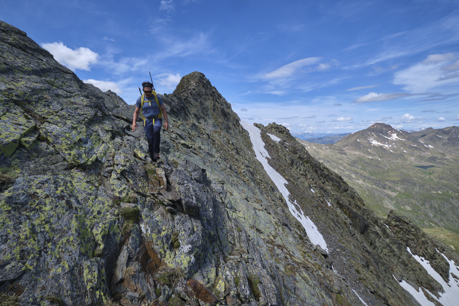
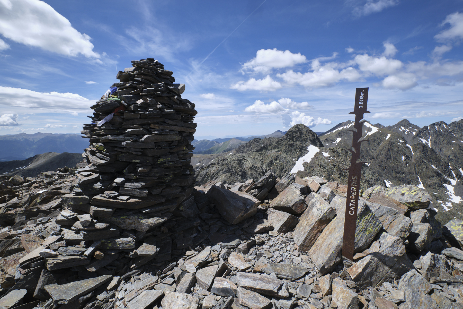
Here, attack the rock, zigzagging as best you can. The climb is max III+, but there are several exposed passages. We finally reach the summit dome of Pic des Langounelles, the highest point of the hike. Walk along the ridge and start to descend, following the few cairns, then switch to the north side to find the path below that joins the Port de l'Angonella. Climb back up, staying as far as possible on the ridge, with a few handholds again and a final gap to negotiate (III+, exposed, equipped with platelets) to climb back up (III) and reach the summit of Pic de Cataperdis, the 2nd summit of the day.
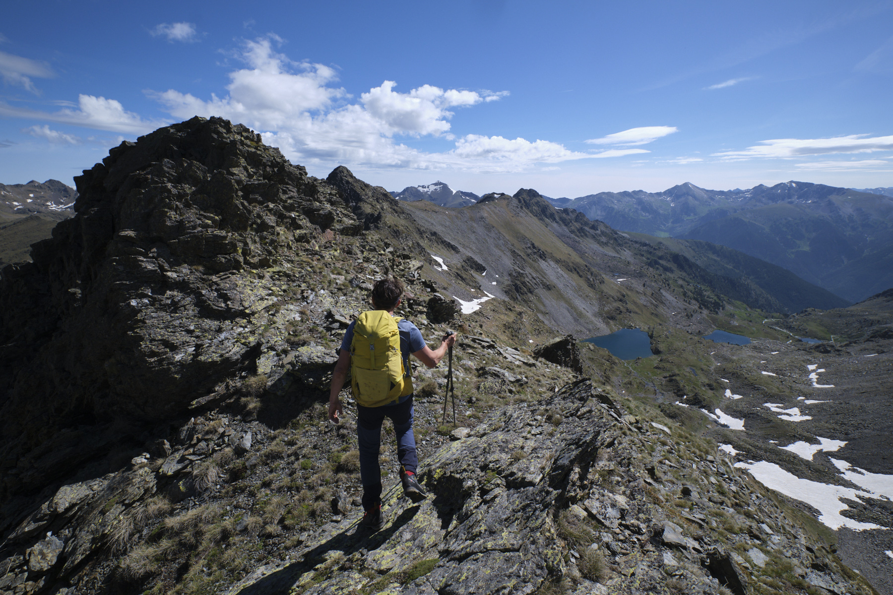
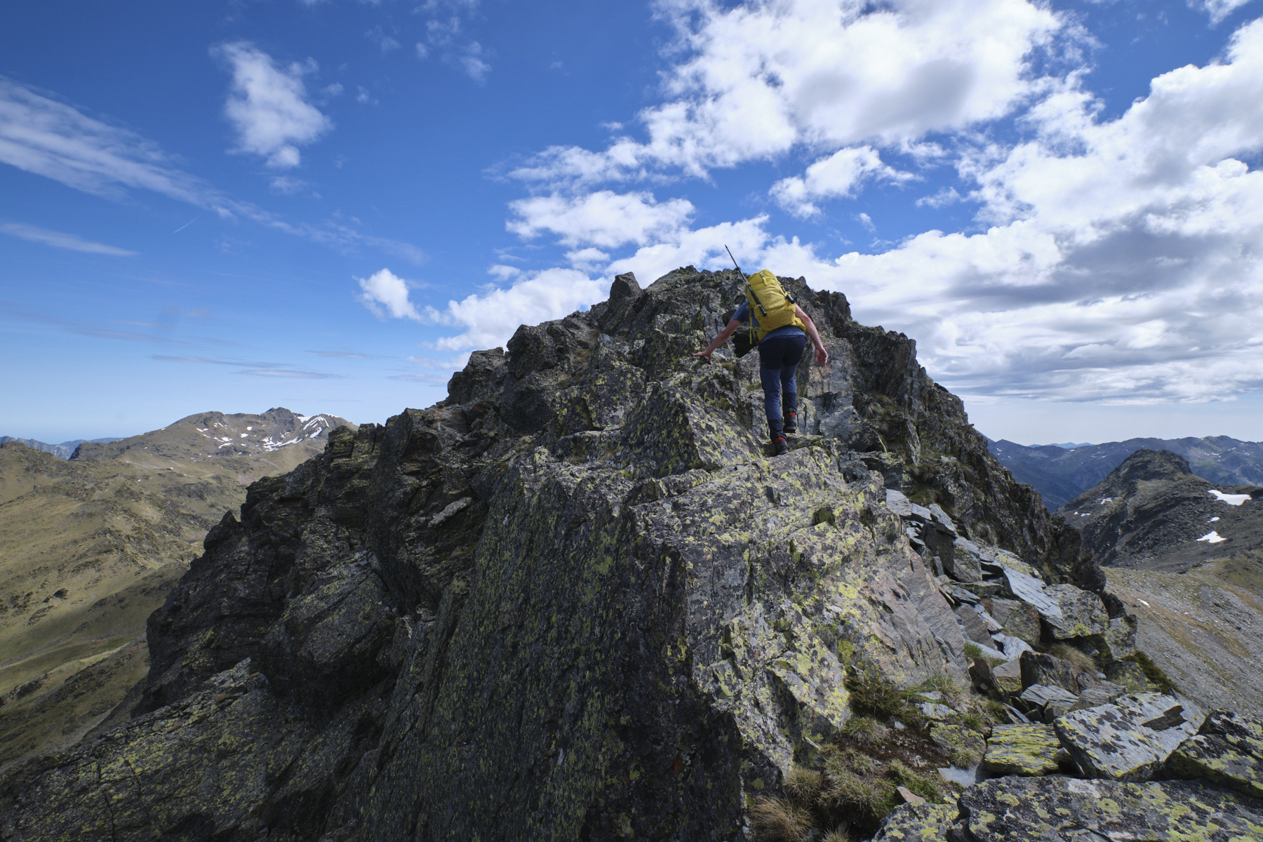
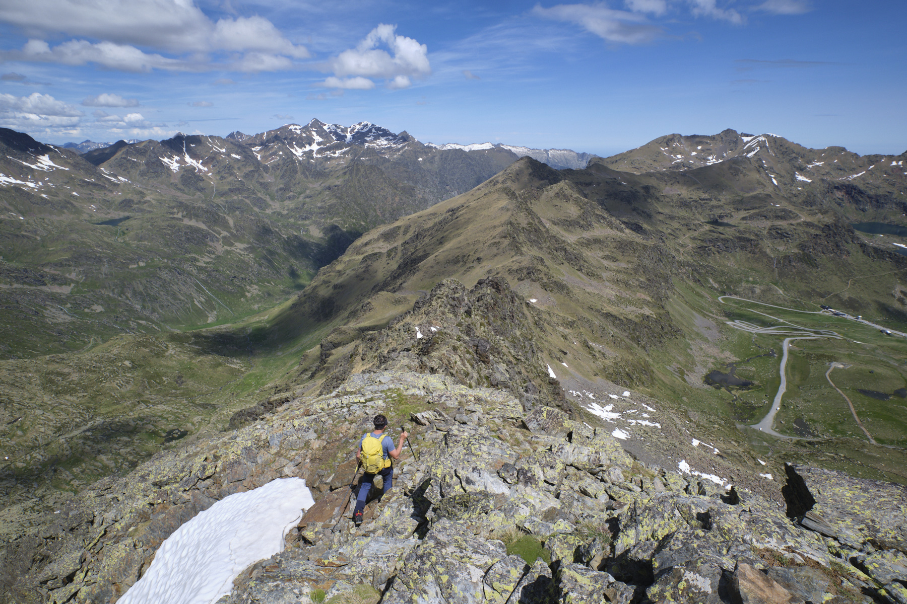
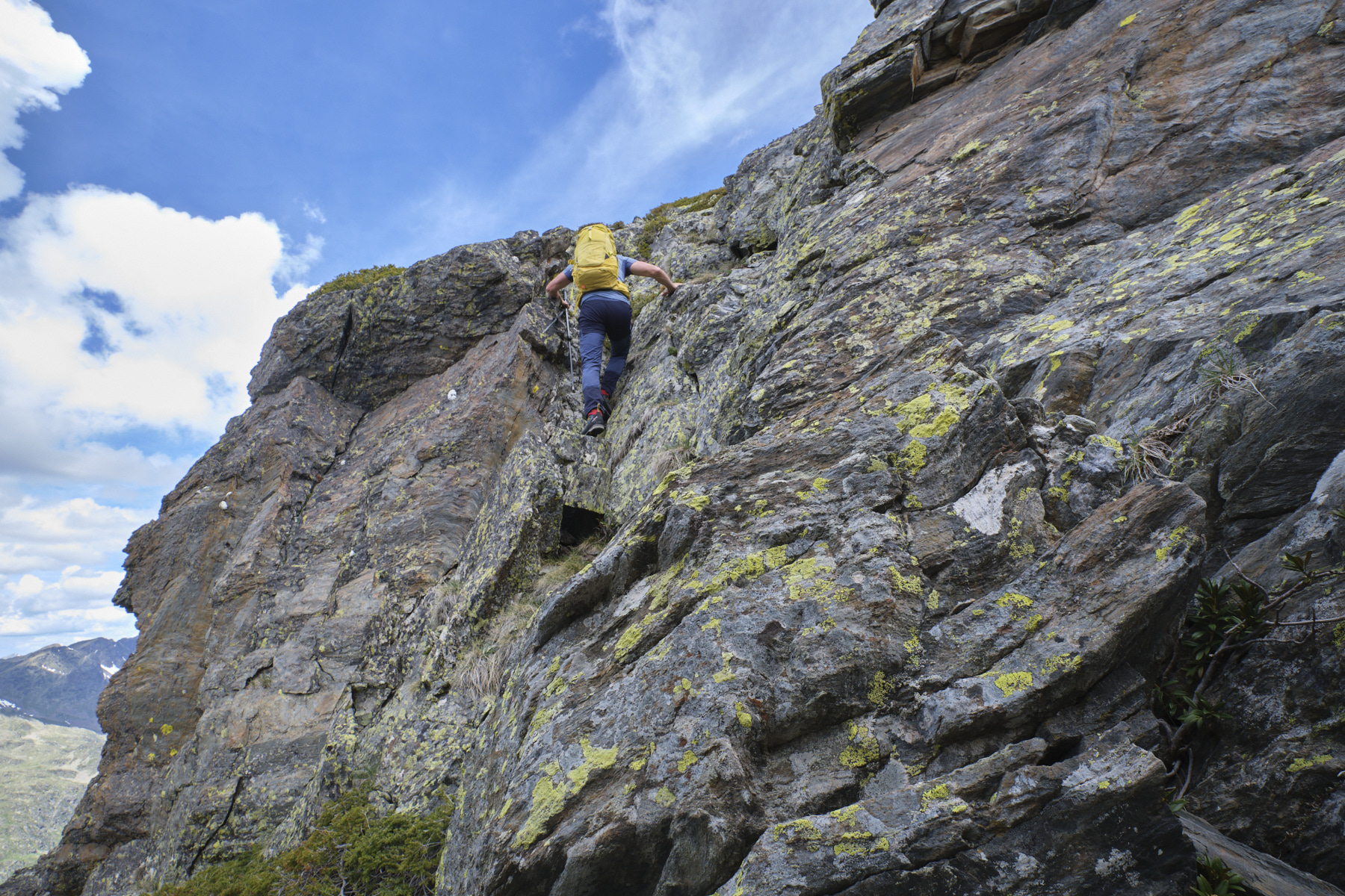
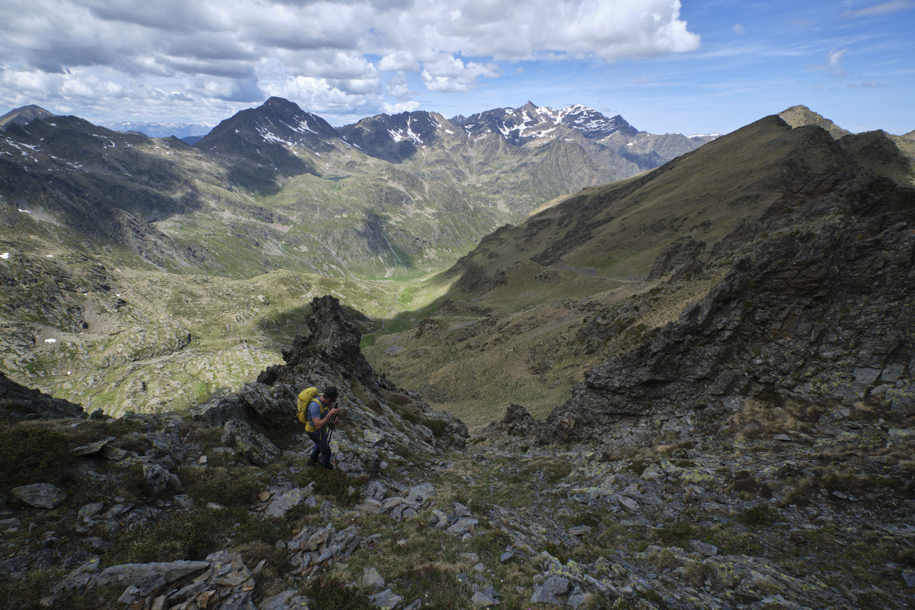
Part 3: Pic de Cataperdis to Port de Rat via the ridges (2805m, 2539m, 45' to 1h)
This part of the route, which we thought would be easier, is in fact even more tricky and chaotic to negotiate. Progress is slow and no clear itinerary is evident, despite the fact that a route exists on the base maps. The start is obvious, wide and easy, but then we find promontories to cross (or avoid?). We then alternate between the ridge with several sections to climb (II/III) and gispet slopes on the French side. Further on, avoiding the last chaotic jolts, we descend a small, unstable, cairned couloir to cut below the ridge, in tricky terrain, on the west-facing slope and reach the Port de Rat at 2539m.
4th part: from Port de Rat to the parking lot via the GR (1h30 to 2h)
Take the GR back to the west to plunge into the valley of the Ruisseau de Rat and rejoin the fork at the bottom of the climb. There remains a long descent on the GR to cross the lower Rat valley, cut the track back to the Estrets hut and finish on the track back to the starting parking lot.
Les crêtes du Pibeste, Viger 16 January 2020 Just above Lourdes, at the entrance to the valley leading to Luz-Ardiden, the Crêtes du Pibeste offers…
Monte Rotondo, Melo and Capitello, Corte 5 August 2017 From the Restonica Valley, climb Corsica's second highest peak, Monte Rotondo at 2622m, and return via the…


 Partager sur WhatsApp
 Partager sur Twitter
Partager sur Instagram
Partager sur Twitter
Partager sur Instagram

 Partager sur Facebook
 Imprimer le topo
 Laisser un commentaire


![2017-08-05_13-35-40 [Monte Rotondo]](https://climbing7.com/wp-content/uploads/2017/09/2017-08-05_13-35-40-monte-rotondo-1024x683.jpg "Monte Rotondo, Melo and Capitello, Corte")
Leave a Reply