

TOPO Hiking | CLIMBING7.COM
Publié le

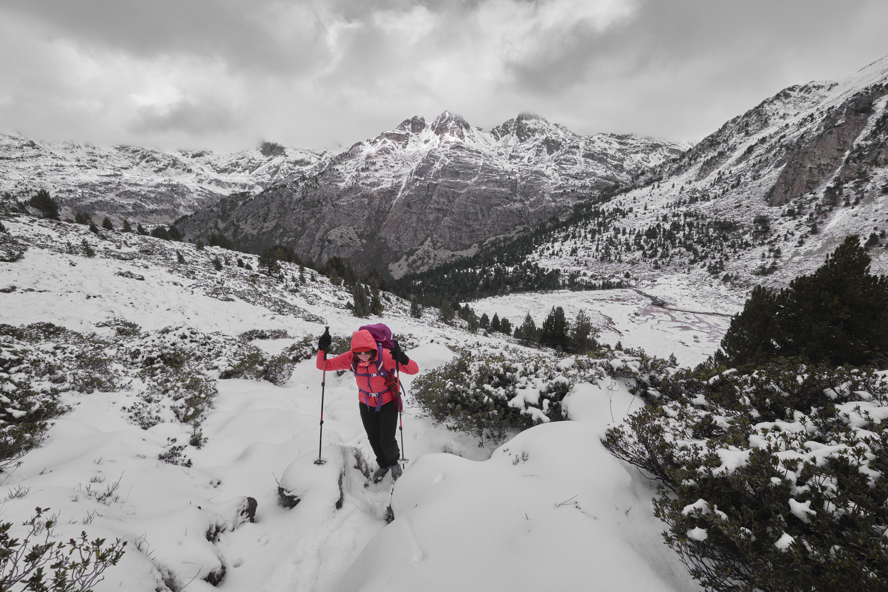
Another excursion into the Vall d'Inclès to climb up to the Siscaro ponds before crossing under the Tosa de Juclar to reach the Juclar ponds. The route follows signposted Andorran footpaths and a small section of the GR on the crossing. An accessible hike in terms of altitude difference, with a fairly substantial distance to cover and a steep, aerial passage, equipped with chains, in the crossing under the Tosa de Juclar. Ponds, rocky peaks, large waterfalls and high-altitude valleys: all the ingredients are there to enjoy the Andorran mountains, particularly out of season, even if you have to deal with snow along the way.
❱❱ Technical summary
► Departure point: Vall d'Inclès, Soldeu, Canillo, Andorra
► Type of route: high mountain loop hike
► Distance to cover: 16 km
► Cumulative elevation gain: +780 m
► Cumulative negative elevation gain: -780 m
► Estimated total time: 6h to 7h
► Min and max altitude: 1770 m / 2324 m
► Signposting: Andorran signposting with yellow dots, GR and GRP.
► Equipment in place: passage equipped with chains on an exposed section in the traverse between Sicaro and Juclar
► Equipment required: none
Difficulties: only technical difficulty, the traverse under the Tosa de Juclar with steep slopes and the steep, aerial equipped passage.
❱❱ Access to the place
Arriving from France, descend from Pas de la Case towards Andorre-la-Vieille and pass through the town of Soldeu. Just after a sharp left-hand bend, turn right into Vall d'Inclès. Park along the stream (parking lot) after about 100 m.
❱❱ Map & topo
❱❱ Itinéraire
1st section: from the Vall d'Inclès parking lot to the Siscaro ponds
From the parking lot, cross the torrent and go up the small road on the opposite side to quickly find the path heading south towards Soldeu. Follow it until another path crosses, then turn left. It climbs in fits and starts through the forest. Further up, you come across a wider path/trail. Cross it and head uphill towards the refuge and the Siscaro ponds (sign). The climb continues without too much difficulty to skirt the base of the Tosa d'Inclès via a wide, long traverse.
Finally, you come out onto open ground opposite the Tosa de Juclar, where you'll find the sign for the refuge (straight ahead) or the Siscaro ponds (right). Turn right and follow the path as it heads further and further south, past a small shoulder, and finishes more gently until you reach the basins where the 2 Siscaro ponds are located.
Part 2: Siscaro ponds to Juclar ponds
Reach the weir to the north of the Siscaro pond and descend the steep couloir along the torrent. Further down, you reach the flat jasse with its meandering riu Siscaro, near the Siscaro refuge. Here too, reach the northern end of the jasse, cross the bridge and take the GR path to the refuge and the Juclar ponds (signposted).
After a steep, sustained start, the GR begins a long traverse under the Tosa de Juclar, with successive ascents and descents. The second part becomes more aerial, and you'll find a section equipped with chains to secure you, with a beautiful void on the left side and a superb view of the bottom of the Vall d'Inclès. The final section is steep too, as you descend to join the main section leading up to the Juclar refuge.
Turn right and continue upwards for a while, crossing a flat area and finishing by climbing a little further to reach the level of the first Juclar pond. The refuge is a little further up. At this point, you can make a round trip to get a view of the second Juclar pond at the foot of the Fontargente ridge.
Part 3: return to the Vall d'Inclès parking lot via the riu de Juclar valley
Return to the refuge and descend along the main path. Return to the fork from Siscaro. Continue along the riu Juclar, crossing a small bridge over the torrent and then to the foot of a magnificent waterfall. The descent continues without difficulty to the Pont del Travenc at the very bottom.
From here, either follow the path on the right bank or cross over to take the track on the left bank. The descent ends at the Pont de la Badalosa. At this point, there are also 2 options: either walk along the Vall d'Inclès road (right bank), or return to the parking lot along the Obac path on the left bank.

Leave a Reply