


TOPO Hiking | CLIMBING7.COM
Publié le
 Partager sur WhatsApp
 Partager sur Twitter
Partager sur Instagram
Partager sur Twitter
Partager sur Instagram

 Partager sur Facebook
 Imprimer le topo
 Laisser un commentaire

Top of the top! The Paglia Orba is one of Corsica's most beautiful climbs! Departing from the Tighjettu hut on the 2nd day of the hike, and after the Cinto, we reach the Ciutullu Di i Mori hut, the starting point for our ascent of Paglia Orba at 2520m. The ascent to the summit, though fairly short, is simply magnificent, with many passages of IV/IV+ climbing in grey granite with green and orange hues, to reach the summit overlooking a very impressive, vertiginous north face. On the way back, we return via the Col de Maures, this time aiming for the Tafunatu, a huge hole in the rock that provides a natural window onto the west coast. It's a short detour on an aerial path, where you have to climb without asking too many questions. The return to the Col de Vergio completes 2 days of hiking and a 2nd stage of almost 8 hours' walking.
❱❱ Technical summary
Type ✦ Scrambling hike
Location ✦ Col de Vergio
Region ✦ Haute Corse
Country ✦ France
Length ✦ 19kms
Vertical rise ✦ 1600m
Difficulty ✦ D / IV+
Max altitude ✦ 2525m
Duration ✦ 8h to 9h
Interest ✦ ★★★
❱❱ Access to the place
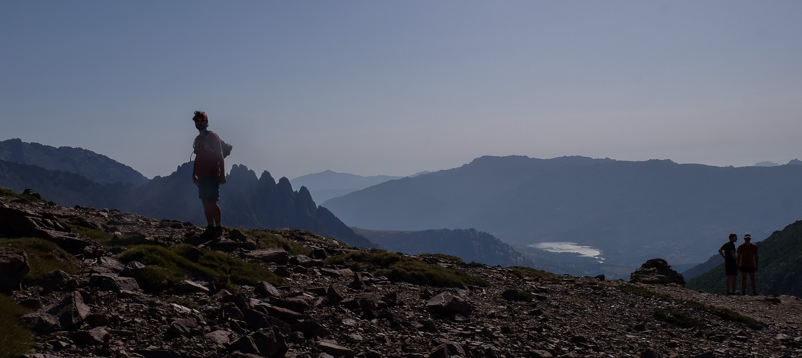
As we're on a 2-day hike, we started from the Tighjettu refuge, but the hike can be done as a return trip from the horseshoe parking lot, just below the Vergio pass, on the road linking Corte/Porte Leccia in the center to Porto/Piana on the west coast. On the map, the 1st day's route to Cinto is shown in green.
❱❱ Map & topo
❱❱ Itinéraire
Nearly 8h of hiking for 19km of walking and 1600m of ascent (1800 negative): a physical route with a number of IV/IV+ climbs to negotiate, for the ascent of Paglia Orba and Tafunatu. The route is well signposted, for the most part on the GR20 and well marked or signposted on the climbs from the Ciutullu Di I Mori refuge.
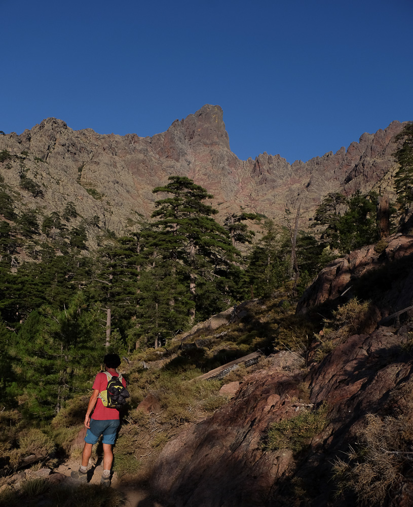
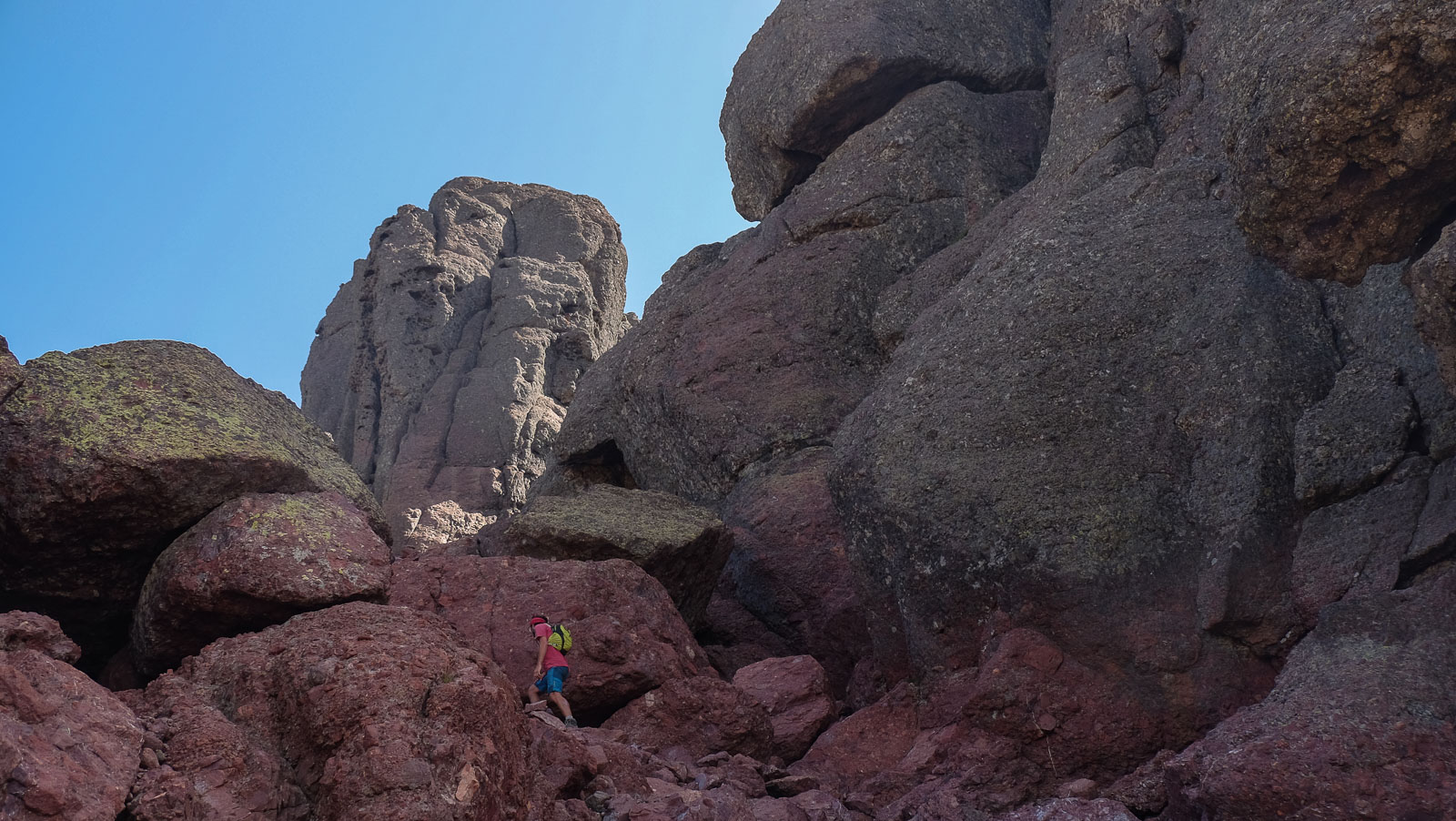
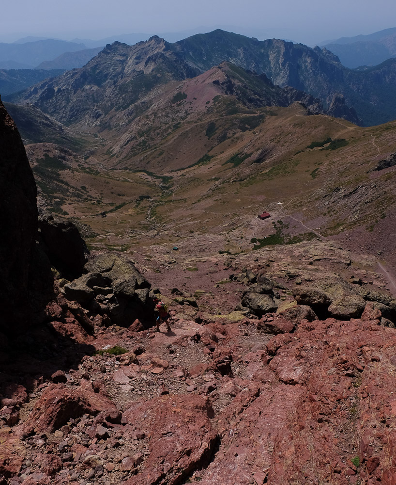
Follow the GR20 down into the valley before crossing a pleasant forest path that actually skirts the base of Paglia Orba, visible at times above. The GR then leaves the forest and climbs steeply upwards, winding its way over large granite slabs to reach a fairly open pass, the Bocca Fiogale at 1962m. You can see the buttresses of Paglia Orba above. Continue uphill on a false flat to reach the Ciutullu Di I Mori refuge above, ideally positioned below the Col des Maures (1991m).
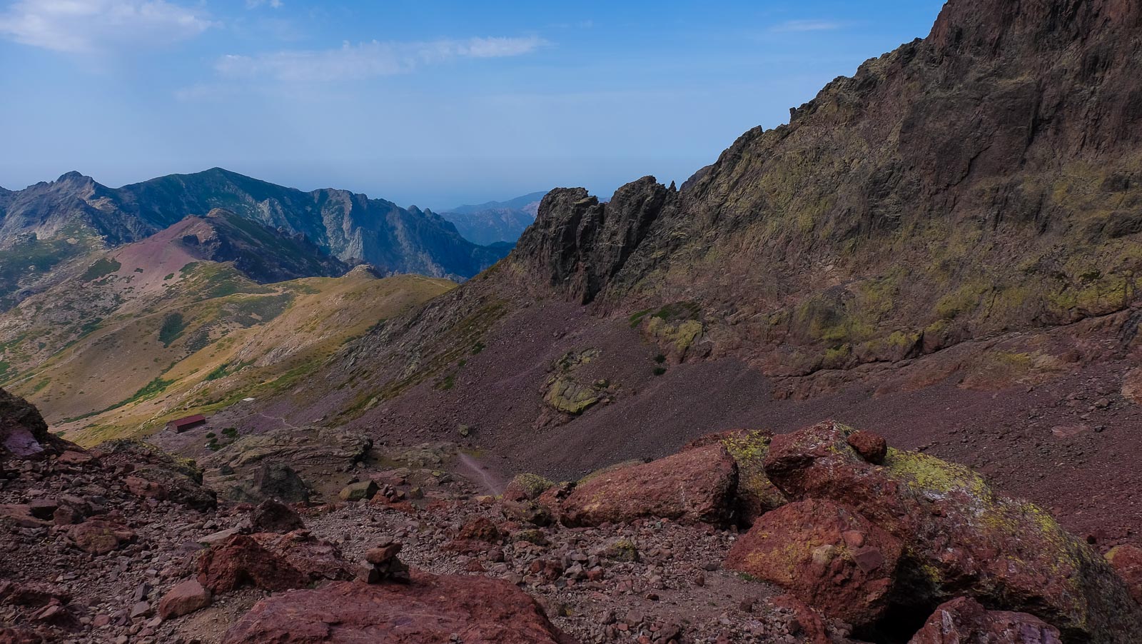
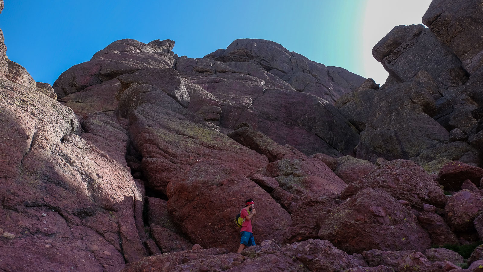
From the refuge, follow the clearly visible path up to the Col des Maures. Turn right before the pass, towards the large walls. The path leading to the summit is generally cairned and weaves its way through the walls, using natural access corridors. Quite extraordinary IV/IV+ climbing, with a few chimneys and ridges to negotiate, on excellent rock that's not too airy.
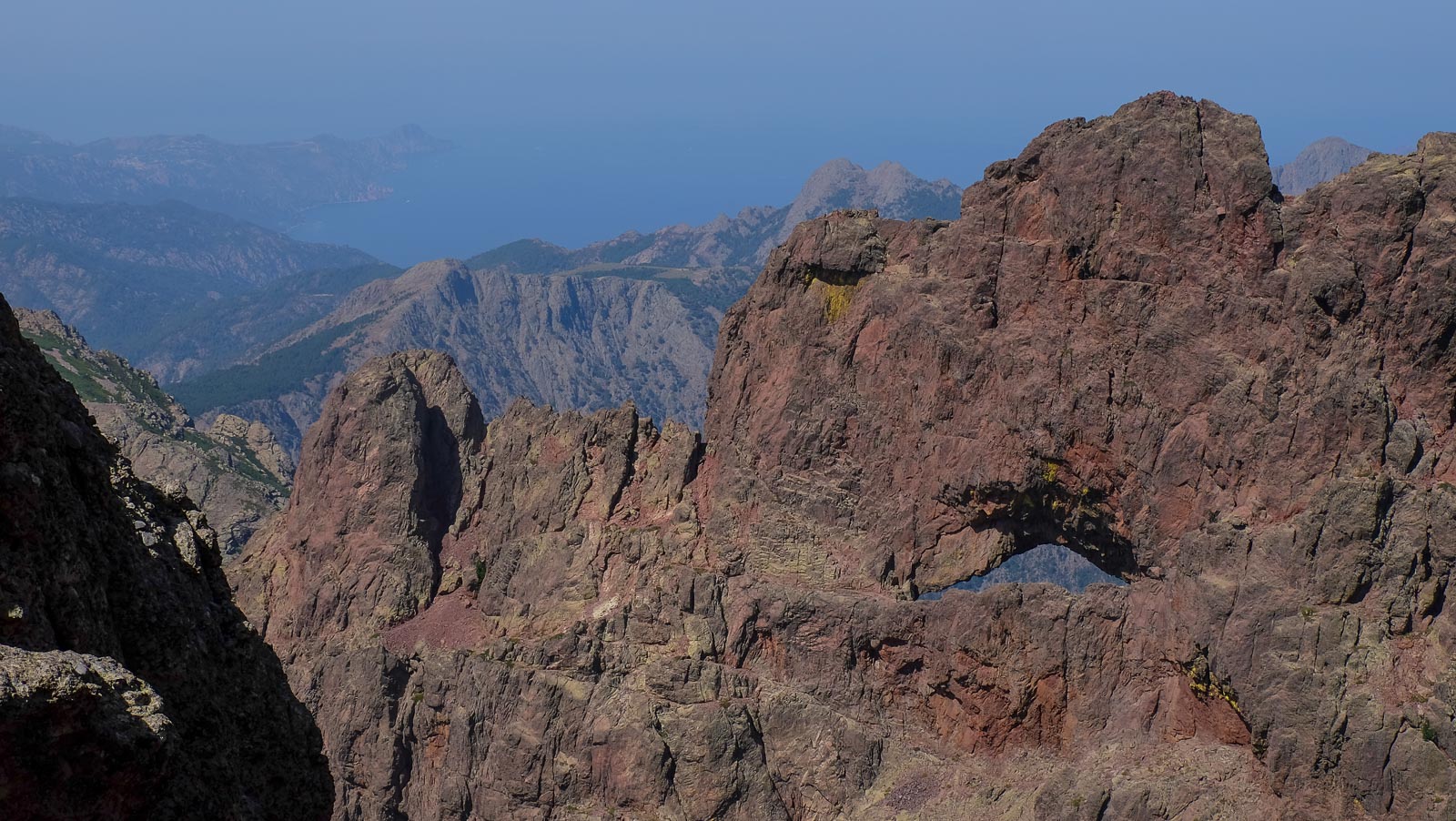
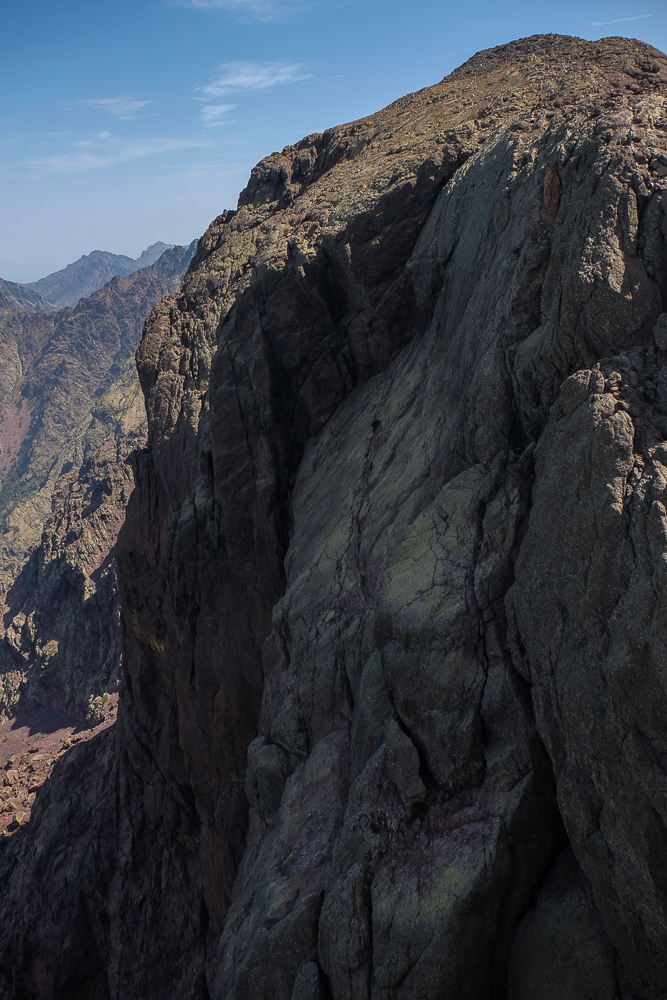
Higher up, as we turn around, we can see Tafunatu at our backs. We then reach a 1st summit and can see the summit of Paglia Orba in the distance. Then it's back down again to cross a pass and make the final ascent to the summit. Heading a little further north, you overlook the impressive cliff face and the almost 500m drop to the ravine.
Descend from the summit of Paglia Orba and de-climb back to the Col des Maures (45′). From here, turn left, following the cairns, and climb up to reach a diagonal ridge that is difficult to see from below. It's quite aerial but not difficult. At the end of the ledge, climb a few steps and return in exactly the opposite direction to descend on a small airy ledge that leads to the Tafunatu natural hole (30′ from the Col des Maures).
From the Tafunatu, descend in the opposite direction to the Col des Maures, then to the Ciutullu Di I Mori refuge (30′). Then take the GR20 down the ridge before plunging into the return valley. Follow the stream below and cross it (nice pools for a swim!). Further down, fork left on the blue-marked path to reach the road and the Fer à Cheval parking lot. There's one more stop to make on the way back to Lozzi, unless a second vehicle is waiting for you there.


Leave a Reply