


TOPO Hiking | CLIMBING7.COM
Publié le
 Partager sur WhatsApp
 Partager sur Twitter
Partager sur Instagram
Partager sur Twitter
Partager sur Instagram

 Partager sur Facebook
 Imprimer le topo
 Laisser un commentaire

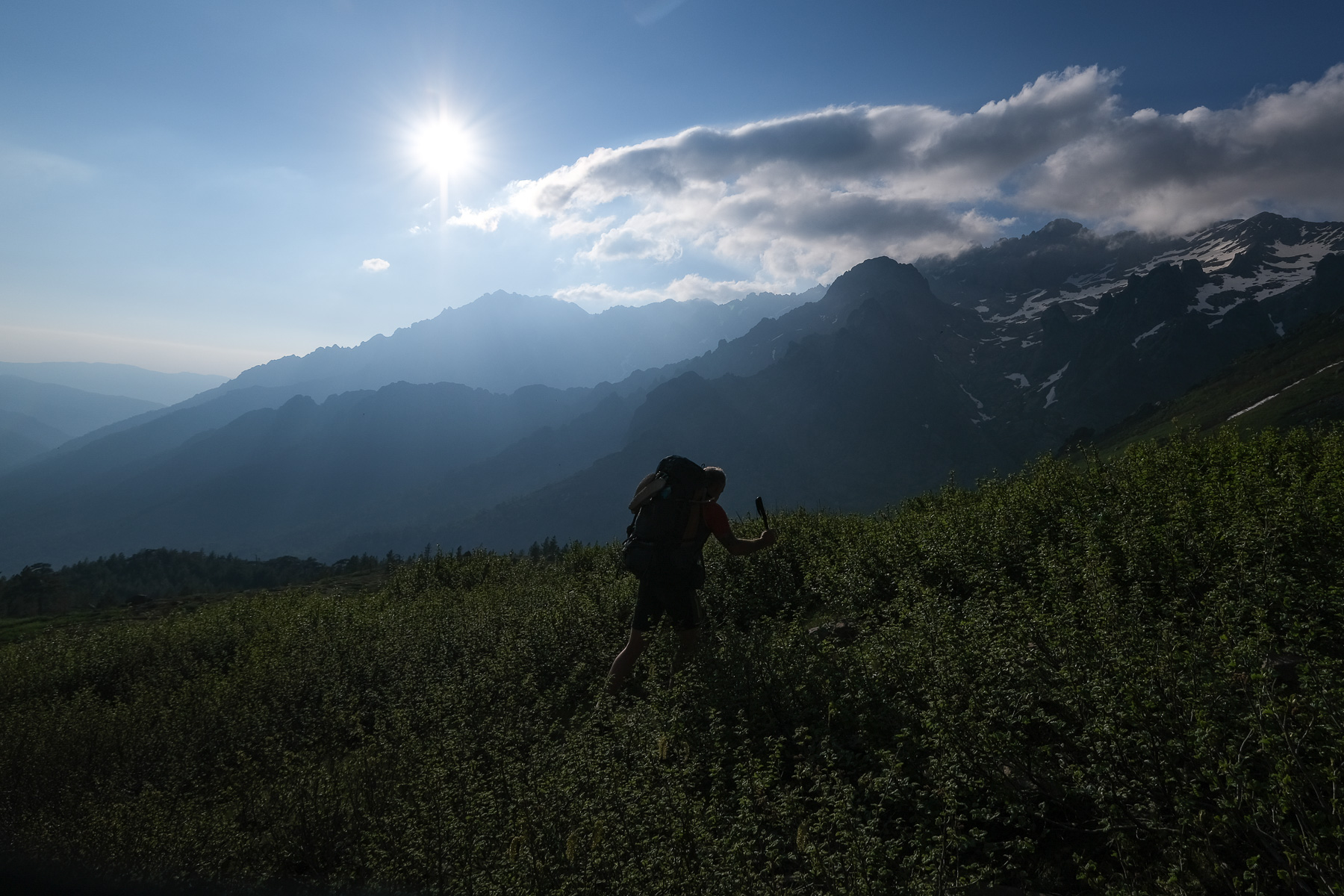
After a serious warm-up on the first 3 stages, here are the first northern nuggets of the GR20: the Cirque de la Solitude, followed a little further south by the ascent of Paglia Orba and Capo Tafunatu. A major section of the GR20, these itineraries are off the beaten track, with superb panoramas to discover, far from the daily flow of walkers. These itineraries are, however, reserved for experienced hikers, as they include long, exposed passages where you have to use your hands to climb or unclimb (IV max), and you need to know how to find your way around off the beaten track. So, 2 long stages, but if the weather cooperates, the show is guaranteed.
❱❱ Technical summary
Type ✦ Alpine touring hike
Location ✦ Refuge d'Asco-Stagnu au Castellu di Vergio
Region ✦ Corsica
Country ✦ France
Max altitude ✦ 2525m
Distance ✦ 25 km
Vertical drop ✦ 2325 m
Dénivelé négatif ✦ 2350 m
Difficulty ✦ E4 / T5 / R5
Duration ✦ 14h30 over 2 days
Interest ✦ ★★★
❱❱ Access to the place
Departure is from the Asco-Stagnu refuge, which can be reached by road from Porte Leccia, north of Corte, and then up the D147 to the Asco ski resort.
❱❱ Map & topo
❱❱ Itinéraire
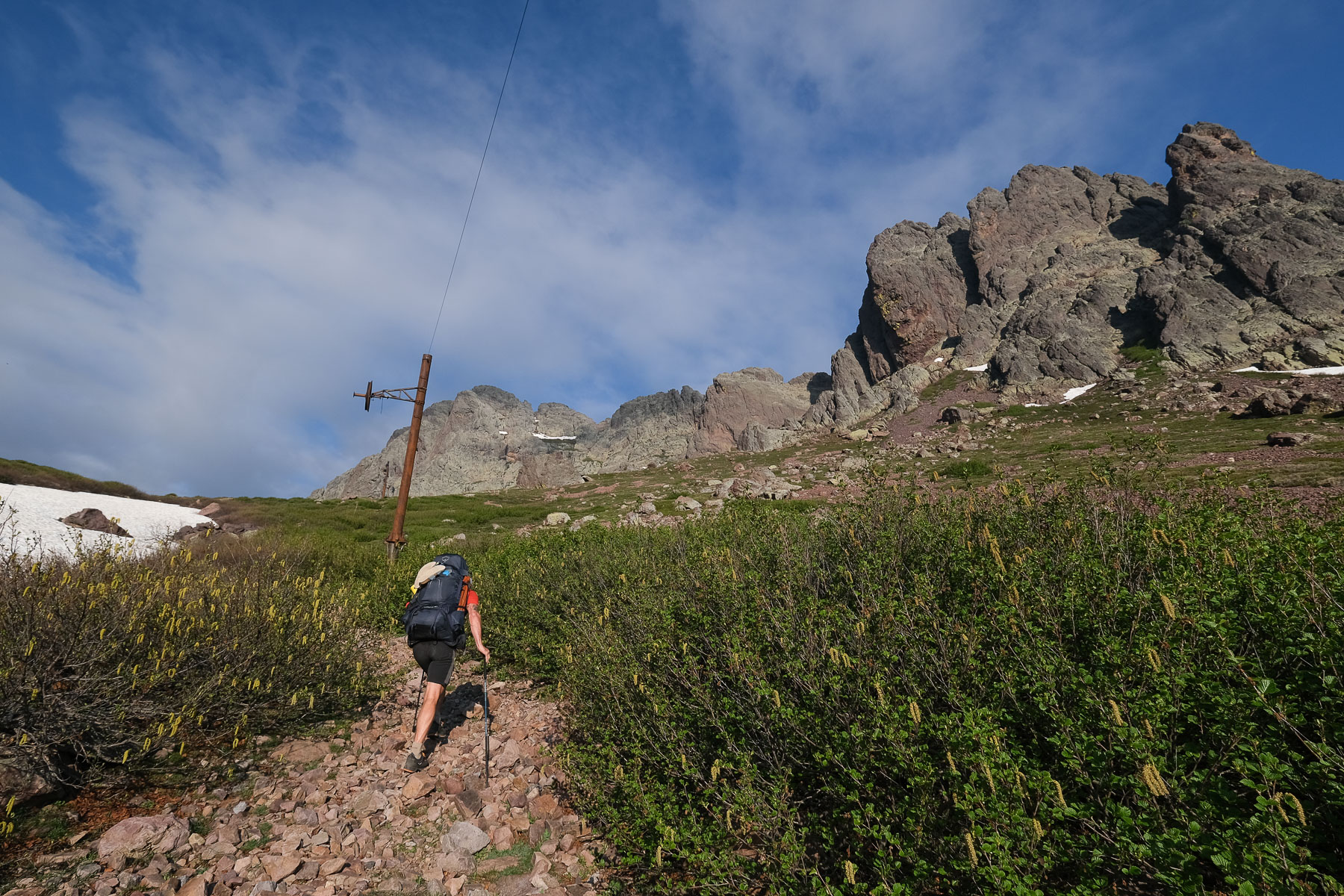
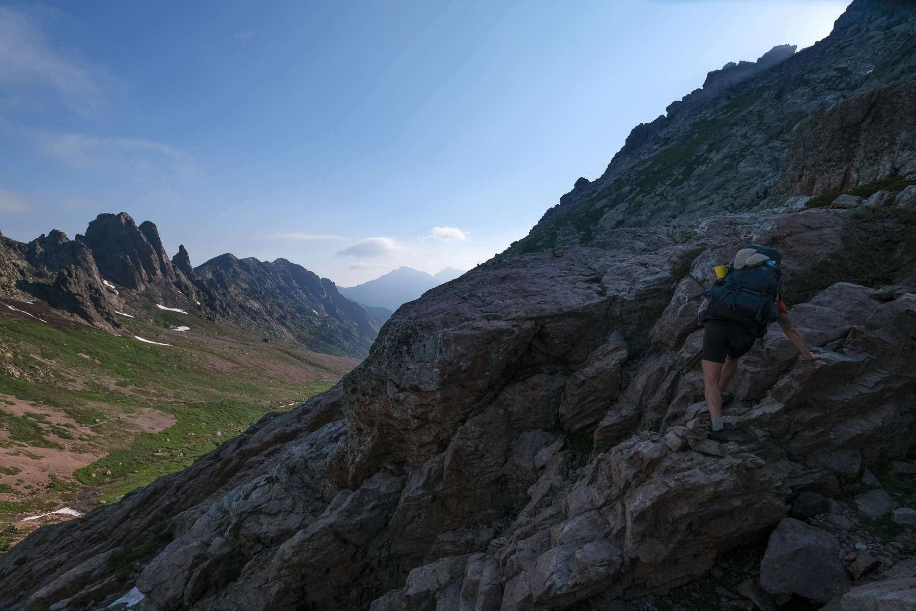
From the Asco refuge, reach the bottom of the slopes and climb up on the main gravel track alongside the ski lift. A little further up, you cross a dry stream on a sort of metal ford. Climb a little further and, under a pylon, you'll find the cairned path that begins the ascent to Bocca Tumasginesca.
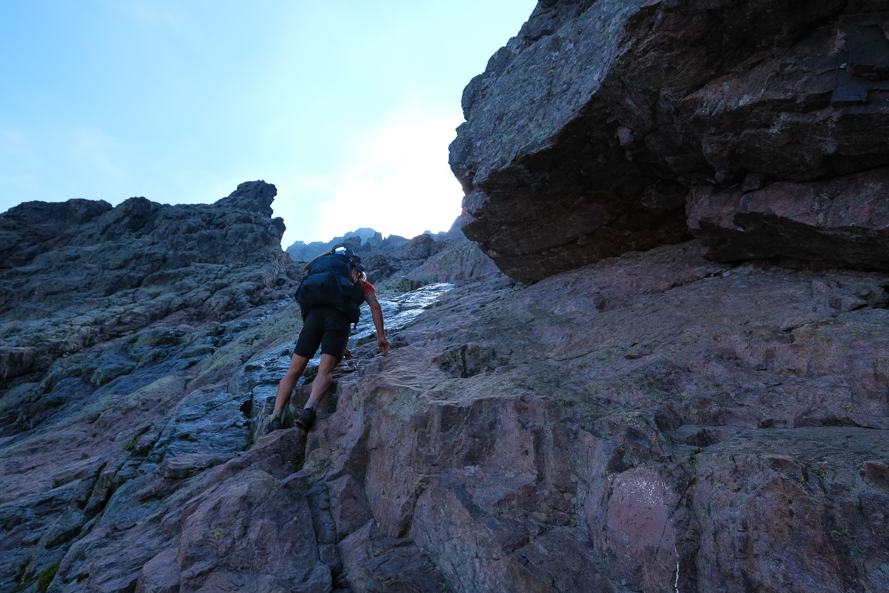
The 2 stages described here are very difficult, in terms of distance, altitude difference, technical sections, exposed passages and route-finding. They are aimed at those accustomed to this type of high-mountain race. The Cirque de la Solitude had been officially closed (prefectoral decree) in 2015 following the collapse of a section of cliff on trailers. Today and since June 2018, this ban has been lifted and it is therefore possible to hike this route. However, the installations in place (chains, ladders) have all been removed and the markings largely erased (you can still see the covered markings for orientation). This is the most logical and direct route to the Tighjettu hut. Another, longer but probably equally interesting route has been reconstructed, passing at the foot of the Cinto via the Pointe des Éboulis.
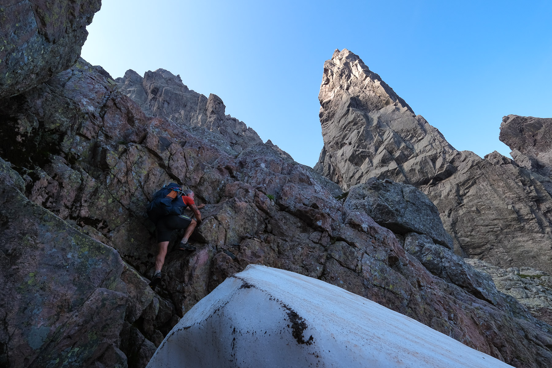
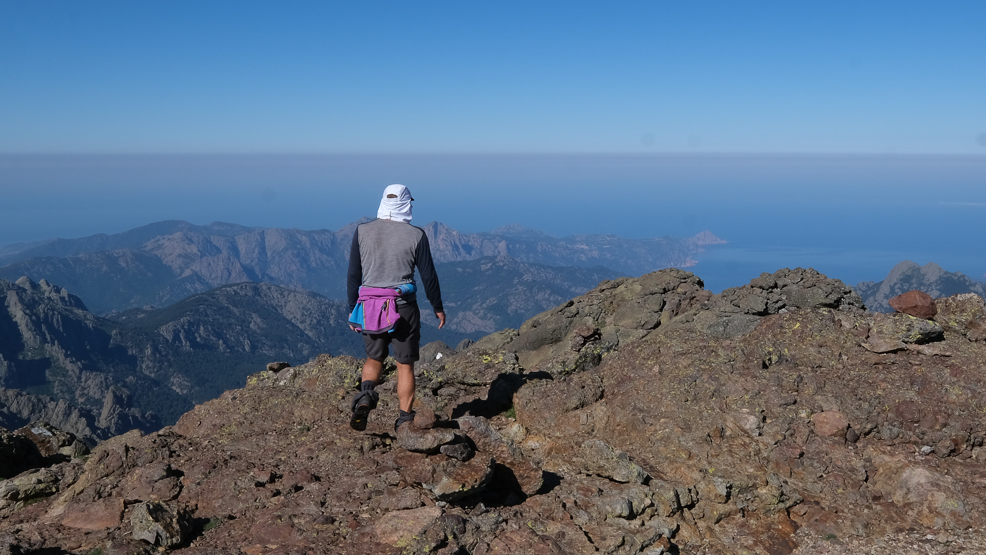
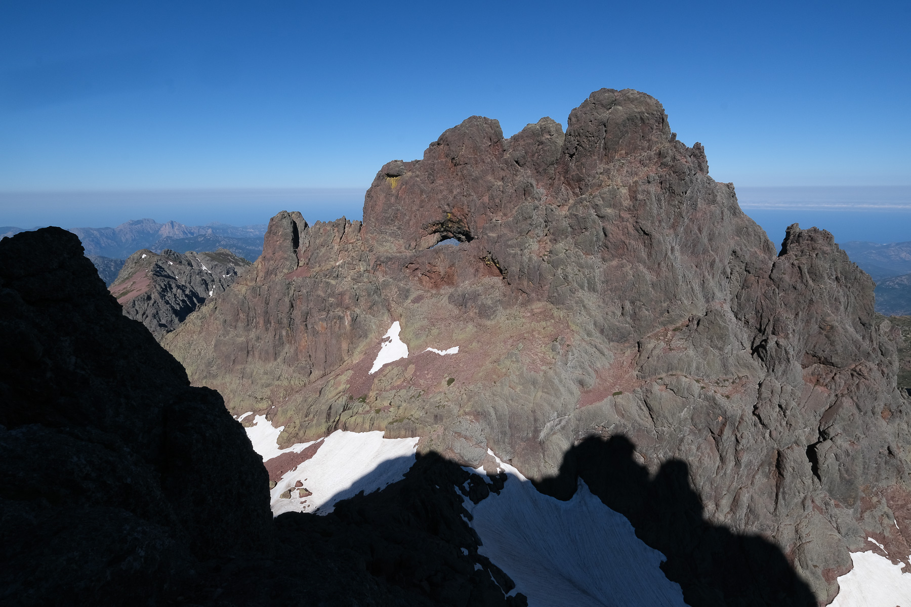
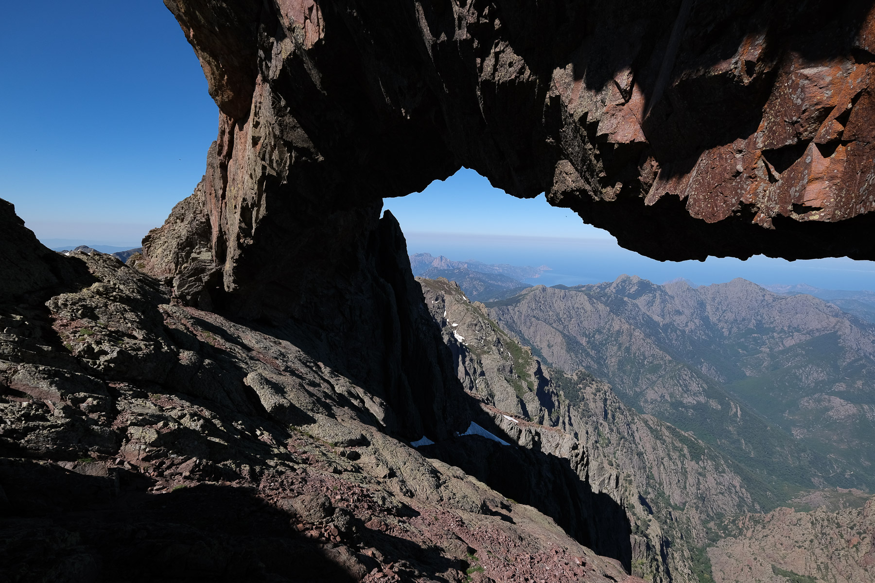
For the ascent of Paglia Orba from the Ciuttulu di i Mori hut, there are no markings either, but the route up the granite south face is cairned and ultimately quite logical. We climb in many places (IV max) and it's exposed on some passages. The ascent to Capo Tafunatu to get to the huge hole offering an incredible view of Corsica's west coast is also made on an unmarked but cairned route, with a passage over 2 aerial ledges without difficulty, the 2nd of which is very exposed.
Stage 4
Refuge d'Asco-Stagnu to refuge de Ciuttulu di i Mori via Cirque de la Solitude (13 km, 1625 m d+, 1060 m d-, alt max 2205 m, 8 hrs 30)
To Bocca Tumasginesca or Col Perdu (2 hours)
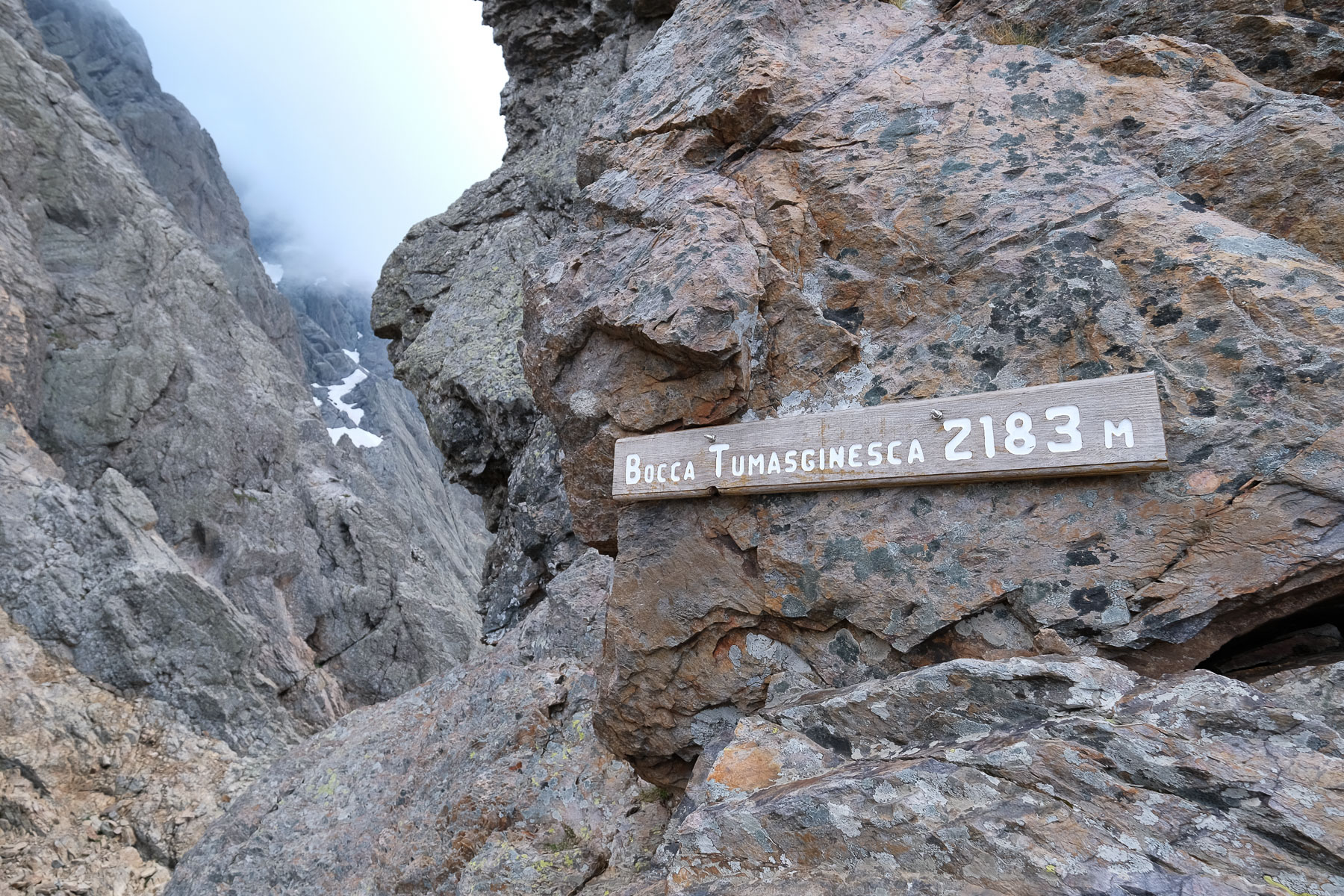
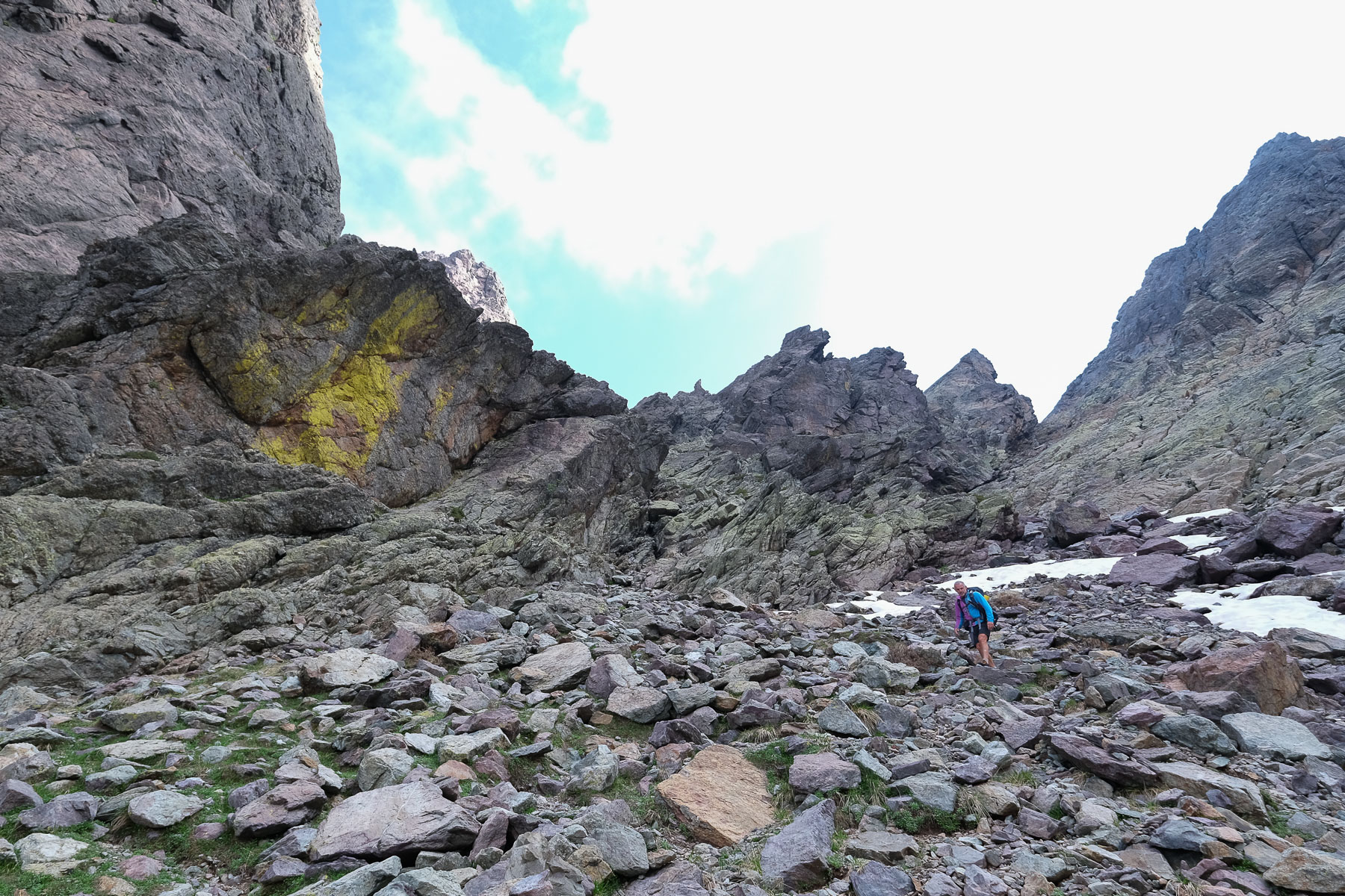
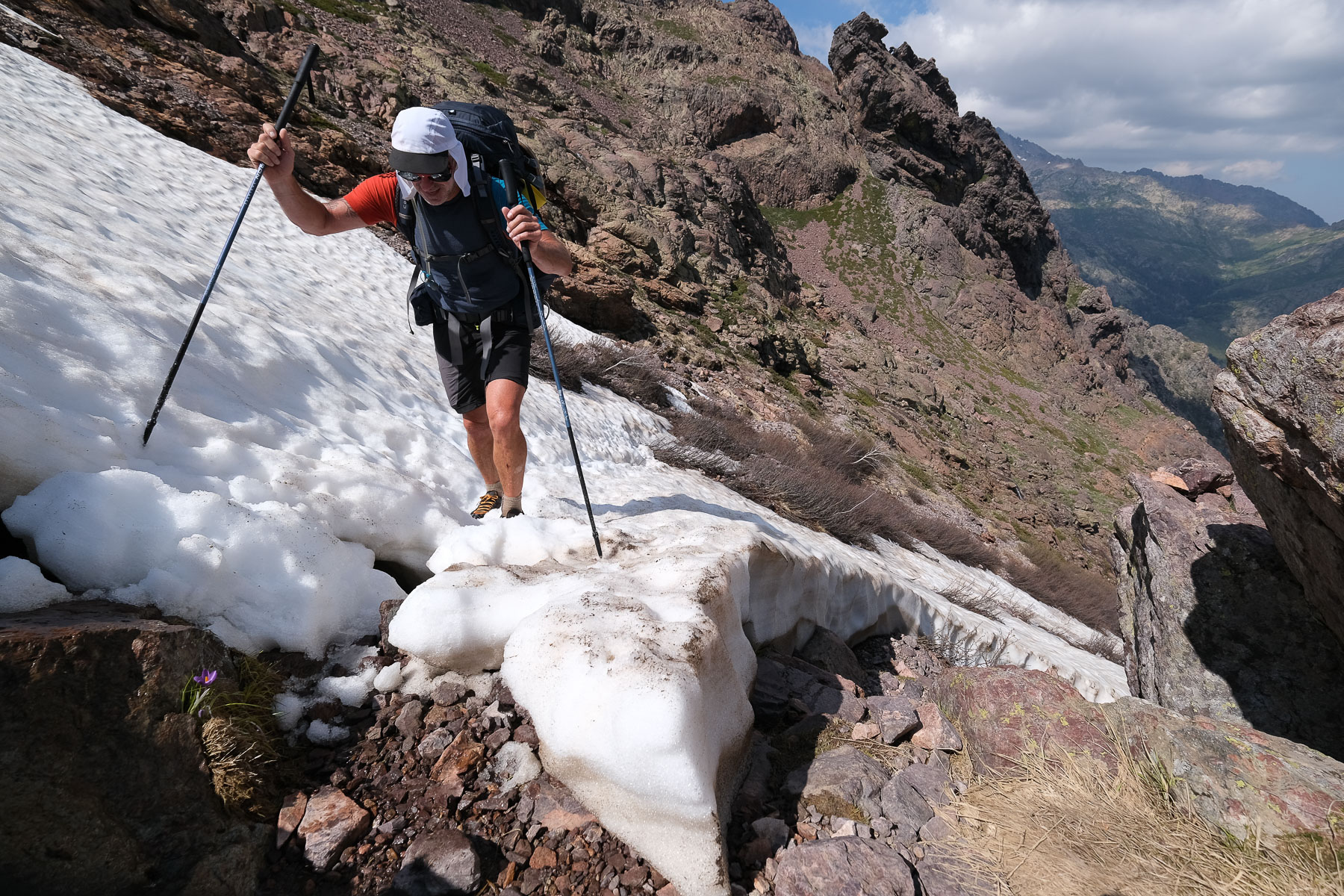
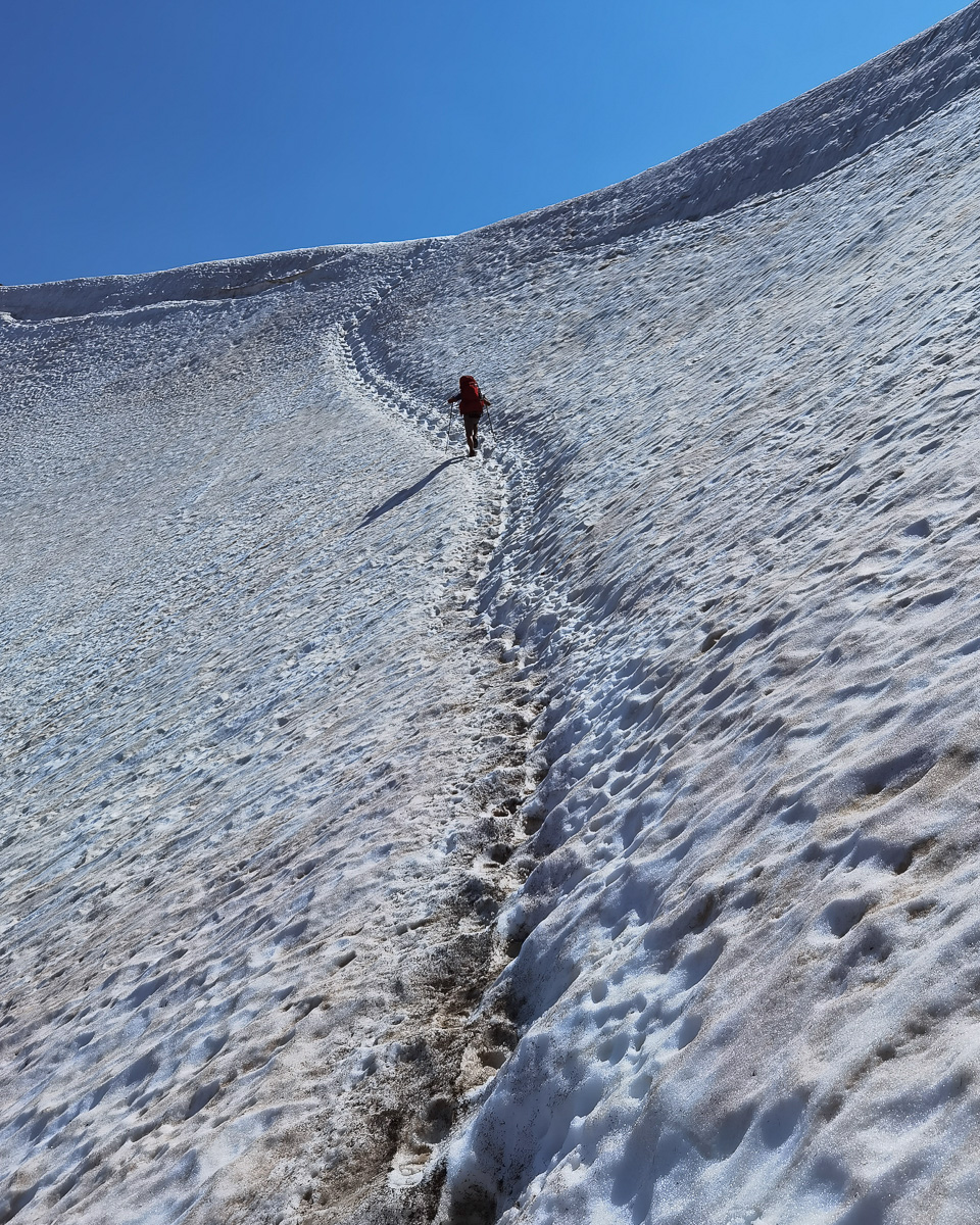
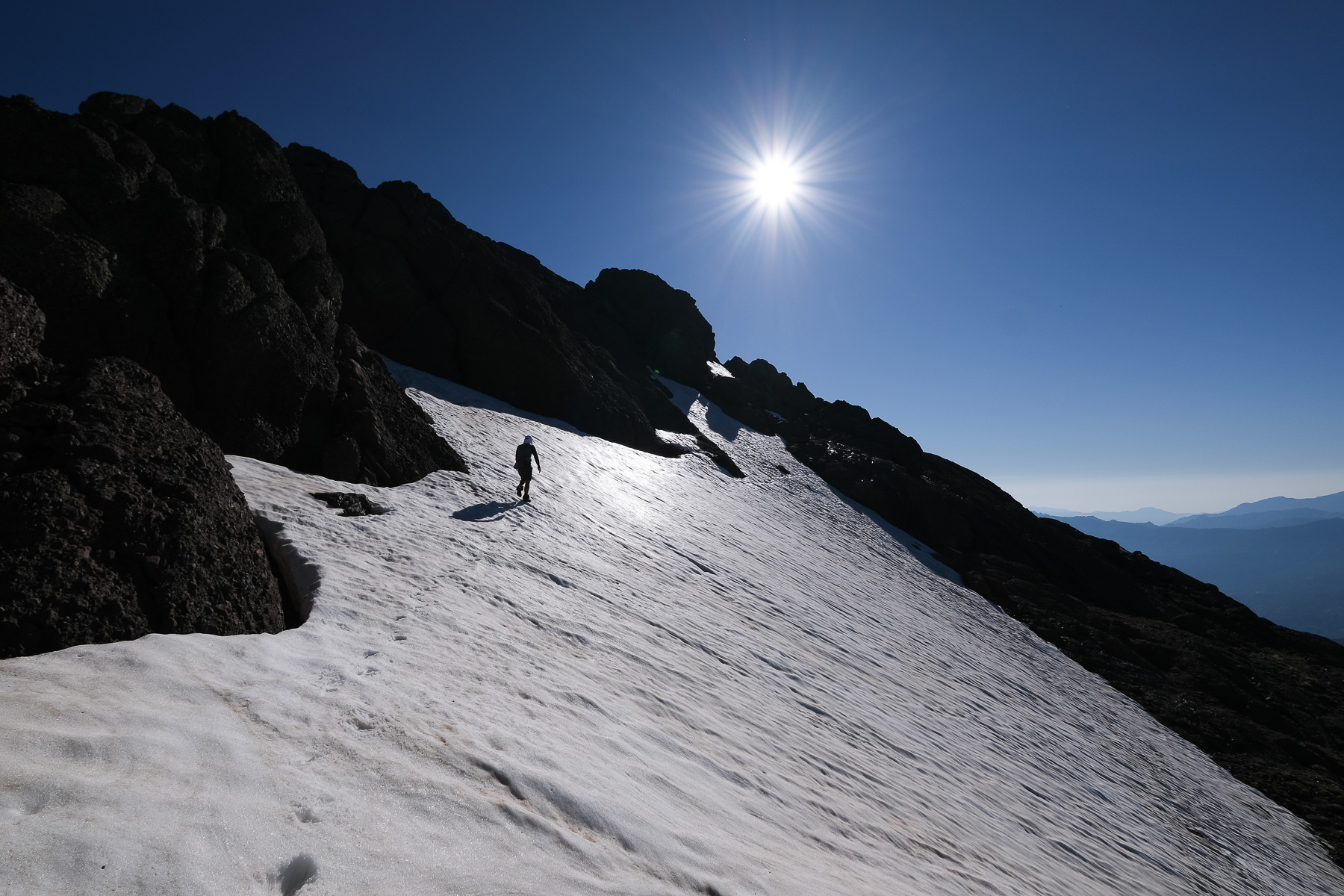
Take the inconspicuous mini-path in the rocky terrain, with a few cairns, to climb generally along or not far from the ski-lift facilities. Higher up, you cross a stream to reach a large, gently sloping opening with a magnificent Laricio pine. This joins the ski lift, which we follow up to the top to find the old GR on the left, which leads into a valley closed off at the bottom by a cirque (1h from the refuge). Follow the old, well-marked GR, which runs along the bottom of the valley, then bends left upwards towards the Bocca Tumasginesca or Col Perdu. After a few passages over rocky flats and a few crossings of névés, you reach the foot of the Bocca with 2 small lakes. The old GR climbs directly up the slope, but in the presence of snow, we switched to the left (east) flank to easily reach the Col Perdu gap at 2183m, the entrance to the Cirque de la Solitude (approx. 2 hrs from the hut).
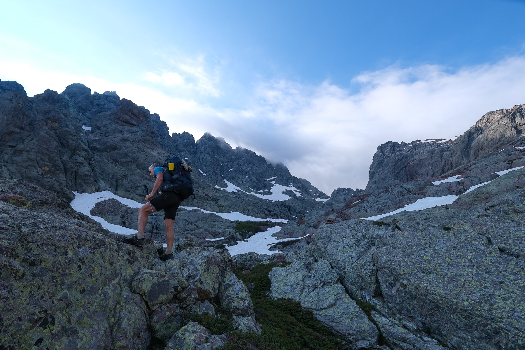
Cirque de la Solitude and Bocca Minuta (2 hours)
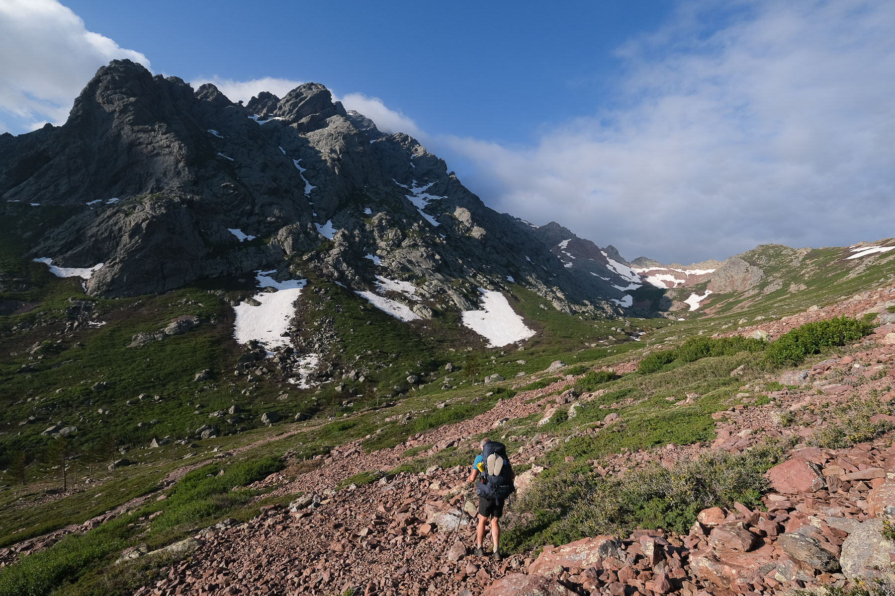
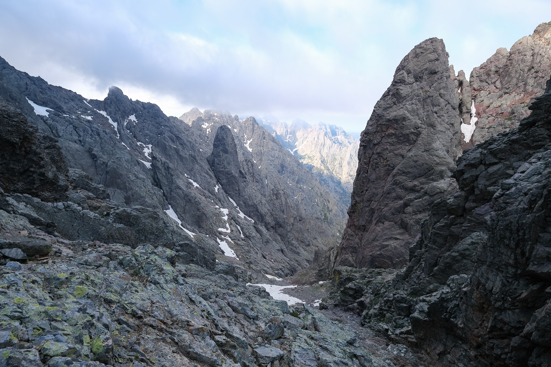
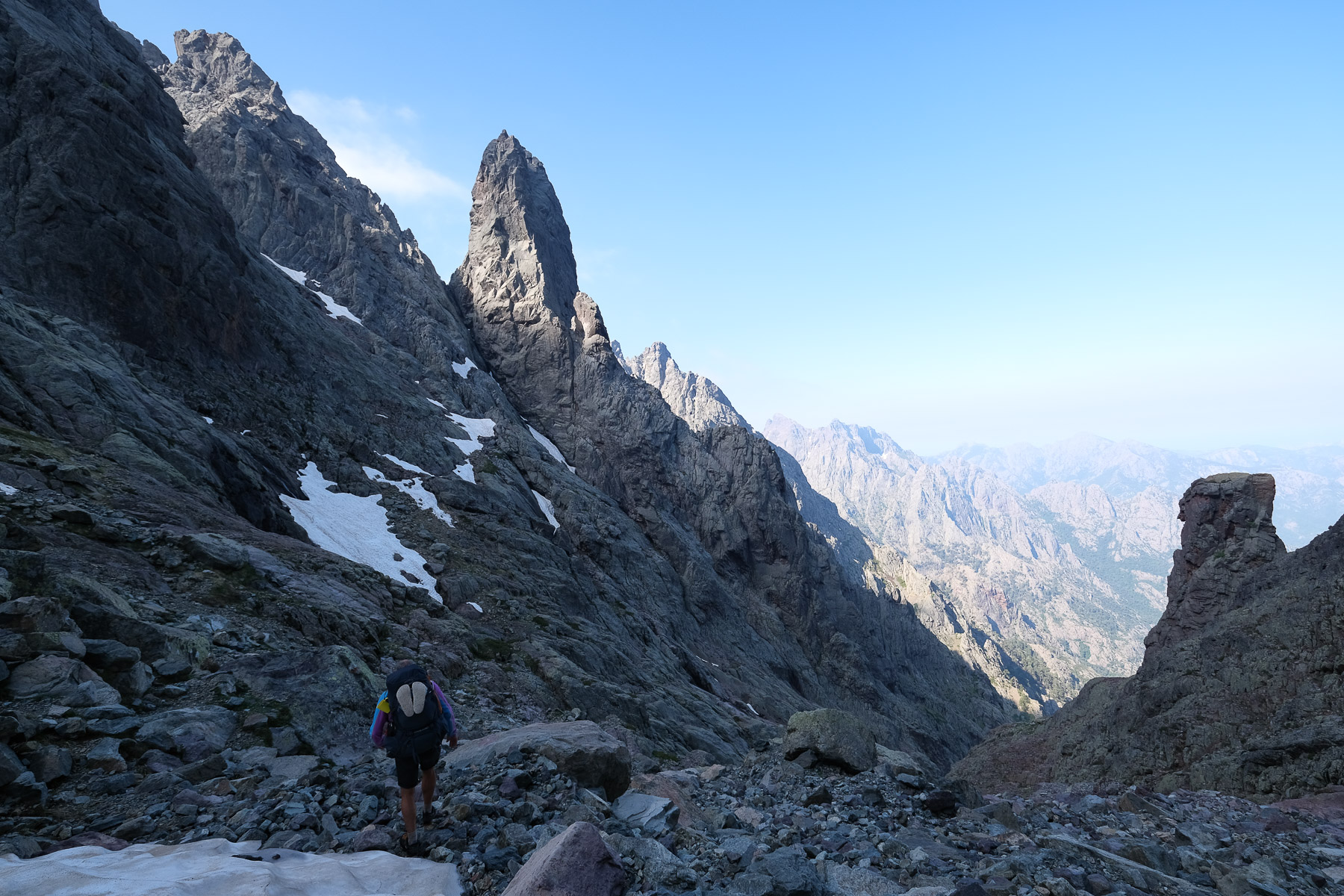
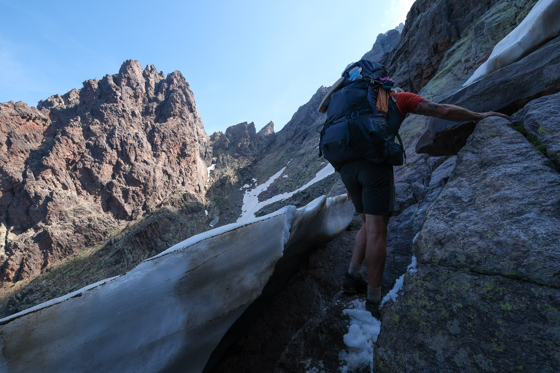
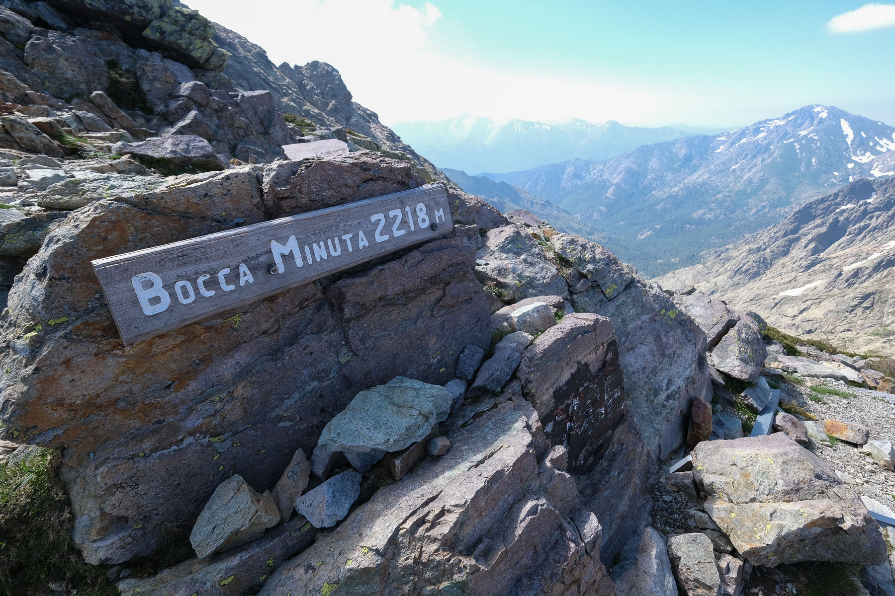
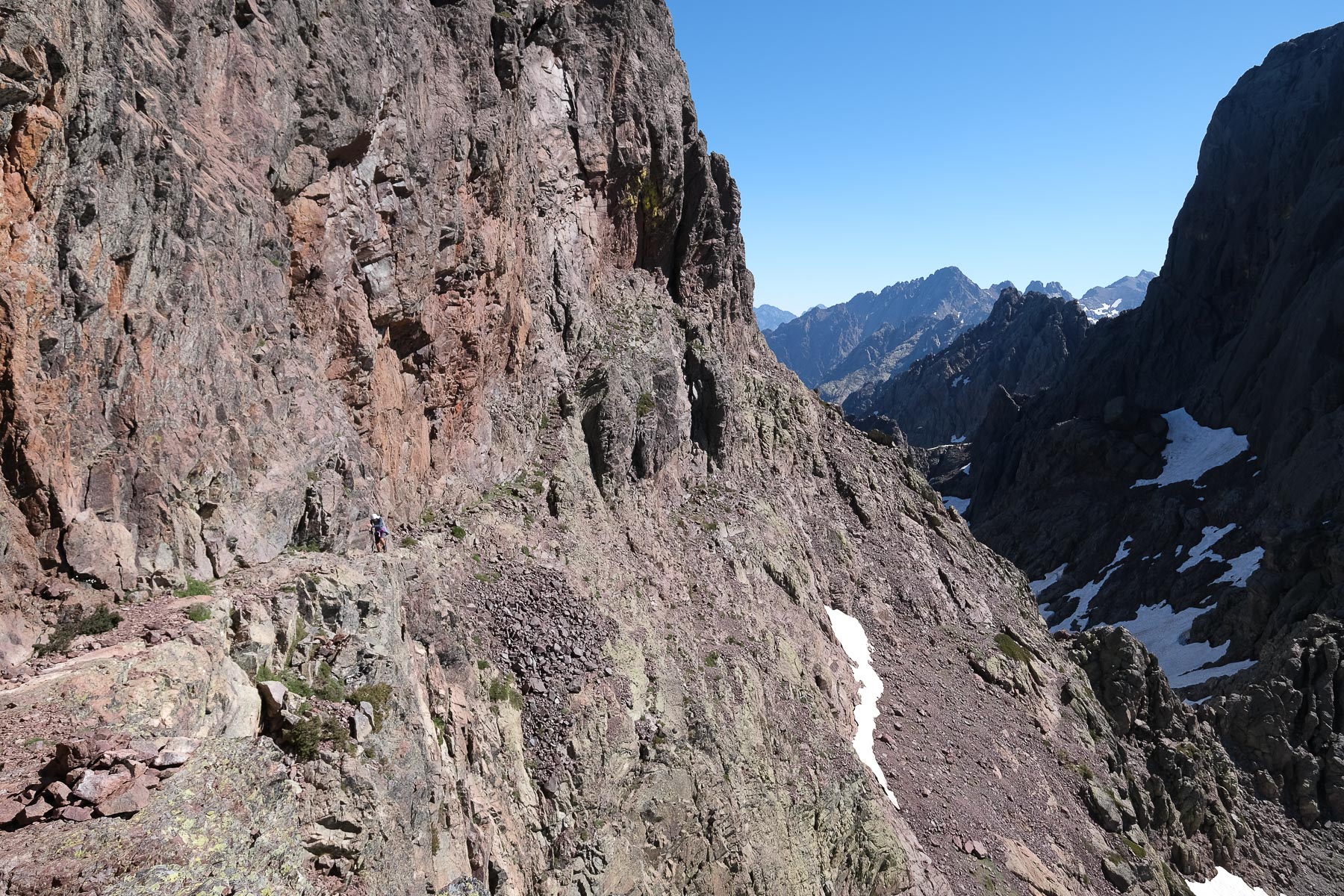
The Cirque is in fact a narrow, deeply incised valley, which we descend to climb up the other side to the Bocca Minuta. There's no path, no equipment, but you'll find your way on steep, level slabs. If possible, follow more or less the old GR itinerary (markings still slightly visible), descending to the left at the start, then skirting the walls to the right below. Cross at the level of a small basin and before a waterfall that can be seen below (approx. 50' from La Bocca). Follow the cairns and climb back up, almost constantly on a series of sloping slabs and sometimes between small persistent névés. The rock holds well, and apart from one step in IV (where a ladder used to be), the rest is in III, where you use your hands to balance yourself rather than to climb. Once past the climbing section, the path veers left again to reach a small shoulder at the foot of a needle, and then veers right again for the final section through scree to the Bocca Minuta (2218m, approx. 4h from the hut).
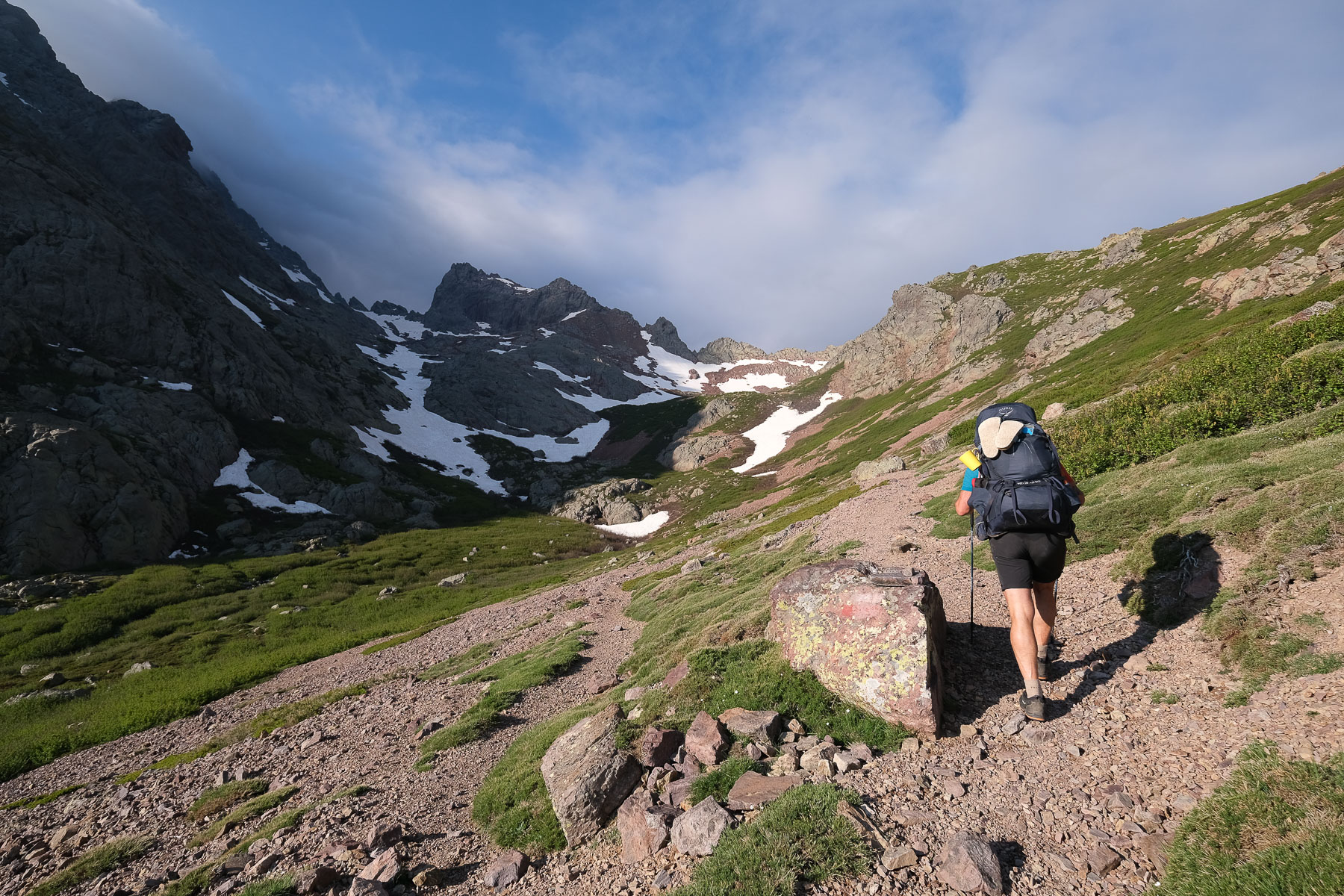
From Bocca Minuta to Ciuttulu di i Mori hut (4h30)
Descend into the more open valley leading to the Tighiettu hut, following the path with GR markings still visible (1h), and continue further down the valley to the Ballone sheepfolds, this time on the official GR. Here, the trail begins a long, more or less level crossing of the forest, gradually turning west into the valley of the Foggialle stream. We then have to climb almost 600m along the stream on a steep, sustained slope until we reach the Bocca Foggialle at 1963m, with a final section on a steep névé. From here, climb immediately to the right over a final hump and back down to the Ciuttulu di i Mori refuge, almost 2000m above sea level, which comes into view at the last moment.
Stage 5
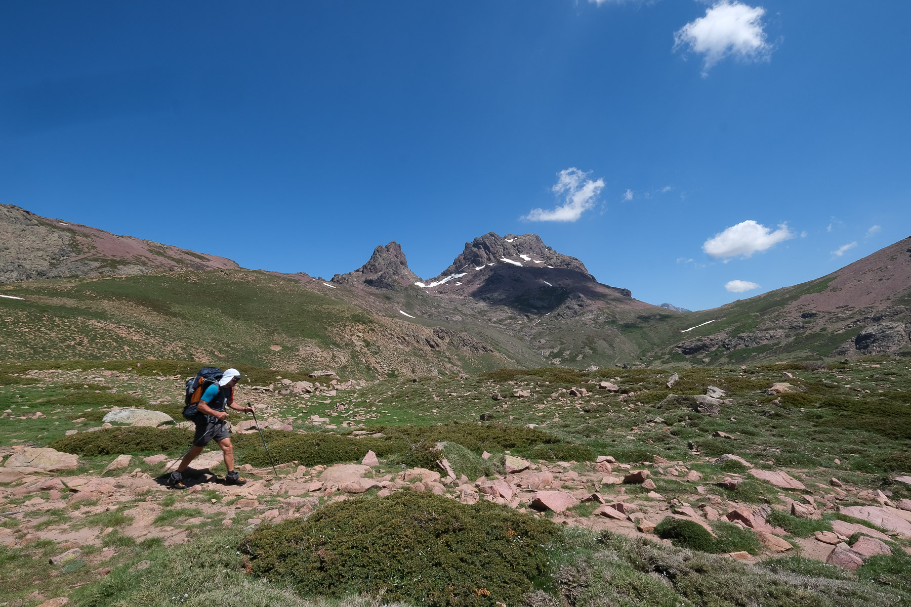
Ciuttulu di i Mori refuge to Castellu di Vergio via Paglia Orba and Capo Tafunatu (12 km, 700 m d+, 1290 m d-, alt max 2525m, 6 hours)
Leaving your bags at the Ciuttulu hut, you can make a round trip in around 3 hours to climb Paglia Orba from the Col des Maures, and then descend to Tafunatu for a breathtaking panorama of Corsica's west coast. For full details of the itinerary for these climbs, see the Paglia Orba post.
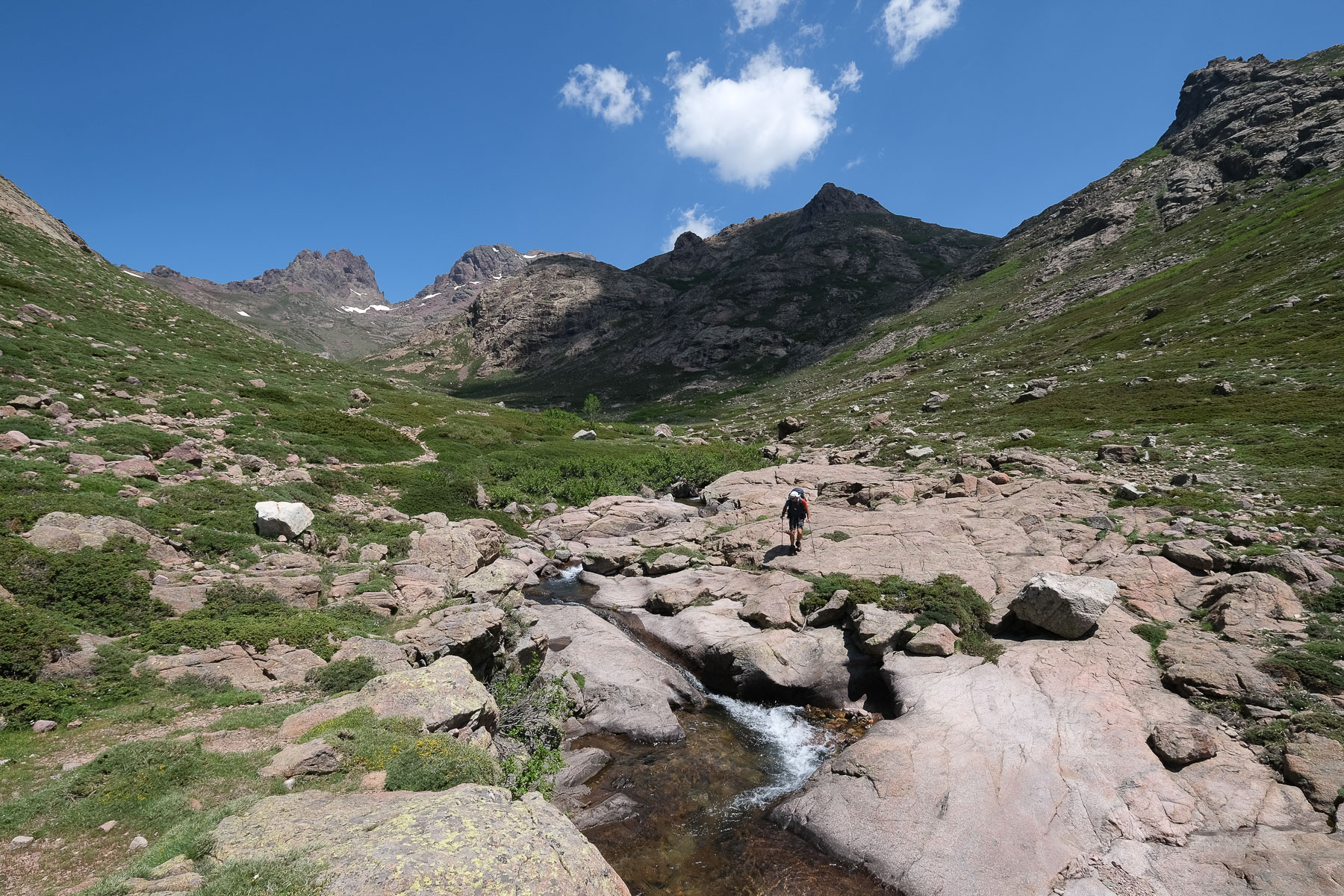
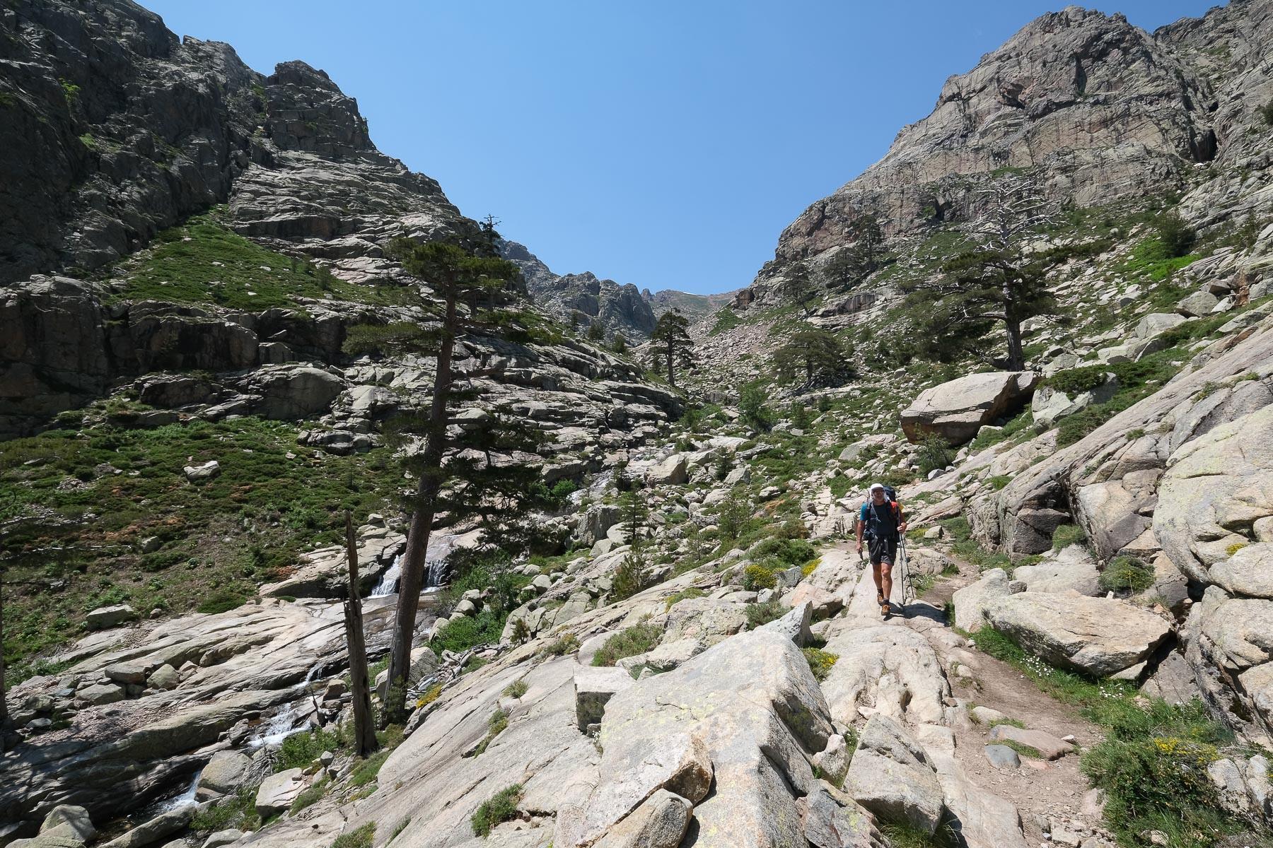
Returning to the Ciuttulu hut, the final leg of the stage takes us below the Col de Vergio, to the Castellu di Vergio campsite. The path follows the ridges for a while, then drops off to the left to reach the bottom of the Golo valley. You then follow the torrent in a splendid setting, with Paglia Orba and Capo Tafunatu at your back. Courageous visitors can swim in the magnificent translucent pools. Further down, you cross the Golo once, then a second time over a bridge to reach the Bergeries de Radule. Follow the GR and not the Mare a Mare. Further on, keep straight on, leaving the fork in the road at the horseshoe parking lot, and after a fairly long walk through the forest, you'll come to the road leading from the Col de Vergio. Turn left down the road to find Castellu di Vergio and its campsite just behind (same prices as the PNRC refuges, good showers and well-stocked grocery stores). 3 hours from the Ciuttulu di i Mori refuge.
Official GR20 website with full descriptions of all classic stages, refuges, equipment, news, advice and even a forum.
The general presentation of the GR20 and the itineraries we've done can be found in the post The GR20 and its variants.
Topo of the first 3 stages of the GR20 from Calenzana to the Asco-Stagnu refuge.


![2017-08-08_14-16-17 [Paglia orba et Tafunatu]](https://climbing7.com/wp-content/uploads/2017/09/2017-08-08_14-16-17-paglia-orba-et-tafunatu-e1544477255208-1024x682.jpg "Paglia Orba, Col de Vergio")

Leave a Reply