


TOPO Hiking | CLIMBING7.COM
Publié le
 Partager sur WhatsApp
 Partager sur Twitter
Partager sur Instagram
Partager sur Twitter
Partager sur Instagram

 Partager sur Facebook
 Imprimer le topo
 Laisser un commentaire
3 major stages on the program: a beautiful transition via Lake Nino before the spectacular stage above the Melo and Capitello lakes, a variant via the ridges and the ascent of Monte Oro for panache! More than 40 kilometers of mountain, high altitude lakes, aerial ridges, rocky breaches, nevé crossings and summits to climb - everything you need to make the most of the GR20 and its variants. The sequence from the Manganu refuge is a solid one, with distance, elevation gain and plenty of technical sections. Vizzavona marks the end of the northern part of the GR20, almost 90 kilometers already covered since Calenzana.
❱❱ Technical summary
Type ✦ Alpine touring hike
Location ✦ Castellu di Vergio in Vizzavona
Region ✦ Corsica
Country ✦ France
Max altitude ✦ 2389 m
Distance ✦ 41.5 km
Vertical rise ✦ 2690 m
Negative vertical drop ✦ 3175 m
Difficulty ✦ E4 / T4 / R4
Duration ✦ 18h30 in 3 days
Interest ✦ ★★★
❱❱ Access to the place
Departure is from Castellu di Vergio, which can be reached via the D84 road between Corte and Porto.
❱❱ Map & topo
❱❱ Itinéraire
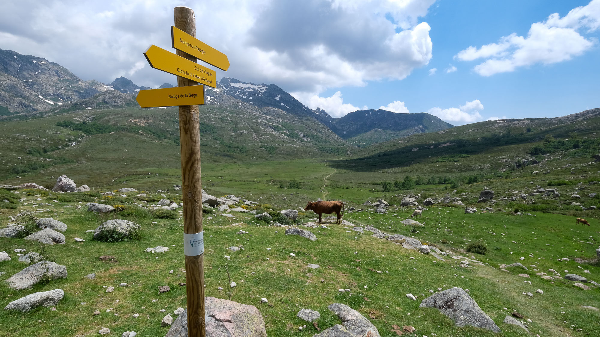
From the Castellu di Vergio campsite, walk downhill along the road to quickly find the GR20 trail which continues through the forest, heading due south.
These 3 stages are very different: stage 6 is easy and straightforward, the first part of stage 7 takes place at high altitude and the presence of névés, particularly in June, requires crampons, the second part follows a variant of the GR20 and is more classic on ridges, stage 8 also takes the variant to climb Monte d'Oro with some passages to climb in the III/IV-.
Stage 6
Castellu di Vergio to Manganu refuge (15.8 km, 610 m d+, 420 m d-, alt max 1870 m, 4 hrs 30)
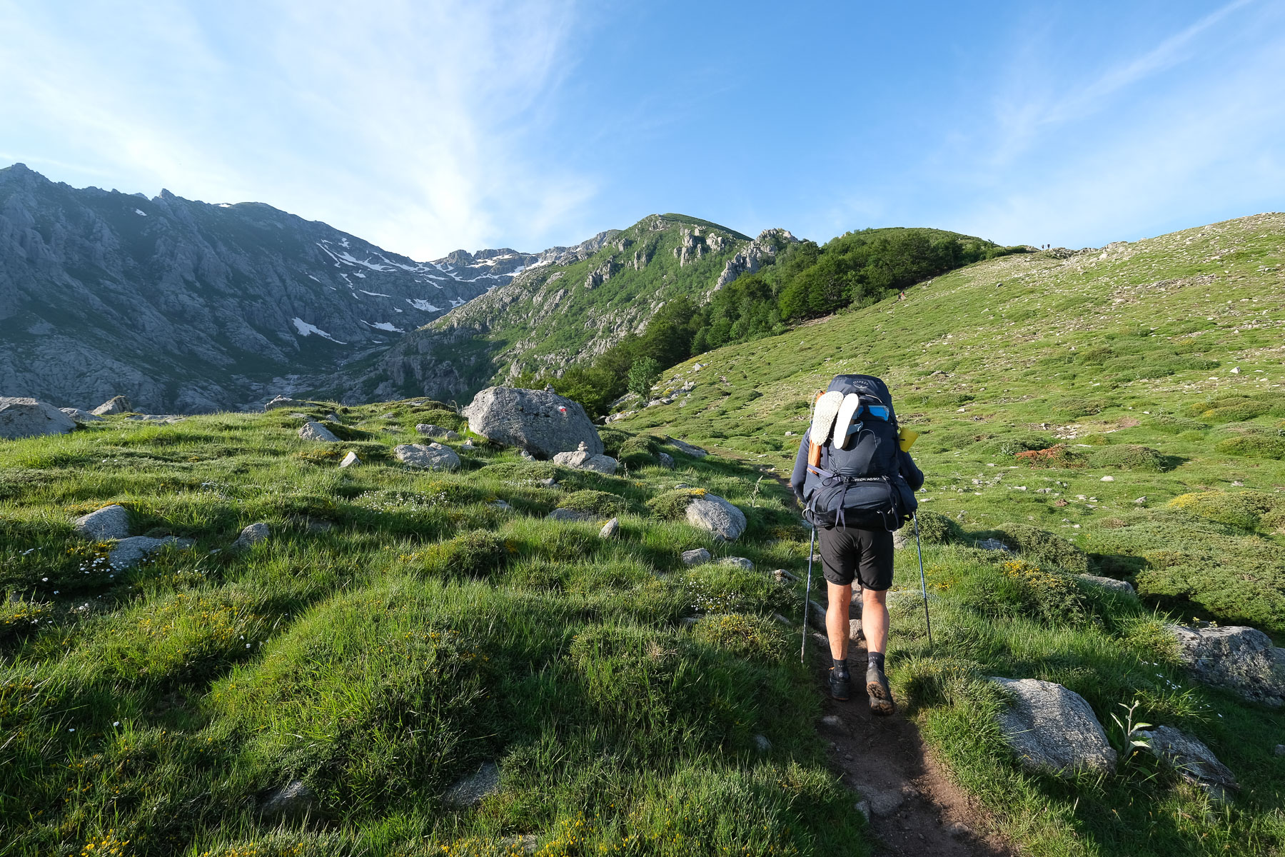
A panoramic, open and much more rolling route, the 15 km are easy to cover and allow you to recover from the first 5 days. 1 hour of forest crossing and 15 minutes to reach the ridge at Bocca San Pedru at 1452m. The views behind us of Paglia Orba, Tafunatu and Cinto are superb. We climb up the rounded ridge, then onto the northern slope of U Tritore, with the Capu a u Tozu in sight, forming a small pyramid in the distance. The path returns to its base and this time crosses over to the southern slope of Capu a u Tozu to reach the Bocca a Reta, a wide, grassy, open pass (approx. 3 hours from the start).
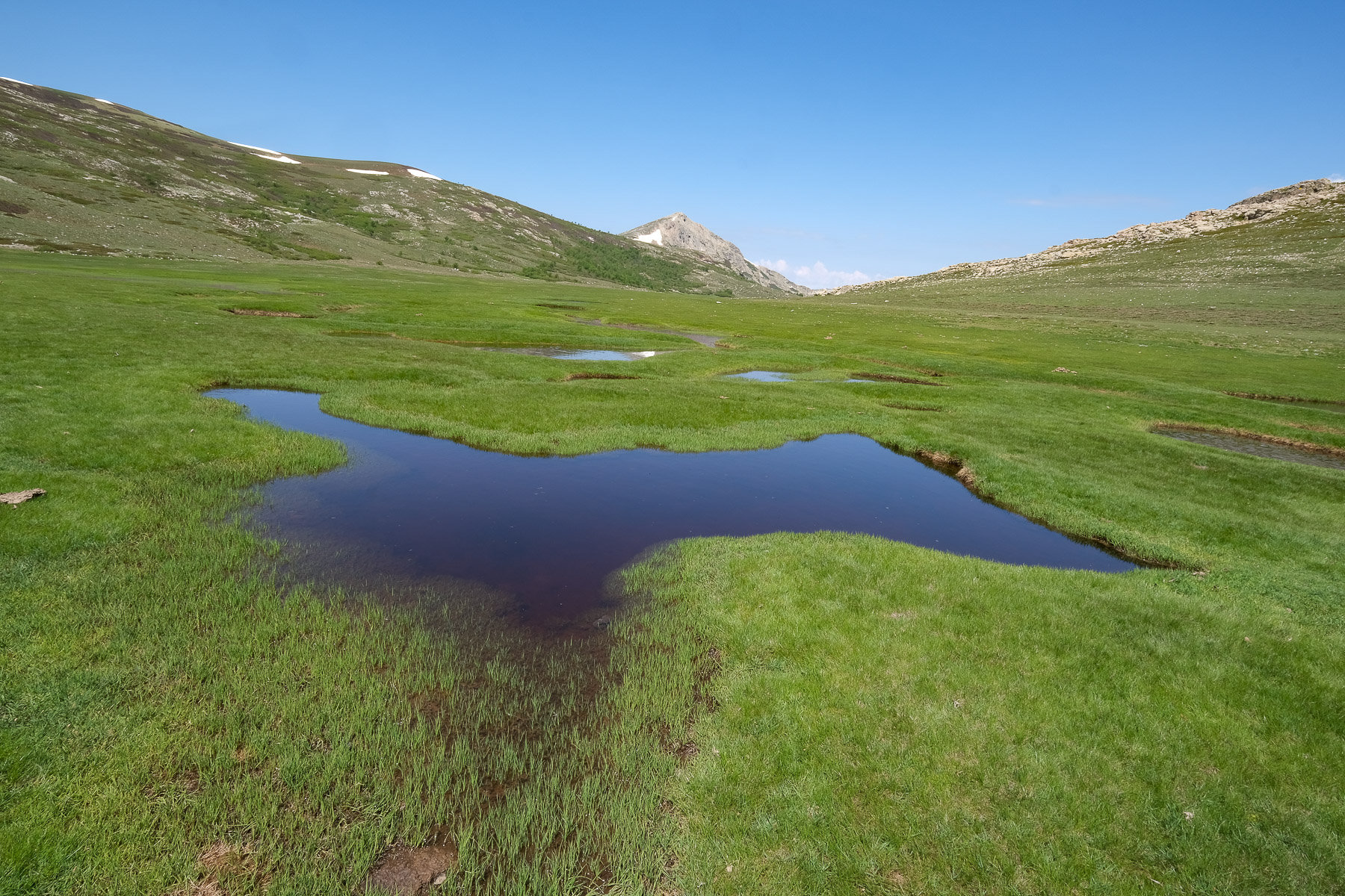
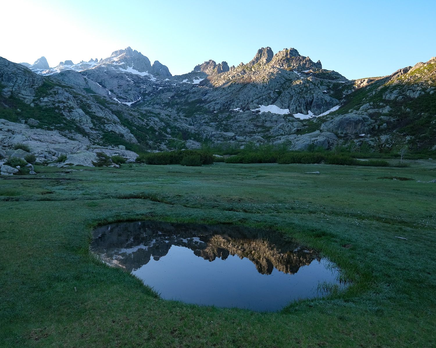
We descend into this wide, high-altitude valley to soon discover Lac de Nino, which we'll skirt along its southern shore. For a while, we walk flat along grassy marshes that form small pools (see photo), before finally exiting and descending through the Tavignano valley (swimming possible). The path then follows the contour to the Bergeries de Vaccaghia (cheese on sale). A large, flat, grassy basin separates us from the Manganu refuge, which can be seen in the distance. Once across, it climbs a little to pass the Bocca d'Aqua Ciarmente and reach the Manganu refuge (good welcome, great shower, poor meal).
Stage 7
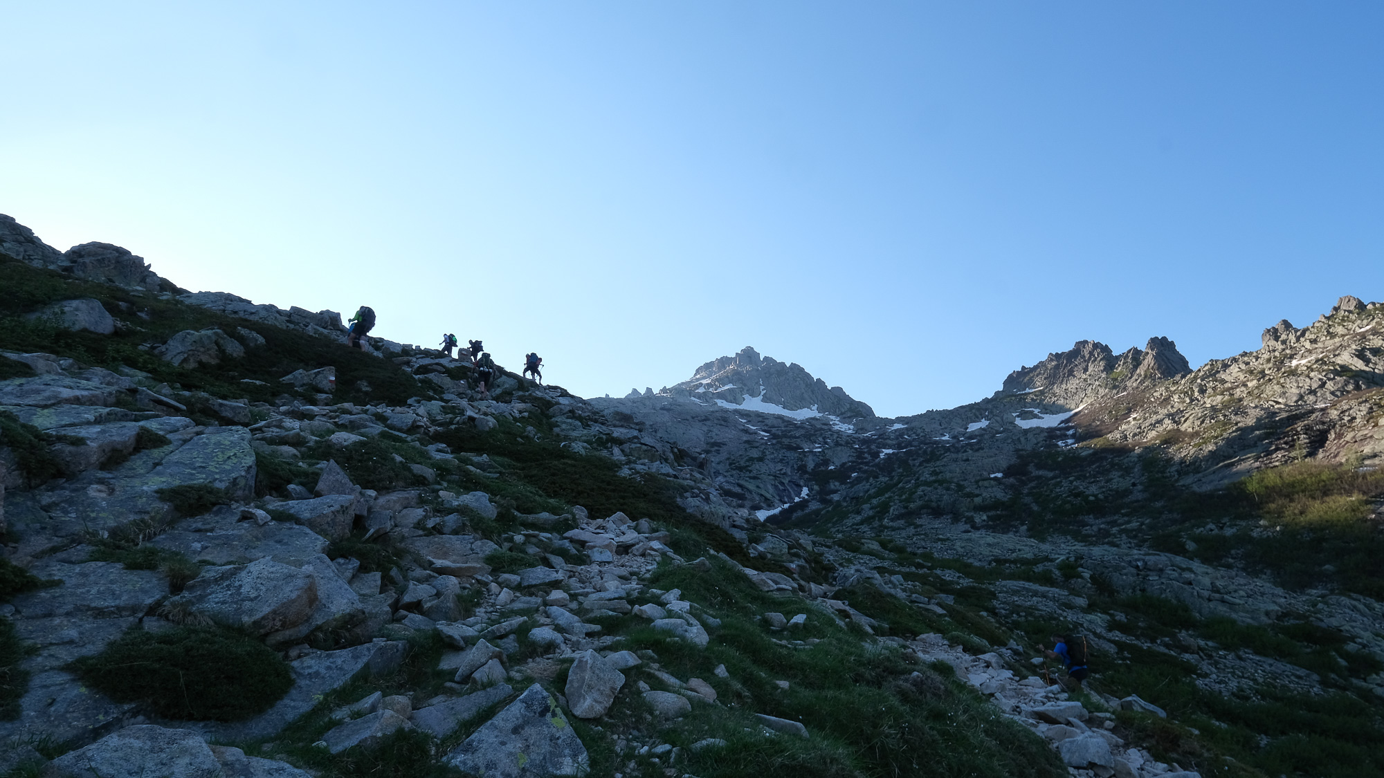
Refuge de Maganu to refuge de l'Onda via Pointe de Pinzi Corbini and Punta di l'Altore (14.7 km, 1135 m d+, 1325 m d-, alt max 2210 m, 7 hours)
La Bocca Alle Porte (2225m, 1h45)
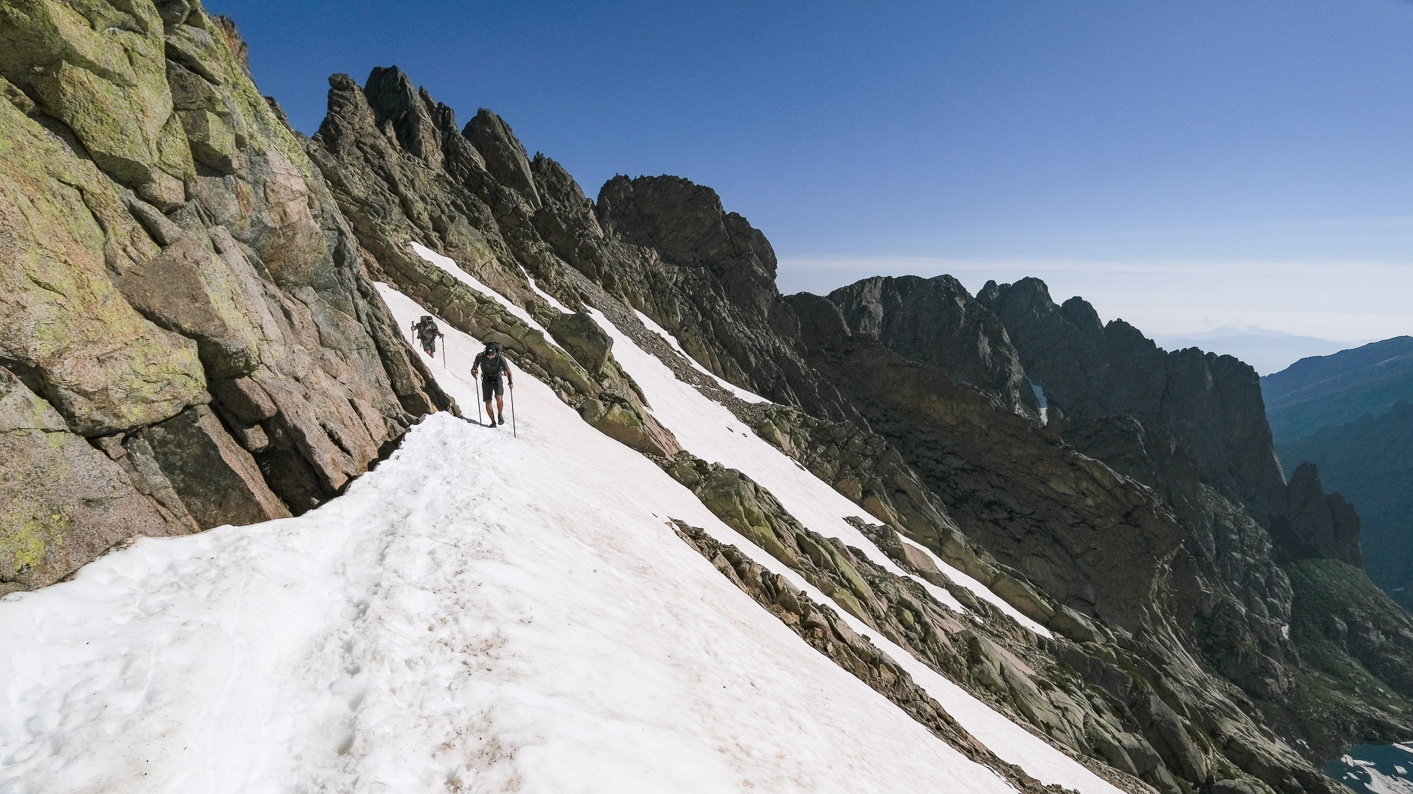
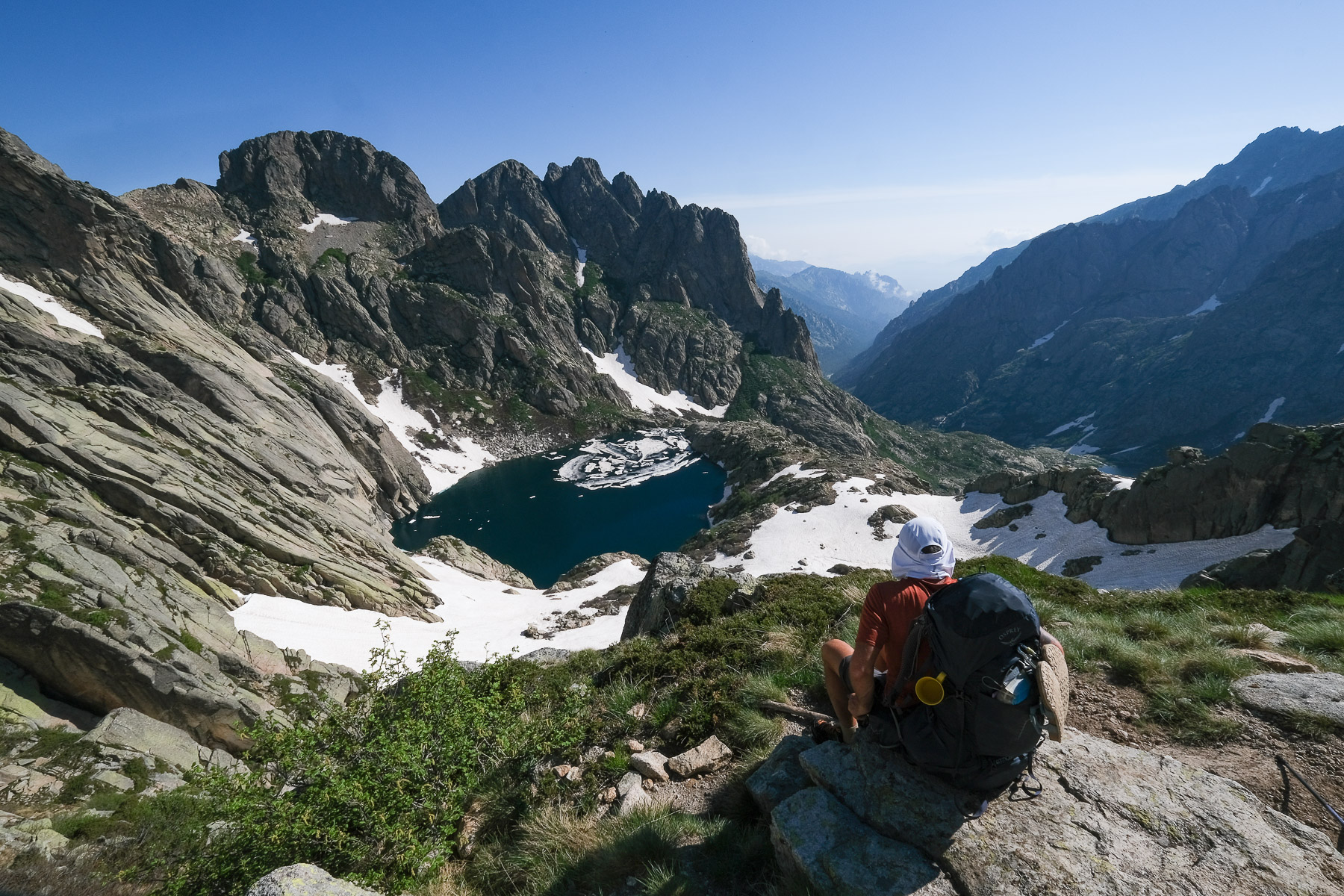
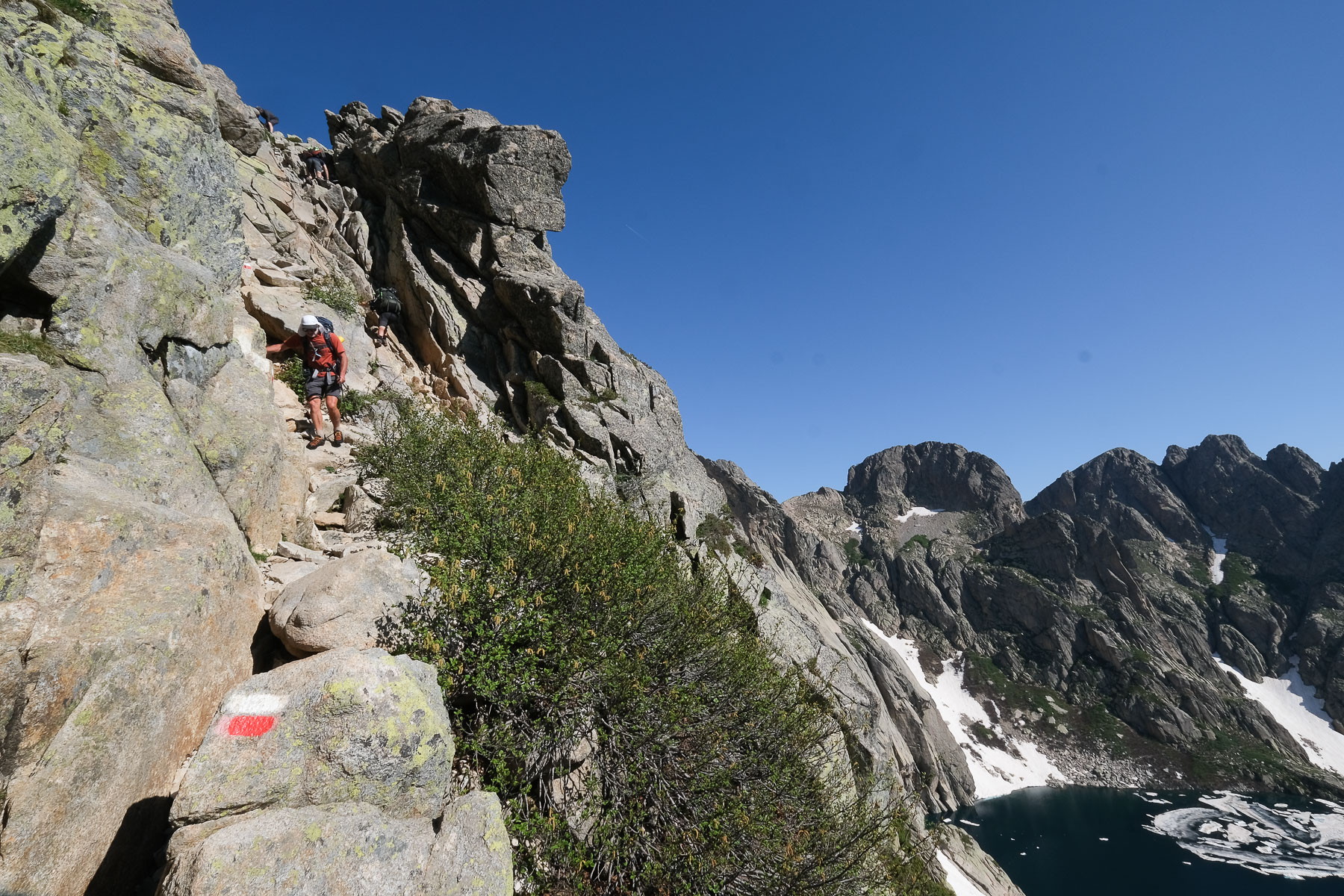
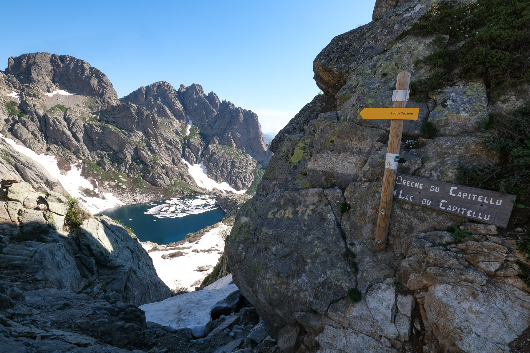
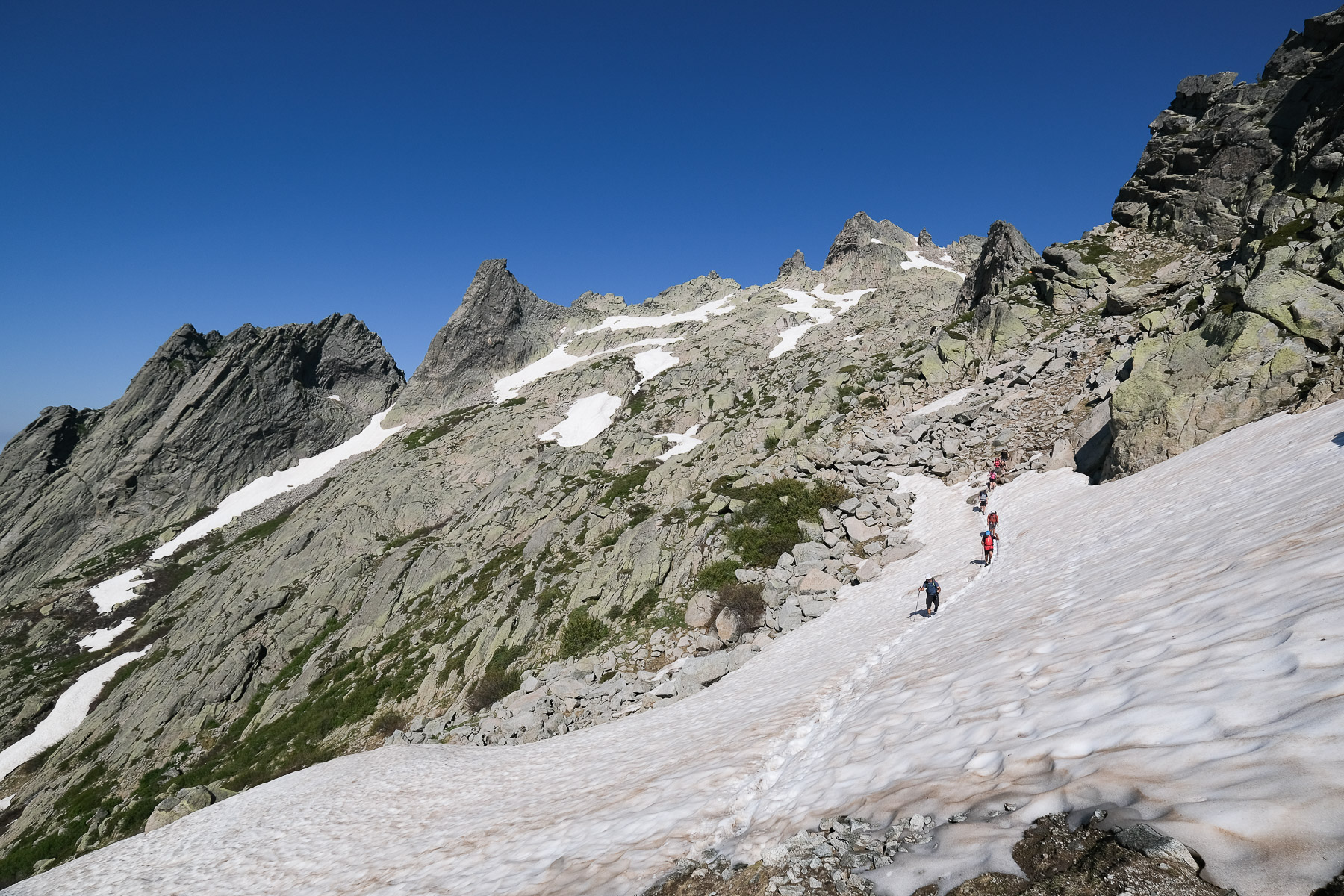
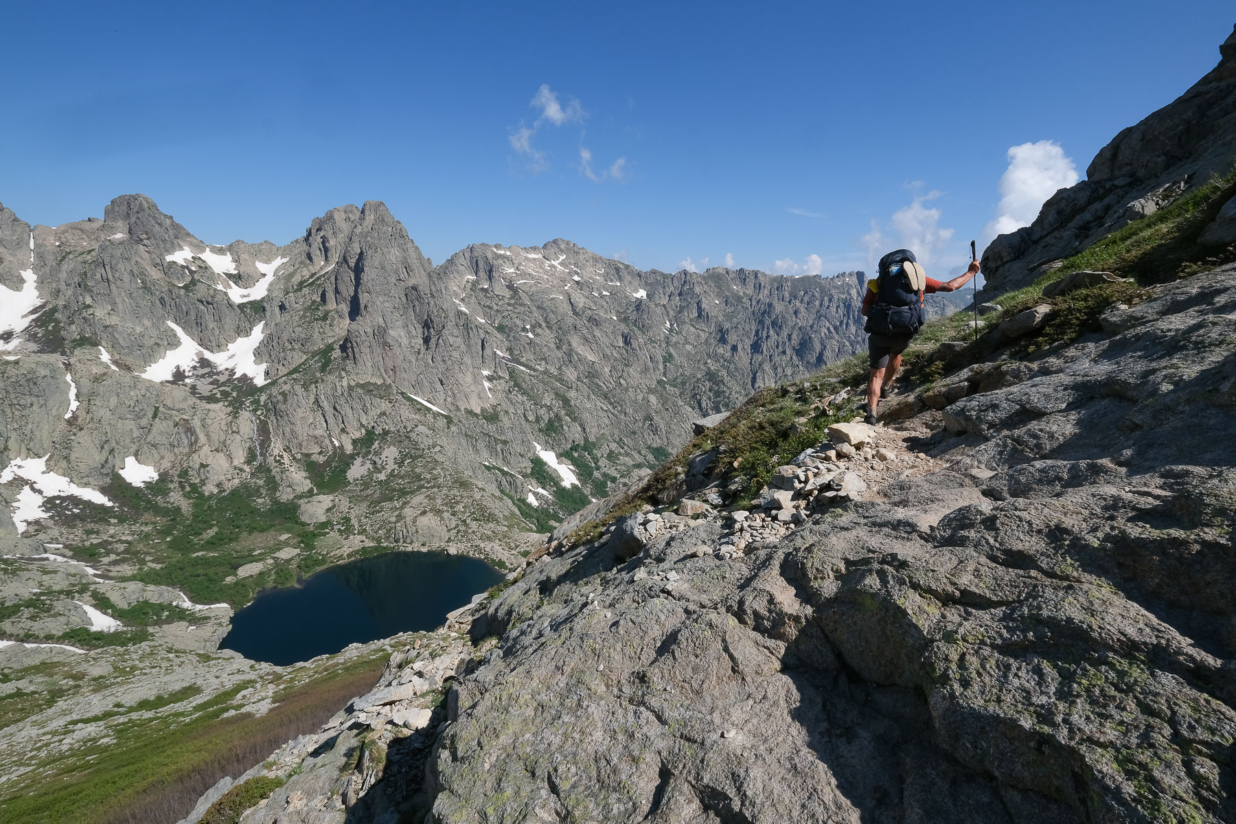
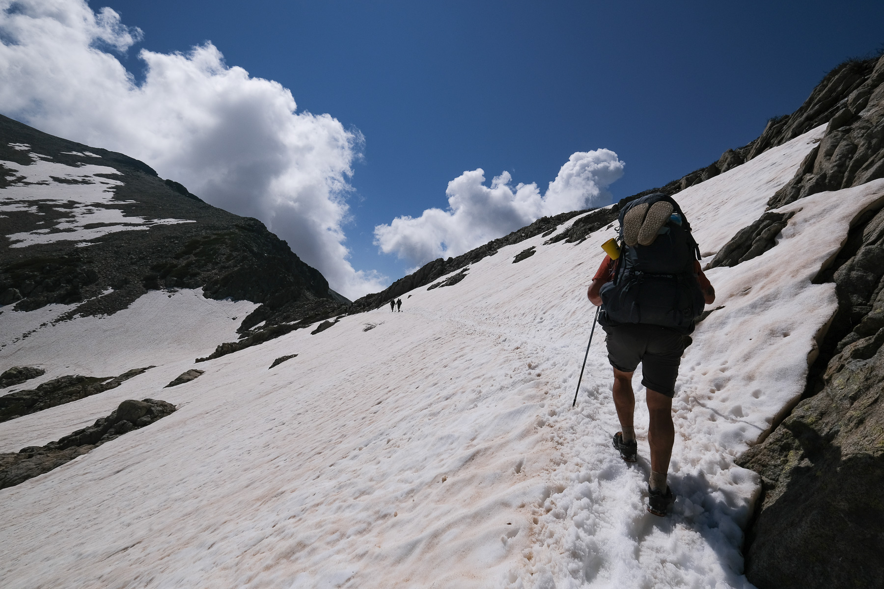
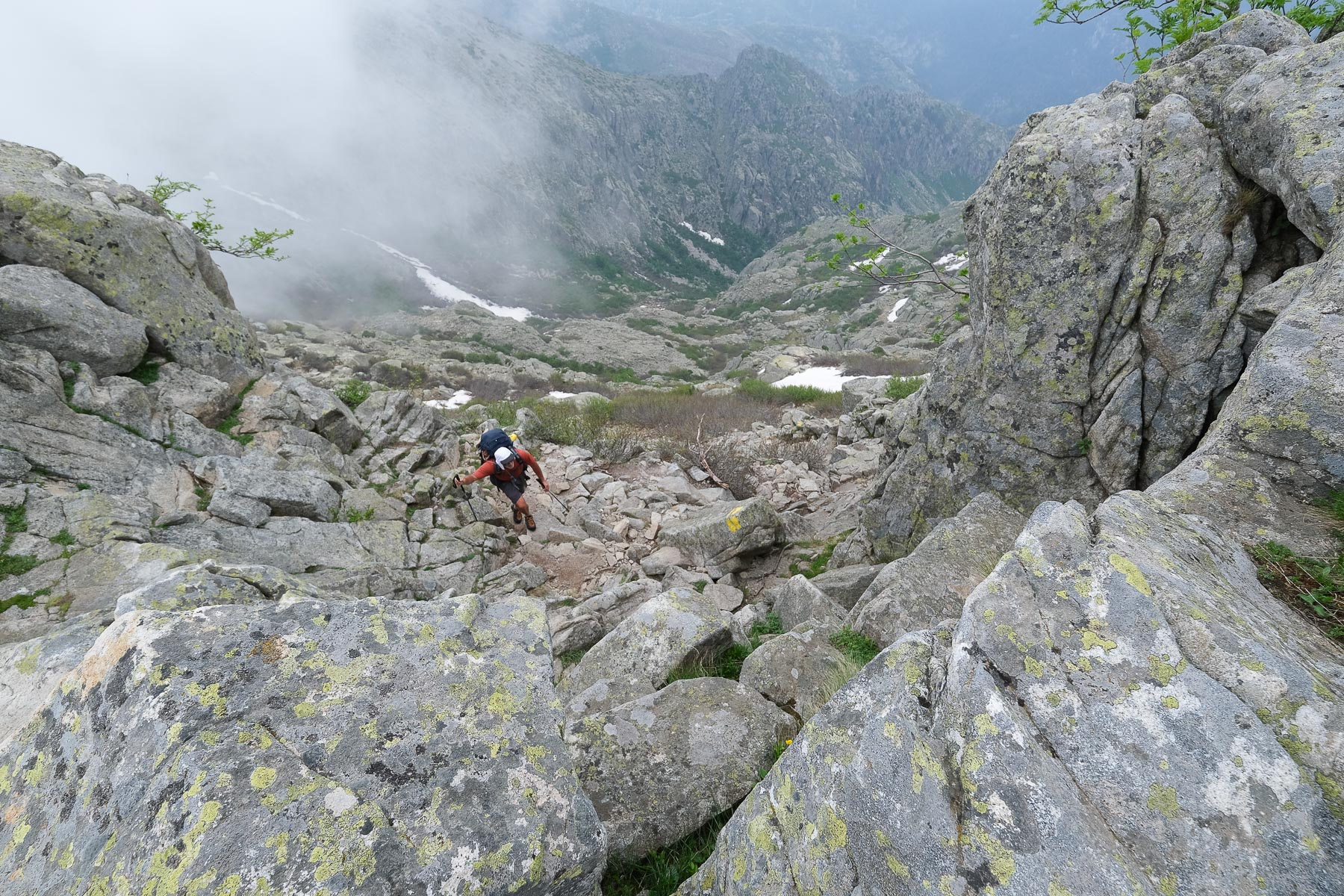
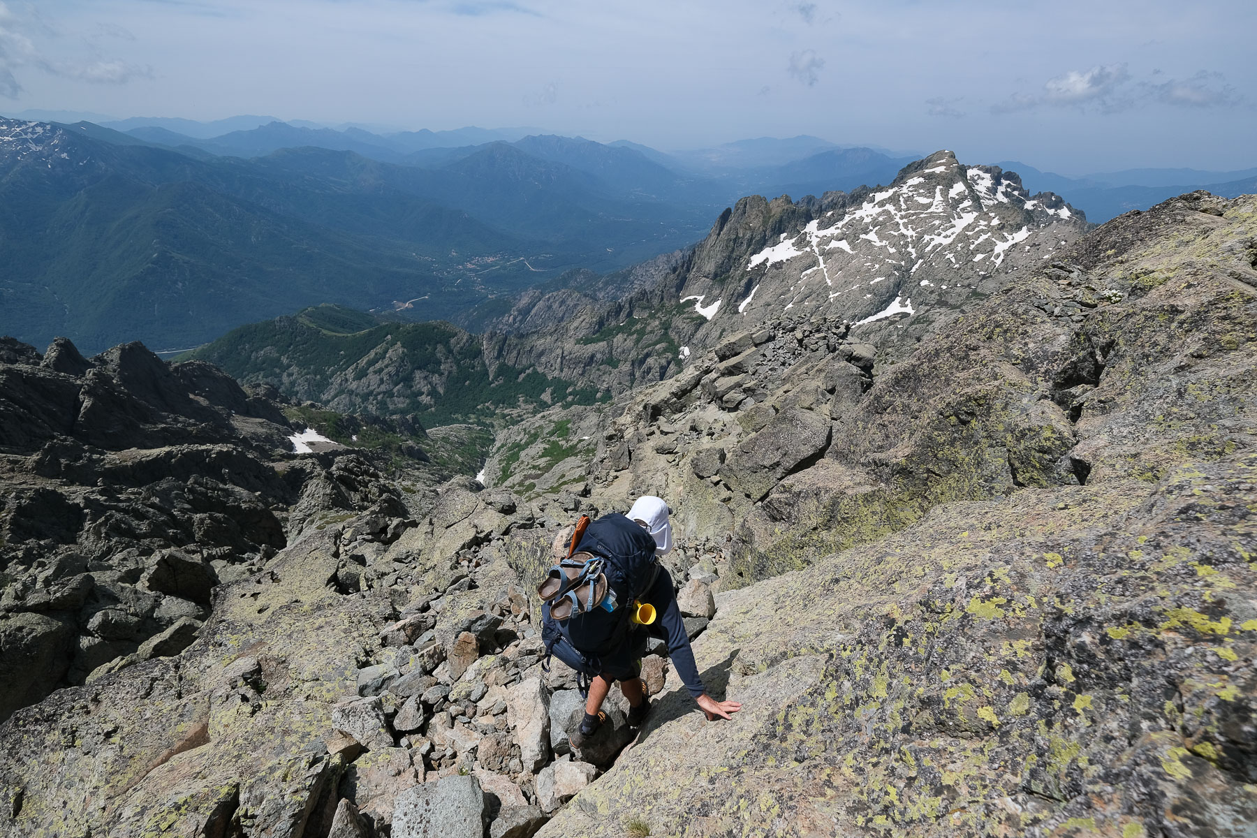
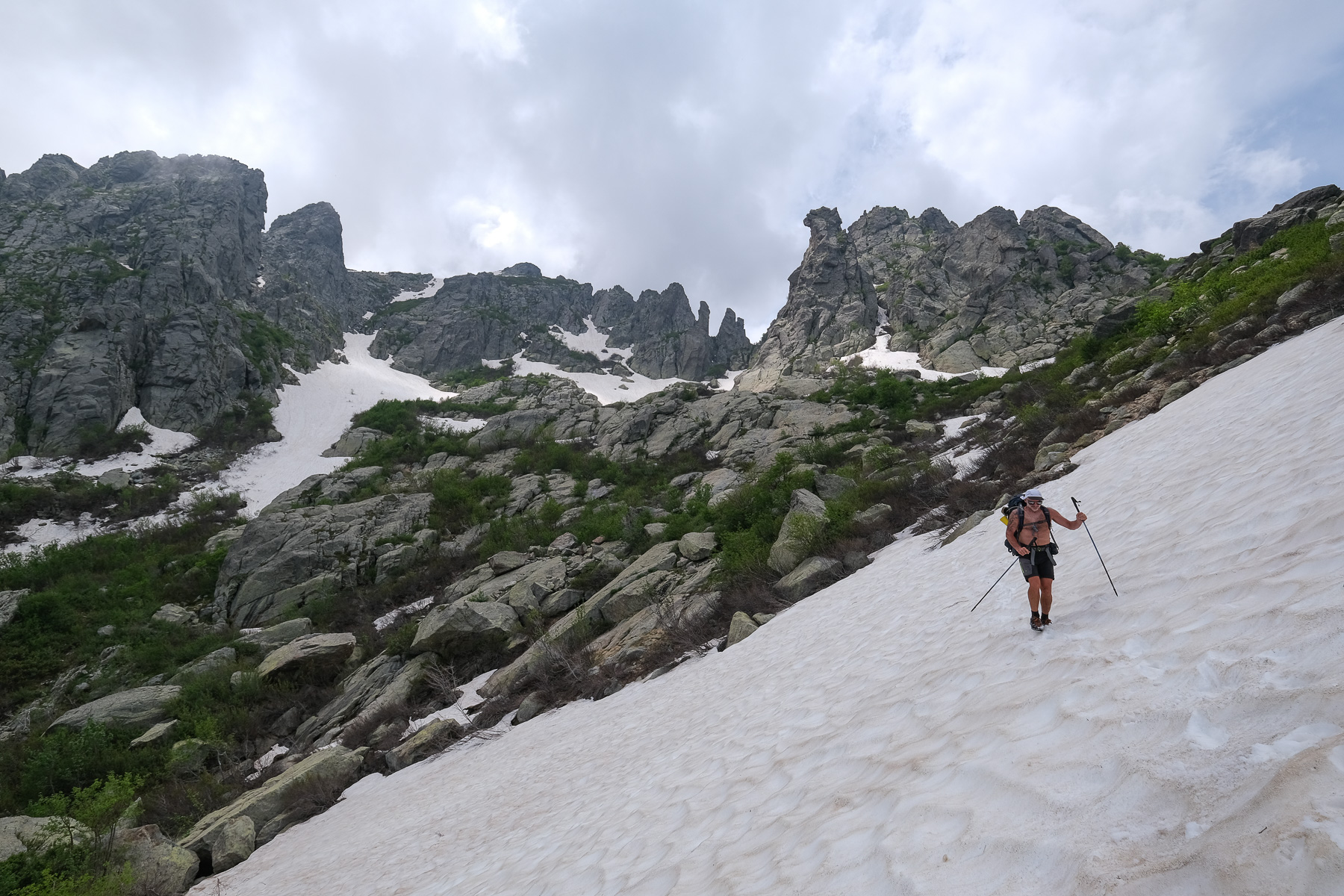
Cross the torrent again and climb for 30 minutes to reach a first landing on a basin with a small pond. Continuing eastwards, we reach a second landing and the basin below the ridges formed by rocky needles. The path climbs steeper again, ending up in a small couloir with snowfalls, until it reaches the narrow Bocca Allae Porte, a tiny gap that gives access to the cirque that shelters the Melo and Capitello lakes.
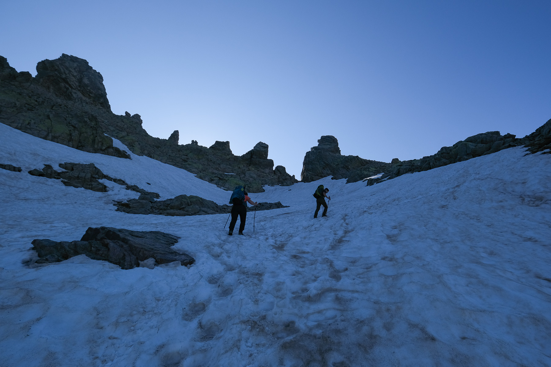
The cirque to Bocca a Muzzella (2206m, 2h15)
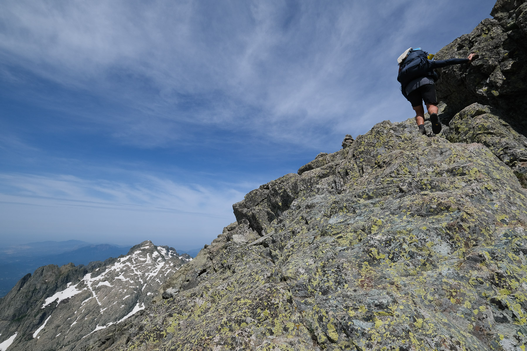
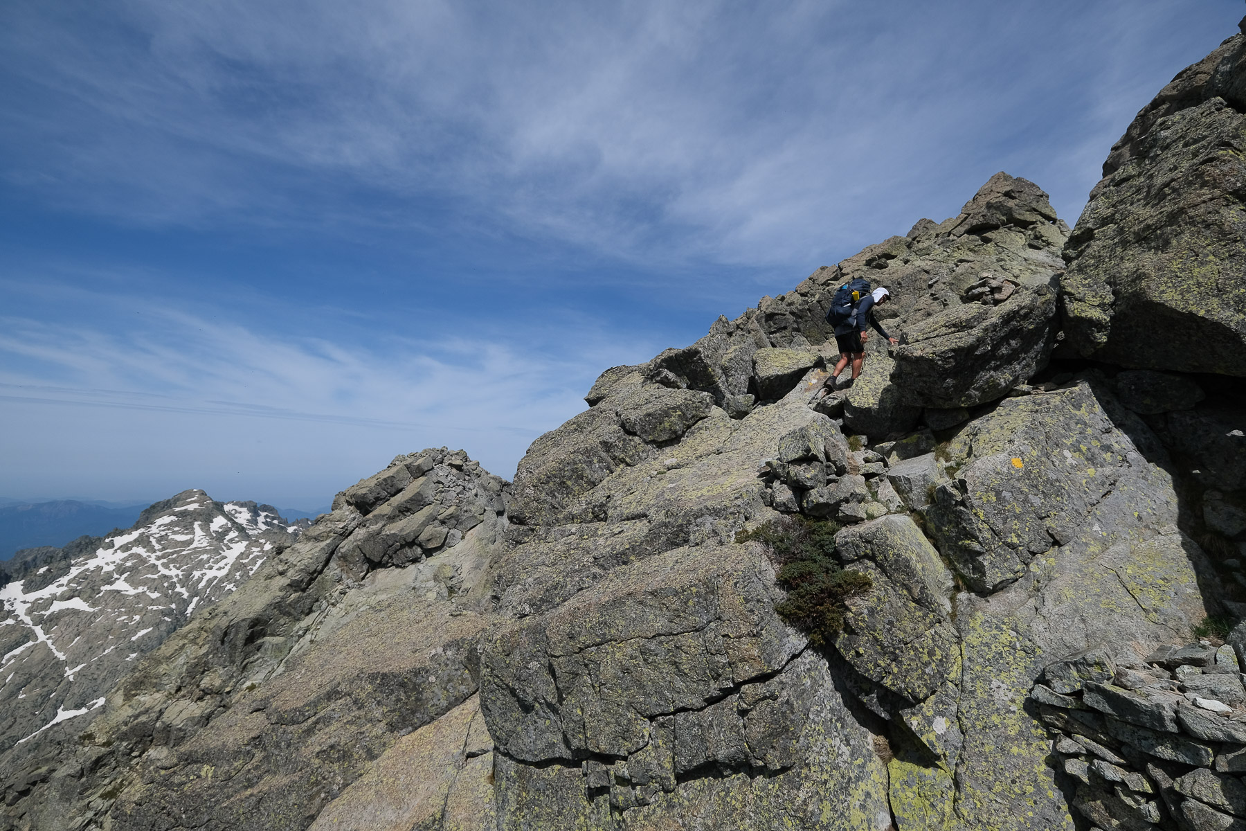
This is the start of a long traverse over the cirque via the ridges to reach the Bocca a Muzzella on the other side. The most impressive and exposed névé passage is here, with no difficulty but aerial, and a slide would lead directly to the Capitello lake 300m below. This is followed by a number of less exposed but steeper névé passages to weave between the rocky needles. We pass the Breche du Capitello and then the Bocca a Soglia on the south side. From here, we cross back to the north-east and find ourselves on the other side of the Bocca Alle Porte, then the path climbs steeply to reach the Col de Rinoso and the Bocca a Muzzella, which will take us out of the cirque for good.
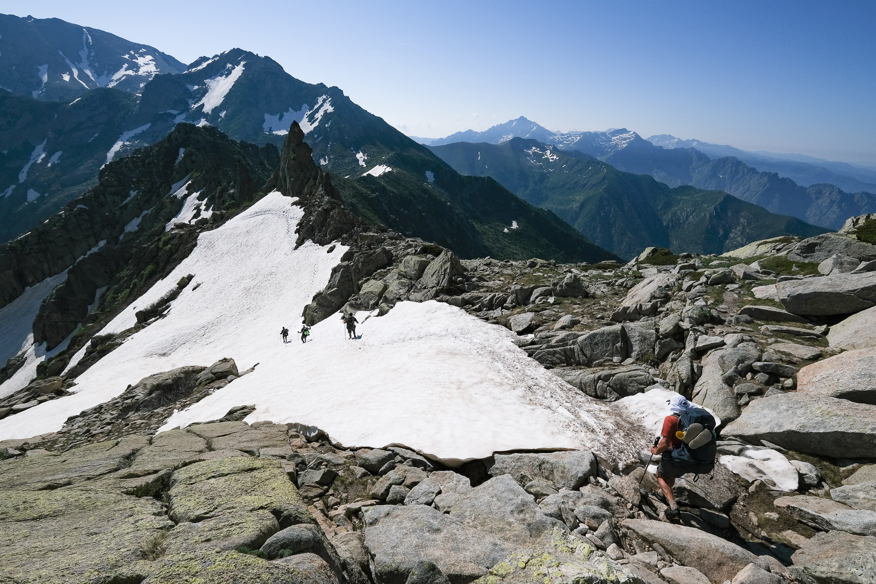
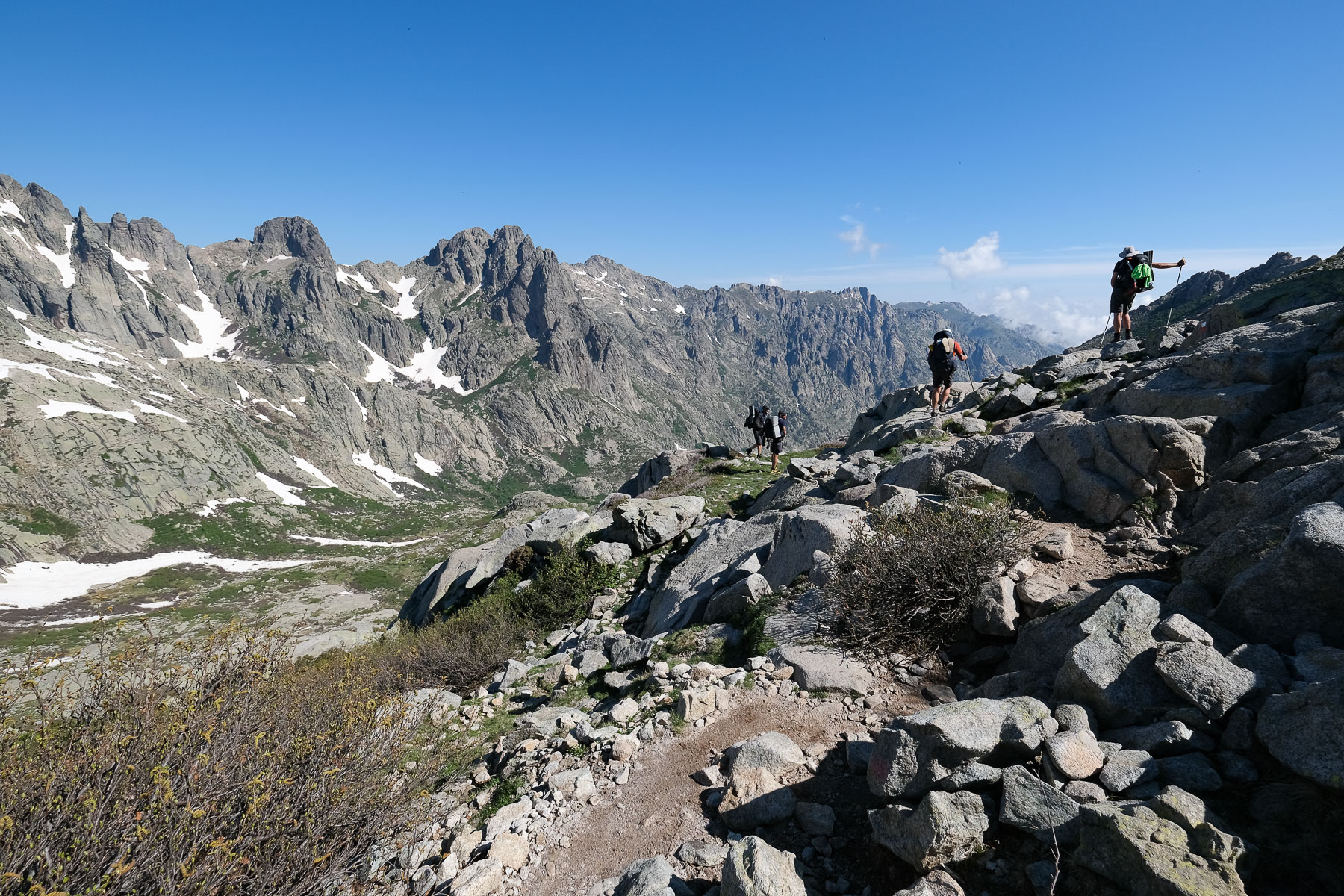
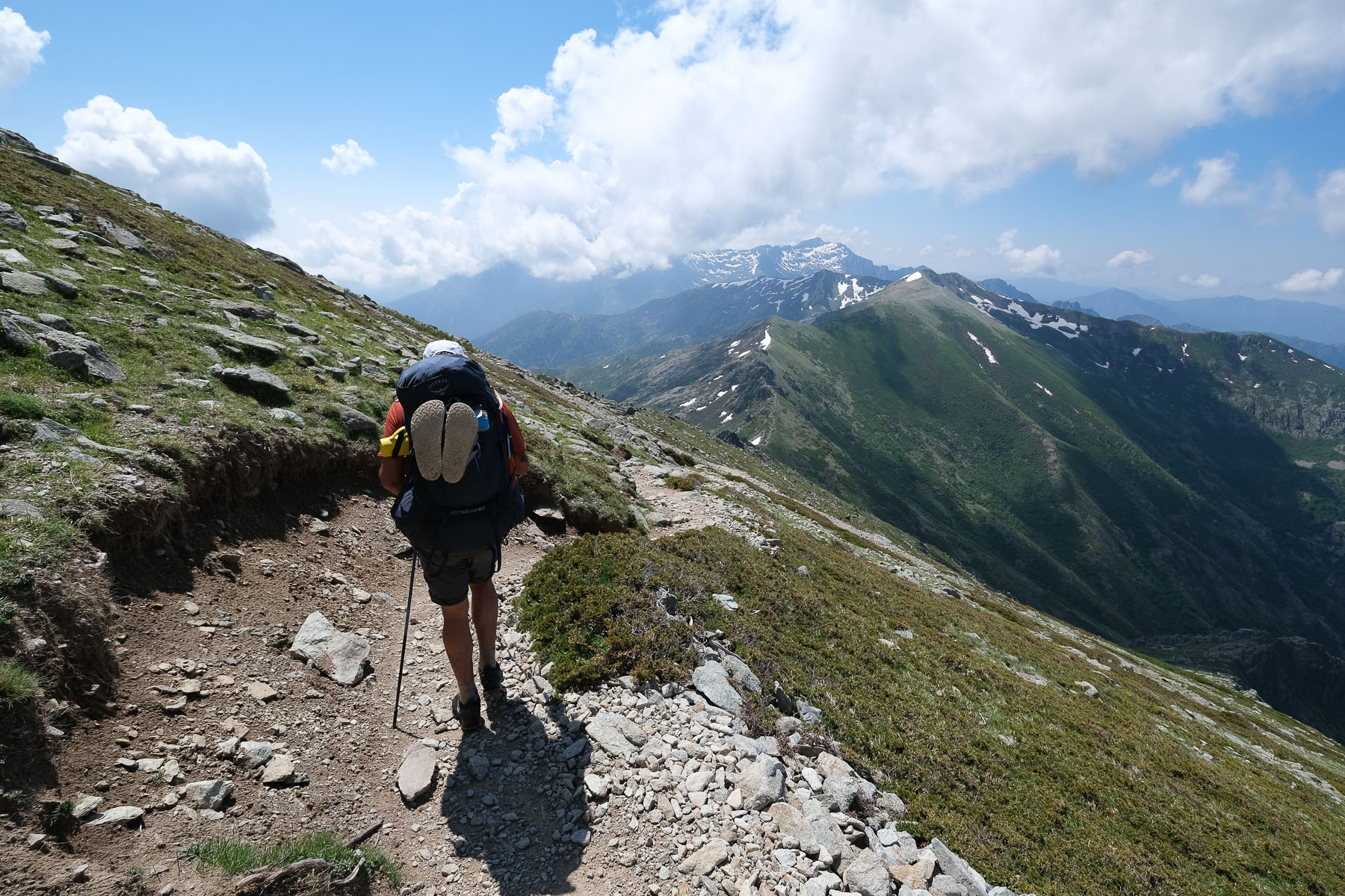
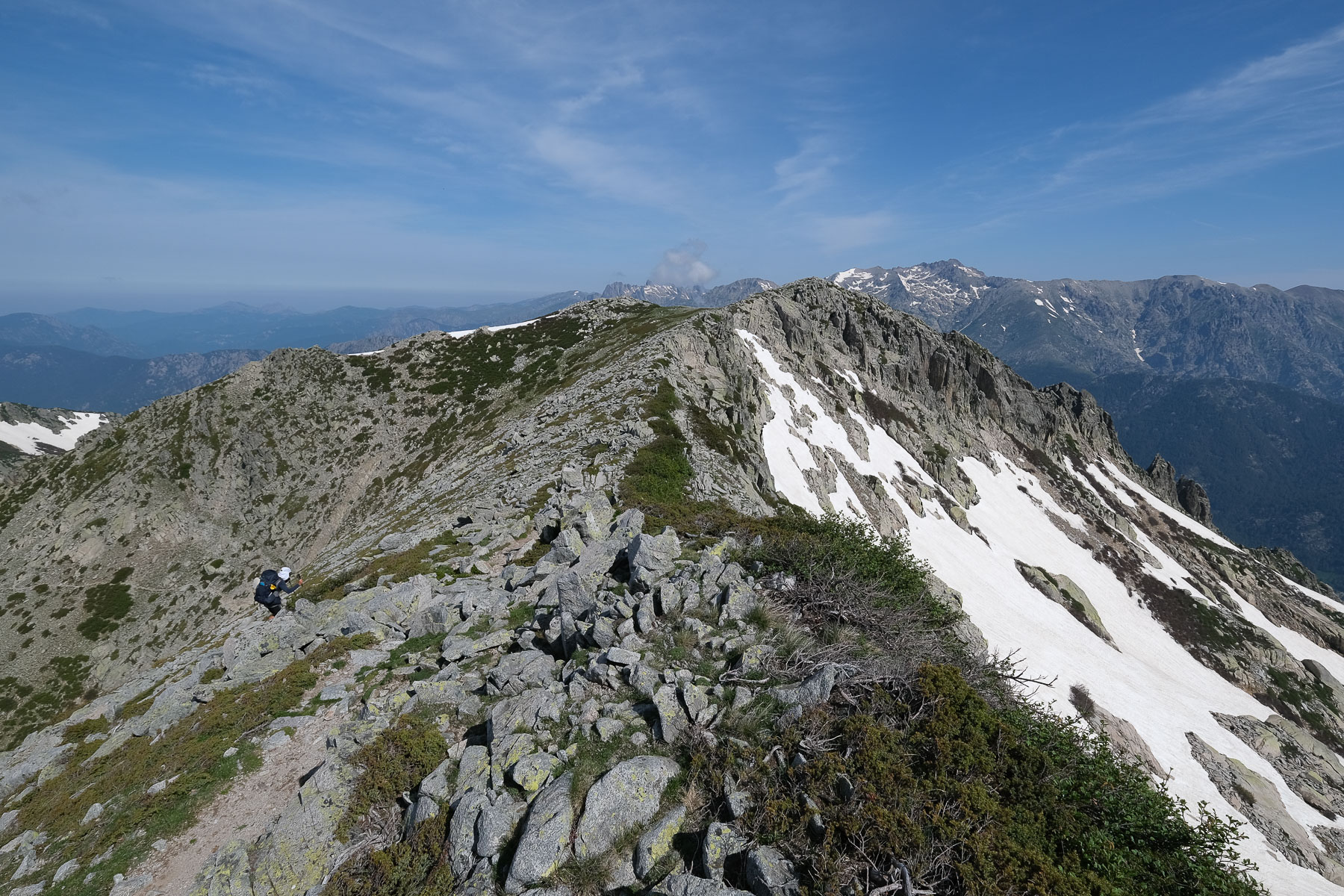
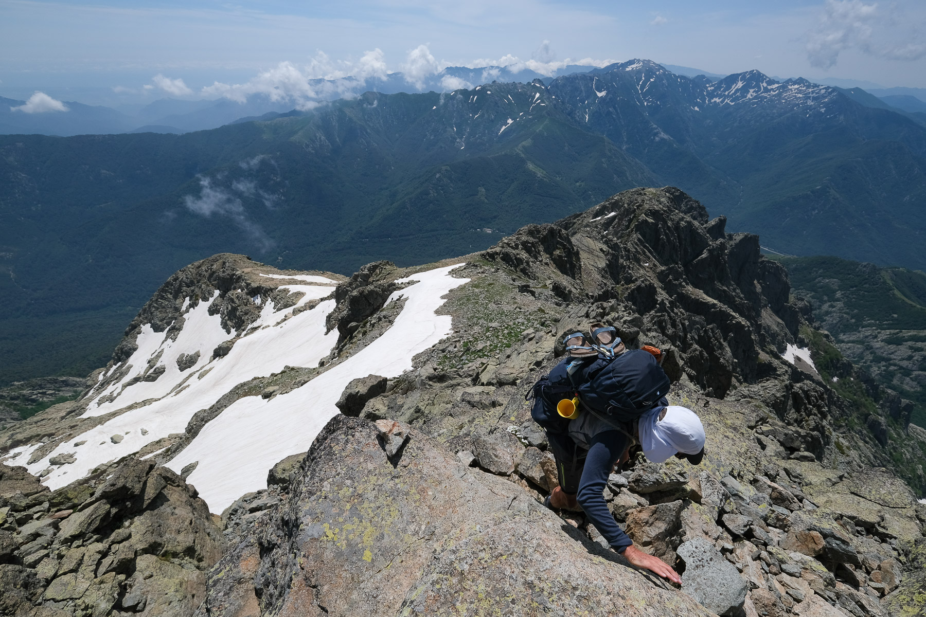
The ridges via Punta Murace and Punta All'Altore (3 hours)
Descend across to the ridge behind which lies the Pietra Piana refuge. Once on this ridge, you can see the refuge below. Leave the GR and descend this ridge off-piste without too much difficulty, to reach the Bocca Manganellu below, where you find the variant of the GR that comes from Pietra Piana. The trail climbs, staying on the ridge edge until it passes under the Pointe Murace and ends on a first summit. The rest of the trail is aerial and steep to reach Punta All' Altore, and immediately afterwards it descends steeply over pebbles to a small pass. We then cross over to the north side of a rocky ridge to finally climb back up to the ridge via a short, rather rough section leading to a tiny gap. On the other side, the path heads south-east and then east, and at the end it drops down to the Bocca d'Orrecia to break a few thighs at the end of the day. There's still a short climb back down to the basin that shelters the Onda refuge.
Stage 8
Refuge de l'Onda to Vizzavona via Monte d'Oro (11 kms, 945m d+, 1430 m d-, alt max 2389 m, 7 hours)
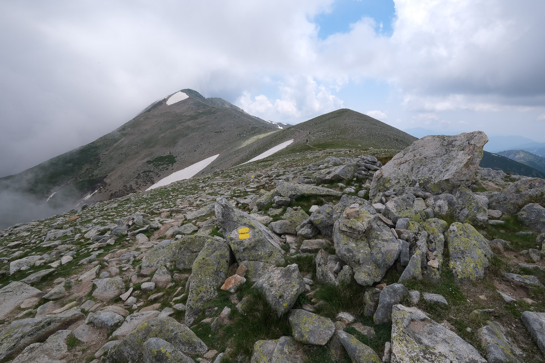
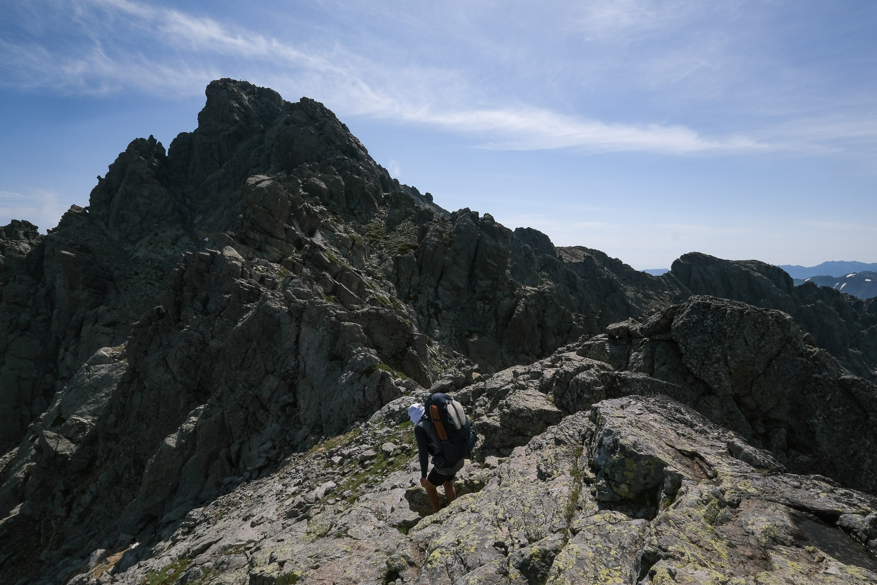
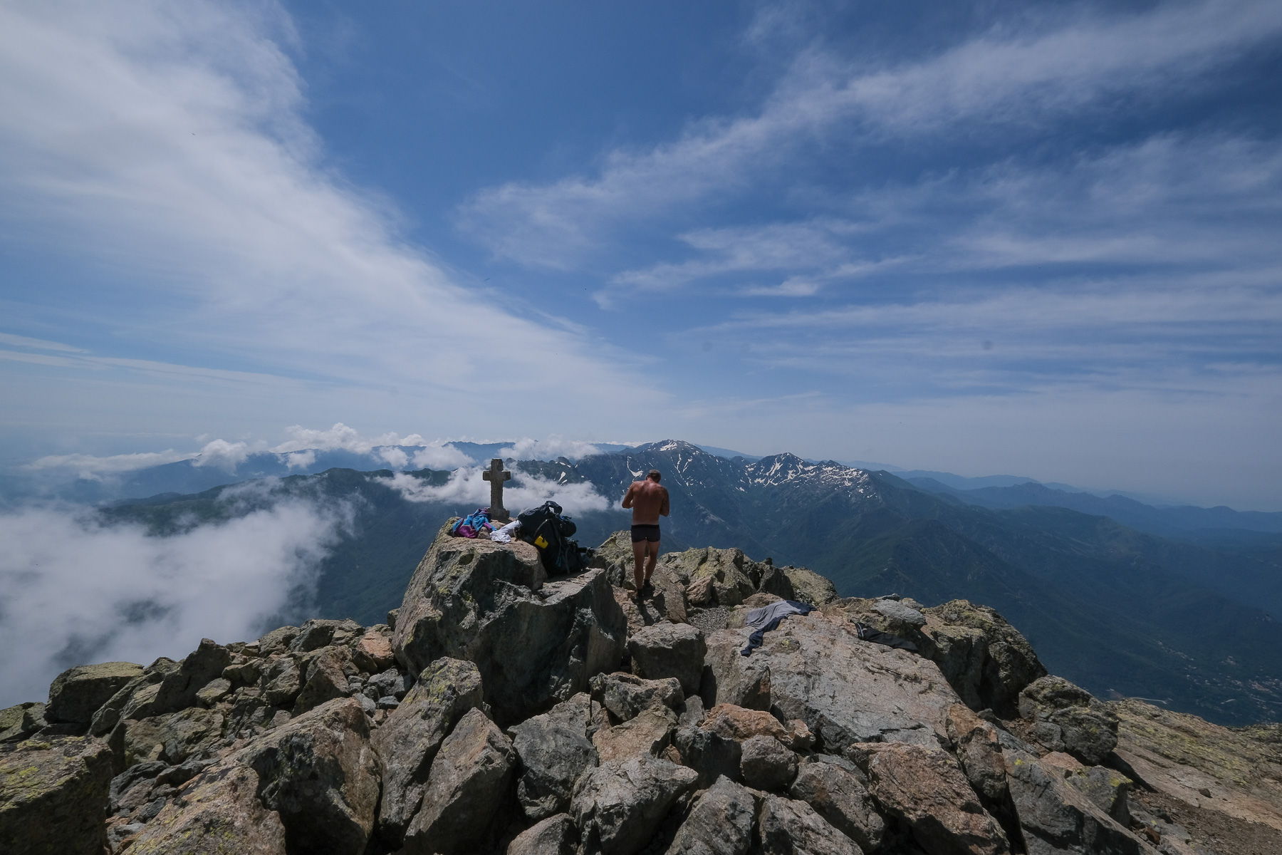
Monte Oro (2389m, 4h30)
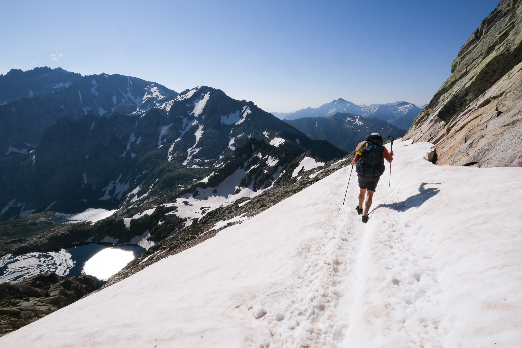
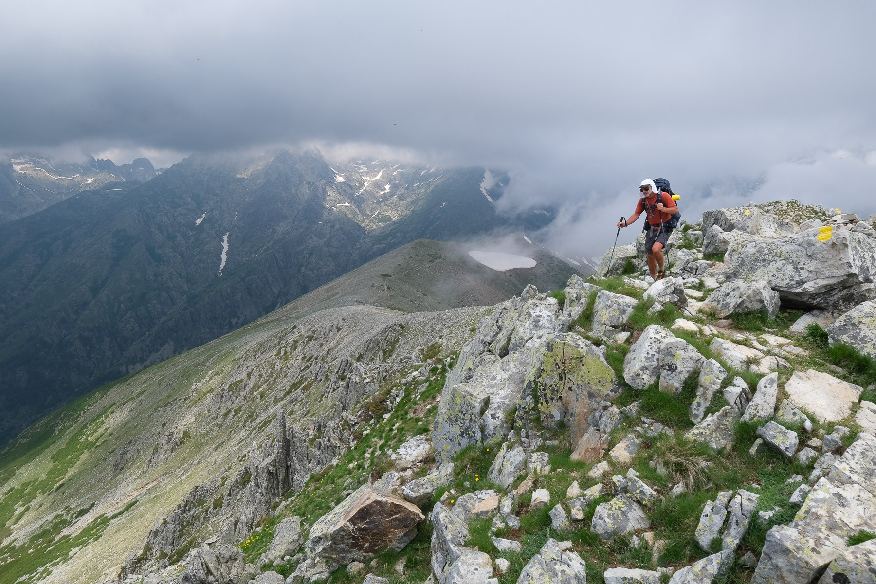
Climb above the refuge to follow the path heading south towards Vizzavona. We'll then climb up a long, fairly open ramp, step by step, to reach the top of the cirque we saw from the refuge. After 2 hours, we're at Bocca Muratellu (2120m). Go down the opposite side to the east, and you'll soon find the fork: to the right, down the official GR20, and straight ahead, climbing a little, the Monte Oro variant, marked with moderately visible yellow dots and cairns. Continue across, climbing a little to cross the Agnone in a ravine, climb below the Bocca di Porco and rejoin the ridge. Below, on the north side, you can see a cirque with Lac d'Oro. The rest of the route follows the ridge on the south-facing slope, with a few easy climbs, before finally passing beneath Monte Oro. From here, climb due north to the rocky summit of Monte Oro (a few pitches of III+/IV- max).
Vizzavona (2h30)
Descend from the summit by the same route and on the shoulder below, this time head due north to skirt the base of Monte Oro. Possible crossing of névé. Further down, the route descends steeply along a rocky spur, crossing another névé at the bottom and leaving the valley after 1h30 from the summit. What remains is a long descent path with almost 1000m of negative altitude difference, quite steep at the start then gentler in the forest, which makes a large loop to the east and returns south towards Vizzavona. At the end, the trail cuts across wide tracks and lands at the railway village of Vzzavona, a private refuge along the railroad line, l'Alzarella.
Official GR20 website with full descriptions of all classic stages, refuges, equipment, news, advice and even a forum.
The general presentation of the GR20 and the routes we've hiked can be found in the post The GR20 and its variants.
Topo of stages 1, 2 and 3 from Calenzana to the Asco-Stagnu refuge.
Topo of stages 4 and 5 from Asco-Stagnu refuge to Castellu di Vergio.


![2017-08-08_14-16-17 [Paglia orba et Tafunatu]](https://climbing7.com/wp-content/uploads/2017/09/2017-08-08_14-16-17-paglia-orba-et-tafunatu-e1544477255208-1024x682.jpg "Paglia Orba, Col de Vergio")

Leave a Reply