TOPO
Crête des Baumes from Superdévoluy station, Dévoluy
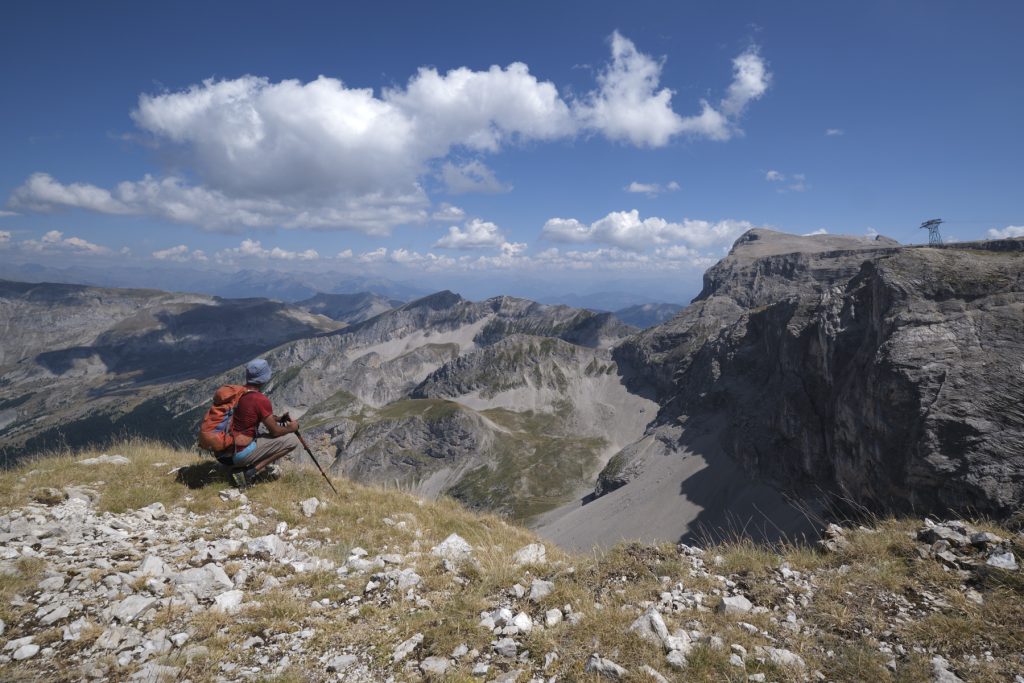
Departing from the Superdévoluy ski resort, this hike, accessible to all, offers breathtaking panoramic views of the Dévoluy. You climb up a gently sloping ridge, with the majestic Obiou massif on one side and the equally characteristic Pic de Bure massif on the other. You can also admire the large rocky bars that enclose the Col du Noyer, Montagne de Faraut and Crêtes de Liéraver, naturally closing the Dévoluy in its green setting. You can also see the Superdévoluy and Joue du Loup ski resorts.

La Tête de l’Obiou depuis les crêtes
Technical summary
■ S tarting point: Superdévoluy, Saint-Ètienne-en-Dévoluy, Hautes-Alpes (05)
■ Type of route: mid-mountain loop hike
■ Distance: 6.5 km
■ Cumulative elevation gain: +220 m
■ Cumulative negative elevation gain: -220 m
■ Estimated total time: 1h30 to 2h
■ Min and max altitude: 1500 m / 1720 m
■ Marking: trail and signposted track
■ Equipment in place: none
■ Equipment required: none
Difficulty: none
Access to the place
Go to the Super-Dévoluy resort above Saint-Étienne-en-Dévoluy. Park in the large visitor parking lot at the entrance to the resort.
Itinerary description
Course
The crest trail is marked with yellow signs and follows a fairly obvious route, forming a counter-clockwise loop. You can do the loop the other way round, but the gradient will be more concentrated. The views in both directions are superb.
1st part: from the Station to the Baumes ridge
From the resort parking lot, climb up the north-east side of the tall buildings and exit to the right, skirting the sports complex, basketball courts and mini-golf course. You'll then find the stony track marked in yellow that leads to the Bois de Boucherac and the Collet du Tat.
Once you're on the track heading north, you'll come to the first fork in the road: to the left is the track leading from Collet du Tat (back), and to the right is the track leading to Bois de Boucherac and the Crête des Baumes. Turn right and climb gently into the Bois de Boucherac. Follow the main track, leaving everything to the right. Further on, leave the track at a bend to take a path still in the forest, which climbs a little and soon leads to the crest, with a great aerial view of Dévoluy to the north and west.
Part 2: Climbing the Baumes ridge
Here, the trail begins to climb, more or less following the edge of the void in a south-westerly direction. The views of the Dévoluy valley and the splendid Obiou range, an astonishing mineral sculpture, are still there. Then the climb gradually flattens out, and this time you discover the Joue du Loup on the right, with the Pic ce Bure massif reappearing on the left. It ends on a large grassy flat with an antenna. The 360° view is spectacular, allowing you to appreciate the whole of Dévoluy at a glance.
Part 3: to Collet du Tat and back to the resort
From the antenna, follow the path down to the south-west before heading due south. The section is steeper and eventually reaches a fairly wide pass, the Collet du Tat, which allows you to switch to the Joue du Loup or Superdévoluy side. The rest of the way is downhill, following the wide track back to the starting fork and the Superdévoluy resort.


Leave a Reply