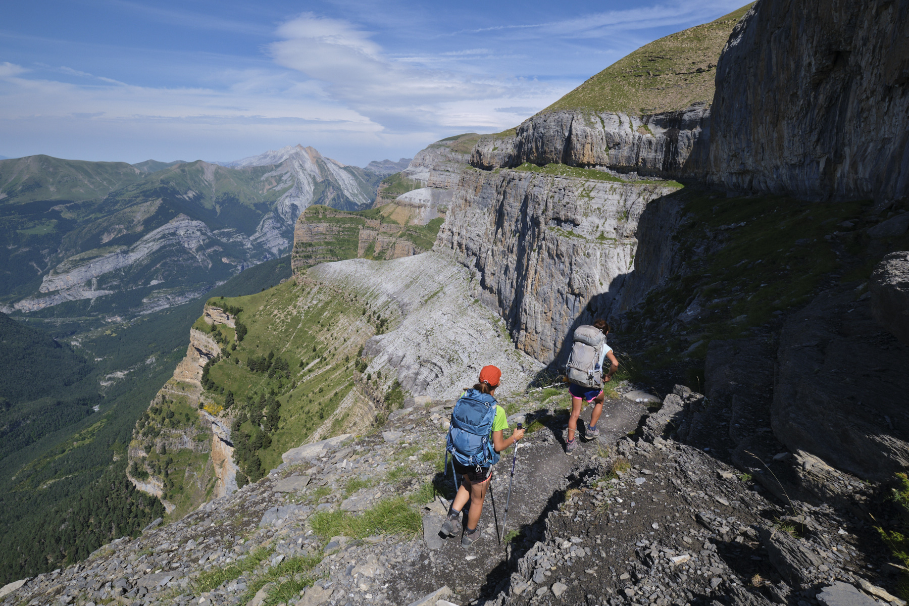
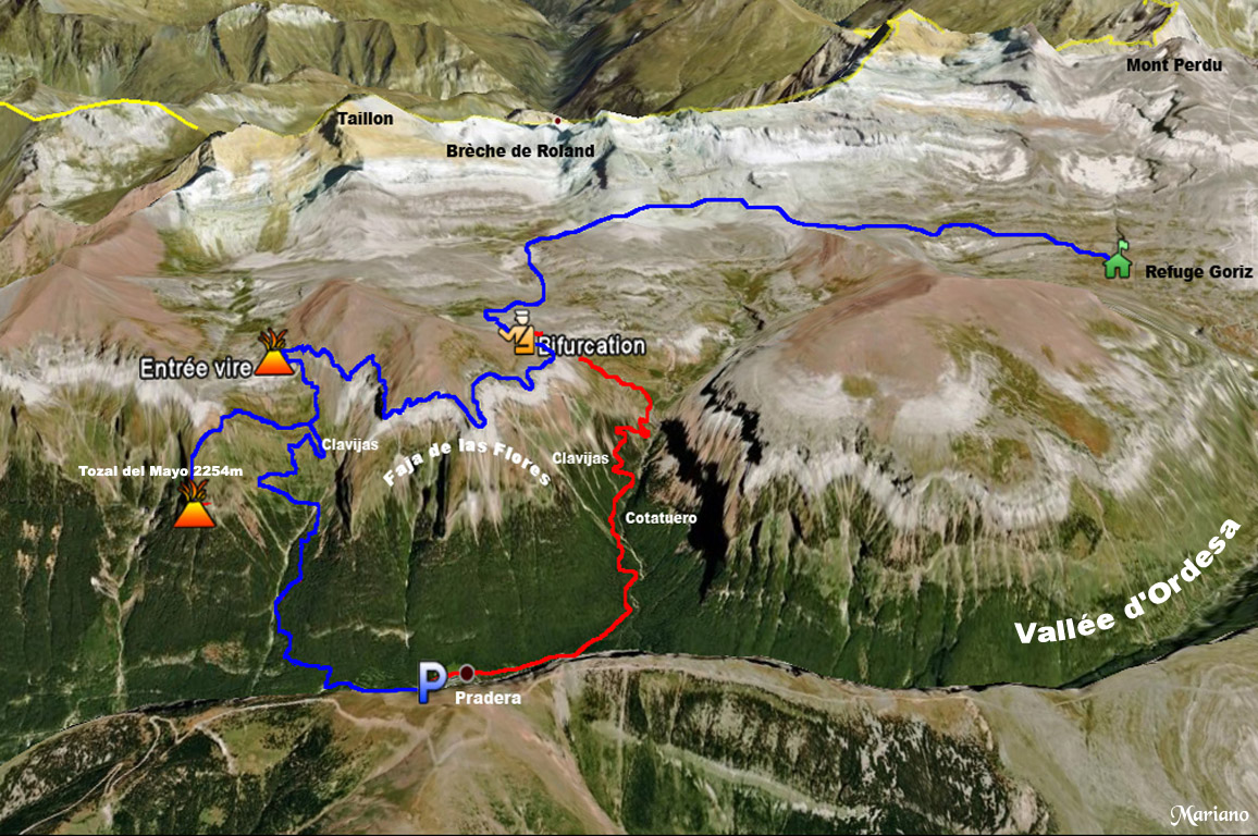
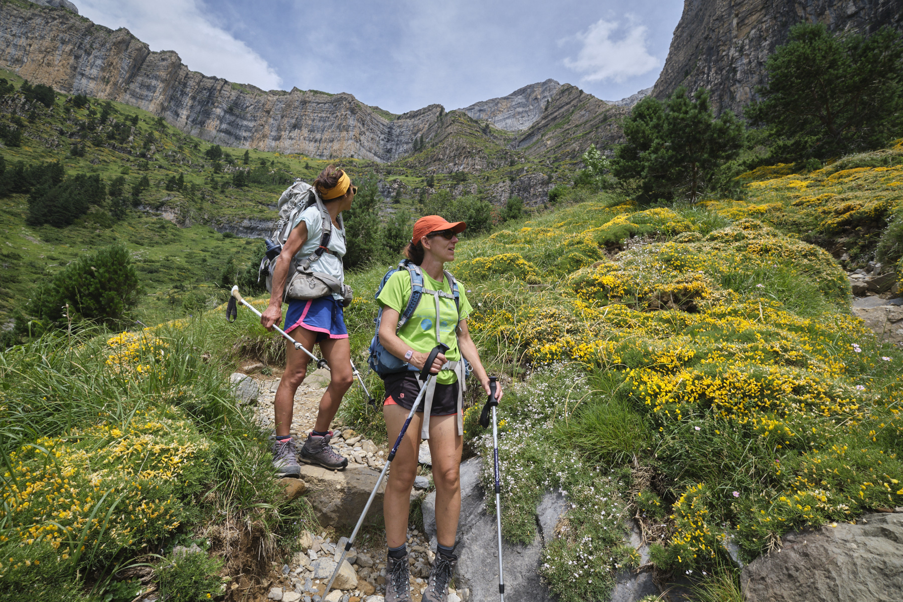
The Faja de las Flores, an exceptional route in one of the most beautiful areas of the Pyrenees. The proposed loop starts at La Pradera d'Ordesa and passes through the small sections equipped with clavijas (nails fixed to the walls to aid progress): the Cotatuero clavijas on the outward journey and the Salarons and Carriata clavijas on the return. A faja, literally meaning "band" or "belt", is a side-wall ledge, the equivalent of the "straps" found in the Alps. It's not technically difficult to climb - you don't even have to use your hands - but it's the sheer size of the void that can be so impressive. So keep your wits about you all the way, especially as your eyes are drawn to the extraordinary aerial views and fantastic vistas of the Ordesa canyon running along at your feet. A major hike, quite demanding in terms of altitude, but one that will remain for all among the most beautiful high-mountain landscapes in the Pyrenees.
❱❱ Technical summary
■ Departure point: Pradera d'Ordesa parking lot, Torla, Aragon, Spain
■ Type of route: high-mountain loop hike, with equipped passages
■ Distance: 13.5 km
■ Cumulative elevation gain: +1230 m
■ Cumulative negative altitude gain: -1230 m
■ Estimated total time: 6h to 8h ■ Min and max altitude: 1520 m / 2490 m
■ S ignposting: numerous direction signs, cairns but no signposting
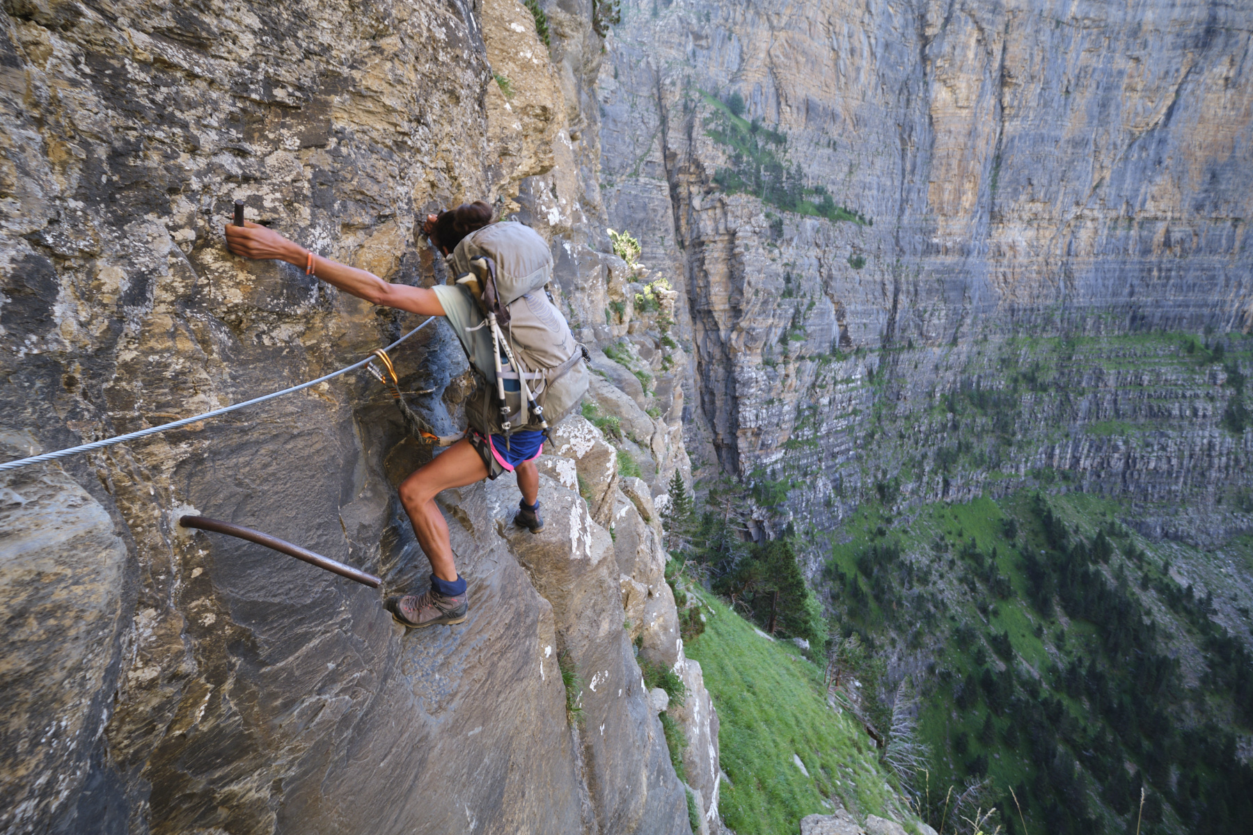
■ Equipment in place: clavijas (nails) and lifeline (only on Cotatuero)
■ Equipment required: ferrata harness and lanyard, helmet if necessary
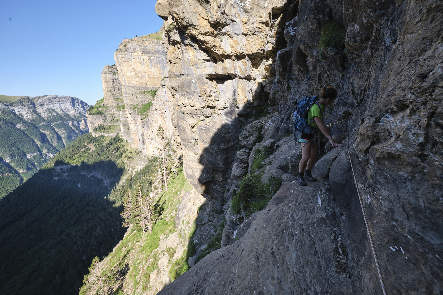
Difficulties: The 2 sections of the clavijas on the way up and down are not very difficult (K2) but aerial and impressive. The faja is done walking without ever putting your hands down, but with a few passages very close to the big void.
❱❱ Access to the place
Go to Torla-Ordesa, north-west of Ainsa. From here, climb up to the Pradera d'Ordesa parking lot, the starting point of the loop. In summer, access to the Pradera is regulated and you must take a shuttle bus that leaves every 15' from Torla for the Pradera (€5 return).
Part 1: from La Pradera to the Cotatuero Circus by the Cotatuero clavijas (2h to 2h30)
Follow the main path heading east from the parking lot, then quickly fork left to follow the signs for the Cirque de Cotatuero. The path leads through the forest, climbing very little at first, then steepening as it nears the Cotatuero barranco. Higher up, you come across the path from faja Canarellos (1st fork in the road) and then the path continuing westwards to faja Racon (2nd fork in the road). Follow the Cotatuero clavijas signs each time. You gradually approach the base of the walls until you reach the start of the section to be climbed.
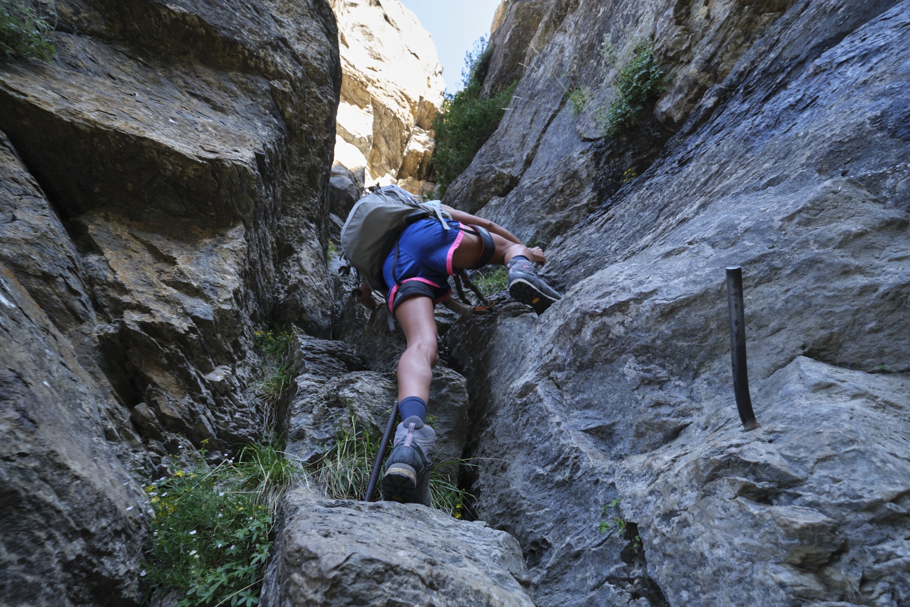
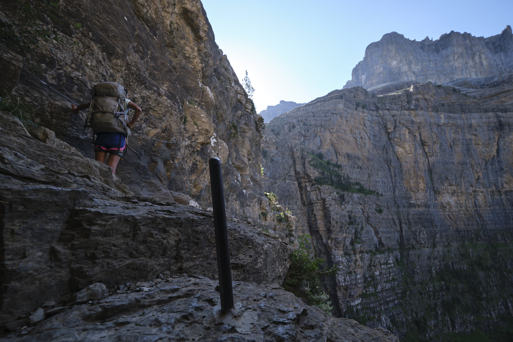
Start on a small ramp to climb, then the steep, airy path weaves between the walls to reach the start of the passage equipped with clavijas. The first short pitch, in a sort of mini-corridor, is equipped with nails and no lifeline. You come out on a platform and begin the traverse, following the edges of the rock and the nails (lifeline). A few metres further on, the route climbs back up to begin a second traverse, still just as aerial but without any difficulty. You end up on the path just below the waterfall at the top of the cirque. Climb back up to set foot on the upper flat just beside the torrent and the top of the waterfall. This is the Cotatuero cirque.
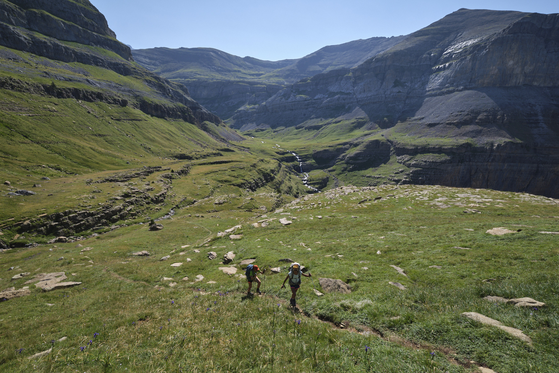
2nd part: climb up to the entrance to the faja de las Flores (1h)
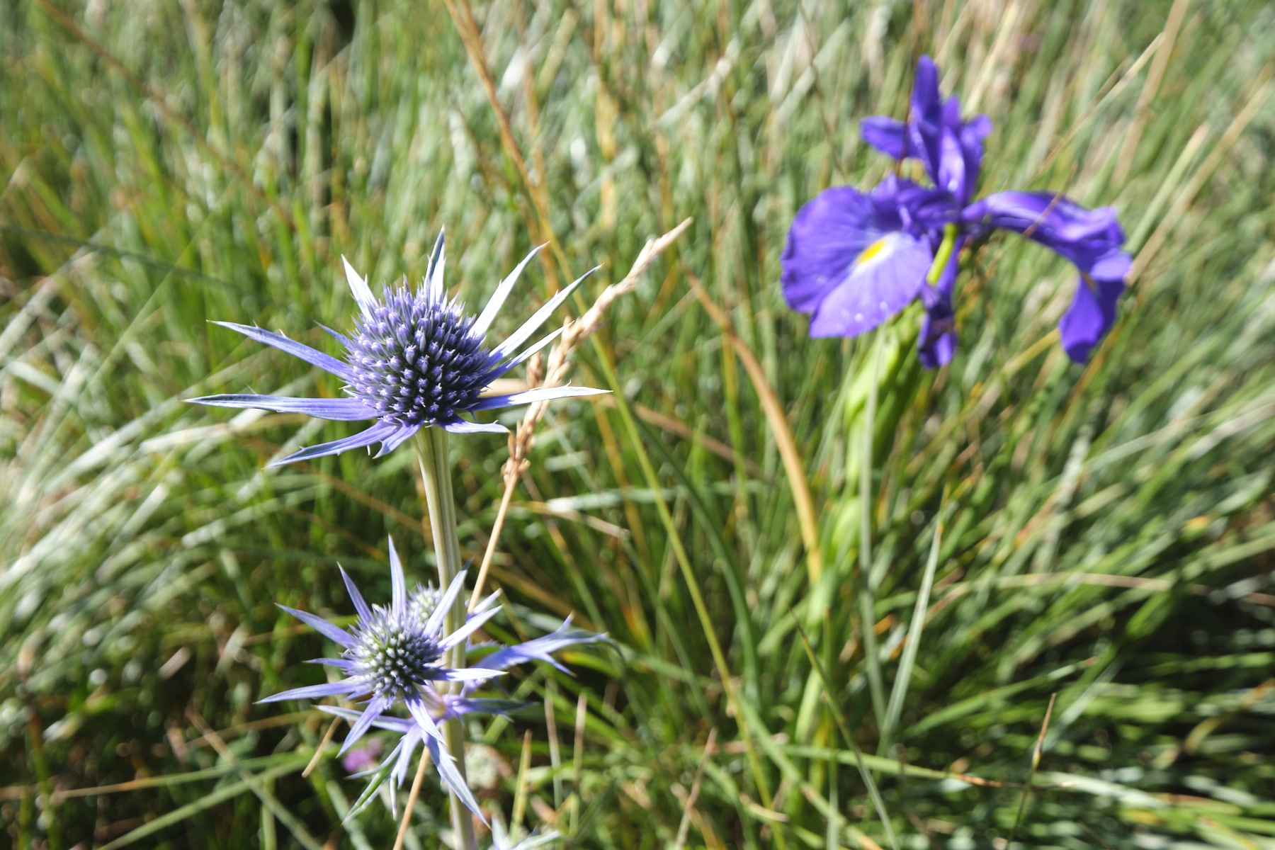
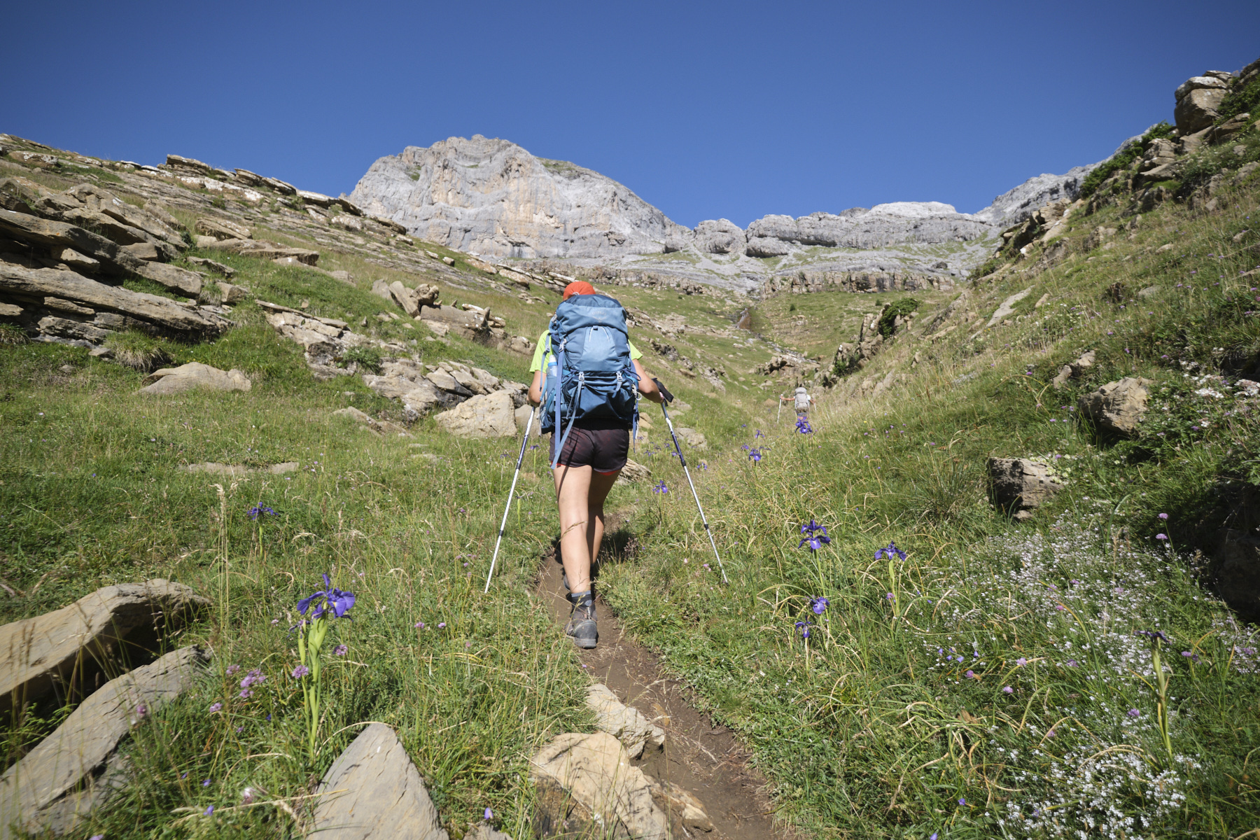
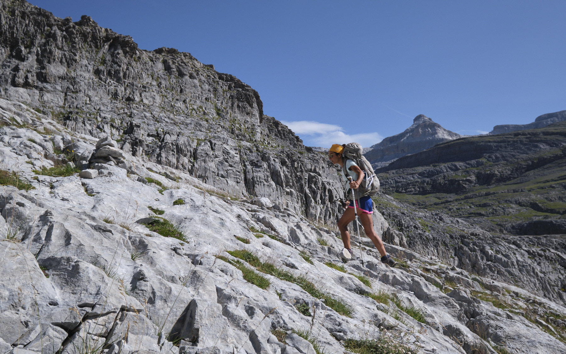
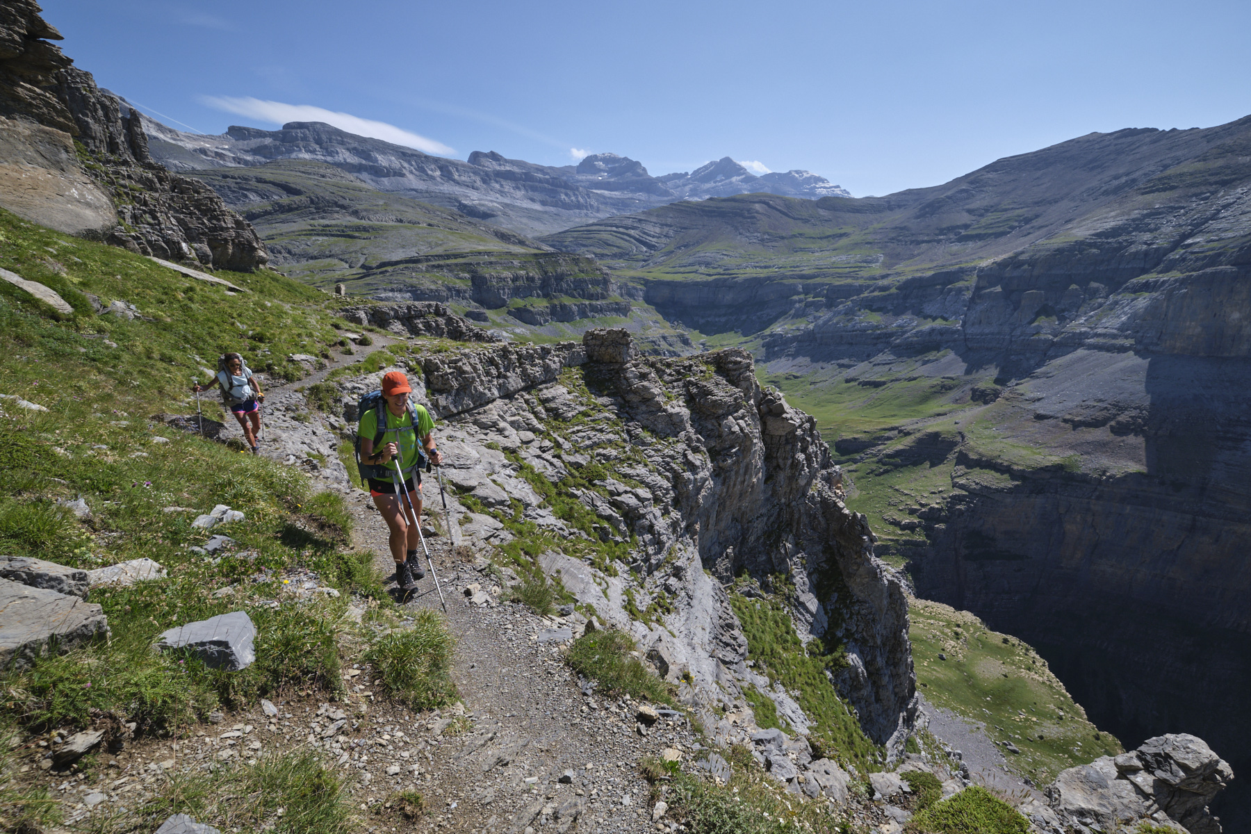
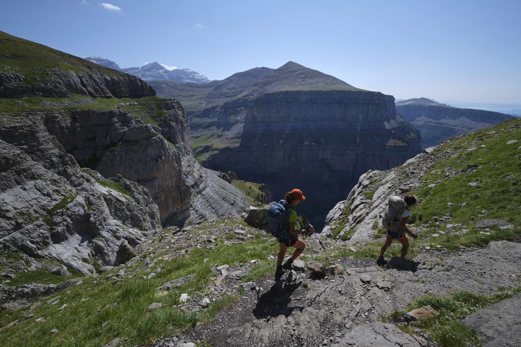
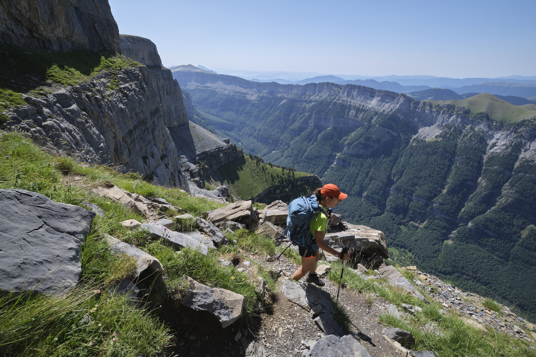
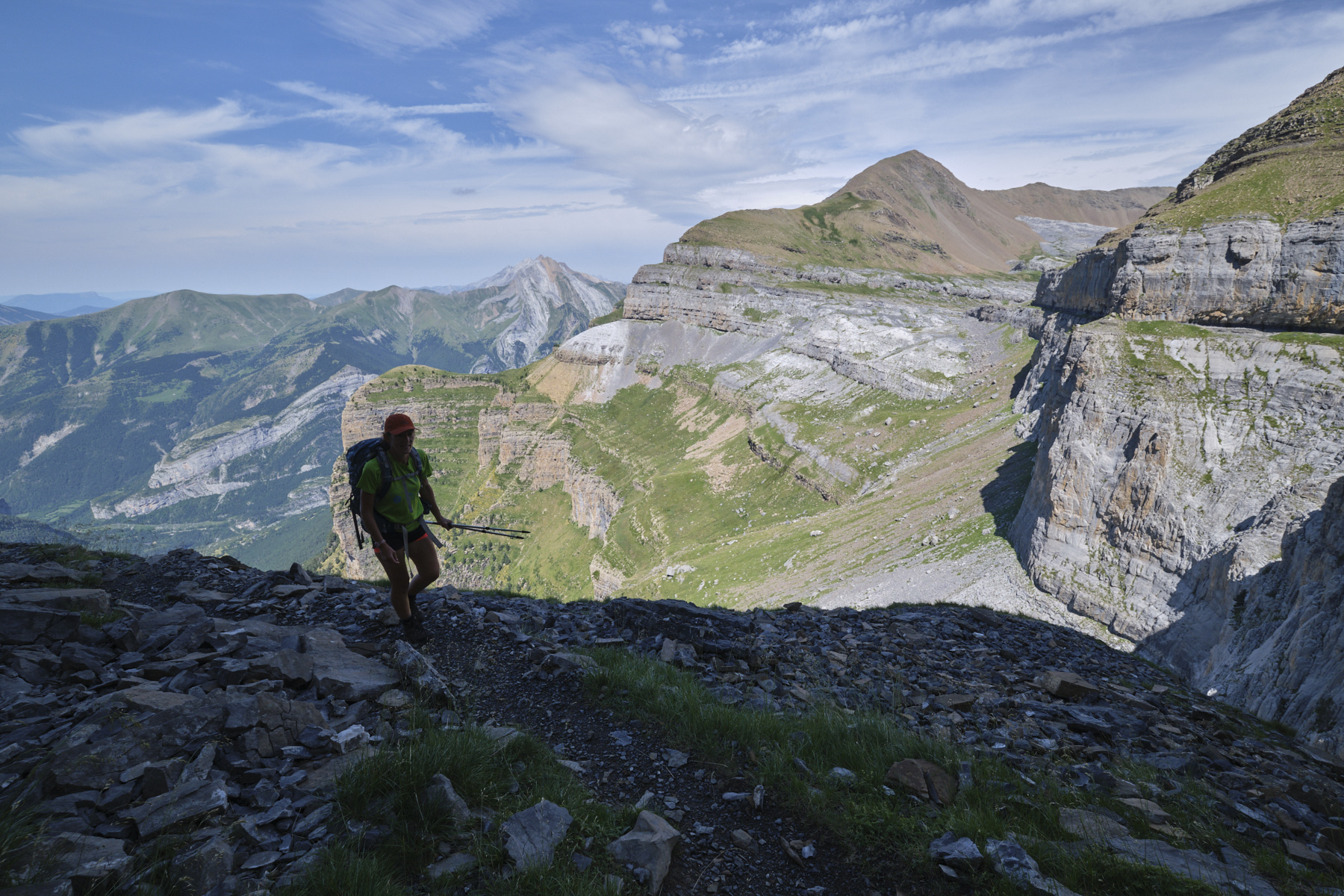
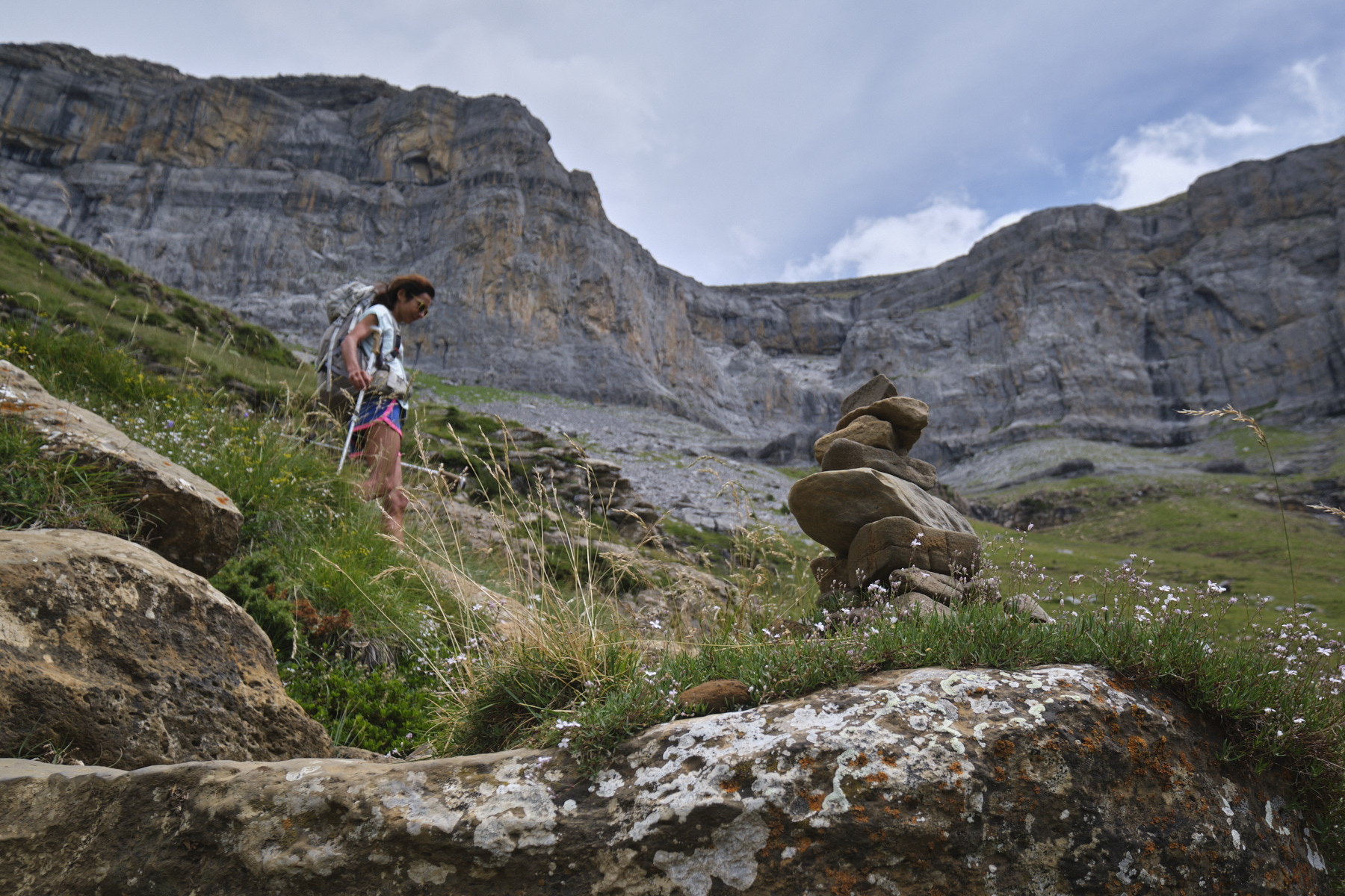
On the grassy flat, follow the path and quickly veer to the left, away from the torrent. The path is well marked with cairns. We'll head upstream along a secondary torrent to pass it above. Signs point to the Faja de las Flores. The path climbs up the grassy slopes and soon dominates the basin of the Cotatuero cirque. After a series of switchbacks, the path approaches the walls, passing over a scree and then into a small rocky corridor (sign). Finish above it, climbing up a lapiaz area and exiting onto a lapiaz palteform with an extraordinary view of the massif from the Brèche de Roland to the Col d'Añisclo. Once you've reached the faja, you'll have to head south to reach the start of the faja, marked by a large boulder in a bend.
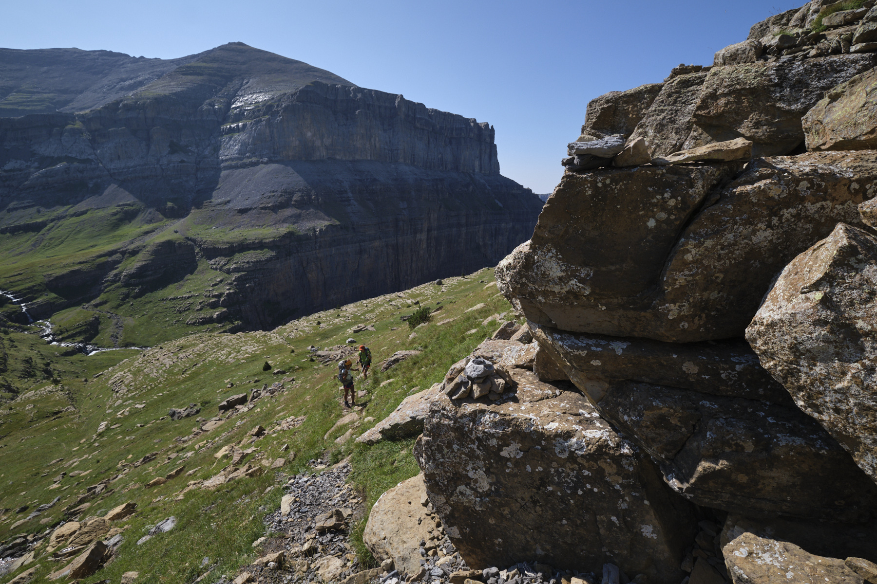
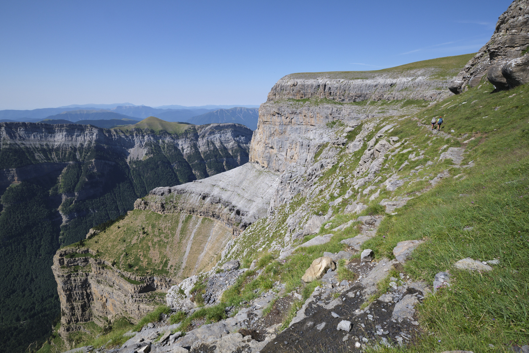
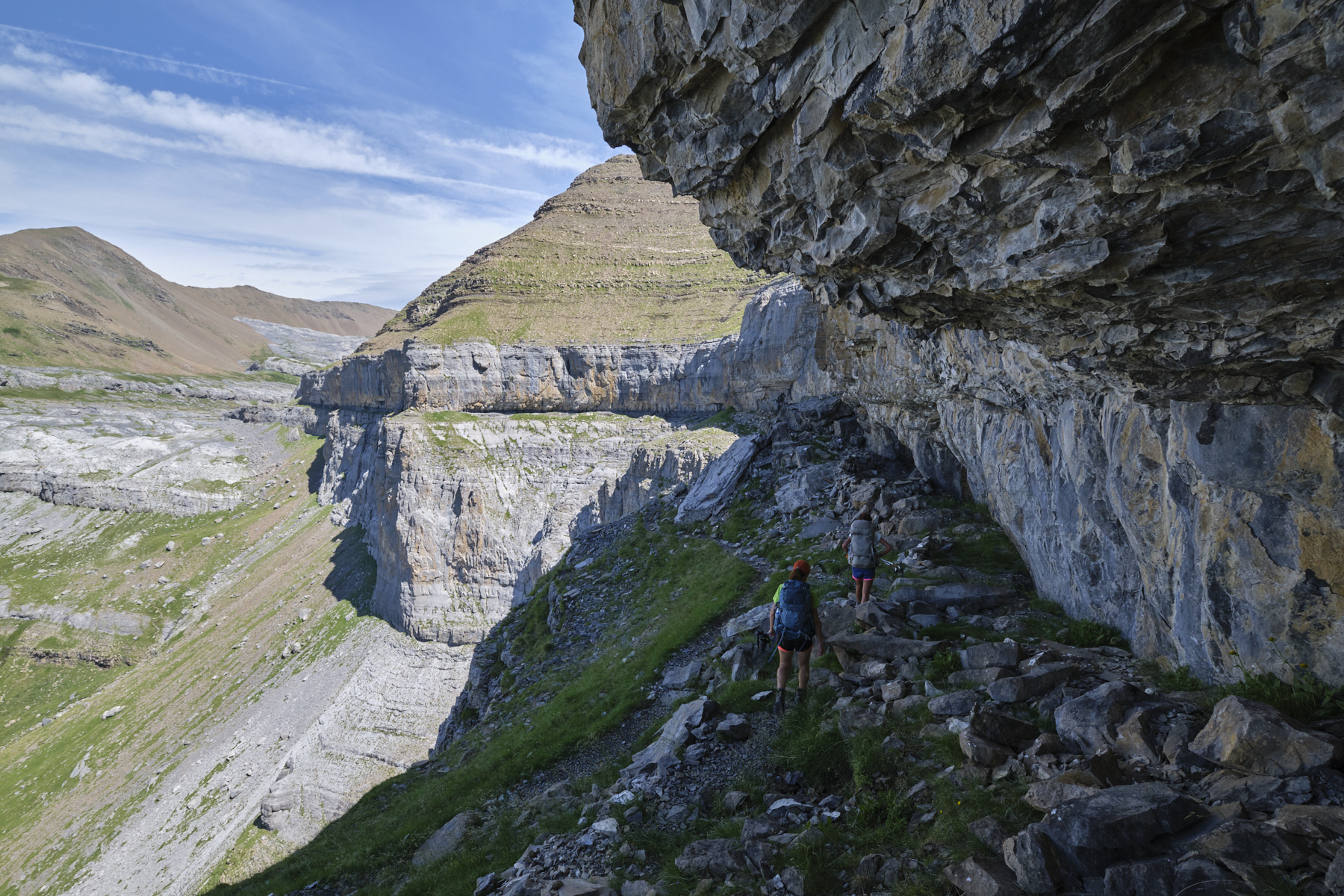
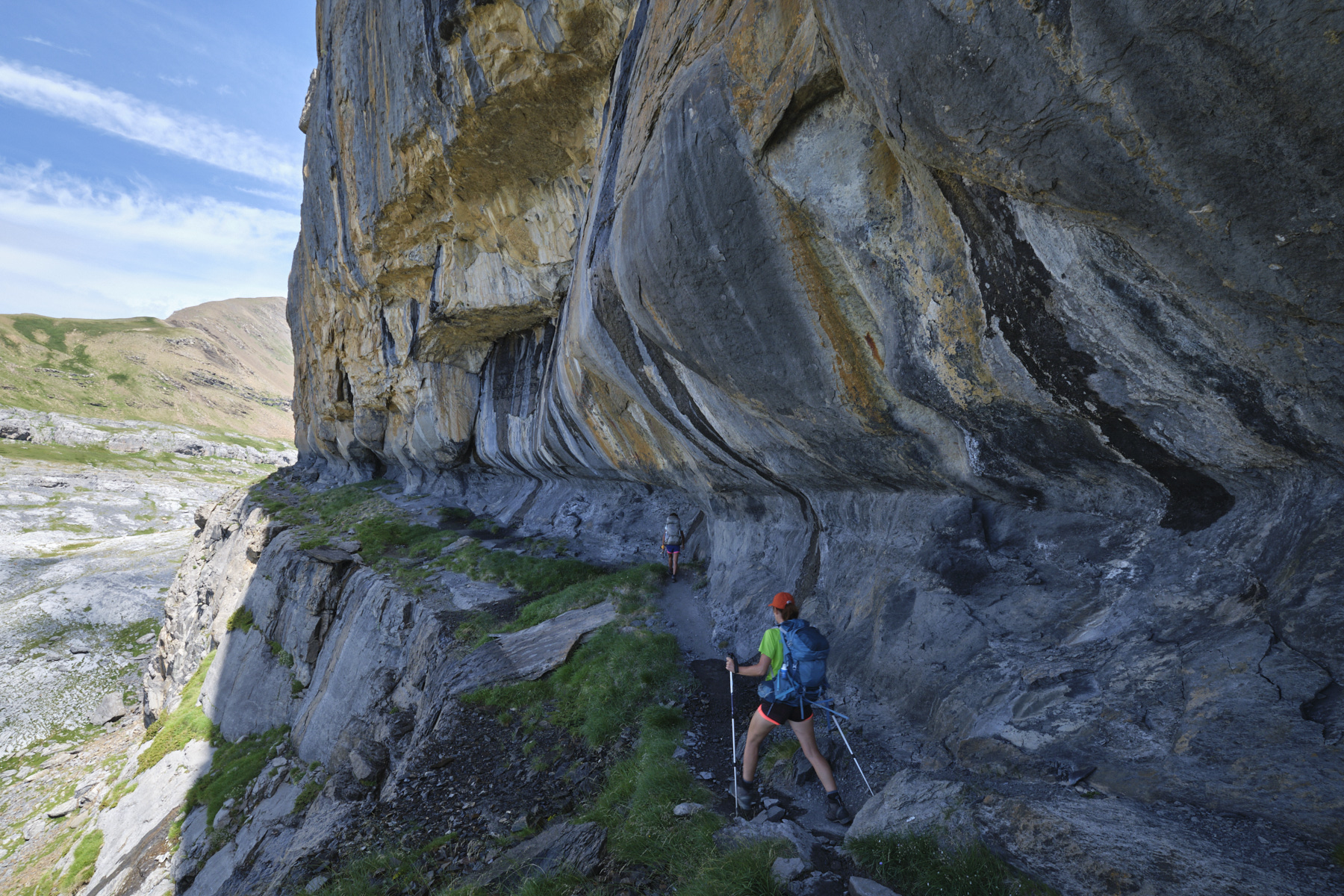
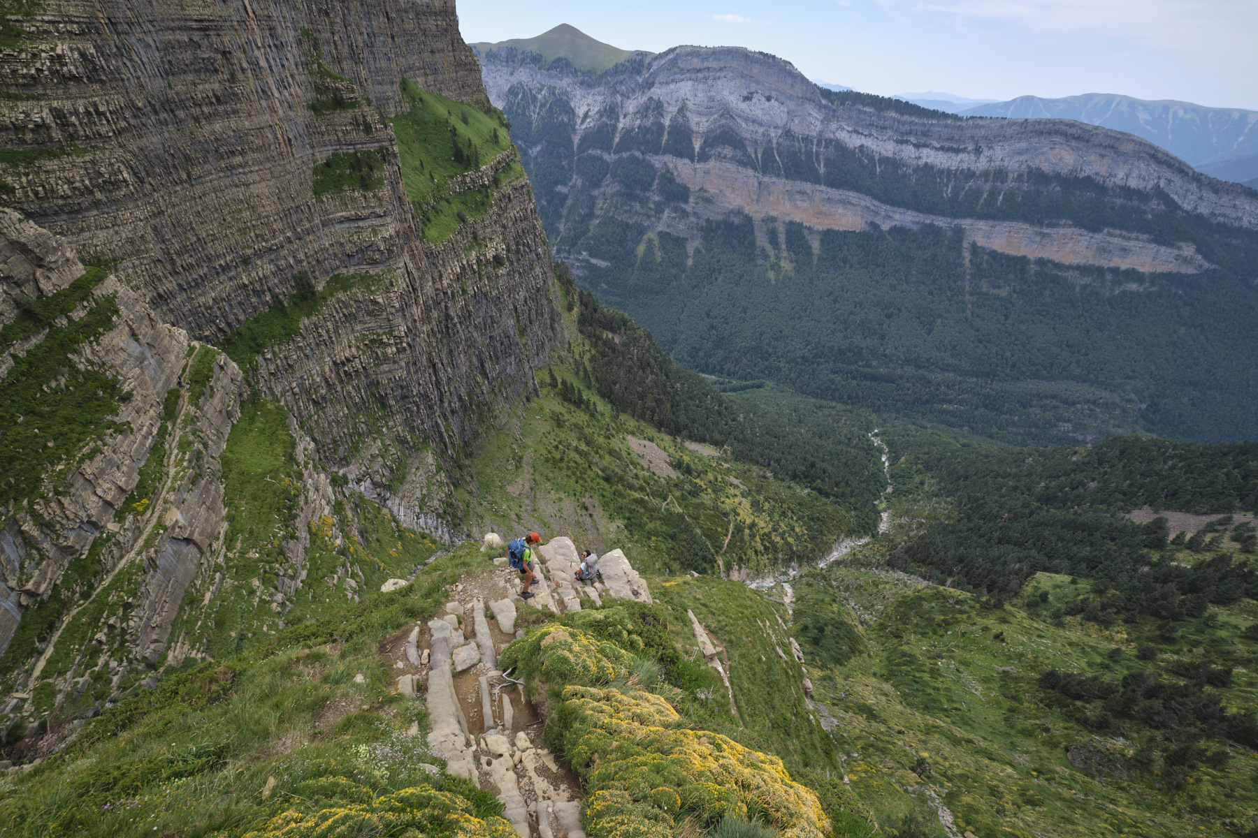
Part 3: Faja de las Flores from Cirque de Cotatuero to Cirque de Salarons (1h to 1h30)
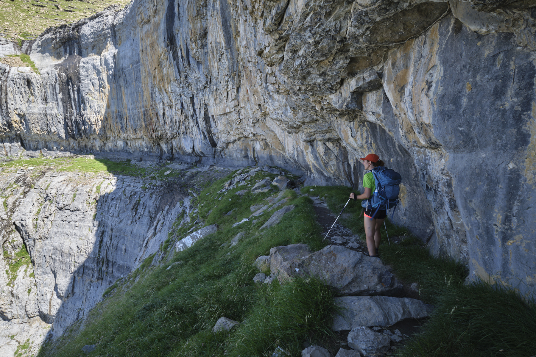
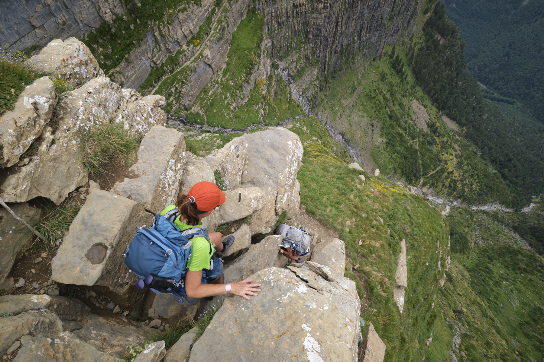
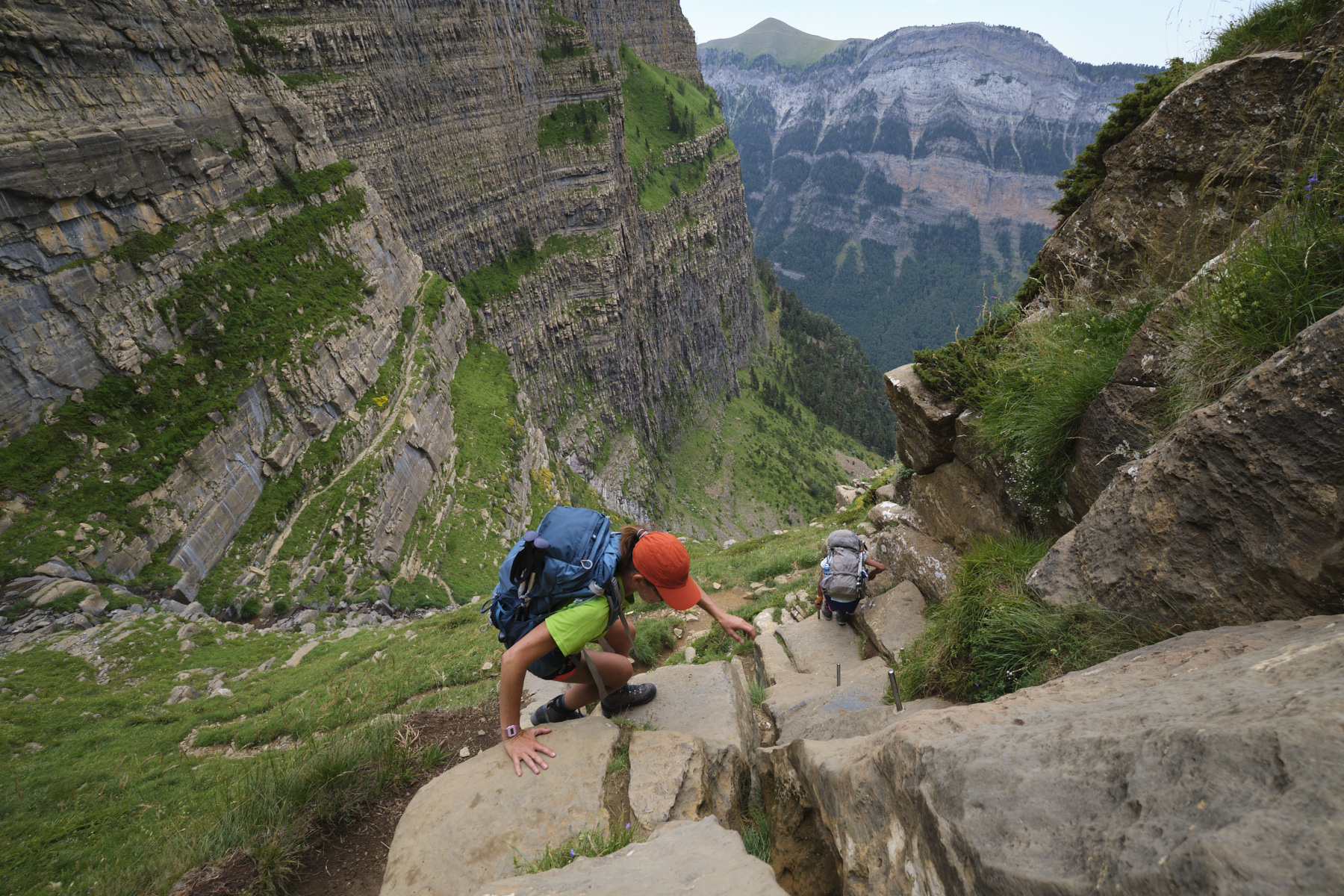
About 3 km of almost flat trail along a ridge that follows the relief of the massif. Most of the time, it's wide and comfortable, but there are a few narrow passages where you need to keep your wits about you, as the void is right next to you. The view is continuous, with exceptional aerial views over the Ordesa canyon. In the final section, the path almost passes through a half-tunnel formed by the walls. We finally pass under a huge boulder leaning against the wall to emerge further out onto the Cirque de Salarons flat.
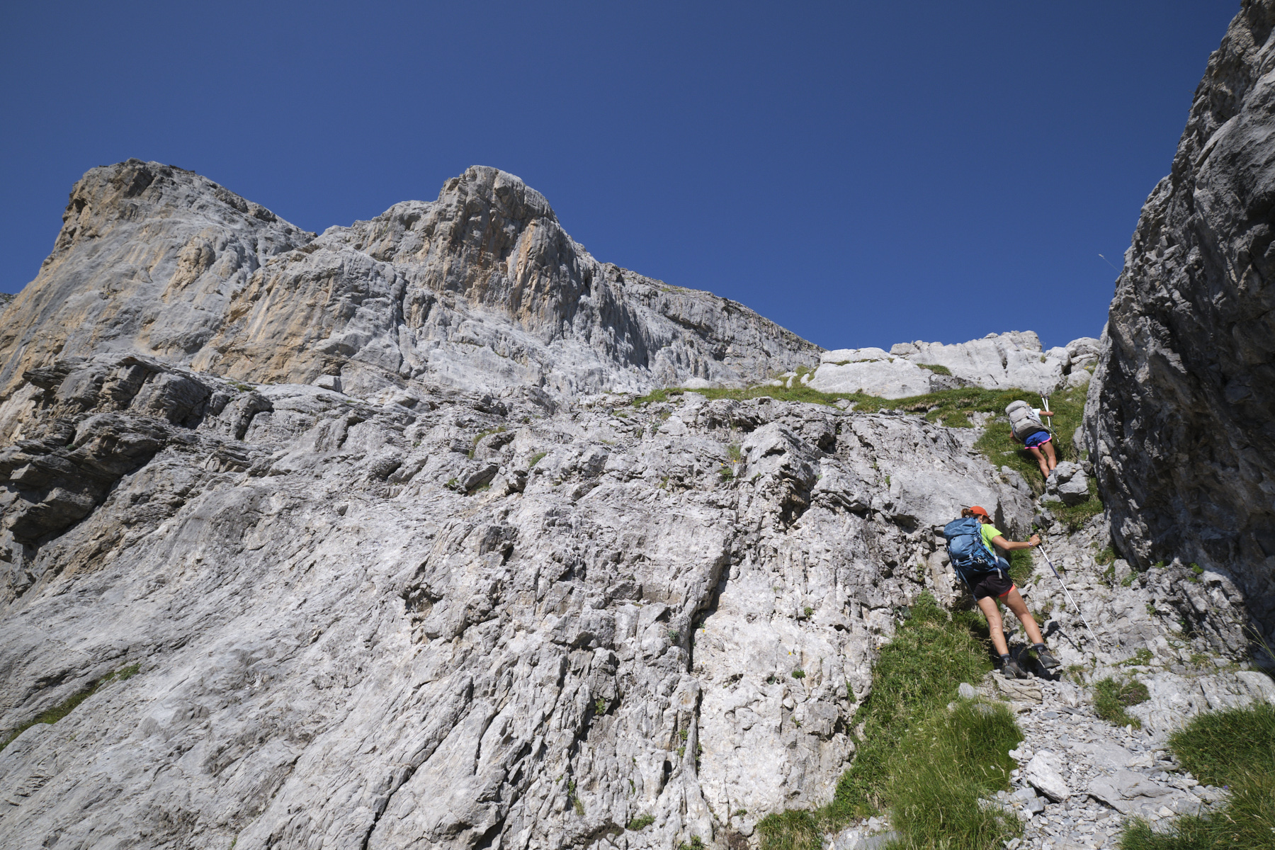
4th part: from Cirque de Salarons to La Pradera via the Salarons and Carriata clavijas (2h to 2h30)
Descend the valley to the south and then south-east, following the cairns. At the end of the first grassy landing, you'll find a fork in the road: to the left is the descent via the Fajeta (to avoid the clavijas) and to the right the clavijas. Turn right, where the slope quickly becomes steeper. Further down is the clavijas de Salarons passage, equipped with nails (no lifeline) to de-escalate a slightly sloping dihedral. It's short and not particularly difficult, but very aerial.
Below, continue the steep descent on foot and soon you'll find the second equipped section, the clavijas de Carriata, also very short, easier, to de-escalate a series of steps. The path then heads back under the walls to traverse the cirque de Carriata, then descends steeply, yawing sharply to the west before heading back east to cross the barranco Salarons. Here the road forks into the Luenga faja (sign). Descend to the Pradera for a long stretch that passes lower down through the forest and finally returns to the Pradera d'Ordesa parking lot.
Faja Pelay, Canarellos and Racon, Ordesa 31 October 2020 Here's an exceptional hike to discover the Ordesa Grand Canyon, a large glacial valley in the Aragonese…
Monte Rotondo, Melo and Capitello, Corte 5 August 2017 From the Restonica Valley, climb Corsica's second highest peak, Monte Rotondo at 2622m, and return via the…


 Partager sur WhatsApp
 Partager sur Twitter
Partager sur Instagram
Partager sur Twitter
Partager sur Instagram

 Partager sur Facebook
 Imprimer le topo
 Laisser un commentaire


![2017-08-05_13-35-40 [Monte Rotondo]](https://climbing7.com/wp-content/uploads/2017/09/2017-08-05_13-35-40-monte-rotondo-1024x683.jpg "Monte Rotondo, Melo and Capitello, Corte")
Leave a Reply