
Montaña de Tauro, Gran Canaria


A superb loop around and over the Montaña de Tauro, in the southern part of the island. A varied itinerary, with…
Read topo


A superb loop around and over the Montaña de Tauro, in the southern part of the island. A varied itinerary, with…
Read topo
To the south of the island, just above Maspalomas, large, fairly deep valleys run due north...
Read topo
In the center of the island, below the small town of Tejeda, the Cañada de las burras forms a pretty loop that…
Read topo
The emblematic Roque Nublo, at over 1700m, dominates most of the island and can be seen from the west...
Read topo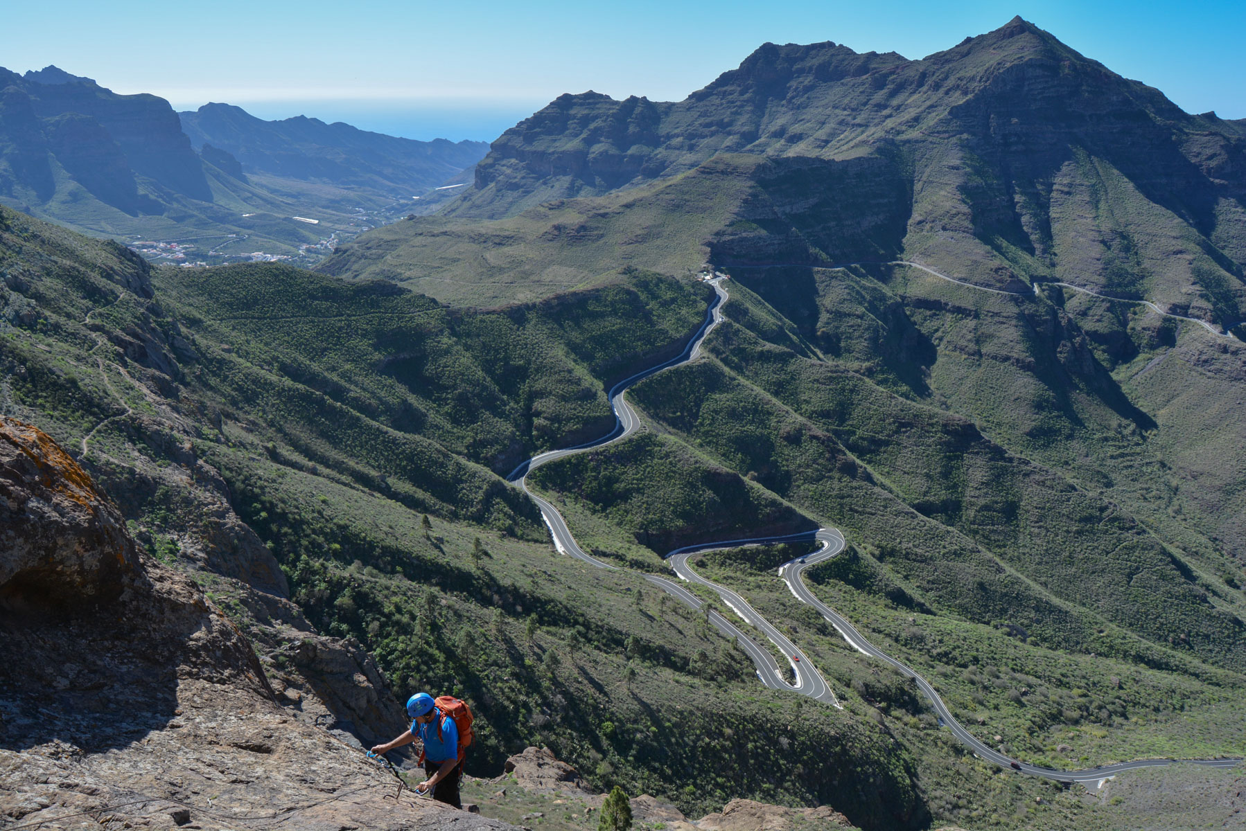
A magnificent new route on the west face of Inagua, opposite the Güi-Güi Natural Park. Amor Cocodrilo offers an…
Read topo
A major trek in the western part of the island: crossing the natural park via the Camino de Güi-Güi in a splendid…
Read topoA classic among classics, the GR20 offers an exceptional itinerary for crossing Corsica from north to south, or vice versa, between sea and high mountains. With more than 160 kilometers of trails and over 12,000 meters of ascent, often between 1,500 and 2,500 meters above sea level, this is a challenging route for experienced hikers. But the GR20 is paying the price for its success, and for a little escape, we offer an alternative itinerary with numerous official and unofficial variants, and the ascent of some interesting peaks: Cirque de la Solitude, Paglia Orba and Capo Tafunatu, Monte d'Oro, Monte Renoso, Monte Incudine. This topo presents the GR20 as we did it in general terms, all the stages being described in more detail in the following posts.
Voir le dossier
Sur la HRP de Hendaye à Banyuls
Été 2025