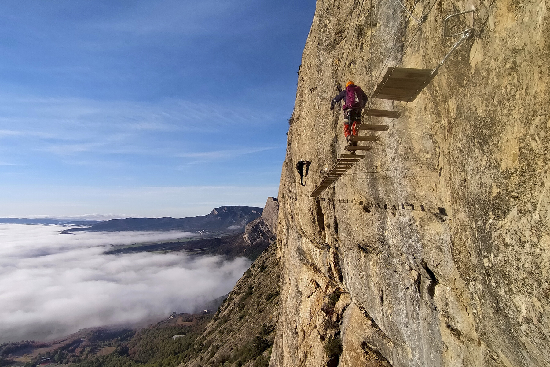
Serra de les Canals, Oliana, Alt Urgell


New via ferrata in the spectacular setting of AltUrgell. Above Oliana, the Serra de les Canals climbs up the south…
Read topo


New via ferrata in the spectacular setting of AltUrgell. Above Oliana, the Serra de les Canals climbs up the south…
Read topo
The ascent from Can Boix des Roques de Sant Honorat offers incredible panoramic views over the Segre valley and Lac…
Read topo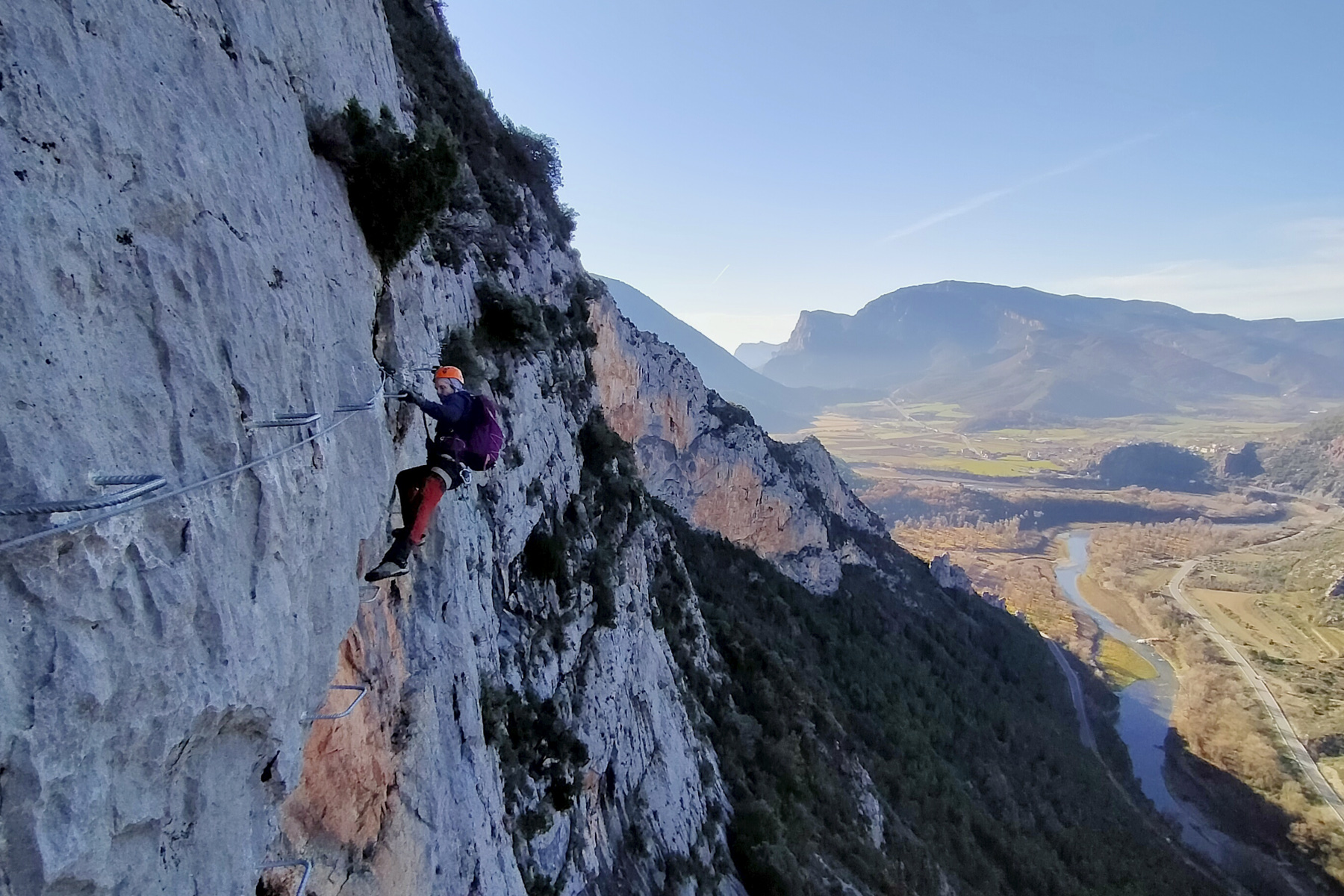
Between Seu d'Urgell and Oliana, above the Segre valley that crosses Alt Urgell, the Roca Narieda via ferrata…
Read topo
Exceptional conditions to enjoy the slopes of the Pic du Tarbésou and panoramic views of the Ariège Pyrenees.…
Read topo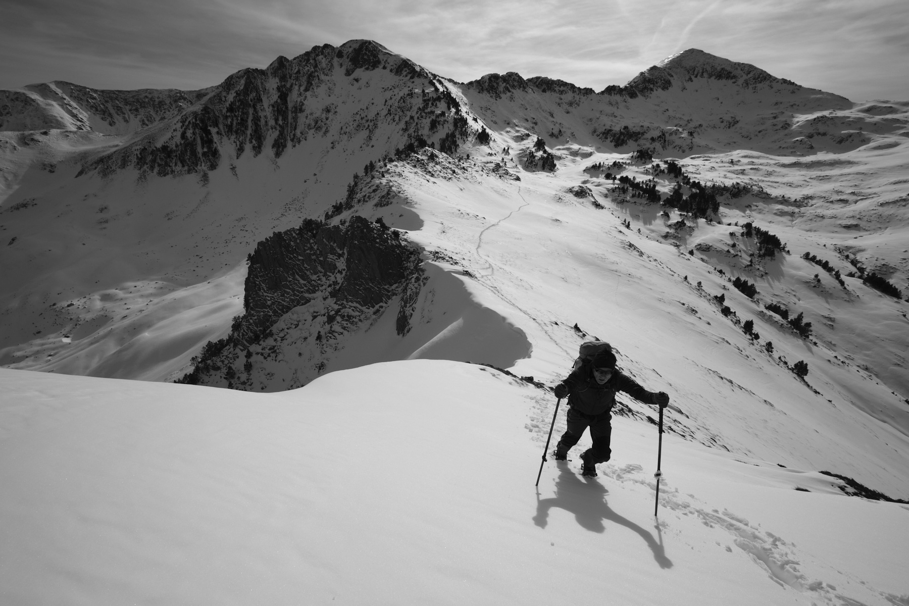
This snowshoeing itinerary takes place in a wild and beautiful high mountain setting, in the heart of the Orlu…
Read topo
Departing from the Etang de Soulcem, here's a 2-day hike between France, Spain and Andorra, featuring two near-3000m…
Read topoA classic among classics, the GR20 offers an exceptional itinerary for crossing Corsica from north to south, or vice versa, between sea and high mountains. With more than 160 kilometers of trails and over 12,000 meters of ascent, often between 1,500 and 2,500 meters above sea level, this is a challenging route for experienced hikers. But the GR20 is paying the price for its success, and for a little escape, we offer an alternative itinerary with numerous official and unofficial variants, and the ascent of some interesting peaks: Cirque de la Solitude, Paglia Orba and Capo Tafunatu, Monte d'Oro, Monte Renoso, Monte Incudine. This topo presents the GR20 as we did it in general terms, all the stages being described in more detail in the following posts.
Voir le dossier
Sur la HRP de Hendaye à Banyuls
Été 2025